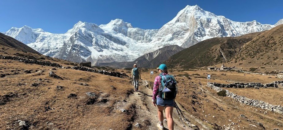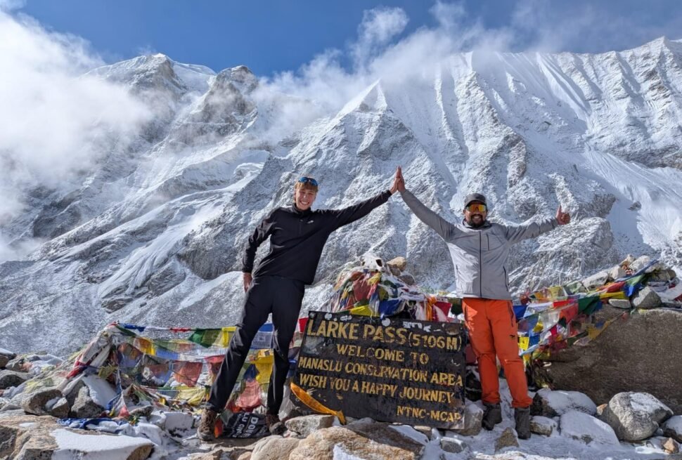
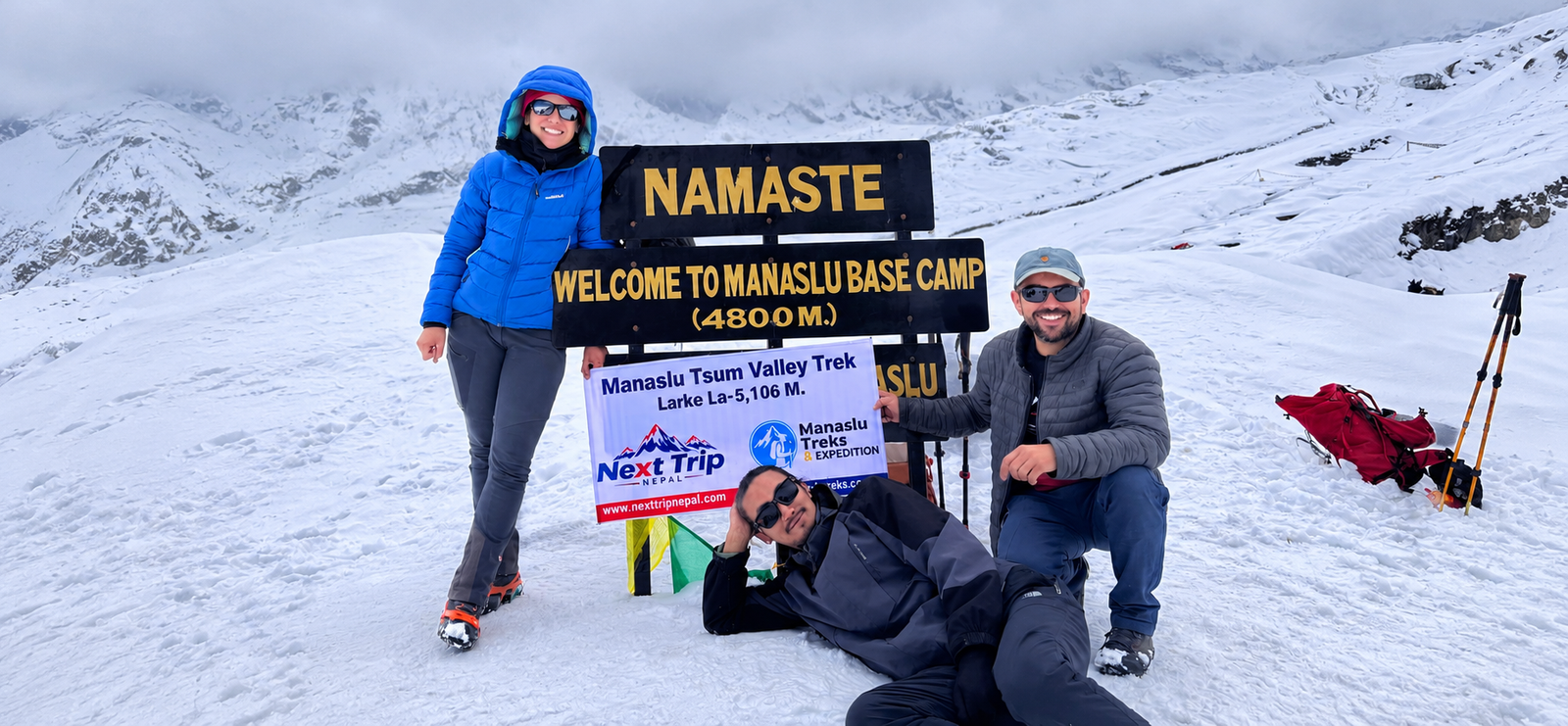
The Manaslu Tsum Valley Trek is the twenty day route that links two trips Nepal normally sells apart: the Manaslu Circuit, which circles the eighth highest mountain on earth and crosses Larkya La Pass at 5,106 meters, and a side trip into Tsum Valley, a restricted Buddhist valley that stayed closed to foreign visitors until 2008. Walking both in one trip means you start and finish in Kathmandu, spend roughly a week deeper inside the Tsum side valley than a standard circuit itinerary allows, then rejoin the main trail at Deng and finish the Manaslu Circuit exactly as a standalone circuit trekker would, including the pass crossing and the descent to Besisahar.
This guide covers that combined route specifically: the twenty day itinerary, the permit math for a trip that spends close to two weeks inside the restricted area rather than one, the extra fitness and acclimatization demands of adding a full side valley before a 5,106 meter pass, and the planning details that differ from doing either trip on its own. If you are deciding whether to add Tsum Valley to a circuit you had already planned, or whether to do the full twenty day version from the start, the information below is built around that specific decision.
Manaslu Tsum Valley Trek at a Glance
- Typical duration: 20 days from Kathmandu back to Kathmandu, including two driving days at each end and around 17 days of trekking and acclimatization on the trail
- Highest point: Larkya La Pass at 5,106 meters
- Highest point inside Tsum Valley itself: Mu Gompa at roughly 3,700 meters
- Trek style: teahouse accommodation throughout, no camping required
- Region: Gorkha District, Gandaki Province, close to the Tibet border
- Permits needed: Manaslu Restricted Area Permit, Manaslu Conservation Area Permit, Annapurna Conservation Area Permit, and a local Chum Nubri Rural Municipality fee
- Guide requirement: a licensed guide is mandatory for the restricted area sections of this route
- Solo trekkers: permitted as of the March 2026 rule change, provided a licensed guide accompanies you
- Starting point: road drive from Kathmandu to Machha Khola
- Finishing point: road drive from Dharapani through Besisahar back to Kathmandu, after descending from Larkya La through Bimthang and Tilije
- Best seasons: September through November for the most reliable pass conditions, with April a strong second choice
What Makes the Combined Route Different From Either Trip Alone
Tsum Valley and the Manaslu Circuit share the same approach road and the same restricted permit zone, which is why operators package them together so often. But they are genuinely two different experiences stitched into one trip, and it helps to understand what each half actually adds before you commit twenty days to it.
- The Manaslu Circuit alone is a loop trek built almost entirely around crossing Larkya La. Every day on the main trail is pointed toward that pass, and the scenery is dominated by Manaslu itself and its surrounding peaks.
- Tsum Valley alone is a side valley that most trekkers visit as an out and back trip, without ever approaching Larkya La. It is slower paced, more culturally focused, and ends at Mu Gompa rather than a mountain pass.
- The combined route asks you to do both without skipping either. You walk into Tsum, go as far as Mu Gompa, walk back out to rejoin the main circuit trail at Deng, and only then begin the long climb toward Samagaon, Samdo, and the pass itself.
- Because of that structure, you reach Larkya La later in your trip and with more accumulated trekking days behind you than a standalone circuit trekker, which is the single biggest factor that makes this version harder than either trip done separately.
Where Tsum Valley and the Manaslu Circuit Actually Sit
Both halves of this trek sit inside Gorkha District in Gandaki Province, in the northwest of central Nepal. The Budhi Gandaki River is the main access corridor for the entire route, and the trail follows its gorge for the first several days regardless of whether you are headed into Tsum or straight up the circuit.
- Tsum Valley itself is bounded by the Ganesh Himal, Sringi Himal, and Boudha Himal ranges, and sits close enough to the Tibetan border that trade with Tibetan communities across the frontier still continues in parts of the valley.
- The valley’s elevation ranges from around 1,900 meters at its lower entrance to over 4,000 meters at its upper reaches, with most trekkers topping out around 3,700 meters at Mu Gompa before turning back.
- The wider Manaslu Circuit climbs from the same river gorge up through Samagaon and Samdo before crossing Larkya La into the Marsyangdi Valley, which is the same valley system used by the Annapurna Circuit.
- Local people in Tsum are known as Tsumba and speak a dialect of Tibetan origin distinct from the Nubri dialect spoken further south along the main circuit trail, a detail that reflects how separate these two communities remained from each other despite being only days apart on foot.
A Short History Worth Knowing Before You Go
Tsum Valley has a specific history that shapes a lot of what you will notice on the ground, so it is worth a few sentences before the itinerary.
- The valley remained closed to foreign trekkers until 2008, later than almost any other region in Nepal’s restricted area system, which is why its teahouse infrastructure is noticeably thinner than the main Manaslu trail just a few days away.
- In Tibetan Buddhism, Tsum is regarded as a beyul, a hidden valley set aside and blessed by religious teachers. That status is part of why local communities have historically protected it from outside development, and it is still reflected in local customs around land use and animal slaughter in parts of the valley.
- Mu Gompa and Rachen Gompa are the two monasteries you will actually walk past on the standard itinerary, and both function as working religious centers rather than tourist sites. Expect to see monks and nuns going about daily routines rather than a museum style presentation.
- Piren Phu, a cave shrine near Burgi village on the standalone Tsum route, is associated in local tradition with the Tibetan poet and saint Milarepa, who is said to have meditated in caves in this area. On the combined itinerary below you will not pass directly through Burgi, so this is a detail worth knowing even if you will not see the cave firsthand on this particular route.
Full Itinerary for the Combined Manaslu Tsum Valley Trek
The itinerary below reflects the standard twenty day structure that most agencies, including Next Trip Nepal, build this trip around. Elevation figures are approximate village elevations rather than exact trailhead measurements, and actual walking time depends heavily on your pace, the season, and trail conditions after monsoon damage, which varies year to year on this route.
Day 1: Kathmandu to Machha Khola
A full day drive west out of Kathmandu, dropping from the city at around 1,400 meters down to Machha Khola at roughly 870 meters. The road has improved in recent years but still includes rough, unpaved stretches once you leave the main highway, so treat this as a long travel day rather than a trekking day.
Day 2: Machha Khola to Jagat
The trail follows the Budhi Gandaki River gorge, crossing several suspension bridges and passing through small riverside villages before climbing to Jagat at around 1,340 meters. This is also the checkpoint where your permits are first checked in detail.
Day 3: Jagat to Lokpa
A steady climb away from the main river trail toward Lokpa, at roughly 2,240 meters, the last village before the trail splits toward Tsum Valley. Lokpa is effectively the gateway to the side valley portion of the trip.
Day 4: Lokpa to Chumling, Lower Tsum Valley
The trail turns off the main Manaslu Circuit route here and climbs into the Shiar Khola valley, entering Tsum Valley proper at Chumling, around 2,386 meters. This is the point where the trip’s character shifts from river gorge walking to side valley trekking.
Day 5: Chumling to Chhokangparo, Upper Tsum Valley
A moderate day of walking brings you into Upper Tsum, reaching Chhokangparo at around 3,010 meters. Fields of barley and buckwheat are common around here depending on the season, along with your first real views of the peaks surrounding the valley.
Day 6: Chhokangparo to Nile, With a Visit to Rachen Gompa
Rachen Gompa, a working nunnery, sits just off the main trail and is worth the short detour most itineraries build in on this day. The trail continues to Nile, at roughly 3,361 meters, one of the highest permanently inhabited villages in the valley.
Day 7: Day Hike From Nile to Mu Gompa and Back
Mu Gompa, at about 3,700 meters, is generally described as the largest monastery in the Tsum Valley region and sits close to the old trade route toward the Tibetan border. This is the highest point reached on the Tsum side of the trip, and most trekkers do it as a day hike from Nile rather than sleeping at Mu Gompa itself.
Day 8: Nile Back to Chumling
A long descent retracing the route back down the Shiar Khola valley to Chumling. Because you already know the trail from the way up, this day is mostly about making distance rather than new sightseeing, though the views face a different direction on the way down and are worth paying attention to.
Day 9: Chumling to Deng, Rejoining the Main Manaslu Circuit
Back through Lokpa and onward to Deng, at roughly 1,860 meters, where the trail rejoins the standard Manaslu Circuit route. From this point on, the itinerary matches what a standalone circuit trekker would walk.
Day 10: Deng to Namrung
The trail climbs steadily through forest and small settlements to Namrung, around 2,630 meters, which also marks a shift in the local culture and architecture toward the more clearly Tibetan influenced villages further up the valley.
Day 11: Namrung to Shyala
A scenic day with your first proper close up views of Manaslu itself, climbing to Shyala at around 3,180 meters. Forest gives way to more open alpine terrain on this stretch.
Day 12: Shyala to Samagaon
A relatively short day to Samagaon, roughly 3,530 meters, one of the main acclimatization hubs on the whole circuit and a good base for the rest day that follows.
Day 13: Acclimatization Day at Samagaon
Most itineraries build in a rest day here before pushing higher. A common option is a day hike up toward Manaslu Base Camp or the Pungyen Gompa viewpoint, both of which gain altitude during the day before you return to sleep at the same elevation, which is the standard acclimatization strategy at this stage of the trek.
Day 14: Samagaon to Samdo
A shorter, gentler day to Samdo, around 3,875 meters, a village close enough to the Tibetan border that it was historically a trading post. The pace eases here deliberately as the altitude climbs.
Day 15: Samdo to Dharmashala (Larkya Phedi)
A short walking day in distance but a meaningful one in altitude, reaching Dharmashala, also called Larkya Phedi, at around 4,460 meters. There is little infrastructure here beyond basic teahouse lodging, since this stop exists purely to stage the pass crossing.
Day 16: Cross Larkya La Pass and Descend to Bimthang
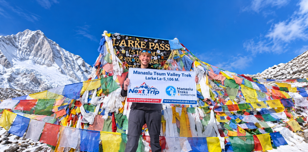
The longest and most demanding day of the trip. An early, often predawn start gets you over Larkya La at 5,106 meters before the wind typically picks up later in the day, followed by a long descent to Bimthang at around 3,720 meters. Weather and visibility at the pass can change quickly, which is part of why most operators insist on an early departure from Dharmashala.
Day 17: Bimthang to Tilije
A descent through forest and pasture land toward Tilije, around 2,300 meters, with the terrain and vegetation noticeably changing as you drop in elevation and move into the Marsyangdi Valley system.
Day 18: Tilije to Besisahar via Dharapani
A drive, rather than a trekking day, from Dharapani through to Besisahar, around 760 meters, where the restricted area portion of the trip effectively ends.
Day 19: Besisahar to Kathmandu
A road transfer back to Kathmandu, typically most of a day depending on road and traffic conditions.
Day 20: Final Departure
A buffer day built into most itineraries to absorb delays earlier in the trip, particularly weather delays around the pass crossing, before your onward flight home.
Permits You Need for the Combined Route
This route crosses three separate regulatory zones, plus a local municipal fee, and all of it has to be arranged in Kathmandu through a registered trekking agency before you start walking. None of these permits are sold at the trailhead, and no permit office exists along the route itself.
Manaslu Restricted Area Permit
The core permit covering the restricted zone is charged per person, per week, with a lower daily rate after the first week. The rate depends on season:
- September through November, the peak autumn season: USD 100 for the first 7 days, then USD 15 for each additional day
- December through August, covering winter, spring, and summer: USD 75 for the first 7 days, then USD 10 for each additional day
Because the combined itinerary above spends close to two weeks inside the restricted zone rather than a single week, most trekkers on this route land well past the first week bracket. Budget for the base week plus roughly ten to fourteen additional days at the applicable daily rate, depending on your exact entry and exit dates.
A note worth flagging honestly: some trekking agency websites publish a separate, lower seasonal rate specifically for a Tsum Valley only permit, distinct from this main restricted area fee, commonly quoted around USD 40 for the first week in peak season and roughly USD 30 in the quieter months. Other sources describe Tsum Valley as fully covered under the single Manaslu restricted area permit above, with no separate charge, since the immigration schedule applies the same restricted area rate whether or not your itinerary includes the Tsum side trip. We have found this detail genuinely inconsistent across agency websites, which is exactly why it matters to confirm your specific permit structure with whichever operator is quoting you a flat price, rather than relying on any single blog post, including this one, as the final word on current government fees.
Manaslu Conservation Area Permit
A flat fee covering the Manaslu Conservation Area, administered by the National Trust for Nature Conservation. The current rate is NPR 3,000 per person, roughly USD 22 at typical exchange rates, with no change based on trip length or season.
Annapurna Conservation Area Permit
Because the standard descent route from Larkya La continues through Bimthang, Tilije, and Dharapani before exiting toward Besisahar, the final days of the trek pass into the Annapurna Conservation Area even though the trip has nothing to do with the Annapurna sanctuary itself. This permit is also a flat fee, NPR 3,000 per person, around USD 22. Carrying both conservation permits for the full trip, even though each technically applies to only part of the route, is standard practice on this trek and what checkpoint staff expect to see.
Chum Nubri Rural Municipality Entry Fee
A local municipal fee of roughly NPR 1,000 per person, collected by the local rural municipality rather than a national agency. Keep a small amount of Nepali cash on hand specifically for this, since it is sometimes handled separately from the main permit paperwork your agency arranges in Kathmandu.
TIMS Card
A standard Trekkers Information Management System card is not required for restricted areas like this one. The restricted area permit itself serves the same registration purpose, so you do not need to separately arrange a TIMS card for this trip.
How Difficult Is the Manaslu Tsum Valley Trek
This is genuinely harder than the standalone Manaslu Circuit, and it is worth being specific about why rather than just labeling it difficult.
- The same Larkya La crossing applies to both the standalone circuit and this combined route, so the pass itself is not technically harder on this version.
- What changes is timing and accumulated fatigue. The combined trip is roughly a week longer overall, and by the time you reach Larkya La you have already walked close to three weeks rather than two, including a full side valley at altitude before you even begin the main climb toward Samagaon.
- Tsum Valley adds its own distinct altitude zone, topping out around 3,700 meters at Mu Gompa, which means your body goes through a full acclimatization cycle in Tsum before descending back to Deng and starting a second acclimatization cycle on the way up to Larkya La. This double exposure is manageable with proper pacing but is a real physiological demand that a standalone circuit trekker does not face.
- Daily walking on most days runs between five and seven hours, with the pass crossing day on Day 16 running significantly longer, often eight to ten hours including the early start, the ascent, and the long descent to Bimthang.
- Previous multi day trekking experience is strongly recommended rather than strictly mandatory. This is not a beginner’s first trek, but a fit, well prepared beginner with a sensible operator and a conservative pace can realistically complete it.
Altitude and Elevation Profile
Understanding the shape of the altitude gain on this route helps explain why pacing matters so much here specifically.
- You spend roughly the first week gaining altitude gradually along the river gorge and into Tsum, topping out at Mu Gompa around 3,700 meters before descending back down to around 1,860 meters at Deng.
- From Deng, you climb again over the following week, passing through Namrung, Shyala, and Samagaon before reaching Samdo at almost 3,900 meters and Dharmashala at around 4,460 meters.
- The final push to Larkya La at 5,106 meters is the single highest point of the entire trip, followed by a steep descent to Bimthang at around 3,720 meters on the same day.
- This up, down, and up again profile is part of what makes the combined route a different physical challenge from a route that climbs steadily in one direction toward its high point.
Best Season to Do This Trek
- September to November: The most reliable season for this specific route, since a clean weather window at Larkya La matters more here than on most other treks given how much altitude and distance you have already covered by the time you reach it. Clear mountain views are also most consistent in this window.
- March to May: A strong second choice, particularly April, when rhododendron forest lower on the route is in bloom. Spring weather at the pass can be less settled than autumn, so build in flexibility around your pass crossing date if you travel in this window.
- December to February: Possible but cold, with some teahouses in Tsum Valley and at the higher villages closing or running reduced services. Snow can also close Larkya La entirely for stretches during winter, which is a real risk to plan around rather than a minor inconvenience.
- June to August: Monsoon season. Trails lower in the Budhi Gandaki gorge can be affected by landslides and leeches, and cloud cover regularly blocks mountain views even when the trail itself remains passable. Most operators discourage this window for the combined route specifically because of the pass crossing risk on top of the lower trail conditions.
Altitude Sickness and Staying Safe on the Trail
Because this route gains and loses altitude twice before the final push to 5,106 meters, altitude sickness awareness matters more here than on a route that climbs in one steady direction. None of the following replaces guidance from a doctor familiar with your personal health history, and it should not be treated as medical advice specific to you.
- Acute mountain sickness can begin at altitudes as low as 2,400 meters, though serious symptoms are uncommon below about 3,700 meters, which on this route means Mu Gompa and everything from Samagaon upward deserves real attention.
- A widely used general guideline in mountain medicine is to avoid increasing your sleeping altitude by more than roughly 300 to 500 meters per day once above 3,000 meters, with a rest day roughly every 1,000 meters of net gain. The itinerary above already builds in rest days at Samagaon for this reason.
- Mild symptoms include headache along with one or more of nausea, loss of appetite, fatigue, dizziness, or poor sleep. Reporting these to your guide early, rather than pushing through them, is the standard and correct response.
- More serious warning signs, which require immediate descent rather than monitoring, include confusion or disorientation, loss of coordination or difficulty walking in a straight line, severe headache that does not respond to basic pain relief, and in the case of fluid in the lungs, breathlessness at rest, a persistent cough, or a gurgling sound when breathing.
- The only reliable treatment for worsening symptoms at altitude is descent. No medication substitutes for moving down when symptoms are serious.
- Stay well hydrated, avoid alcohol and sedatives at altitude, and walk at a pace where conversation remains comfortable rather than racing other trekkers on the trail.
- Acetazolamide, commonly known by the brand name Diamox, is sometimes used preventively to speed acclimatization, but it must be started before symptoms appear and is a prescription medication. Talk to a travel medicine doctor before your trip if you are considering it, rather than deciding on the trail.
Accommodation and Food Along the Route
- Teahouse accommodation is available the entire way, so camping gear is not required for this trek.
- Lodges in the lower villages and at Samagaon tend to be reasonably comfortable, with private or semi private rooms and, in some cases, hot showers for an extra charge.
- Rooms in Tsum Valley, and at the higher stops of Samdo and Dharmashala, are noticeably more basic, often with shared walls, limited electricity, and shared bathroom facilities.
- Meals are built around the standard teahouse menu found across Nepal’s trekking regions: dal bhat, fried rice, noodle dishes, soups, and simple breakfast options, with prices rising the higher and more remote the village.
- Dal bhat in particular is worth leaning on at altitude, since most teahouses offer free second servings, which matters on long trekking days when your appetite and calorie needs are both higher than usual.
What to Pack
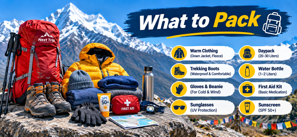
Packing for this trek means preparing for both a humid, forested lower gorge and a cold, high altitude pass crossing in the same trip, so layering matters more here than on shorter, single climate treks.
Clothing and Layers
- Moisture wicking base layers, both top and bottom, in quick drying fabric rather than cotton
- A warm mid layer such as a fleece or light down jacket for evenings at the higher villages
- A heavier down jacket for Samdo, Dharmashala, and the pass crossing itself
- A waterproof and windproof outer shell, particularly important given how exposed the final approach to Larkya La can be
- Trekking trousers for daytime walking, plus warmer insulated layers for camp in the evenings
- Warm hat, sun hat, sunglasses rated for high altitude glare, and a buff or scarf for dust and wind protection lower in the gorge
- Warm gloves, plus a lighter pair for general daytime use
Footwear
- Broken in, waterproof trekking boots with ankle support, rather than trail runners, given the mixed terrain and the pass crossing
- Comfortable camp shoes or sandals for evenings at teahouses
- Several pairs of good quality trekking socks, with a thicker pair reserved for the pass crossing day
- Gaiters if you are trekking in a season with likely snow at altitude
Sleep System and Health
- A sleeping bag rated to at least negative 15 degrees Celsius, since teahouse rooms at the higher villages are not heated
- A basic personal first aid kit, including blister treatment, pain relief, and any personal medication you take regularly
- Water purification tablets or a filter, since bottled water is not a sustainable option on a trip this long
- Hand sanitizer and a small personal toiletry kit, since hot showers become less reliable the higher you go
- A basic altitude sickness medication kit, discussed with your doctor in advance rather than assembled on the trail
Documents and Extras
- Passport with at least six months of validity remaining, plus passport photos for permit paperwork
- Travel insurance documentation that specifically covers high altitude trekking and emergency helicopter evacuation up to at least 6,000 meters
- A headlamp with spare batteries for the early, often predawn start on the pass crossing day
- Trekking poles, which genuinely help on the long, steep descent from Larkya La to Bimthang
- A power bank, since charging is limited and sometimes charged by the hour at the higher teahouses
Culture and Etiquette While Trekking Through Tsum Valley
Because Tsum Valley opened to outside visitors relatively recently and remains more traditional than the main circuit trail, a few points of etiquette go a long way here specifically.
- Walk clockwise around mani walls, chortens, and prayer wheels, which is the correct direction in Tibetan Buddhist practice and the direction local people will expect.
- Ask before photographing monks, nuns, or local residents, particularly inside or near monasteries such as Mu Gompa and Rachen Gompa, which remain active religious spaces rather than tourist attractions.
- Dress modestly, covering shoulders and knees where practical, especially when visiting monasteries.
- Remove your shoes when entering monastery prayer halls, and keep voices low inside.
- Avoid public displays of affection and overly casual behavior in villages, which reads as more out of place here than it might in more heavily visited parts of Nepal.
- If offered tea or food in a village home, it is polite to accept at least a small amount, even briefly, as refusing outright can be seen as impolite in some households.
Solo Trekkers, Guides and Group Requirements
- A licensed guide is mandatory for any trek through the Manaslu restricted area, including the Tsum Valley portion, regardless of your experience level or group size.
- As of a rule change that took effect in March 2026, the previous minimum of two trekkers per restricted area permit was removed, meaning a single trekker can now obtain a solo permit through a registered agency, provided a licensed guide accompanies them.
- Unguided solo trekking inside the restricted zone remains not permitted, even after that change. The rule change affects group size minimums, not the guide requirement itself.
- If you are trekking as part of a small private group rather than solo, permit paperwork and daily logistics are generally simpler to arrange as a single party through one agency rather than trying to split permits across different operators.
Cost of the Manaslu Tsum Valley Trek
Package pricing for this combined route commonly starts in the region of USD 1,290 per person for larger groups, with most individual and small group quotes landing between roughly USD 1,350 and USD 1,650 depending on group size, season, and exactly what is included. This figure typically covers guided trekking days, teahouse accommodation, meals on the trail, and permit arrangement, but it is worth confirming exactly what is and is not included before booking, since practices vary between agencies.
- Commonly included: licensed guide and porter fees, teahouse accommodation on the trek, three meals a day while trekking, permit arrangement and fees in many packages, and airport transfers in Kathmandu.
- Commonly excluded: international flights, Nepal visa fees, travel insurance, personal trekking gear, alcoholic or bottled drinks, tips for your guide and porter team, and any extra nights in Kathmandu beyond the standard itinerary.
- Permit costs are sometimes bundled into the headline price and sometimes quoted separately, which is one of the first things worth clarifying when comparing quotes between operators, since the restricted area permit alone can represent a meaningful share of the total cost on a trip this long.
- Contact a registered operator directly for a quote against your specific travel dates and group size, since season and group size both move the final price noticeably on this particular route.
Frequently Asked Questions
How many days does the combined Manaslu Tsum Valley Trek take?
Most itineraries run between 18 and 23 days from Kathmandu back to Kathmandu, depending on the operator, your pace, and how many acclimatization or buffer days are built in. Twenty days, as laid out above, is a realistic planning figure that includes two driving days at each end.
Is this harder than doing the Manaslu Circuit without Tsum Valley?
Yes. The pass crossing itself is the same, but the combined trip is roughly a week longer, adds a second distinct altitude zone in Tsum Valley before you even reach the main circuit climb, and means you cross Larkya La after significantly more accumulated trekking days than a standalone circuit trekker.
Do I need a separate permit specifically for the Tsum Valley portion?
Tsum Valley sits inside the same Manaslu restricted area, and the core permit fee structure that applies to the standard Manaslu Circuit also covers the Tsum Valley extension according to most current sources. Some agency websites describe an additional, lower Tsum specific fee bracket instead. Confirm the exact current structure with your operator when you book rather than relying on any single published figure, including this one.
Can I trek this route solo, without joining a group?
Yes, as of the March 2026 rule change that removed the previous two person minimum for restricted area permits. A licensed guide is still required, and unguided solo trekking in the restricted zone remains not permitted.
What is the maximum altitude I will reach on this trek?
Larkya La Pass, at 5,106 meters, is the highest point of the full combined itinerary. Mu Gompa in Tsum Valley, at roughly 3,700 meters, is the highest point reached on the Tsum side of the trip before you descend back to rejoin the main circuit trail.
Do I need previous high altitude trekking experience for this route?
It is strongly recommended rather than strictly required. This is a longer and more demanding trip than a first time trekker’s typical introduction to Nepal, given the combination of a second altitude zone in Tsum Valley and a 5,106 meter pass crossing later in the trip, but a fit and well prepared beginner trekking with an experienced operator and a conservative pace can realistically complete it.
What kind of accommodation should I expect along the way?
Teahouse accommodation throughout, ranging from reasonably comfortable lodges in the lower villages and at Samagaon to very basic rooms in Tsum Valley and at Samdo and Dharmashala. Shared bathrooms are standard above the lower sections of the route, and hot showers become less reliable the higher you go.
Final Planning Notes
The combined Manaslu Tsum Valley Trek rewards trekkers who treat it as its own distinct trip rather than simply a longer version of either half. Build in the rest days the itinerary already allows for, confirm your permit structure directly with your operator given how much agency websites disagree on the Tsum specific fee question, and plan your travel dates around the autumn or spring windows if a reliable pass crossing matters to your schedule. Done that way, this is one of the more complete ways to see the Manaslu region in a single trip, combining a side valley that very few trekkers visit with a full circuit and one of Nepal’s more demanding high passes.
Related Manaslu Tsum Valley Guides
Planning deeper into this trek? These guides cover the details this itinerary overview does not, from training and altitude prep to packing and culture.