The Ghorepani Poon Hill Trek follows a loop through the Annapurna foothills west of Pokhara. It starts at Nayapul, climbs through terraced farmland and rhododendron forest to Ghorepani at 2,860 m, reaches the Poon Hill viewpoint at 3,210 m for the sunrise, then descends through Tadapani and the Gurung village of Ghandruk before returning to Nayapul. Most trekkers complete the loop in 5 days. A 4-day version cuts the overnight at Tikhedhunga. A 6 or 7-day version adds Panchase Danda or extensions through Landruk on the return leg.
This page covers every day of the standard itinerary in detail, with distance, altitude, and walking time for each section, plus the most common alternatives and the trail conditions by season.
Ghorepani Poon Hill Trek: At a Glance
| Duration | 5 days (standard), 4 days (express), 6 to 7 days (extended) |
| Total Distance | Approximately 60 km for the full 5-day loop |
| Maximum Altitude | 3,210 m (Poon Hill viewpoint) |
| Trailhead | Nayapul (1,070 m), 1 hr 30 min drive from Pokhara |
| Daily Walking | 4 to 7 hours depending on the day |
| Accommodation | Teahouses at every overnight stop |
| Meals | Breakfast, lunch, and dinner available at teahouses |
| Permits | TIMS card (USD 20) and ACAP permit (NPR 3,000) |
| Best Months | October, November, March, April |
| Hardest Section | Tikhedhunga to Ulleri: approximately 3,000 stone steps in 90 minutes |
| Easiest Section | Ghandruk to Nayapul: mostly downhill on wide trail |
| Guide Required | Yes, mandatory under Nepal government regulations since April 2023 |
Day 1: Pokhara to Tikhedhunga
Day 1 Summary
| Detail | Info |
|---|---|
| Drive: Pokhara to Nayapul | 42 km, approximately 1 hr 30 min by private vehicle |
| Trek start altitude | Nayapul: 1,070 m |
| Trek end altitude | Tikhedhunga: 1,525 m |
| Trek distance | Nayapul to Tikhedhunga: 7 km |
| Walking time | 3 to 4 hours |
| Elevation gain | 455 m |
| Trail type | Flat riverside trail, then stone steps near Tikhedhunga |
Day 1 begins with a drive from Pokhara to Nayapul. Most trekking agencies arrange a private vehicle that departs between 7:00 and 8:00 in the morning. The drive takes approximately 1 hour and 30 minutes on a paved road that follows the Modi Khola river valley. Nayapul is a small market town at the road end where you register your permits at the ACAP checkpoint before setting foot on the trail.
From Nayapul, the trail crosses a suspension bridge over the Bhurungdi Khola and follows the Modi Khola south bank. The first section to Birethanti (1,025 m) takes about 20 to 30 minutes and is completely flat. Birethanti is the last settlement with reliable ATMs and phone coverage before the upper trail sections. Stock up on cash here. The TIMS checkpoint in Birethanti registers your trekking permit before you turn north toward Hile.
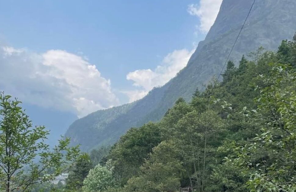
From Birethanti the trail climbs gradually through Sudame to Hile, passing through cultivated fields and small Magar settlements. Hile sits at 1,430 m and has a cluster of teahouses where many trekkers stop for an early lunch. The section from Hile to Tikhedhunga (1,525 m) follows the Bhurungdi Khola on its right bank, a flat walk through shaded forest and past small waterfalls. Tikhedhunga is a village of about 12 teahouses strung along the trail. It is the last flat ground before the famous Ulleri stone staircase begins.
Whether to stop at Tikhedhunga or push on to Ulleri depends on your fitness and departure time from Pokhara. Groups leaving Pokhara at 7:00 am typically reach Tikhedhunga by 1:00 pm and can comfortably push on to Ulleri by 3:00 pm. Groups leaving after 9:00 am are better served stopping at Tikhedhunga. The Ulleri climb is punishing in afternoon heat and should ideally be done in the morning.
The Tikhedhunga teahouses are basic but adequate. Expect a private room with two single beds, a shared bathroom, and blankets. Meals are standard trekking food: dal bhat, fried rice, noodle soup, pasta. The village sits in a narrow valley with no mobile signal on NTC or Ncell. Download offline maps before you leave Pokhara.
If you stop at Tikhedhunga, you face the Ulleri staircase first thing the next morning with fresh legs and cool air. Most guides recommend this split: Tikhedhunga on Day 1, Ghorepani on Day 2. Covering the hardest climbing across two mornings rather than one long push is more comfortable for the large majority of trekkers.
Key stops today: Nayapul (permits), Birethanti (ATM, TIMS check), Hile (lunch option), Tikhedhunga (overnight).
Day 2: Tikhedhunga to Ghorepani
Day 2 Summary
| Detail | Info |
|---|---|
| Start altitude | Tikhedhunga: 1,525 m |
| End altitude | Ghorepani: 2,860 m |
| Distance | Approximately 11 km |
| Walking time | 5 to 7 hours |
| Elevation gain | 1,335 m |
| Hardest section | Tikhedhunga to Ulleri: approximately 3,000 stone steps |
| Key villages | Ulleri (1,960 m), Banthanti (2,250 m), Nangethanti (2,460 m) |
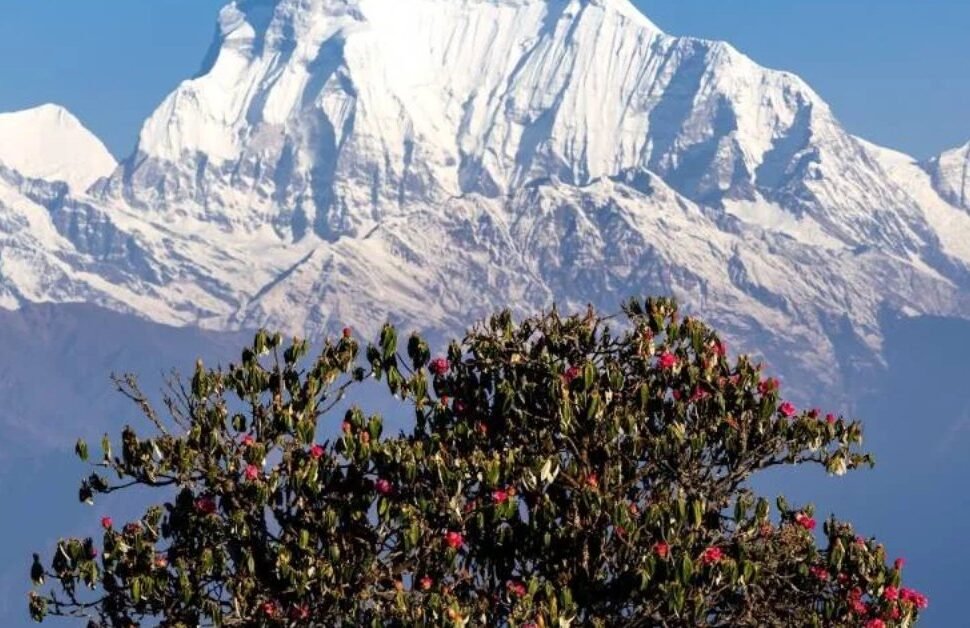
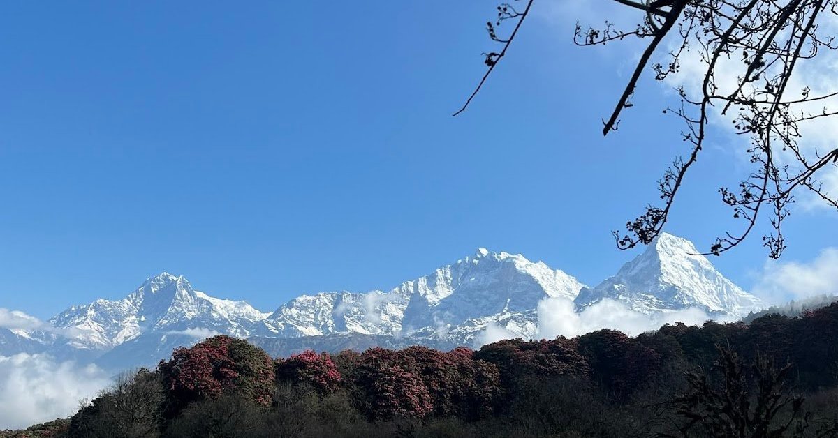
The Tikhedhunga to Ulleri section is the section every trekker remembers. From the bottom of the village, the trail cuts sharply upward on stone steps that climb approximately 500 m in under 2 km. The steps are wide and well maintained, edged with mani stones and small shrines. In October and November the surrounding forest is open and the views back down the Modi Khola valley open up quickly as you gain height. In March and April the rhododendron trees along this section are in full bloom, red and pink against the green slopes, and the climb feels less demanding with the colour around you.
The climb to Ulleri takes 1 hour 30 minutes to 2 hours depending on pace. Ulleri (1,960 m) is the largest Magar village on the route, spread across a broad ridge with a handful of teahouses, a school, and a health post. Stop here for tea and second breakfast before continuing. The views from Ulleri toward Annapurna South (7,219 m) and Hiunchuli (6,441 m) are the first clear mountain views of the trek.
Above Ulleri the trail enters the lower edge of the rhododendron forest that covers the entire hillside up to Ghorepani. The forest thickens as you gain altitude. By Banthanti (2,250 m) you are walking through old-growth trees with hanging moss and a cool, damp air that smells of damp earth and bark. Banthanti has three or four teahouses and is a natural lunch stop roughly halfway between Ulleri and Ghorepani. From Banthanti the trail continues steadily upward through Nangethanti (2,460 m) to the ridge at Ghorepani.
Ghorepani (2,860 m) sits on a wide saddle between two ridgelines. It is the largest settlement on the trek, with approximately 30 to 40 teahouses and lodges, several small shops, and an ACAP information centre. The Poon Hill viewpoint is a 30-minute walk northeast of the village, at 3,210 m. Most trekkers arrive in Ghorepani between 1:00 and 3:00 pm, check in, rest, eat dinner early, and sleep by 8:00 pm in preparation for the 4:00 am Poon Hill start.
At 2,860 m, Ghorepani nights are cold. In October and November expect temperatures between 2 and 8 degrees C overnight. In December and January, the temperature drops below zero. Your teahouse provides blankets, but bring a sleeping bag liner or a light sleeping bag rated to at least minus 5 degrees C for October through April. Down jackets are available for rent at most Ghorepani lodges if you do not have one.
The teahouses in Ghorepani range from basic to quite comfortable. Rooms with attached bathrooms cost more but are available at most mid-range lodges. Solar hot showers cost NPR 200 to 400. NTC and Ncell both have signal in the village. WiFi is available at most teahouses for NPR 300 to 500 per session.
Key stops today: Ulleri (tea, mountain views), Banthanti (lunch), Nangethanti (checkpoint), Ghorepani (overnight).
Book the Ghorepani Poon Hill Trek with Next Trip Nepal
Licensed guides, all permits included, private transport both ways. Groups of 2 or more, any month of the year.
View Trek Details and PricingDay 3: Poon Hill Sunrise, Then Ghorepani to Tadapani
Day 3 Summary
| Detail | Info |
|---|---|
| Wake-up time | 4:00 am for Poon Hill sunrise |
| Poon Hill altitude | 3,210 m (350 m above Ghorepani) |
| Time to reach Poon Hill | 45 to 60 minutes from Ghorepani |
| Trek after sunrise | Ghorepani to Tadapani via Deorali |
| Start altitude (post-sunrise) | 2,860 m (Ghorepani) |
| End altitude | Tadapani: 2,590 m |
| Distance (Ghorepani to Tadapani) | Approximately 10 km |
| Walking time (full day) | 6 to 8 hours including Poon Hill ascent and descent |
| Key section | Deorali pass (3,100 m): steepest descent section |
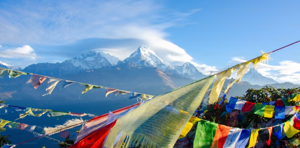
The Poon Hill sunrise is the defining experience of the entire trek. Every group staying in Ghorepani begins the climb to the viewpoint before dawn. The trail from Ghorepani to Poon Hill is marked with stone steps all the way to the summit tower. It climbs approximately 350 m over 1.5 km. In October and November the path is crowded with 100 to 200 trekkers from multiple teahouses, all converging on the observation tower at the top. In quieter months (December through February) you may find yourself with far fewer people.
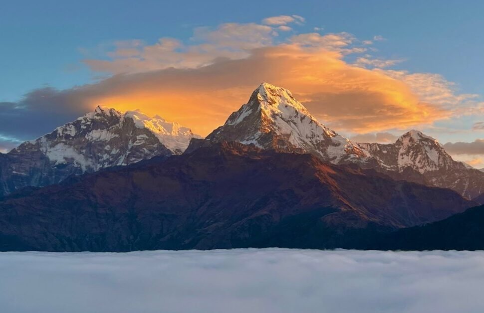
Sunrise from Poon Hill presents one of the most complete high-altitude panoramas in the Annapurna region. From the tower, looking northeast, you see Dhaulagiri (8,167 m) framed to the left, Annapurna I (8,091 m) and Annapurna South (7,219 m) filling the centre, and Machhapuchhre (6,993 m) to the right. The alpenglow on these peaks as the first light turns the snow from grey to orange to gold happens over approximately 20 minutes beginning about 15 minutes before the sun clears the horizon. Arrive at least 30 minutes before sunrise to find a position on the tower or on the open slope below it.
Sunrise times by month at Poon Hill: October (6:15 am), November (6:30 am), December (6:45 am), January (6:50 am), February (6:35 am), March (6:10 am), April (5:50 am). Set your alarm to allow 60 minutes for the walk from Ghorepani plus 30 minutes of waiting time at the top. This means departing Ghorepani no later than 4:30 am in all months except January when you can leave at 4:45 am.
After sunrise, return to Ghorepani for breakfast. The descent back to the village takes about 30 minutes on the same stone steps. Most teahouses serve breakfast from 5:30 am onward for the Poon Hill groups. After eating and packing, you continue the main walk of the day toward Tadapani.
The route from Ghorepani to Tadapani passes through Deorali (3,100 m), a high pass on the ridge east of Ghorepani. The climb from Ghorepani to Deorali takes about 1 hour through dense rhododendron. On a clear day the views from Deorali are wider than from Poon Hill itself, with Annapurna South and Machhapuchhre directly ahead as you face east. From Deorali the trail descends steeply through forest to the small settlement of upper Banthanti, then continues along the ridge to Tadapani.
Tadapani (2,590 m) sits on a forested ridge with views of Annapurna South and Machhapuchhre from the teahouse terraces. The village is smaller than Ghorepani, with 8 to 12 teahouses. It is quieter and many trekkers find the views from Tadapani more direct and more rewarding than from Poon Hill. The lodge terraces face toward Machhapuchhre (Fishtail Mountain) and on clear evenings the reflection of sunset on the peak is one of the better photographic moments of the trek.
Key stops today: Poon Hill (sunrise), Ghorepani (breakfast and pack), Deorali (views, checkpoint), Tadapani (overnight).
Day 4: Tadapani to Ghandruk
Day 4 Summary
| Detail | Info |
|---|---|
| Start altitude | Tadapani: 2,590 m |
| End altitude | Ghandruk: 1,940 m |
| Distance | Approximately 6 km |
| Walking time | 3 to 4 hours |
| Elevation change | 650 m descent |
| Trail type | Steep descent through rhododendron and oak forest |
| Village highlights | Ghandruk: Gurung Cultural Museum, traditional stone houses, mountain views |
Day 4 is the shortest trekking day of the standard itinerary by distance, but the descent from Tadapani to Ghandruk is steep and needs careful footing, particularly on wet or muddy days. The trail drops 650 m over 6 km through thick forest. Trekking poles help significantly on this section for the knee impact of the sustained descent over stone and root-covered ground.
The trail from Tadapani first passes through a section of old-growth forest where the trees are large, with hanging moss and occasional clearings that give partial views toward the valley below. There are no permanent settlements between Tadapani and Ghandruk, only a small tea stall about halfway down where you can rest. On a clear morning the south face of Annapurna South and the tip of Hiunchuli appear through gaps in the trees as you descend toward the valley floor.
Ghandruk (1,940 m) is the largest Gurung village in the Annapurna region. It is built on a terraced hillside facing Machhapuchhre and Annapurna South, with traditional stone-paved lanes, slate-roofed houses, and stone-walled terraces going down the hillside in layers. The village has had electricity for several decades and the main walking lanes are clean and well maintained. It is also accessible by dirt road from Pokhara via Kimche, which means Ghandruk has a wider range of accommodation than other villages on the route, from basic teahouses to mid-range lodges with attached bathrooms and solar hot water.
The Gurung Cultural Museum in Ghandruk documents the history, dress, and traditions of the Gurung people, who have lived in these hills for centuries and have provided soldiers to the Gurkha regiments for over 200 years. Entry costs a small fee. There is also an ACAP information centre in Ghandruk with trail condition and weather updates.
The views from Ghandruk are outstanding. On a clear afternoon, the terraced village and its surrounding fields sit in the foreground while Annapurna South and Hiunchuli rise directly to the north. Machhapuchhre appears to the east. This is the most photogenic village on the trek and many trekkers rate the view from their teahouse terrace in Ghandruk as equal to Poon Hill, without the pre-dawn alarm and the crowds.
Because Day 4 is short in walking hours, you can use the afternoon for a walk around the village, a museum visit, or simply resting your legs before the final descent on Day 5. Most trekkers find the afternoon in Ghandruk one of the most enjoyable parts of the whole trip.
Key stops today: Tadapani (breakfast), forest trail, Ghandruk (overnight, museum optional).
Ready to Book? We Handle Everything
Permits, licensed guide, teahouse bookings, and private vehicle both ways. Fixed price, no hidden costs.
Get a Quote for Your DatesDay 5: Ghandruk to Nayapul to Pokhara
Day 5 Summary
| Detail | Info |
|---|---|
| Start altitude | Ghandruk: 1,940 m |
| End altitude | Nayapul: 1,070 m |
| Distance | Approximately 12 km to Nayapul |
| Walking time | 4 to 5 hours |
| Elevation loss | 870 m descent to Nayapul |
| Drive: Nayapul to Pokhara | Approximately 1 hr 30 min |
| Key villages | Kimche (1,640 m, jeep option), Birethanti (TIMS exit) |
The final day descends from Ghandruk to Nayapul via Kimche and Birethanti. Leave Ghandruk by 7:00 to 8:00 am. The trail from Ghandruk initially descends on stone steps to the Kimche river crossing, then continues downhill on a mix of stone and dirt path. At Kimche (1,640 m) there is a jeep track running back to Pokhara via the Landruk road. Trekkers who are short on time or have significant knee discomfort can arrange a jeep from Kimche. Most groups continue on foot to Birethanti, which is a pleasant walk along the river.
From Kimche the trail follows the Modi Khola on a mostly flat path to Syauli Bazaar and then to Birethanti. This lower section passes through smaller farming villages and terraced rice fields. By the time you reach Birethanti (1,025 m) the trail feels much warmer and the landscape is subtropical compared to the cold ridgeline of Ghorepani two days earlier. At Birethanti there is a small market, a few restaurants for a final lunch, and the exit checkpoint for your TIMS card.
From Birethanti to Nayapul takes about 20 to 30 minutes on a flat, wide track. Nayapul is where your private vehicle waits. The drive back to Pokhara lakeside takes approximately 1 hour 30 minutes. Most groups return to Pokhara by 1:00 to 2:00 pm, in time for a hot shower, a proper meal, and an evening rest before travel the following day.
If your flight or bus departs Pokhara on Day 5, this is manageable. The return to Pokhara lakeside from Nayapul takes 1 hr 30 min, meaning you can catch an afternoon bus to Kathmandu departing at 3:00 pm or an evening flight at 5:00 pm or later. Confirm your return travel time with your guide before Day 5 to plan the morning departure from Ghandruk accordingly.
Key stops today: Ghandruk (breakfast), Kimche (jeep option), Birethanti (exit checkpoint, lunch), Nayapul (end), Pokhara (return by vehicle).
4-Day Itinerary Option
4-Day Express Itinerary: Summary
The 4-day version pushes to Ulleri on Day 1 and combines Tadapani and Ghandruk into one long Day 3 after Poon Hill. This works for fit trekkers with prior multi-day hiking experience who have a genuine schedule constraint.
| Day | Route | Distance | Walking Time | Overnight |
|---|---|---|---|---|
| 1 | Pokhara to Ulleri via Nayapul and Tikhedhunga | 10 km | 5 to 6 hrs | Ulleri (1,960 m) |
| 2 | Ulleri to Ghorepani | 8 km | 4 to 5 hrs | Ghorepani (2,860 m) |
| 3 | Poon Hill sunrise, then Ghorepani to Ghandruk via Deorali and Tadapani | 16 km | 8 to 9 hrs | Ghandruk (1,940 m) |
| 4 | Ghandruk to Nayapul to Pokhara | 12 km walk plus drive | 4 to 5 hrs | Pokhara |
Day 3 of the 4-day version is the demanding part: Poon Hill at 4:30 am, breakfast, then 16 km from Ghorepani through Deorali, Banthanti, and Tadapani to Ghandruk, arriving around 4:00 to 5:00 pm. This is feasible in October and March when daylight is long and trail conditions are good. In December or January it gets dark by 5:30 pm, so this combined day requires an early breakfast and a strong pace throughout.
We do not recommend the 4-day version for first-time trekkers or anyone who has not walked 6 or more hours on mountain terrain recently. The standard 5-day version is more comfortable and gives you time to actually enjoy the villages, the culture, and the views rather than just moving through them.
6-Day Extended Itinerary
| Day | Route | Walking Time | Overnight |
|---|---|---|---|
| 1 | Pokhara to Tikhedhunga | 3 to 4 hrs | Tikhedhunga (1,525 m) |
| 2 | Tikhedhunga to Ghorepani | 5 to 7 hrs | Ghorepani (2,860 m) |
| 3 | Poon Hill sunrise, Ghorepani to Tadapani | 6 to 8 hrs | Tadapani (2,590 m) |
| 4 | Tadapani to Ghandruk | 3 to 4 hrs | Ghandruk (1,940 m) |
| 5 | Ghandruk to Australian Base Camp viewpoint and back, or to Landruk | 4 to 5 hrs | Ghandruk or Landruk (1,565 m) |
| 6 | Landruk or Ghandruk to Nayapul to Pokhara | 3 to 4 hrs | Pokhara |
The 6-day extension adds an optional hike from Ghandruk toward the Australian Base Camp viewpoint at approximately 2,100 m, which looks directly toward the Annapurna South face from a different angle than Poon Hill. The trail is less used than the main Poon Hill route and passes through dense forest. Alternatively, Day 5 can be spent walking from Ghandruk to Landruk (1,565 m), a smaller Gurung village that is quieter than Ghandruk and has excellent views of Machhapuchhre. From Landruk, Day 6 descends to Nayapul via Tolka and Birethanti.
Altitude Profile and Daily Elevation
| Location | Altitude | Change from Previous Stop |
|---|---|---|
| Nayapul (trail start) | 1,070 m | Trek begins |
| Birethanti | 1,025 m | 45 m descent |
| Hile | 1,430 m | +405 m |
| Tikhedhunga (night 1) | 1,525 m | +95 m |
| Ulleri | 1,960 m | +435 m |
| Banthanti | 2,250 m | +290 m |
| Nangethanti | 2,460 m | +210 m |
| Ghorepani (night 2) | 2,860 m | +400 m |
| Poon Hill viewpoint | 3,210 m | +350 m |
| Deorali pass | 3,100 m | 110 m descent from Poon Hill |
| Tadapani (night 3) | 2,590 m | 510 m descent from Deorali |
| Ghandruk (night 4) | 1,940 m | 650 m descent |
| Kimche | 1,640 m | 300 m descent |
| Birethanti | 1,025 m | 615 m descent |
| Nayapul (end) | 1,070 m | +45 m |
Best Time to Start Each Day
The daily start time matters on this trek because Poon Hill clears quickly after sunrise and afternoon clouds build from 11:00 am onward on most days. Mountain mornings in Nepal are almost always clearer than afternoons.
| Day | Recommended Start | Reason |
|---|---|---|
| Day 1 | 7:00 to 8:00 am from Pokhara | Arrive Tikhedhunga by midday, avoiding afternoon heat on the stone steps above |
| Day 2 | 7:00 am from Tikhedhunga | Climb to Ulleri in cool morning air; reach Ghorepani by 1:00 to 2:00 pm for rest |
| Day 3 (Poon Hill) | 4:00 to 4:30 am from Ghorepani | Arrive Poon Hill 30 minutes before sunrise; begin main trek at 7:30 am after breakfast |
| Day 4 | 7:30 to 8:00 am from Tadapani | Arrive Ghandruk by noon; afternoon free for village walk or museum |
| Day 5 | 7:00 am from Ghandruk | Reach Nayapul by noon; drive back to Pokhara in early afternoon |
Trail Conditions by Season
| Month | Trail Condition | Visibility | Crowds | Notes |
|---|---|---|---|---|
| October | Dry and firm | Excellent | Very high | Best month; post-monsoon clarity on Poon Hill is outstanding |
| November | Dry and firm | Very good | High | Cooler than October; light snow possible on Poon Hill late in month |
| December | Cold; ice on steps before dawn | Good on clear days | Low | Snow on Poon Hill area possible; traction footwear useful |
| January | Snow possible on upper sections | Good on clear days | Very low | Coldest month; Ghorepani below zero overnight |
| February | Improving; snow melting | Good to very good | Low to moderate | Rhododendron begins to bloom in lower sections |
| March | Good | Good | High | Rhododendron in full bloom above Ulleri; second peak season |
| April | Warm; lower sections dry | Moderate to good | High | Pre-monsoon haze reduces views on some days later in month |
| May | Pre-monsoon; possible rain | Often hazy | Low | Views variable; trails muddy after rain showers |
| June to September | Monsoon; trails muddy and slippery | Poor to moderate | Very low | Leeches above 1,500 m; some teahouses closed July and August |
Transport to the Trailhead
The standard approach to the trailhead at Nayapul is a 42 km drive from Pokhara lakeside. Options:
- Private vehicle (included in NTN packages): A private car or minibus drops you at Nayapul and collects you on Day 5. Booked independently, a private vehicle from Pokhara to Nayapul costs NPR 2,500 to 3,500 each way depending on vehicle size.
- Tourist bus or local bus: Buses run from Pokhara bus park to Nayapul. The journey takes 2 to 2 hr 30 min due to stops. Cost is NPR 100 to 150 per person. Not practical for groups with large luggage.
- Taxi from Pokhara lakeside: A one-way taxi to Nayapul costs NPR 1,500 to 2,000. Return taxis need pre-booking or arrangement at Nayapul on arrival.
If you start from Ghandruk on the reverse route, the drive from Pokhara to Kimche takes approximately 2 hours by jeep on a rougher road. The cost is NPR 3,500 to 5,000 per jeep.
Permits and Checkpoints on the Route
You need two permits for the Ghorepani Poon Hill Trek:
- TIMS card: USD 20 per person (approximately NPR 2,700). Obtained at Nepal Tourism Board offices in Kathmandu or Pokhara, or through a registered trekking agency. Checked at Birethanti checkpoint on Day 1 and at the exit checkpoint on Day 5.
- ACAP permit: NPR 3,000 per person. Obtained at ACAP offices in Pokhara or at the checkpoint in Nayapul. Checked at multiple points along the route including Ghorepani.
Both permits are included in all Next Trip Nepal trekking packages. If booking independently, allow 2 to 3 hours in Pokhara the day before departure to obtain both permits. The ACAP office in Pokhara lakeside and the Nepal Tourism Board office are both within 10 minutes of most guesthouses.
Accommodation Overview by Night
| Night | Village | Altitude | Teahouses | Hot Shower | WiFi |
|---|---|---|---|---|---|
| 1 | Tikhedhunga | 1,525 m | 8 to 12 | Cold water only | No signal |
| 2 | Ghorepani | 2,860 m | 30 to 40 | Solar hot shower (NPR 200 to 400) | Yes (NPR 300 to 500) |
| 3 | Tadapani | 2,590 m | 8 to 12 | Solar hot shower at most lodges | Limited, slow |
| 4 | Ghandruk | 1,940 m | 20 to 30 | Solar hot shower (NPR 200 to 400) | Yes (NPR 200 to 400) |
What to Eat Each Day
Every teahouse on the Ghorepani route serves a standard trekking menu. Dal bhat (lentil soup with rice, vegetables, and pickles) is the most filling and most affordable option, typically NPR 350 to 550 depending on altitude. It is also the most nutritious option for sustained daily walking. Most NTN guides eat dal bhat at least twice a day during this trek.
Other items available on every menu: pasta, fried rice, noodle soup, spring rolls, momo (steamed dumplings), Tibetan bread, eggs any style, porridge, pancakes, and sandwiches. At higher altitudes (Ghorepani and above), prices are 20 to 40 percent higher than at lower villages because all food is carried up by porter or mule team. A full meal costs NPR 600 to 1,000 at Ghorepani versus NPR 400 to 600 at Birethanti.
Drinks on trail include black tea, milk tea, lemon tea, ginger tea, and bottled mineral water. Bottled water costs NPR 100 at Nayapul and NPR 300 to 400 at Ghorepani. Carry a reusable water bottle and refill from the teahouse boiled water supply (NPR 50 to 100 per litre) to reduce plastic on the trail. Iodine tablets or a SteriPen are useful backup above Banthanti.
5 Days, All Inclusive from Pokhara
Our Ghorepani Poon Hill Trek package covers everything: licensed guide, porter, permits, teahouses, all meals, and private transport. No surprises at the end.
See the Full PackageFrequently Asked Questions
Can I do the Ghorepani Poon Hill Trek without a guide?
No. Nepal’s government made licensed guides mandatory for all treks in the Annapurna Conservation Area from April 2023. This applies to all foreign trekkers regardless of experience level. Guides must hold a government-issued trekking guide licence, which is checked at permit checkpoints. Independent trekking without a registered guide carries a fine at checkpoints.
Is the 4-day or 5-day itinerary better?
The 5-day version is better for almost all trekkers. The extra night at Tikhedhunga means you tackle the steep Ulleri climb in the morning with fresh legs and cool temperatures rather than in the afternoon heat. The 4-day version is only worth considering if you have a genuine schedule constraint. Saving one day at the cost of comfort and enjoyment on the hardest section is not a worthwhile trade for most people.
What time does sunrise happen at Poon Hill?
Sunrise at Poon Hill ranges from 5:50 am in April to 6:50 am in January. Most groups leave Ghorepani between 4:00 and 4:30 am to arrive at the observation tower 30 minutes before sunrise. In peak season (October and November) the tower fills with trekkers, so arriving early gives you a better viewing position on the tower or on the open slope below it.
Is there mobile phone signal on the trek?
NTC and Ncell both have signal at Ghorepani and Ghandruk. Signal is unreliable or absent between Tikhedhunga and Ghorepani and on parts of the Deorali to Tadapani section. Download offline maps on your phone (Maps.me or Gaia GPS) before leaving Pokhara and do not rely on mobile data above Birethanti.
Can I start from Ghandruk instead of Nayapul?
Yes. The reverse route starts in Ghandruk, climbs to Tadapani, then to Ghorepani, ascends Poon Hill on Day 3 morning, then descends via Ulleri and Tikhedhunga to Nayapul. The elevation profile is similar but the hardest climbing (the Ulleri steps) comes on Day 3 rather than Day 2. Some trekkers prefer this because the Poon Hill sunrise comes after two days of acclimatisation at altitude rather than on the second night at Ghorepani.
How far is Nayapul from Pokhara?
Nayapul is 42 km from Pokhara lakeside by road. The drive takes approximately 1 hour 30 minutes by private vehicle on a paved road. By tourist bus it takes 2 to 2 hr 30 min. By local bus from Pokhara bus park it can take up to 3 hours with stops.
What happens if weather is bad on Poon Hill morning?
If cloud covers Poon Hill on Day 3 morning, most guides and groups wait one additional night in Ghorepani to try for sunrise on Day 4. This extends the trek by one day and adds one extra night accommodation cost. If you have a fixed return flight or bus, build one buffer day into your itinerary to allow for this possibility. Cloud-covered mornings are most common during the pre-monsoon period (April and May) and in the shoulder months (February and early March).
Money and Cash on the Ghorepani Poon Hill Trek
There are no ATMs on the trail after Birethanti. Withdraw enough Nepali rupees in Pokhara before departure or from the ATMs in Birethanti on Day 1. A rough budget for personal expenses across 5 days:
| Expense | Per Day Estimate | Notes |
|---|---|---|
| Hot showers | NPR 200 to 500 | Available at Ghorepani, Tadapani, Ghandruk |
| WiFi access | NPR 200 to 500 | Only at Ghorepani and Ghandruk |
| Phone charging | NPR 100 to 300 per device | Use a power bank above Tikhedhunga |
| Bottled drinks and snacks | NPR 300 to 800 | Cheaper if you buy in Pokhara before leaving |
| Entrance to Gurung Museum (Ghandruk) | NPR 100 | One time, Day 4 only |
| Tips for guide and porter | USD 8 to 15 total per day | 10 percent of total package is the standard |
In total, carry NPR 8,000 to 15,000 in cash for personal expenses across 5 days, depending on how freely you spend. Groups that buy snacks and drinks in Pokhara beforehand spend considerably less on the trail. Credit cards are not accepted anywhere on the trek beyond Birethanti. USD is not accepted at teahouses. Exchange in Pokhara before you leave.
Teahouses on this route generally do not overcharge significantly compared to the Everest Base Camp trail. Prices are posted in most lodges and are relatively standardised across villages at the same altitude. At Ghorepani, do not be surprised if your teahouse includes a minimum meal order as a condition of staying in their rooms for a low room rate. This is normal practice and is typically NPR 500 to 700 per person per meal.
Solo Trekkers and Small Groups
The Ghorepani Poon Hill Trek is one of the most popular routes in Nepal and you will always have company on the trail, even if you book alone. Solo trekkers booked through a trekking agency are assigned a private guide. If you prefer to share a guide with another solo traveler for a lower cost, ask your agency whether they can match you with another solo trekker on the same dates.
The trail is well marked and the teahouses are well spaced, so getting lost is unlikely on the main route between Nayapul and Ghorepani. However, above Ghorepani on the Deorali to Tadapani section, the trail becomes less obvious in snow or fog. A guide is not just a regulatory requirement on this route; on Day 3 in poor weather, a guide who knows the Deorali section is a genuine safety asset.
Couples and pairs are the most common group size for this trek. The teahouse rooms are designed for two people. If you are traveling solo, most teahouses assign you a twin room as a single supplement may or may not apply depending on the lodge. On busy nights in October, solo travelers are sometimes asked to share a room, which is common practice in the busiest teahouses. Your guide handles room allocation and will advocate for your preference.
What to Carry Each Day
Your porter carries the main pack (up to 15 kg). You carry a daypack with items you need access to during walking hours. What to keep in your daypack each day:
- Water (1 to 2 litres): Refill at teahouses. Do not drink directly from streams on this route.
- Snacks: Nuts, dried fruit, energy bars, or chocolate for between meal energy. Buy in Pokhara before leaving.
- Rain jacket and warm layer: Weather above 2,500 m can change within an hour. Even in October, afternoon rain or wind is possible above Ghorepani.
- Sun protection: Sunscreen SPF 50, sunglasses, and a hat. The UV is significantly stronger at altitude than at sea level.
- Headlamp with charged batteries: Essential for the Day 3 pre-dawn Poon Hill climb. LED headlamps with red light mode are easiest on your eyes in the dark.
- Trekking poles: Optional on the ascent, very helpful on the long descent from Tadapani and on Day 5. Reduces knee stress significantly on sustained downhill sections.
- First aid basics: Ibuprofen, blister pads, and any personal medication. Your guide carries a group first aid kit with altitude medication (acetazolamide is not needed on this trek due to the low max altitude).
- Camera or smartphone with full charge: The Poon Hill sunrise, the Ulleri mountain view, and Ghandruk village are the three main photography opportunities.
- Permit documents: Carry your TIMS card and ACAP permit in a waterproof bag or envelope. They are checked at multiple points and need to be accessible quickly at each checkpoint.
Safety Tips for the Trail
The Ghorepani Poon Hill Trek is one of the safest trekking routes in Nepal because of its low altitude, dense teahouse network, and heavy foot traffic. Serious altitude sickness is extremely rare at 3,210 m. However, basic safety awareness applies:
- Watch the stone steps: The Ulleri staircase and the descent from Deorali are both on wet stone that becomes very slippery in rain or with ice before dawn. Tread carefully, place each step deliberately, and use poles on descents.
- Start Poon Hill early: The pre-dawn trail from Ghorepani to Poon Hill involves a steep rocky path with torch light only. Walk at a pace that allows careful footing. Falls on this section do happen in the dark when trekkers rush.
- Communicate with your guide: If you feel unusually short of breath, have a persistent headache, or feel nauseated at or above Ghorepani, tell your guide immediately. Even at 2,860 m, a small number of people experience symptoms. Your guide has dealt with this before and knows when a descent is the right call.
- Do not hike alone above Deorali: The trail between Deorali and Tadapani passes through an area with limited visibility in cloud or snow. This is a mandatory guide situation in these conditions.
- Travel insurance must cover trekking: Standard travel insurance does not always cover mountain trekking. Confirm your policy covers trekking up to 4,000 m and helicopter evacuation before departing Nepal.
More Ghorepani Poon Hill Trek Guides
Continue planning your trek with these detailed guides: