Trek at a Glance
Lukla, 2,860m
Everest Base Camp, 5,364m
Approx. 130km from Lukla
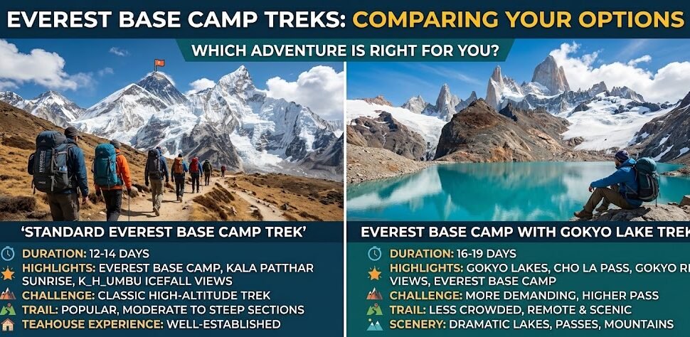
12 to 14 days
Namche Bazaar and Dingboche
March to May and October to November
Sagarmatha NP (NPR 3,000) and KLPA permit (USD 20)
8 overnight stops from Lukla to Gorak Shep
The Everest Base Camp trek passes through twelve distinct settlements on the way from Lukla to base camp and back. Each one is different. Namche Bazaar has ATMs and espresso machines. Gorak Shep has one frozen lake and a few stone teahouses where the generator cuts out at nine. Knowing what to expect at each stop before you arrive makes a real difference in how you manage your energy, your schedule, and your health at altitude. This guide covers every village in order, with walk times, teahouse costs, wifi access, food advice, and altitude warnings based on actual conditions at each elevation.
If your descent will be by helicopter rather than back through these same villages, our day by day itinerary for the Everest Base Camp Trek with Helicopter Return shows exactly which villages you will still pass through on the way up.
The Everest Base Camp Route: An Overview
The standard Everest Base Camp trek starts with a flight into Lukla (2,860m) and follows the Dudh Koshi River valley northeast through the Khumbu region. The total round-trip distance from Lukla back to Lukla is approximately 130 kilometers, with a maximum altitude of 5,643 meters if you summit Kala Patthar above Gorak Shep. Most people take 12 to 14 days for the full round trip, which includes two acclimatization rest days at Namche Bazaar and two nights at Dingboche. You gain roughly 2,500 meters of net altitude from Lukla to Everest Base Camp, though the actual daily ascent is far more than that because the trail climbs, descends, and climbs again continuously.
The villages on the route fall into three distinct zones. The lower zone, from Lukla to Namche, sits between 2,600 and 3,440 meters and has reliable wifi, running water, flush toilets, and a reasonable variety of food. The middle zone, from Tengboche to Dingboche, sits between 3,820 and 4,410 meters, where facilities thin out and the altitude begins to affect appetite, sleep, and energy. The upper zone, from Lobuche to Gorak Shep, sits above 4,900 meters. Accommodation here is basic, the food choices are limited, and you will not sleep as well as you did at lower elevations. Recognizing these three zones helps you prepare appropriately for each stage of the journey.
The trail is well marked throughout the entire route. You will walk on stone paths, cross suspension bridges over the Dudh Koshi and its tributaries, climb through rhododendron and pine forests in the lower sections, and move across open rocky terrain and glacier moraines above Dingboche. Yak caravans are a regular presence above Namche. Yield to them on narrow trail sections. They are large animals with wide loads and no interest in negotiating right of way.
Complete Village Distance and Altitude Chart
| Village | Altitude | From Lukla | Walk from Previous Stop | Role on Route |
|---|---|---|---|---|
| Lukla | 2,860m | 0km | Flight from Kathmandu or Ramechhap | Gateway, first night |
| Phakding | 2,610m | 8km | 3 to 4 hours | First overnight stop |
| Monjo | 2,835m | 12km | 1 to 1.5 hours from Phakding | National park entry checkpoint |
| Namche Bazaar | 3,440m | 19km | 5 to 6 hours from Phakding | Sherpa capital, first acclimatization |
| Khumjung (side trip) | 3,790m | 22km | 1.5 to 2 hours from Namche | Acclimatization day hike |
| Tengboche | 3,867m | 28km | 4 to 5 hours from Namche | Monastery village, overnight stop |
| Deboche | 3,820m | 29km | 15 to 20 minutes from Tengboche | Nunnery, optional overnight |
| Pheriche | 4,280m | 38km | 4 to 5 hours from Tengboche | Medical clinic stop |
| Dingboche | 4,410m | 39km | 1 hour from Pheriche | Second acclimatization base |
| Lobuche | 4,940m | 48km | 5 to 6 hours from Dingboche | Last main overnight stop |
| Gorak Shep | 5,164m | 52km | 2 to 3 hours from Lobuche | Final settlement before EBC |
| Everest Base Camp | 5,364m | 55km | 2 to 3 hours from Gorak Shep | Destination (no accommodation) |
Planning your Everest Base Camp Trek?
Our team at Next Trip Nepal runs private and group EBC departures with licensed Sherpa guides, proper acclimatization itineraries, and full logistics support from Kathmandu to base camp. Get in touch and we will answer every question before you book.
Lukla, 2,860m: Where Every Everest Trek Begins
| Lukla Quick Stats | |
|---|---|
| Altitude | 2,860m (9,383 feet) |
| Distance from Lukla | 0km (start point, arrival by flight) |
| Walk to Phakding | 3 to 4 hours (8km, mostly downhill) |
| Accommodation type | Teahouses, lodges, and a few mid range hotels |
| Wifi availability | Yes, reliable in most lodges (paid) |
| Typical room cost | NPR 300 to 600 per night |
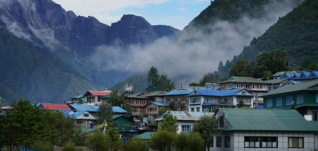
Lukla is where the Everest Base Camp trek starts, and the airport is what most people remember about it. Tenzing Hillary Airport sits at 2,860 meters, with a 527-meter-long runway on a 12 percent gradient. Flights approach from a steep valley, touch down on an uphill strip, and rely on that incline to slow down before the mountain wall at the top end. It sounds extreme and it is genuinely unusual, but the pilots who fly this route do so multiple times a day throughout the season. The flight from Kathmandu takes about 35 minutes. During peak season (March to May and October to November), many flights are rerouted through Ramechhap Airport, which requires a 4 to 5 hour drive from Kathmandu starting around 1 to 2am.
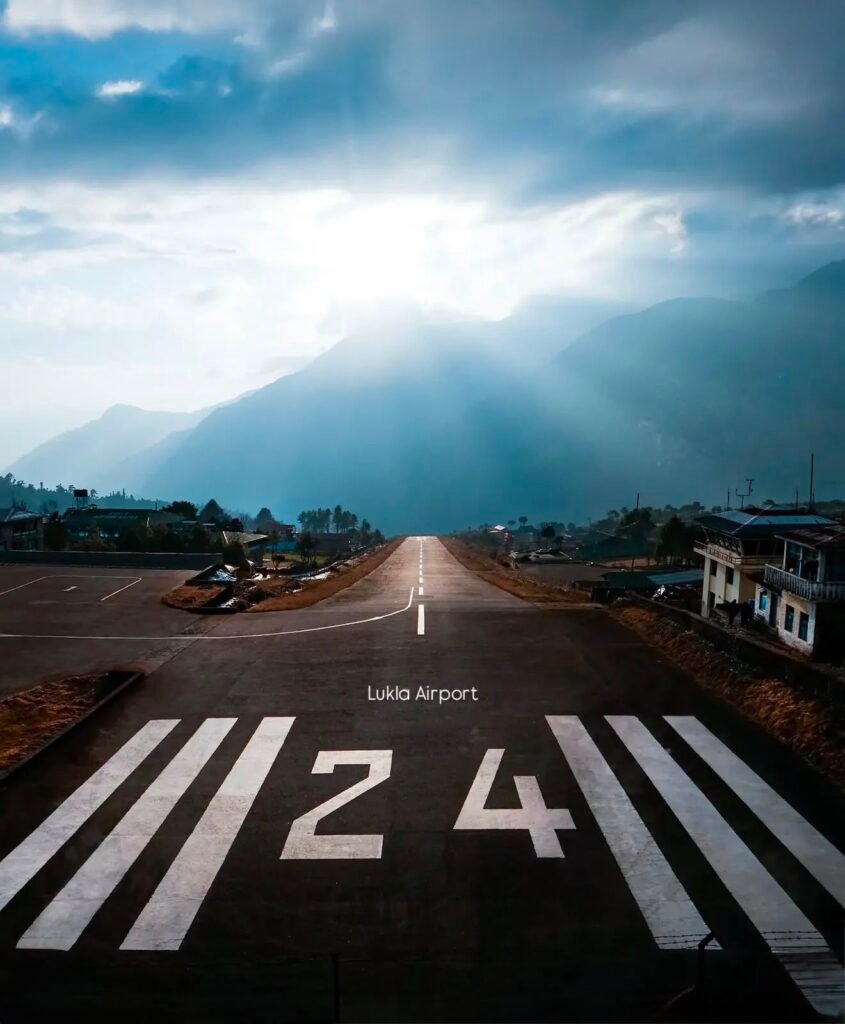
Sir Edmund Hillary supervised the construction of Lukla airport in 1964. Before it existed, expeditions walked to the Khumbu from Kathmandu or Jiri, a journey of ten or more days. Today, the airport handles dozens of flights daily during peak seasons. Weather controls the schedule. Morning flights are the most reliable because clouds build through the day and afternoon landings at Lukla carry higher cancellation rates. Budget a buffer day in Kathmandu before your trek starts in case of weather delays.
The town itself is a long single street lined with gear shops, bakeries, lodges, and restaurants. You can buy or rent trekking poles, walking sticks, sleeping bags, down jackets, and most consumables here. Prices are higher than Kathmandu but lower than Namche. Most trekkers arrive in Lukla by mid-morning, sort their gear and porter arrangements, have lunch, and then walk down to Phakding in the afternoon. Some stay the first night in Lukla if flights are delayed or if they arrive late. At 2,860 meters, altitude sickness is unlikely but possible for people who flew in from sea level that morning.
- Runway length: 527 meters at 12 percent gradient, one of the shortest commercial runways in the world
- Most flights operate in the morning only, before clouds build in the valley
- Good gear shops for last minute purchases at reasonable prices
- ATM available in Lukla (withdraw extra cash here before you go higher)
- Most trekking companies do guide and porter briefings in Lukla on day one
- Walk to Phakding is mostly downhill and takes 3 to 4 hours
Phakding, 2,610m: Your First Night on the Trail
| Phakding Quick Stats | |
|---|---|
| Altitude | 2,610m (8,563 feet) |
| Distance from Lukla | 8km |
| Walk time from Lukla | 3 to 4 hours |
| Accommodation type | Teahouses along the river |
| Wifi availability | Yes, available in most teahouses (paid) |
| Typical room cost | NPR 300 to 500 per night |
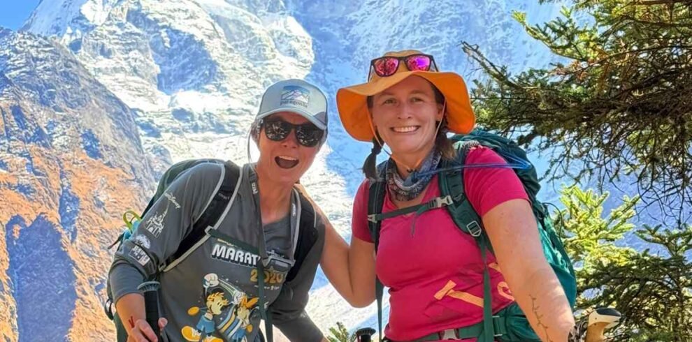
Phakding sits 250 meters lower than Lukla, which makes it a smart first night stop from an acclimatization standpoint. You descend from the airport, cross several suspension bridges over the Dudh Koshi River, and arrive in a narrow valley where the river runs loud and clear through rhododendron and pine forests. The first day’s walk is not long or strenuous, which is intentional. It gives your body time to begin adjusting to the altitude, the gear weight, and the rhythm of walking six to eight hours a day.
The Dudh Koshi, which translates to milk river, runs white with glacial silt through this valley. You will cross it multiple times on hanging suspension bridges, some narrow enough that two people pass each other with care. These bridges are a regular feature of the lower Khumbu trail and most swing noticeably underfoot. Watch your footing and keep moving at a steady pace rather than stopping in the middle. The bridges are maintained but they are not built for comfort.
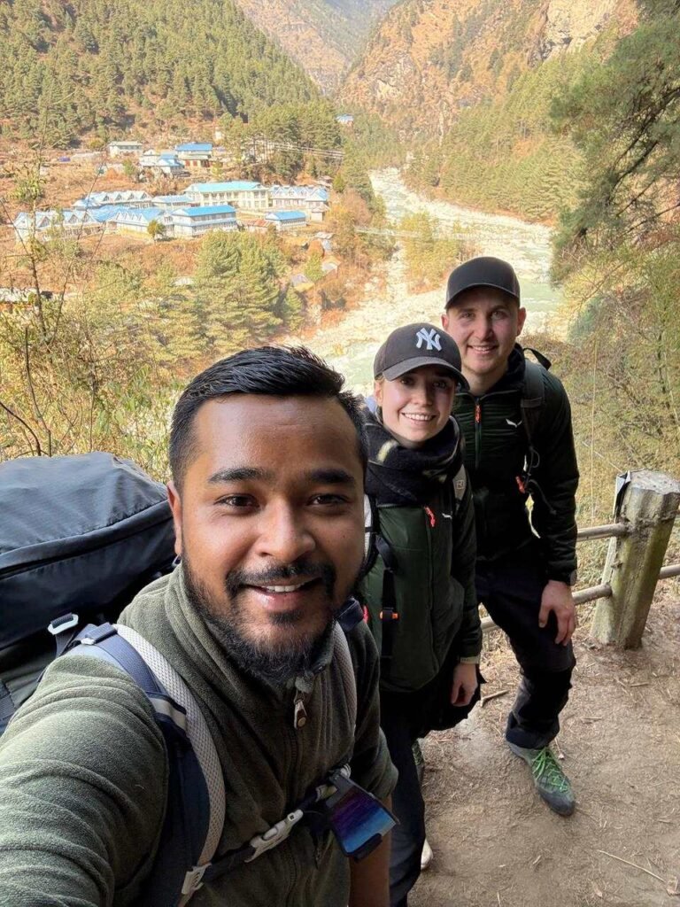
Phakding has a solid concentration of teahouses, most of them family run. Rooms are basic: a single or twin bed, a thin mattress, a blanket, and a shared toilet down the hall. The dining rooms are warm and communal. You will likely share a table with trekkers from several different countries. Dal bhat is the main event and costs NPR 600 to 700 here. Most teahouses also offer noodles, fried rice, spring rolls, and various forms of pasta. The food is fresh at this elevation and the vegetables are real vegetables, not the boiled mush you get higher up.
- Phakding is 250m lower than Lukla, which helps with acclimatization on day one
- Multiple suspension bridges across the Dudh Koshi River on this section
- Good food quality at this elevation: fresh vegetables and reliable teahouse menus
- Arrive by early afternoon if possible, shower and rest before the bigger day to Namche
- The next day to Namche is the hardest single day of the trek, gaining 830 meters
Monjo, 2,835m: The Gateway to Sagarmatha National Park
| Monjo Quick Stats | |
|---|---|
| Altitude | 2,835m (9,301 feet) |
| Distance from Lukla | 12km |
| Walk time from Phakding | 1 to 1.5 hours |
| Accommodation type | Basic teahouses |
| Wifi availability | Limited but available |
| Typical room cost | NPR 300 to 500 per night |
Monjo marks the official start of Sagarmatha National Park. There is a checkpoint here where park rangers check your permits. You need your Sagarmatha National Park Entry Permit (NPR 3,000 for foreign nationals, collected at Monjo or Lukla) and your TIMS card if your company arranged one, though the TIMS card requirement was effectively removed in recent years. Your guide or trekking company handles this process. Have your passport handy at the checkpoint. The park entry queue can be slow during busy seasons and early morning departures help you move through faster.
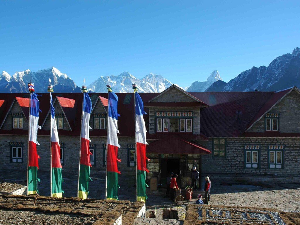
Most trekkers pass through Monjo without stopping overnight, using it as a lunch stop on day two. The views improve noticeably beyond Monjo as you enter the national park boundary. The forests are denser and the trail becomes quieter. Jorsale, a small settlement about 20 minutes past Monjo, is where you cross the Hillary Suspension Bridge, one of the highest suspension bridges on the trek. From Jorsale, the trail climbs steeply, with little respite, for three to four hours to Namche Bazaar. This is the section that separates comfortable trekkers from overconfident ones. Take it slowly.
Namche Bazaar, 3,440m: The Sherpa Capital of the World
| Namche Bazaar Quick Stats | |
|---|---|
| Altitude | 3,440m (11,286 feet) |
| Distance from Lukla | 19km |
| Walk time from Phakding | 5 to 6 hours (800m elevation gain) |
| Accommodation type | Full range from teahouses to mid range hotels with private bathrooms |
| Wifi availability | Excellent, multiple providers, both free and paid |
| Typical room cost | NPR 400 to 800 per night |
Namche Bazaar is the most important village on the entire EBC route. Not because of the views (though they are extraordinary), but because this is where your acclimatization success or failure starts to be determined. Every responsible EBC itinerary includes at least two nights here, with the second day spent on an acclimatization hike to a higher elevation before returning to sleep at 3,440 meters. The physiological principle is simple: climb high, sleep low. Going to 3,960 meters during the day and returning to Namche to sleep gives your blood the stimulus to start producing more red blood cells for higher altitudes ahead.
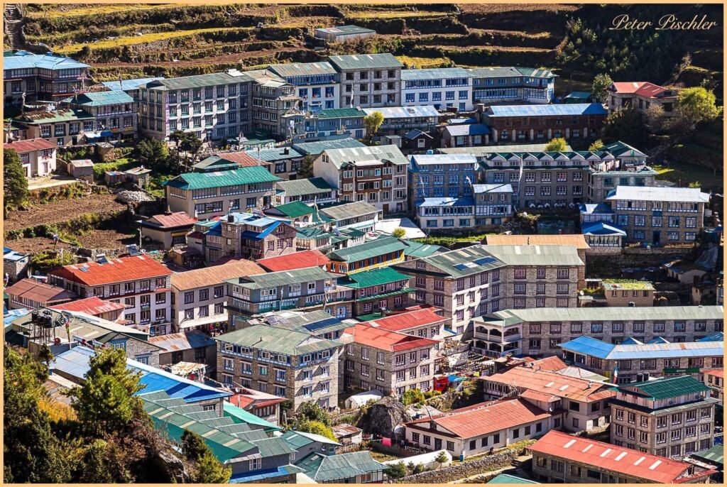
The town itself occupies a horseshoe-shaped valley carved into the hillside. Buildings stack up the steep slopes in concentric arcs. It is the largest town in the Khumbu region and the main trading post for the entire Everest area. The famous Saturday market, which has run for generations, draws Tibetan traders from across the Nangpa La pass and Sherpa villagers from surrounding valleys. You will see yak wool goods, turquoise jewelry, dried meats, locally made cheese, and general supplies changing hands alongside the usual tourist gear. Even if you arrive on a different day, Namche has a distinct energy on any morning that other villages on the route do not.
Practically, Namche has everything you need. There is a Himalayan Rescue Association office where you can get altitude advice. There are bakeries that turn out genuinely good cinnamon rolls and apple pie. There is an ATM operated by Nabil Bank, though it can run out of cash during peak season so withdraw enough for the rest of the route above Namche. There are gear shops where you can replace anything you forgot or upgrade gear that is not performing. There is a medical clinic. There are coffee shops with actual espresso machines. Above the town, at Syangboche (3,780m), sits the Everest View Hotel at 3,962 meters, the highest positioned hotel in the world, which offers the clearest view of Everest from a terace chair.
From Namche on a clear morning, you can see Everest for the first time. It appears to the northeast between the ridgelines, its upper pyramid visible above the Lhotse shoulder. Thamserku and Kongde dominate the skyline above and around the town. Many trekkers who push too fast and skip the Namche acclimatization day end up struggling above Tengboche. Do not skip it. The altitude above Namche is unforgiving to people who arrive undertreated and overconfident.
- Spend two nights here minimum, with one day doing an acclimatization hike (Everest View Hotel at 3,962m or Khumjung at 3,790m)
- Saturday market: local Tibetan traders, yak products, handmade crafts and local produce
- ATM available (Nabil Bank): withdraw enough for the full route above Namche
- Last reliable place to buy or replace gear before high altitude
- HRA office: free altitude advice from doctors staffed seasonally
- Wifi is fast and reliable here, better than anywhere else on the route above Lukla
- Bakeries, restaurants serving Western food, and a genuine espresso machine exist here
- The climb to Namche from Phakding via Jorsale gains 830m. Take it at a very slow pace
Khumjung, 3,790m: Hillary’s Village Above the Clouds
Khumjung is not on the main EBC trail but it is the single best acclimatization day hike from Namche. The village sits at 3,790 meters, about 1.5 to 2 hours above Namche, tucked below the sacred mountain Khumbila (5,761m). Most trekkers visit Namche on their acclimatization day. The hike up gains around 350 meters, which is exactly the kind of moderate elevation push that primes your body for higher altitudes without overdoing it.
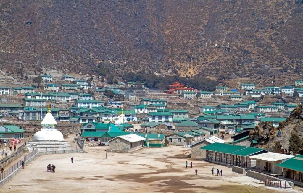
The Hillary School in Khumjung was built in 1961 by Sir Edmund Hillary through his Himalayan Trust foundation. It is still operating. Around 400 students from remote Khumbu villages receive education here, many boarding during term time because their home villages are too distant for daily travel. The school is a genuine legacy project from Hillary that outlasted the summit attempt by decades. The Khumjung Monastery is the other main reason to visit. It houses what is claimed to be a yeti skull, displayed in a glass case and examined by scientists over the years. Whether you believe in yetis or not, the monastery itself is old and atmospheric. The Khunde Hospital, just below Khumjung at the village of Khunde (3,840m), was also built with Hillary Trust support in 1966 and provides medical care for the surrounding region.
Khumjung also offers a clear view across the valley to Everest, Lhotse, and Ama Dablam from an elevated vantage point. On clear mornings before the clouds build, the panorama from the village edge is one of the best on the entire trek route. Come back to Namche for the night.
Tengboche, 3,867m: The Spiritual Heart of the Khumbu
| Tengboche Quick Stats | |
|---|---|
| Altitude | 3,867m (12,687 feet) |
| Distance from Namche | 9km |
| Walk time from Namche | 4 to 5 hours |
| Accommodation type | Teahouses and a small bakery |
| Wifi availability | Limited, often slow (paid) |
| Typical room cost | NPR 400 to 700 per night |
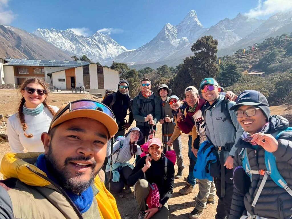
The walk from Namche to Tengboche is one of the most visually striking days on the entire trek. You descend from Namche through rhododendron forests, cross the Dudh Koshi on a suspension bridge at Phunki Tenga (3,250m), and then climb 600 meters through a forest of juniper and rhododendron to reach the Tengboche ridge. The path opens suddenly at the top to give you one of the best unobstructed views of Ama Dablam (6,812m) anywhere on the route. The pyramid of Everest is visible to the north, with Lhotse and Nuptse completing the skyline. On a clear day, Tengboche has a view that justifies the entire trek by itself.
The Tengboche Monastery is the largest in the Khumbu region and one of the most important in the Everest region. It was first constructed in 1923 and served as the spiritual center of the Sherpa people for decades before a 1989 fire destroyed much of the original structure. It was rebuilt with contributions from foreign aid organizations and local community efforts and is now a fully functioning monastery with resident monks. You can attend morning and evening prayers if you are respectful and quiet. The chanting, drums, and cymbals echo across the ridge and create an atmosphere you will not find anywhere else on the route. Remove your shoes before entering and ask permission before photographing inside.
The Mani Rimdu festival is held at Tengboche Monastery each year, usually in late October or November, on the full moon of the Tibetan lunar calendar. The festival runs for several days and includes masked dances, prayers, chanting, and the distribution of sacred rice from the head lama. Sherpa families travel from across the Khumbu to attend. If your trek timing aligns with Mani Rimdu, it is worth building it into your itinerary.
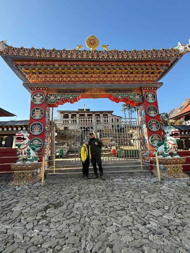
- Tengboche Monastery: the largest in the Khumbu, rebuilt after the 1989 fire, morning and evening prayers open to respectful visitors
- Best view of Ama Dablam (6,812m) on the entire trek route
- Mani Rimdu festival (October to November): one of the major Buddhist festivals in the Himalayan calendar
- Small bakery near the monastery: one of the last places for good coffee and pastries before Dingboche
- The descent from Tengboche to Deboche and Pangboche the next morning is steep and slippery after rain
- Altitude warning: 3,867m is high enough for mild altitude symptoms. Drink 3 to 4 liters of water per day from here
Deboche, 3,820m: A Quiet Stop Below the Monastery
Deboche is a tiny settlement about 15 to 20 minutes below Tengboche on the descent toward Pangboche. It sits in a clearing in the forest at 3,820 meters and is anchored by a small nunnery associated with the Tengboche Monastery above. The nunnery has been operating for several generations and a small number of resident nuns live and practice here year round. There are two or three teahouses in Deboche that serve as an alternative overnight stop to Tengboche. The setting is quieter and the prices are slightly lower. Some trekkers who arrive at Tengboche late in the afternoon prefer to continue to Deboche rather than fight for space in the busier lodges on the ridge.
Deboche is not a mandatory stop and most itineraries continue straight from Tengboche to Dingboche the next day. But it is a pleasant place to walk through, and if your pace is slow or the weather turns, it is worth knowing there is accommodation here. The forest around Deboche is one of the last significant tree cover sections you will walk through before the trail opens into the open Khumbu valley above Pangboche.
Pheriche, 4,280m: Where You Can Get Medical Advice
| Pheriche Quick Stats | |
|---|---|
| Altitude | 4,280m (14,042 feet) |
| From Tengboche | 14km, 4 to 5 hours |
| Accommodation type | Basic teahouses |
| Wifi availability | Very limited |
| Typical room cost | NPR 500 to 800 per night |
Pheriche and Dingboche are sister villages in the upper Khumbu, sitting about one hour apart in different valleys. Most organized treks use Dingboche as the overnight stop, but Pheriche is significant for one reason: the Himalayan Rescue Association medical clinic. The HRA runs a seasonal clinic at Pheriche, staffed by volunteer doctors during the main trekking seasons, from October to November and March to May. The doctors run daily altitude lectures in the afternoon, usually at 3pm, that cover the symptoms and treatment of Acute Mountain Sickness, High Altitude Pulmonary Edema, and High Altitude Cerebral Edema. Attendance is free and strongly recommended.
If you or anyone in your group has persistent headaches, unusual fatigue, loss of appetite, vomiting, or confusion above 4,000 meters, the HRA clinic is the place to go. The doctors at Pheriche see hundreds of altitude cases per season and can assess whether your symptoms require descent or whether you can continue with adjustments. If you are staying in Dingboche, the HRA clinic is a one-hour walk, which is manageable even for someone feeling unwell. Do not delay if symptoms are serious.
Pheriche itself is an open, windswept settlement on the floor of the Khumbu Khola valley. It is colder than Dingboche because of its exposed location. The few teahouses here are functional rather than comfortable. If you have a choice between Pheriche and Dingboche for your acclimatization stop, Dingboche offers better shelter and slightly more facilities. But for trekkers coming down from a bad altitude day at Lobuche or above, Pheriche with its clinic access can be the more important choice.
Dingboche, 4,410m: Your Second Acclimatization Base
| Dingboche Quick Stats | |
|---|---|
| Altitude | 4,410m (14,469 feet) |
| Distance from Namche | 20km (via Tengboche) |
| Walk time from Tengboche | 5 to 6 hours via Pangboche |
| Recommended stay | 2 nights with 1 acclimatization hike day |
| Wifi availability | Limited, available in some teahouses (paid, slow) |
| Typical room cost | NPR 600 to 1,000 per night |
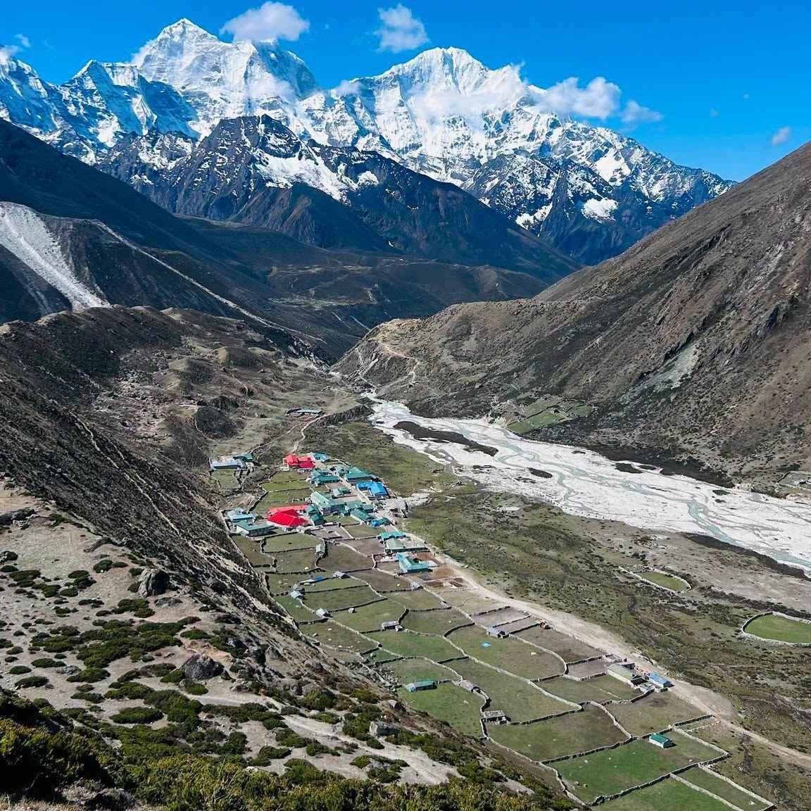
Dingboche is the second major acclimatization stop on the EBC trek, and it is more important than it gets credit for. At 4,410 meters, your body is operating on roughly 58 percent of the oxygen available at sea level. The leap from 3,440 meters at Namche to here is substantial. A proper two-night stay at Dingboche, with the second day spent on an acclimatization hike to a higher point, is not optional if you want to reach base camp safely. Trekkers who rush past Dingboche to save a day often pay for it between Lobuche and Gorak Shep.
The recommended acclimatization hike from Dingboche is the climb to Nangkartshang Peak viewpoint at 5,083 meters. The trail goes steeply up the ridge above the village to a high point offering a 360-degree view of Lhotse (8,516m), Island Peak (6,189m), Makalu (8,485m), Ama Dablam, and the head of the Imja Valley. The climb takes about 3 hours up and 2 hours down, and the altitude you reach is higher than anything you will sleep at on the entire standard EBC route. Come back to Dingboche to sleep at 4,410m and you will feel the benefit the next morning.
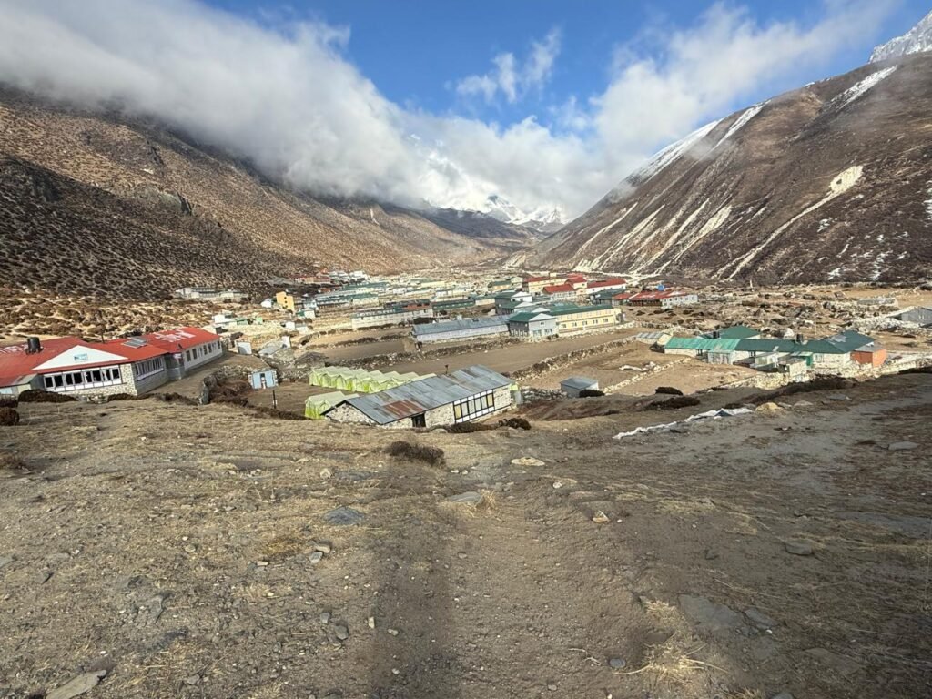
The village sits between two valleys: the Khumbu Khola, leading toward Lobuche and EBC, and the Imja Khola, leading toward Chhukung and the Island Peak base camp. Stone walls partition the yak pastures around the village. In spring (March to May), the pastures are grazed by yaks and naks (female yaks) while the snow retreats up the ridges. In autumn (October to November), the high passes above are dusted with fresh snow and the skies are at their clearest. Dingboche’s protected valley position means it is less windy than Pheriche across the hill, and sleeping here is generally more comfortable despite the higher elevation.
- Two nights minimum: arrive on day one and hike to 5,083m on day two before sleeping at 4,410m
- Best acclimatization hike: Nangkartshang Peak (5,083m) with views of Lhotse, Makalu, and Island Peak
- Yak pastures and stone field walls are characteristic of the landscape here
- Food quality starts to decline noticeably: stick to dal bhat, rice dishes, and soup
- Altitude warning: headaches are common on arrival. Drink water consistently, avoid alcohol
- The HRA clinic is one hour away in Pheriche if symptoms are serious
- Diamox (acetazolamide) can help with acclimatization here if advised by your guide or doctor
Lobuche, 4,940m: In the Shadow of the Memorials
| Lobuche Quick Stats | |
|---|---|
| Altitude | 4,940m (16,208 feet) |
| Distance from Dingboche | 9km |
| Walk time from Dingboche | 5 to 6 hours |
| Accommodation type | Basic stone teahouses, no private bathrooms |
| Wifi availability | Very limited, unreliable |
| Typical room cost | NPR 700 to 1,200 per night |
The walk from Dingboche to Lobuche crosses the Thukla Pass (4,620m) at the shoulder of the ridge above the village of Dughla. Before you reach the pass, you climb a steep moraine slope. At the top of this slope, on a ridge overlooking the Khumbu Glacier, stands one of the most moving sights on the entire trek: a collection of memorial stupas and cairns built for climbers who died on Everest and the surrounding peaks. Scott Fischer, who led a team to the summit in May 1996 and died in the catastrophic storm that killed eight climbers, has a memorial here. Rob Hall, the New Zealand guide who died in the same storm, has one too. There are dozens of memorials in total, ranging from large painted stupas to simple stone cairns with engraved plaques.
Most groups stop at the memorials for ten to fifteen minutes in silence. Some leave prayer flags or incense. The ridge is exposed and windy, and at nearly 4,700 meters, you feel the altitude doing its work as you stand among the stones. It puts the objective of reaching base camp into a quieter perspective. Climbers have died on Everest every year since expeditions began in 1921. The memorials at Thukla Pass are a reminder of that history without being morbid about it.
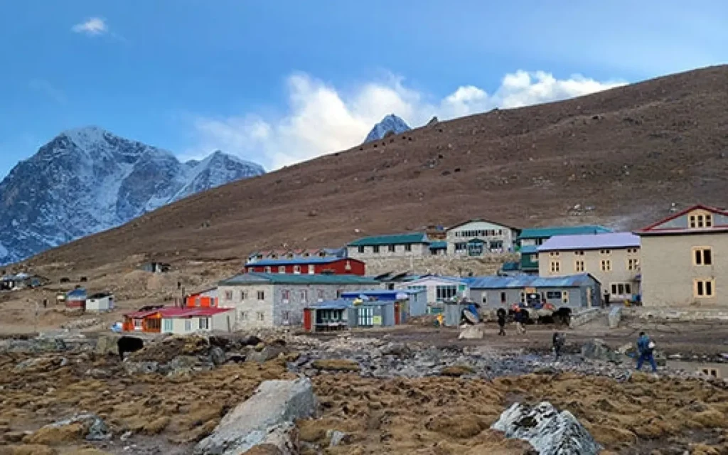
Lobuche itself is a collection of stone teahouses at the edge of the Khumbu Glacier moraine. The settlement has no permanent residents outside of the trekking season. The teahouses are functional but cold. At 4,940 meters, the air is noticeably thin, and exertion feels different here than anywhere below. Walking fast from the dining room to the toilet and back is enough to leave you mildly breathless. Eat what you can manage (appetite drops significantly at this altitude), drink water deliberately, and sleep as warmly as possible. The sleeping bags provided by teahouses at this elevation are sometimes inadequate. Bring your own rated to minus 10 degrees Celsius or below.
- Memorial stupas at Thukla Pass (4,620m): for climbers who died on Everest, including 1996 disaster victims Scott Fischer and Rob Hall
- The Khumbu Glacier is visible from above Lobuche, one of the longest glaciers in Nepal
- Lobuche Peak (6,119m) rises above the village, popular as a trekking peak for acclimatization climbs
- No permanent residents: teahouses operate only during trekking seasons
- Bring your own sleeping bag rated to at least minus 10 degrees Celsius
- Altitude warning: at nearly 5,000m, any symptoms of HAPE or HACE (breathlessness at rest, severe headache, confusion, poor coordination) require immediate descent
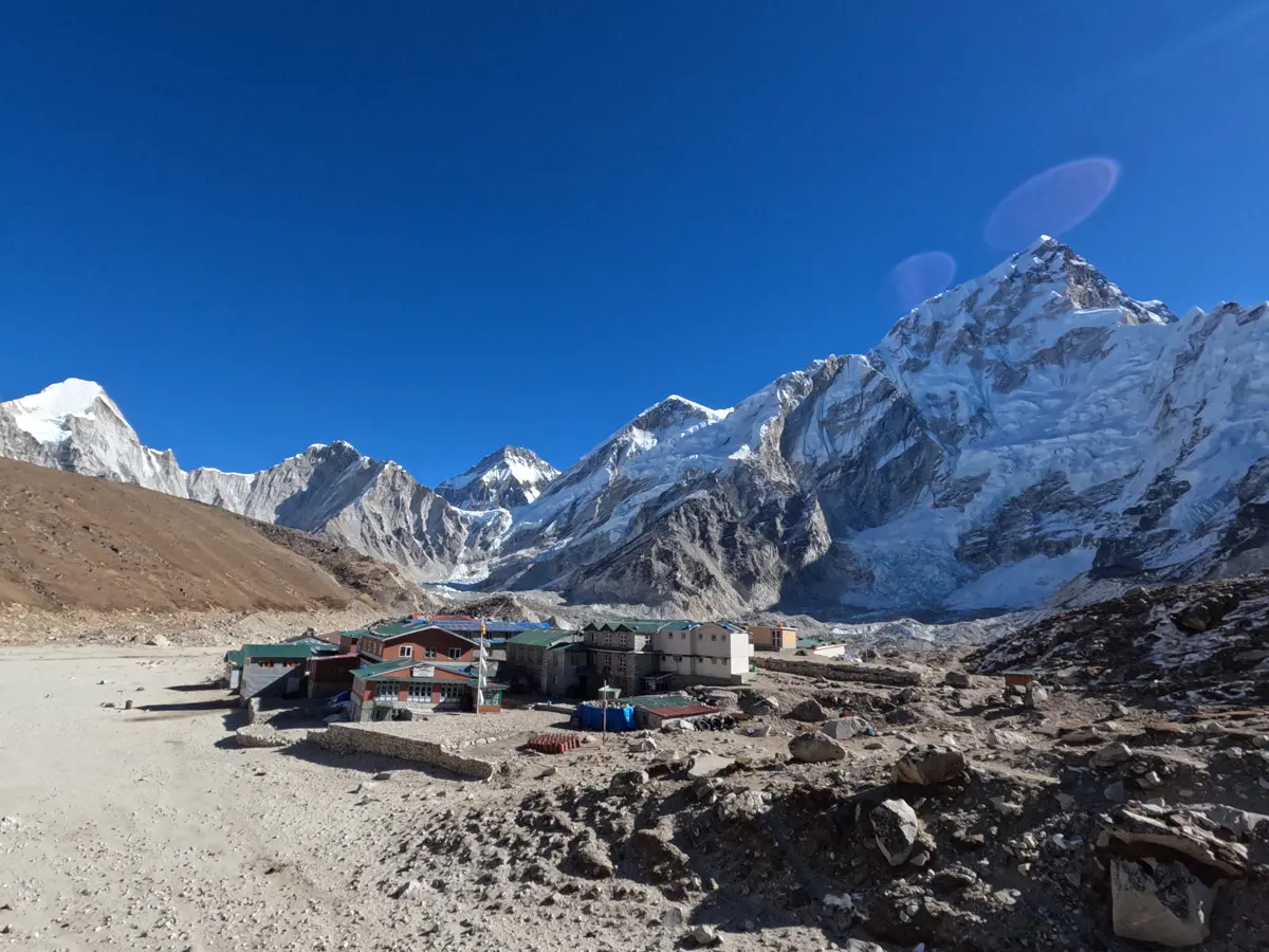
Gorak Shep, 5,164m: The Last Stop Before Base Camp
| Gorak Shep Quick Stats | |
|---|---|
| Altitude | 5,164m (16,942 feet) |
| Distance from Lobuche | 4km |
| Walk time from Lobuche | 2 to 3 hours |
| Accommodation type | Very basic teahouses, shared dormitories in peak season |
| Wifi availability | Minimal, satellite based, expensive and slow |
| Typical room cost | NPR 800 to 1,200 per night |
Gorak Shep is the highest permanent settlement on the EBC route and the last place you will sleep before reaching Everest Base Camp. At 5,164 meters, it sits on the edge of a former glacial lake, which gives the location its name: Gorak Shep translates roughly as dried lake or raven lake in the local dialect, a reference to the flat sandy lakebed that the settlement occupies. The lake itself dried out centuries ago, leaving a pale sandy floor surrounded by glacier moraines and the walls of the Khumbu Glacier. When the wind picks up in the afternoon, the sand blows across the flat and coats everything in fine pale dust.
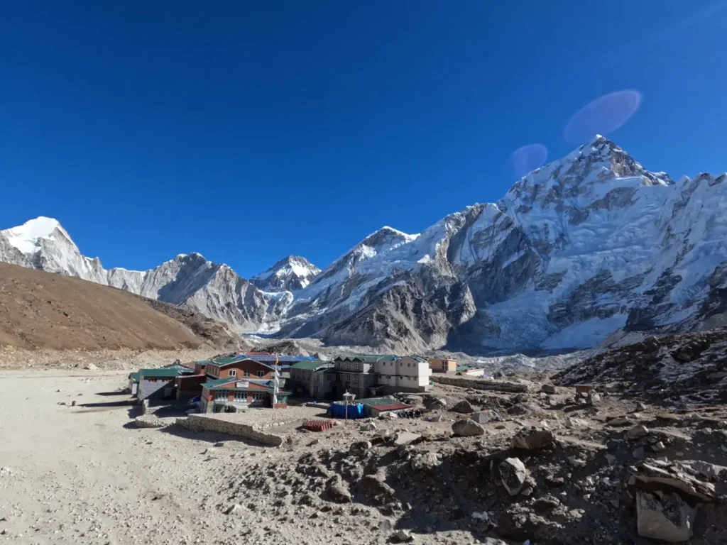
There are four or five teahouses at Gorak Shep. They are the most basic accommodations on the entire route: stone walls, thin mattresses, blankets of variable quality, and shared pit toilets outside. At this altitude, even turning over in bed requires a conscious adjustment in breathing. Sleep quality is poor for almost everyone above 5,000 meters, regardless of how well they have acclimatized. The dining rooms are heated by small yak-dung stoves and fill up with trekkers in the evenings, keeping the temperature just about bearable. Wifi exists here in theory, through satellite connections, but it is slow, intermittent, and expensive. Do not count on it for anything important.
The standard plan at Gorak Shep is to arrive in the afternoon from Lobuche, rest, eat what you can manage, sleep as well as possible, and then set off for base camp or Kala Patthar the following morning. The sunrise walk to Kala Patthar (5,643m) starts before dawn, typically around 4 to 5am, for the clearest view of Everest before clouds build over the summit. Kala Patthar is a 480-meter climb from Gorak Shep and takes 2 to 3 hours up. At that altitude, two to three hours of uphill walking in the cold and dark is a genuine physical challenge. Go slowly, breathe steadily, and keep moving. The view from the summit ridge of Kala Patthar of the south face of Everest is the best view of the mountain available from any non-technical vantage point on earth.
- The name means dried lake or raven lake, a reference to the ancient glacial lakebed the settlement sits on
- Four to five teahouses, all very basic, shared toilets, no hot showers
- Sleep quality is poor at 5,164m for almost everyone: this is normal, not a medical concern unless accompanied by other symptoms
- Kala Patthar (5,643m) start: leave at 4 to 5am for sunrise, allow 2 to 3 hours up and 1.5 to 2 hours down
- Everest Base Camp: 2 to 3 hours from Gorak Shep along the glacier moraine
- Altitude warning: you are at 5,164m. Any worsening of symptoms requires descending, not waiting to see how you feel in the morning
Everest Base Camp, 5,364m: The Destination
Everest Base Camp is not a village. There are no teahouses, no permanent structures, and no accommodation for trekkers. During expedition seasons (April to May and September to October), the camp fills with colorful tents belonging to teams from around the world preparing to climb Everest via the South Col route. Outside of expedition seasons, EBC is an empty moraine with prayer flags and little else. You will not see Everest itself from the base camp because the mountain is hidden behind the West Shoulder. What you will see is the Khumbu Icefall, the chaotic and constantly moving river of ice and seracs that climbers must cross to access the upper mountain. The Icefall is one of the most dangerous sections of the entire Everest climb, and watching it from base camp gives you an immediate sense of the scale of what the expedition teams are attempting.
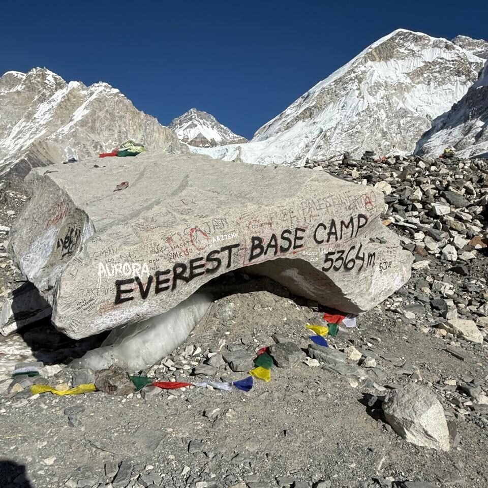
The walk from Gorak Shep to EBC takes 2 to 3 hours along the lateral moraine of the Khumbu Glacier. The trail crosses the glacier in sections, traversing rocks and ice. At 5,364 meters, the effort of walking on uneven moraine at altitude is substantial, even over a short distance. Most trekkers spend 30 to 60 minutes at base camp before turning around. There is genuinely not much to see beyond the icefall and the camp itself, which is extraordinary enough. The physical act of standing at the base of Everest and looking up at the icefall is the moment most trekkers have been building toward for the entire journey.
Return to Gorak Shep the same way, then continue to Lobuche or Pheriche that afternoon if your energy allows. Most guides recommend not sleeping at Gorak Shep for more than one night. The faster you descend after reaching base camp and Kala Patthar, the better you will feel. The descent to Namche usually takes two days and feels dramatically easier than the ascent. At 3,440 meters, the air feels thick and the appetite returns quickly. Many trekkers eat their best meal of the entire trip at Namche on the way down.
- No accommodation at EBC: trekkers stay at Gorak Shep and walk to EBC and back in one day
- The Khumbu Icefall is visible from base camp: the primary objective for Everest summit teams
- Everest itself is not visible from base camp: it sits behind the West Shoulder
- Walk time from Gorak Shep: 2 to 3 hours each way
- Descent to Namche takes 2 days. Do not linger at high altitude once your objective is reached
- During expedition season, you may encounter Sherpa teams, porters, and support staff moving through the area
Teahouse Accommodation: What to Expect at Each Elevation
The quality of teahouse accommodation on the EBC route changes sharply with elevation. In the lower zone from Lukla to Namche, you will find options that rival basic guesthouses anywhere in Nepal: private rooms with attached bathrooms, hot showers, reliable heating, and varied menus. In the middle zone between Tengboche and Dingboche, private bathrooms become less common, hot water is available at an extra cost, and the menus shrink. In the upper zone from Lobuche to Gorak Shep, you are sleeping in stone buildings built to survive Khumbu winters, not to provide comfort. Shared dormitories are common in peak season when demand outstrips private room availability. Bring earplugs and your own sleeping bag, regardless of what your package says is included.
In all zones, teahouses earn their real revenue from meals, not from room charges. This is why rooms are so cheap (NPR 300 to 600 in most places) while a plate of dal bhat runs NPR 600 to 900, and a basic pasta dish costs NPR 700 to 1,000 at higher elevations. You are expected to take your meals at the teahouse where you sleep. This is a reasonable social contract. Checking into one teahouse and walking to another to eat causes friction and is genuinely not appreciated in these small communities that depend on trekking income for their annual livelihood.
Solar power is the main electricity source above Namche. The charging points in teahouse dining rooms fill up quickly in the evening. Bring a power bank and charge your devices during meals rather than waiting for a dining room socket. Above Dingboche, hot showers are expensive (NPR 400 to 800 extra) and often involve buckets rather than running water. Save the shower for when you return to Namche or Lukla.
Mobile Network and Wi-Fi Availability by Village
| Village | Ncell / NTC Signal | Teahouse Wifi | Notes |
|---|---|---|---|
| Lukla | Strong (3G to 4G) | Yes, reliable | Best signal outside of Kathmandu |
| Phakding | Moderate (2G to 3G) | Yes, available | Can be slow in evenings |
| Monjo | Moderate (2G to 3G) | Limited | Use for calls, not video |
| Namche Bazaar | Strong (3G to 4G) | Excellent, multiple providers | Best wifi on the entire route |
| Khumjung | Moderate (2G to 3G) | Some teahouses have wifi | Side trip, usually day hike |
| Tengboche | Weak (2G, unreliable) | Available but slow | Valley blocks signal from towers |
| Dingboche | Weak (2G, intermittent) | Available in main teahouses, slow | Buy data for calls, not streaming |
| Lobuche | Very weak to none | Very limited, often none | Download maps and media before arriving |
| Gorak Shep | None | Satellite only, very slow, expensive | Assume no connectivity from here up |
The practical implication of this coverage map: download offline maps (Maps.me or Google Maps offline for the Khumbu region), save any documents you need to read, and inform family members of your schedule before you leave Namche. Above Tengboche, you should not depend on a phone call to resolve a problem. Your guide’s walkie talkie is a more reliable communication tool above Namche than any mobile network.
Food and Water at Each Stop: What to Eat and What to Avoid
Food quality changes with altitude in a way that surprises most trekkers who have not been told to expect it. In the lower villages from Lukla to Namche, menus are broad, ingredients are fresh, and cooking is competent. You can eat salads, fresh vegetables, eggs prepared multiple ways, good dal bhat, and even pizza or momos. At Tengboche and Dingboche, the menus narrow and fresh vegetables become harder to source because everything is carried in by porter or pack animal. Dal bhat is the most reliable choice from here up. It is filling, high in carbohydrates, easy to digest, and usually freshly cooked. The rice and lentil broth provide steady energy without the digestive stress that heavy or unfamiliar foods can cause at altitude.
Above Dingboche, avoid salads, raw vegetables, and uncooked items entirely. Not because Sherpa cooks are careless, but because water source quality is harder to control at high altitude and at 5,000 meters your immune system is already under stress from the altitude itself. Stick to cooked food, boiled rice, soup, and dal bhat. Garlic soup is popular above 4,000 meters because garlic is believed (and there is some evidence) to assist with acclimatization. It is warming, high in energy, and easy on the stomach.
Water at all elevations should be treated as potentially contaminated unless it comes from a sealed bottle or has been boiled. Carry water purification tablets or a filter. Most teahouses sell boiled water for NPR 100 to 200 per liter. Bottled water is available but the plastic waste it generates in the Khumbu is a genuine environmental problem. Carry a reusable bottle and purify rather than buying plastic. Drink a minimum of 3 to 4 liters per day above 3,500 meters. Dehydration accelerates the effects of altitude sickness and is one of the most common preventable problems on this route.
Best Season to Visit Each Village
The Everest Base Camp route is trekable year-round, but the experience varies significantly by season. The two main trekking windows are spring (March to May) and autumn (October to November). Both offer clear skies, manageable temperatures, and fully operational teahouses. Between these windows, monsoon season (June to September) brings heavy rain, leeches in the lower forests, cloud cover that blocks mountain views, and genuinely difficult trail conditions. Winter (December to February) is possible but cold, with temperatures at Gorak Shep dropping below- 20 degrees Celsius at night, and many teahouses closed above Namche.
| Village | Spring (Mar to May) | Autumn (Oct to Nov) | Winter (Dec to Feb) |
|---|---|---|---|
| Lukla to Namche | Rhododendrons bloom, warm and green, very busy | Clear skies, cooler, excellent visibility | Cold but manageable, fewer crowds |
| Tengboche to Dingboche | Warm afternoons, snow possible above 4,000m | Best mountain views, cold nights | Very cold, some teahouses closed |
| Lobuche to Gorak Shep | Expedition season, busy, cold nights | Crisp and clear, fewer expeditions | Extreme cold, most teahouses closed |
Autumn (October to November) is considered the best overall season for the EBC trek. The monsoon has finished, the air is washed clean, visibility is at its highest, and the mountain views are as clear as they get. Namche Bazaar in October is crowded but the crowds are part of the energy of the place. Spring is equally popular but the rhododendron forests in bloom between Namche and Tengboche add a specific visual element that autumn cannot match.
Altitude Sickness Warning Signs by Elevation Zone
Altitude sickness is not a character failure. It is a physiological response to reduced oxygen pressure that can affect anyone regardless of fitness, age, or prior trekking experience. What matters is recognizing the signs early and responding correctly. The key rule above 3,000 meters is straightforward: if symptoms are worsening, descend. Do not sleep higher if you have a headache that will not go away, and do not assume you will feel better in the morning if you are not sleeping.
| Elevation Zone | Common Symptoms | Action Required |
|---|---|---|
| Lukla to Namche (2,600 to 3,440m) | Mild headache, fatigue, reduced appetite | Hydrate, rest, do not ascend if headache is severe |
| Namche to Tengboche (3,440 to 3,870m) | Headache, mild nausea, disrupted sleep | Extra acclimatization day at Namche if needed, drink 4 liters per day |
| Dingboche and Pheriche (4,280 to 4,410m) | Persistent headache, reduced appetite, fatigue, poor sleep | Do not ascend with a headache. Visit HRA clinic at Pheriche if symptoms worsen |
| Lobuche (4,940m) | All above plus breathlessness on rest, dry cough | Descend immediately if breathless at rest or coughing at night. These are HAPE warning signs |
| Gorak Shep and EBC (5,164 to 5,364m) | Poor sleep is normal. Gurgling breath, confusion, loss of coordination are emergencies | Descend to Pheriche or Namche immediately. Do not wait until morning. Evacuate by helicopter if needed |
Your guide should be taking pulse oximeter readings for the entire group every morning above Namche. SpO2 readings below 80 percent at Namche, below 75 percent at Dingboche, or below 70 percent at Lobuche are signals that warrant a serious conversation about whether to continue. A good guide will tell you this directly. A reliable trekking company provides supplemental oxygen on the trail above Namche and has established helicopter evacuation contacts in the Khumbu for genuine emergencies. Ask about both before you book.
Ready to Trek to Everest Base Camp?
We run private and group EBC departures year round with licensed Sherpa guides, daily SpO2 monitoring, proper acclimatization itineraries, and full support from Kathmandu to base camp and back. View our Everest Base Camp Trek or reach out directly with any questions.
Frequently Asked Questions
How many villages do you pass through on the Everest Base Camp trek?
On the standard EBC route from Lukla to base camp, you pass through or stop at approximately eight to twelve distinct settlements depending on your exact itinerary. The main overnight stops on a 14 day trek are Lukla, Phakding, Namche Bazaar (two nights), Tengboche, Dingboche (two nights), Lobuche, and Gorak Shep. In addition, you walk through or past Monjo, Deboche, Pangboche, Dughla, and several smaller unnamed settlements. Some itineraries also include a side trip to Khumjung as an acclimatization day hike from Namche, which adds an additional village to your route. The exact number depends on your pace and whether your company builds in any additional stops.
Which village is the hardest day to reach?
Most trekkers find the day from Phakding to Namche Bazaar to be the hardest single day on the entire route, despite occurring on day two when you are fresh. The trail gains 830 meters of elevation in approximately 8 kilometers, with the steepest section coming after the Hillary Suspension Bridge at Jorsale. Your legs are not yet conditioned for sustained uphill walking and the altitude is enough to begin making itself felt. The second hardest day is usually Dingboche to Lobuche, which crosses the emotionally demanding Thukla Pass with its memorial stupas and then climbs onto the Khumbu Glacier moraine at nearly 5,000 meters. The walking distance is shorter but the altitude amplifies the effort considerably.
Is there accommodation at Everest Base Camp itself?
No. Everest Base Camp has no teahouses or lodges for trekkers. The only accommodation at base camp is the tented camps used by climbing expedition teams during the spring and autumn climbing seasons. Trekkers always sleep at Gorak Shep (5,164m) and walk to base camp and back in a single day. The walk from Gorak Shep to EBC takes 2 to 3 hours each way, following the Khumbu Glacier moraine trail. Most groups visit base camp and then return to Gorak Shep before walking back down to Lobuche the same afternoon, as spending as little time as possible above 5,000 meters is the sensible approach once you have reached your objective.
What should I eat in the villages at high altitude?
Dal bhat is the most reliable food choice from Dingboche upward. It is a plate of steamed rice with lentil soup, vegetable curry, and pickles, and most teahouses offer unlimited refills of the rice and lentil component. It is high in carbohydrates, freshly cooked, and easy for most digestive systems to handle at altitude. Garlic soup is also widely recommended above 4,000 meters. It is warming, high in energy, and the allicin in garlic may have a mild supportive effect on circulation at altitude. Avoid anything uncooked above Tengboche, including salads, and be careful with meats at high altitude where refrigeration is unreliable. Pasta, fried rice, and potato based dishes are other safe and filling choices.
Can I use an ATM anywhere above Lukla?
The only ATM on the EBC route above Lukla is at Namche Bazaar. It is operated by Nabil Bank and accepts most international cards. However, it can run out of cash during peak season (April to May and October to November) when thousands of trekkers are in the Khumbu simultaneously. Always withdraw enough cash in Kathmandu before your trip to cover the full route, and use the Namche ATM only as a top up. Cash is the only payment method accepted in all teahouses above Namche. Budget approximately NPR 3,000 to 5,000 per person per day for food, accommodation, water, and incidentals above Namche, with higher costs at Lobuche and Gorak Shep.
How cold does it get in the villages at night?
Temperatures vary significantly by season and elevation. At Namche Bazaar in October, nights drop to around minus 5 to minus 8 degrees Celsius. At Dingboche, expect minus 10 to minus 15 degrees at night during autumn and winter. At Lobuche and Gorak Shep, nights in October and November regularly reach minus 15 to minus 20 degrees Celsius, and in December through February the temperatures can drop below minus 25 degrees Celsius at Gorak Shep. Teahouse rooms are not heated at night in most cases above Namche. A sleeping bag rated to minus 10 degrees Celsius is the absolute minimum for the upper section of the route, and a bag rated to minus 15 degrees is more appropriate for Lobuche and Gorak Shep.
Is the Saturday market in Namche worth timing your trek around?
If you can align your Namche arrival with a Saturday, it is genuinely worth doing. The Saturday market in Namche Bazaar has operated for generations and draws local Sherpa traders from surrounding villages as well as Tibetan traders who cross the Nangpa La pass from the Tibetan plateau. You will see yak wool products, dried yak cheese, turquoise and coral jewelry, traditional clothing, local spirits, dried meat, and farming produce. The market runs from early morning until midday in the main market area below the Namche steps. It is not a tourist market. It is a real functional trade event that has defined Namche’s role as the Khumbu’s commercial center for centuries.
What permits do I need and where are they checked?
Two permits are required for the EBC trek in 2026. First, the Sagarmatha National Park Entry Permit costs NPR 3,000 per person for foreign nationals and is checked at the Monjo checkpoint at the national park entrance. Second, the Khumbu Pasang Lhamu Rural Municipality Permit costs USD 20 per person and can only be obtained in Lukla or Monjo, not in Kathmandu. This is a common point of confusion. The TIMS card (Trekkers Information Management System) was effectively discontinued for independent trekkers on the EBC route in recent years, though group trekkers may still need it depending on their company policy. Your trekking company should arrange all permits before or at the start of your trek. Carry your passport at all times because it is required at permit checkpoints.
Can I do the EBC trek without a guide?
Nepal law does not legally require a guide on the EBC route. The trail is well marked and many solo trekkers complete it without a guide each season. However, going without a guide at high altitude carries real risks that are worth understanding honestly. A licensed guide takes daily SpO2 readings for every group member, which is the most reliable early detection method for altitude sickness. A guide manages logistics, communicates with teahouse owners (most of whom speak limited English above Namche), handles permit checkpoints, makes real-time decisions if symptoms appear, and has established contacts for helicopter evacuation. The difference between a manageable altitude incident and a fatal one often comes down to how quickly the right response is initiated. For most trekkers, the cost of a licensed guide is one of the best investments they will make on the entire trip.
How far is it from Namche Bazaar to Everest Base Camp?
From Namche Bazaar to Everest Base Camp, one way is approximately 55 kilometers. The standard itinerary covers this in five walking days: Namche to Tengboche (9km, 4 to 5 hours), Tengboche to Dingboche via Pangboche (11km, 5 to 6 hours), an acclimatization day at Dingboche, Dingboche to Lobuche (9km, 5 to 6 hours), Lobuche to Gorak Shep and on to Everest Base Camp (7km to Gorak Shep plus 3km to EBC, 5 to 6 hours total). The return from Gorak Shep to Namche takes two days of walking, retracing the same distance. The total walking distance for the round-trip from Lukla back to Lukla is approximately 130 kilometers over 12 to 14 days.