Quick Overview
10 day hikes and short treks
1,750m (Namobuddha) to 2,760m (Phulchoki)
30 minutes to 2.5 hours by road
October to November and March to April
Shivapuri NP (NPR 250) and Nagarjun (NPR 250) only
Easy (Kakani) to Moderate (Phulchoki summit)
Most people who come to Kathmandu spend their days in Thamel or rushing between temples. That’s understandable given how much the city has to offer. But if you’re here for more than three days, you’ll want to get out and walk. The ridges that ring the Kathmandu Valley rise to over 2,700 meters, and on a clear morning after rain, you can see a wall of white from Annapurna all the way east to Kanchenjunga. None of this requires a multiday trek permit or an organized expedition. You can be on a forested trail above the smog line by 8am and back in your hotel for a late lunch.
This guide covers ten of the best day hikes and short treks within reach of Kathmandu. Each one is different. Nagarkot is famous and crowded on weekends; Phulchoki is barely known outside birdwatching circles. Shivapuri takes you through a genuine forest where leopards have been photographed by trail cameras. Namobuddha is a sacred Buddhist site that combines a 3- to 4-hour hike with a monastery visit and, optionally, a visit to the medieval town of Panauti. There’s something here for everyone, from absolute beginners to people who want a hard day in the hills. Distances, transport costs, entry fees, and trail conditions are current for 2026.
Want to go hiking around Kathmandu?
We can help you plan an easy day hike, village walk, or viewpoint hike near Kathmandu.
WhatsApp Us Email UsOverview: Hiking Near Kathmandu
The Kathmandu Valley sits at around 1,400 meters above sea level, ringed on all sides by forested ridges and hills. The highest point on the valley rim is Phulchoki at 2,760 meters to the south. Shivapuri to the north reaches 2,732 meters. These hills mean that within 1.5 to 2.5 hours of leaving Thamel by road or local bus, you can be standing in an actual mountain forest with views that most visitors never see. The city air drops away quickly once you’re above 2,000 meters, and the contrast with Thamel is sharp enough to feel like a different country.
Transport is straightforward. Most trailheads are reachable by taxi in under an hour, and several are accessible by public bus for NPR 60 to 100. You don’t need to hire a private jeep or book a full-day tour unless you want to. The most popular trailhead, Budhanilkantha for Shivapuri, is about NPR 400 to 600 by taxi from Thamel. A taxi to Nagarkot costs NPR 2,500 to 3,500. For Dhulikhel, the public bus from the old bus park takes about 1.5 hours and costs NPR 60-100.
The best months for hiking near Kathmandu are October through November and March through April. October and November are the clearest months of the year after the monsoon washes the air clean. The mountain views are extraordinary. March and April bring rhododendron forests into full bloom, particularly on Shivapuri and Phulchoki, and the temperatures are warm enough to hike in a light jacket. December through February is cold but possible, with snow possible above 2,500 meters after a storm. Monsoon season from June through August brings heavy rain, trail mud, and leeches in the forest below 2,000 meters, though the hills stay green and the waterfalls are dramatic.
Complete Comparison Table: All 10 Hikes
| Hike | Altitude | Difficulty | Distance | Duration | Best For |
|---|---|---|---|---|---|
| Nagarkot Sunrise | 2,175m | Easy | 3 to 8km walk | Half day | Mountain views, photos |
| Champadevi Hill | 2,278m | Moderate | 6 to 10km | 4 to 6 hours | Closest proper hike to city |
| Shivapuri Peak | 2,732m | Moderate | 12 to 16km | 6 to 8 hours | Forest, wildlife, big views |
| Phulchoki Hill | 2,760m | Moderate | 10 to 14km | 5 to 7 hours | Birdwatching, solitude |
| Namobuddha | 1,750m | Easy to Moderate | 8 to 12km | 3 to 5 hours | Buddhism, culture |
| Dhulikhel to Namobuddha | 1,750m | Easy to Moderate | 12km | 4 to 5 hours | Mountain views, culture combo |
| Kakani Hill | 2,073m | Easy | 5 to 8km | 3 to 4 hours | Quiet trails, families |
| Balthali Village | 1,700m | Easy to Moderate | 10 to 15km | Full day | Village life, terraces |
| Hattiban Forest Loop | 1,800m | Easy | 4 to 6km | 2 to 3 hours | Morning walk, city escape |
| Jamacho Peak | 2,096m | Moderate | 10 to 12km | 4 to 5 hours | Valley views, wildlife |
1. Nagarkot Sunrise Hike, 2,175m: The Classic Mountain View
| Nagarkot Quick Stats | |
|---|---|
| Difficulty | Easy |
| Distance | 3 to 8km depending on starting point |
| Duration | Half day (sunrise walk) or full day (Bhaktapur to Nagarkot) |
| Starting Point | Nagarkot village or Bhaktapur (long route) |
| Elevation Gain | 300 to 800m depending on route |
| Transport from Kathmandu | Taxi: NPR 2,500 to 3,500 (32km, about 1.5 hours) |
| Entry Fee | No permit required |
| Best Season | October to November and March to April |
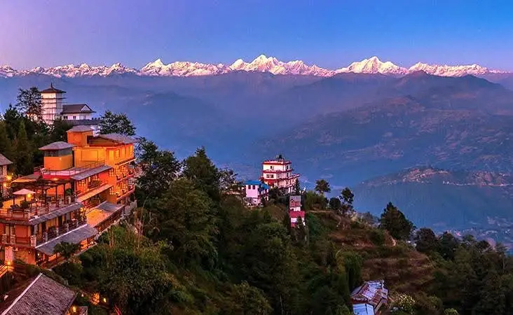
Nagarkot is the most visited sunrise viewpoint within reach of Kathmandu, and there’s a straightforward reason for that: on a clear morning, you can see more Himalayan peaks from this one ridge than from almost anywhere else in Nepal that doesn’t require a trekking permit. The view stretches from the Annapurna massif in the west to Kanchenjunga (the world’s third-highest peak) in the far east, with Langtang, Ganesh Himal, Dorje Lakpa, Jugal Himal, Rolwaling, Mahalangur (where Everest sits), Makalu, and Chamlang all filling the gap between. On an exceptional October morning, you’ll count 16 or more distinct peaks above 6,000 meters. Everest itself appears as a pointed pyramid above the nearer ridges to the northeast.
The most popular way to do Nagarkot is to take a taxi in the evening, stay overnight in one of the village lodges, and walk up to the viewpoint tower before dawn. The tower at the highest point of the ridge (about 2,175 meters) is a 10 to 15 minute walk from the village center. It’s free to access and open all night. If you don’t want to stay overnight, you can do a very early morning taxi departure from Kathmandu (around 4 am) to arrive before sunrise. The drive from Thamel takes about 1.5 hours. The road is paved most of the way but gets steep on the final approach to the village. Standard taxi fare runs NPR 2,500 to 3,500 one way.
The longer and more interesting option is to walk to Nagarkot from Bhaktapur, the medieval Newari city 14km east of Kathmandu. The trail from Bhaktapur climbs through terraced fields, pine forest, and several small Newari settlements before reaching the Nagarkot ridge from below. The walk takes about 4 to 5 hours one way and gains around 800 meters. You’ll pass the gompa and small settlement at Nala, cross a few minor ridges, and enter the pine forest section above 1,800 meters, where it’s genuinely quiet even on weekends. This version of the hike gives you a full day out and Nagarkot at the end rather than just the viewpoint.
Nagarkot village has plenty of lodges catering to every budget. The cheapest guesthouses run NPR 800 to 1,500 per room. The higher end resorts on the ridge with valley views charge USD 50 to 150. There’s a cluster of restaurants near the viewpoint tower serving dal bhat, momos, and breakfast food. The village gets busy on Friday and Saturday nights with Kathmandu residents escaping for the weekend, so if you’re going mid-week, you’ll have the viewpoint largely to yourself.
- Arrive the night before for the best sunrise experience; early morning taxi from Kathmandu means arriving in the dark
- The viewpoint tower is free and accessible at any hour
- Bhaktapur to Nagarkot trail: 4 to 5 hours, 800m elevation gain, passes through Nala village
- Cloud buildup happens quickly after 8 am; the clearest window is 5:30 to 7:30am
- October and November give the clearest mountain views; March and April are second best
- Bring warm layers: even in October, the ridge at 2,175m can be cold before sunrise
- No entry fees anywhere on this route
Want to go hiking around Kathmandu?
We can help you plan an easy day hike, village walk, or viewpoint hike near Kathmandu.
WhatsApp Us Email Us2. Champadevi Hill, 2,278m: Closest Proper Hike to the City
For the full route breakdown, trailheads, and a turn by turn walkthrough, see our complete Champadevi day hike guide.
| Champadevi Quick Stats | |
|---|---|
| Difficulty | Moderate |
| Distance | 6 to 10km round trip |
| Duration | 4 to 6 hours round trip |
| Starting Point | Hattiban Resort area or Pharping village |
| Elevation Gain | 450 to 600m |
| Transport from Kathmandu | Taxi to Hattiban: NPR 400 to 600 (8km south of Ring Road) |
| Entry Fee | No permit required |
| Best Season | October to May (avoid monsoon) |
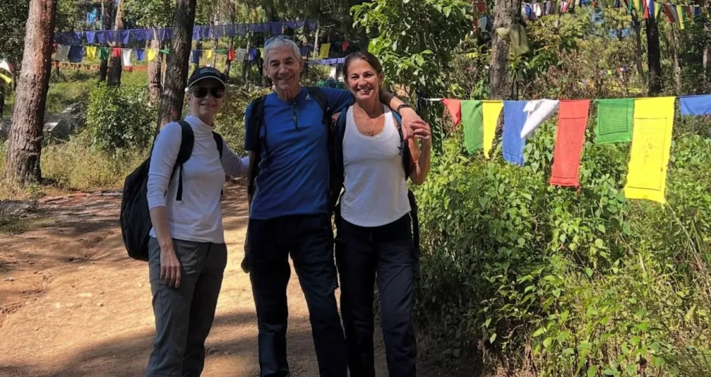
Champadevi is the closest serious hill hike to Kathmandu city. The trailhead at Hattiban is about 8km south of the Ring Road, which means you can be on the trail by 7 am and back in Thamel before noon if you move at a reasonable pace. The hill is named after Champa Devi, a Hindu goddess, and there’s a small temple at the summit at 2,278 meters with prayer flags strung between the trees. The views from the top look south over the Bagmati River valley and north across the Kathmandu Valley with the white peaks of Ganesh Himal and the Langtang range visible on a clear morning.
Quick Trip Facts DetailInformationTrip TypeKathmandu Day HikeDuration1 DayMaximum Altitude2,285m / 7,497ftDifficultyEasyStarting PointPharping or HattibanEnding PointMachchhe Gaun, Kirtipur, or Hattiban returnDistance…
There are two main approaches. From Hattiban, the trail starts in pine forest and climbs steadily through mixed woodland for about 3 to 4km to the summit ridge. The gradient is consistent but not brutal. From Pharping, which is about 15km south of Kathmandu, the trail approaches from the other side and is slightly longer, passing through the ancient Vajrayogini temple complex and the Gorakhnath cave before climbing the southern flank. The Pharping approach is quieter and has more cultural interest along the way. If you’re doing it as a full day trip, you can go up one side and descend the other.
The forest on Champadevi is quite different from the dry hills you see from the city. There’s a mix of pine, rhododendron, and deciduous trees, and the trail is genuinely forested for most of the climb. You’ll likely see langur monkeys in the trees and possibly Himalayan monal pheasants, Nepal’s national bird, which are so vivid that first-time sighters often mistake them for something exotic. The trail is well marked with prayer flags and the occasional mani stone. There’s a natural water source about halfway up from the Hattiban side. Check if it’s flowing before you rely on it.
Champadevi is one of the best hikes for solo travellers and first time hikers in Nepal. You don’t need a guide, the trail is impossible to lose, and you’re never more than 30 minutes from habitation. That said, it can get very busy on weekends, particularly Saturday mornings when Kathmandu families come out in force. If you want the trail to yourself, go on a weekday morning. Check our Champadevi Day Hike trip page if you’d prefer a guided experience.
- Closest proper hill hike to Kathmandu city center: trailhead in 20 to 30 minutes by taxi
- No permits or entry fees required at either trailhead
- From Hattiban: 3 to 4km to the summit, 450m elevation gain, well marked trail
- From Pharping: longer route passing Vajrayogini temple and Gorakhnath cave
- Look for Himalayan monal pheasants in the mixed forest section above 2,000m
- Water source halfway up from Hattiban side (seasonal, verify before use)
- Gets very busy Saturday mornings; weekday hiking recommended for solitude
- No accommodation at summit: this is a day hike only
3. Shivapuri Nagarjun National Park, 2,732m: Forested Hills and Wildlife
| Shivapuri Quick Stats | |
|---|---|
| Difficulty | Moderate |
| Distance | 12 to 16km round trip |
| Duration | 6 to 8 hours round trip |
| Starting Point | Budhanilkantha (north Kathmandu) |
| Elevation Gain | 1,300m from Budhanilkantha (1,440m) |
| Transport from Kathmandu | Taxi to Budhanilkantha: NPR 400 to 600 (10km from Thamel) |
| Entry Fee | NPR 250 foreigners / NPR 50 Nepalis |
| Best Season | October to May |
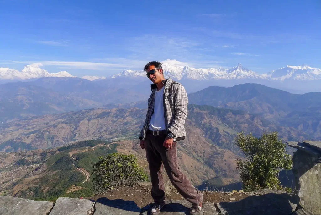
Shivapuri Nagarjun National Park is the closest protected forest to Kathmandu and one of the most underused options for a serious day hike in the entire Kathmandu Valley. The park covers 159 square kilometers of the hills immediately north of the city, and the main entrance at Budhanilkantha is about NPR 400-600 by taxi from Thamel. The entry permit costs NPR 250 for foreign nationals and NPR 50 for Nepalis, and you collect it at the checkpoint gate just past the famous Budhanilkantha sleeping Vishnu temple. From the gate, a well-maintained trail climbs through dense forest to Shivapuri Peak at 2,732 meters.
The forest inside the park is genuinely impressive. This is not the scrubby hillside you see from the Kathmandu ring road. The trail passes through mixed oak and rhododendron forest, and as you climb above 2,000 meters, the rhododendrons start to dominate. In March and April, the hillside turns red, pink, and white. The park is home to leopards, Himalayan black bears, rhesus and langur monkeys, barking deer, and over 300 bird species. You won’t see a leopard on a day hike, but the trail cameras inside the park have documented regular sightings in the zone above 2,200 meters. You may well see deer or hear barking deer alarm calls in the forest.
The climb to Shivapuri peak from Budhanilkantha is about 1,300 meters of elevation gain over 6 to 8 kilometers, depending on which trail you take. The main trail goes to the Bagdwar spring (the source of the Bagmati River) at about 2,500 meters, then continues to the summit. The Bagdwar area is a significant religious site for Hindus, and there’s usually a small tea stall open near the spring area during trekking season. From the summit, the view takes in the entire Kathmandu Valley to the south and the Langtang range to the north, with peaks including Langtang Lirung (7,227m), Dorje Lakpa (6,966m), and Ganesh Himal (7,422m) visible on clear days.
There’s an alternative descent route from Shivapuri that heads east and exits the park at Sundarijal, the park’s other main entrance. If you have two vehicles or can arrange a taxi pickup, this point-to-point option is excellent: you start at Budhanilkantha, summit Shivapuri, descend to Sundarijal, and take a taxi back to Thamel. The Sundarijal exit is about 18km from Thamel by road. This route is 15 to 18km total and a genuinely full day of walking.
- Entry permit: NPR 250 for foreigners, NPR 50 for Nepalis. Collected at Budhanilkantha checkpoint
- Budhanilkantha sleeping Vishnu temple is worth 20 minutes before starting the hike
- 1,300m elevation gain: start early (7 am or before) to have time to reach the summit and return
- Bagdwar spring (source of the Bagmati) at about 2,500m: religious site with a tea stall in season
- Alternative exit via Sundarijal for a point-to-point route (arrange taxi pickup)
- Wildlife: leopards documented by trail cameras above 2,200m; barking deer and langurs more commonly seen
- Bring 2 to 3 liters of water; sources inside the park are not reliably safe without treatment
- The trail is signed inside the park, but a basic map from the entrance checkpoint helps
4. Phulchoki Hill, 2,760m: Nepal’s Best Birdwatching Hill Hike
| Phulchoki Quick Stats | |
|---|---|
| Difficulty | Moderate (steep in upper section) |
| Distance | 10 to 14km round trip on foot |
| Duration | 5 to 7 hours round trip |
| Starting Point | Godavari (south of Patan) |
| Elevation Gain | 900 to 1,100m from Godavari |
| Transport from Kathmandu | Taxi to Godavari: NPR 600 to 900 (16km from Thamel) |
| Entry Fee | No permit required |
| Best Season | October to November and February to April |
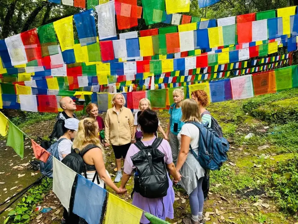
Phulchoki is the highest point on the rim of the Kathmandu Valley at 2,760 meters and one of the least known serious hikes in the area. It’s directly south of Patan, and the trailhead at Godavari is about NPR 600 to 900 by taxi from Thamel. Unlike Shivapuri or Nagarkot, Phulchoki has no entry fee, no park permit, and very few foreign hikers. You’re likely to share the trail with Nepali students, birdwatchers, and weekend walkers from Lalitpur district. There’s a large Marian statue and shrine near the summit area, maintained by the Catholic community, and an antenna cluster at the very top.
Phulchoki has recorded over 350 bird species, more than any comparably sized forest patch in Nepal. This is partly because it’s the highest forested hill near the valley and acts as a concentration point for migratory birds in spring and autumn. The forest is dense old growth jungle on the upper sections, dominated by enormous oak trees draped in moss. In February and March, the rhododendron trees at altitude flower in multiple colors simultaneously. Birdwatchers specifically target Phulchoki in the pre-monsoon period from late February through May for species including the satyr tragopan, red-billed blue magpie, Himalayan cutia, Nepal fulvetta, and a long list of warblers and flycatchers visible during migration. You don’t need to be a birdwatcher to appreciate the forest: it’s simply beautiful to walk through.
The road to the top of Phulchoki is a jeep track that taxis and private vehicles can drive almost to the summit. If you want a shorter version, you can hire a jeep to take you to around 2,400 meters and walk the upper section. The proper hiking trail from Godavari follows a different line and is steeper and more interesting. The upper section above 2,400 meters is the best part: the trees are enormous, and the trail weaves through boulder sections with moss-covered roots underfoot. The summit view looks north over the entire Kathmandu Valley and south toward the lower hills of the Terai.
- No permit or entry fee: completely free to access
- Over 350 bird species recorded, more than any comparable site near Kathmandu
- Best birdwatching: February to May and September to October during migration
- Jeep track from Godavari to summit: can be driven, but the walking trail is more interesting
- Bring binoculars if you have them; even non birdwatchers will spot compelling species
- The old growth oak forest above 2,400m is the highlight of the entire hike
- Rarely crowded; significantly quieter than Shivapuri or Nagarkot
- In winter (December to February) the upper section can have frost or light snow; bring warm layers
Want to go hiking around Kathmandu?
We can help you plan an easy day hike, village walk, or viewpoint hike near Kathmandu.
WhatsApp Us Email Us5. Namobuddha, 1,750m: Sacred Buddhist Hilltop East of Kathmandu
| Namobuddha Quick Stats | |
|---|---|
| Difficulty | Easy to Moderate |
| Distance | 8 to 12km from Dhulikhel |
| Duration | 3 to 5 hours one way from Dhulikhel |
| Starting Point | Dhulikhel (45km east of Kathmandu) |
| Elevation Gain | 400 to 500m from valley floor |
| Transport from Kathmandu | Public bus: NPR 60 to 100, 1.5 hours. Taxi: NPR 1,500 to 2,000 |
| Entry Fee | No entry fee for hike; monastery donation welcome |
| Best Season | October to May |
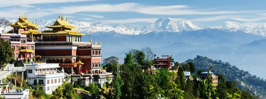
Namobuddha is one of the most significant Buddhist pilgrimage sites in the Kathmandu region and the hike to reach it from Dhulikhel is one of the best day walks east of the city. The site marks the spot where, according to Buddhist legend, a young prince named Mahasattva gave his body to a starving tigress and her cubs. A stupa dating from at least the 15th century marks the location, and the Thrangu Tashi Yangtse monastery, built more recently on the hill above the ancient stupa, now houses around 200 monks. The monastery is an active center for Tibetan Buddhist practice and is open to visitors.
To get to Dhulikhel from Kathmandu, you can take the public bus from the old bus park near Ratna Park. The bus costs NPR 60 to 100 and takes about 1.5 hours, running regularly from early morning. A taxi will run NPR 1,500 to 2,000 and takes about 50 minutes. From Dhulikhel, the trail to Namobuddha descends from the town and follows a winding path through rice fields and small settlements, gradually climbing to the hilltop monastery complex. The entire walk is about 10 to 12km round trip from Dhulikhel and takes 3 to 5 hours at a relaxed pace with time spent at the monastery.
The monastery complex at the top has a guesthouse, a bakery, and a dining hall where visitors can eat simple vegetarian food. You can stay overnight here if you want to attend morning prayers, which start at 5am and are open to respectful visitors. The views from the monastery terrace look west toward Kathmandu and north toward the Langtang, Jugal, and Ganesh Himal ranges. On a clear October morning the mountain panorama from here rivals Nagarkot for quality.
This walk combines well with a visit to Panauti, a medieval Newari town about 6km from Dhulikhel. Panauti sits at the confluence of two rivers and has some of the best-preserved Newari architecture outside of Bhaktapur. It was barely damaged by the 2015 earthquake compared to most valley towns. You can drive from Dhulikhel to Panauti, visit the Indreshwar Mahadev temple complex, and then hike from Panauti toward Namobuddha on a different trail that approaches from the south.
- Public bus from Ratna Park to Dhulikhel: NPR 60 to 100, runs regularly from 6am
- Monastery guesthouse at Namobuddha: overnight possible, simple vegetarian meals available
- Morning prayers at 5am: open to respectful visitors who have stayed overnight
- Combine with Panauti for a full cultural day: medieval Newari town with intact temples
- The trail from Dhulikhel passes through active farming villages: this is real rural life, not a tourist route
- No entry fee for the trail; a donation at the monastery is appreciated
- Best mountain views: October to November from the monastery terrace
6. Dhulikhel to Namobuddha Hike: The Best Day Walk East of Kathmandu
| Dhulikhel to Namobuddha Quick Stats | |
|---|---|
| Difficulty | Easy to Moderate |
| Distance | 12km one way (round trip or circular option) |
| Duration | 4 to 5 hours one way, 7 to 8 hours circular |
| Starting Point | Dhulikhel old town viewpoint |
| Elevation Gain | Undulating, 400m cumulative gain |
| Transport from Kathmandu | Bus: NPR 60 to 100. Taxi: NPR 1,500 to 2,000 |
| Entry Fee | No permit required |
| Best Season | October to May |
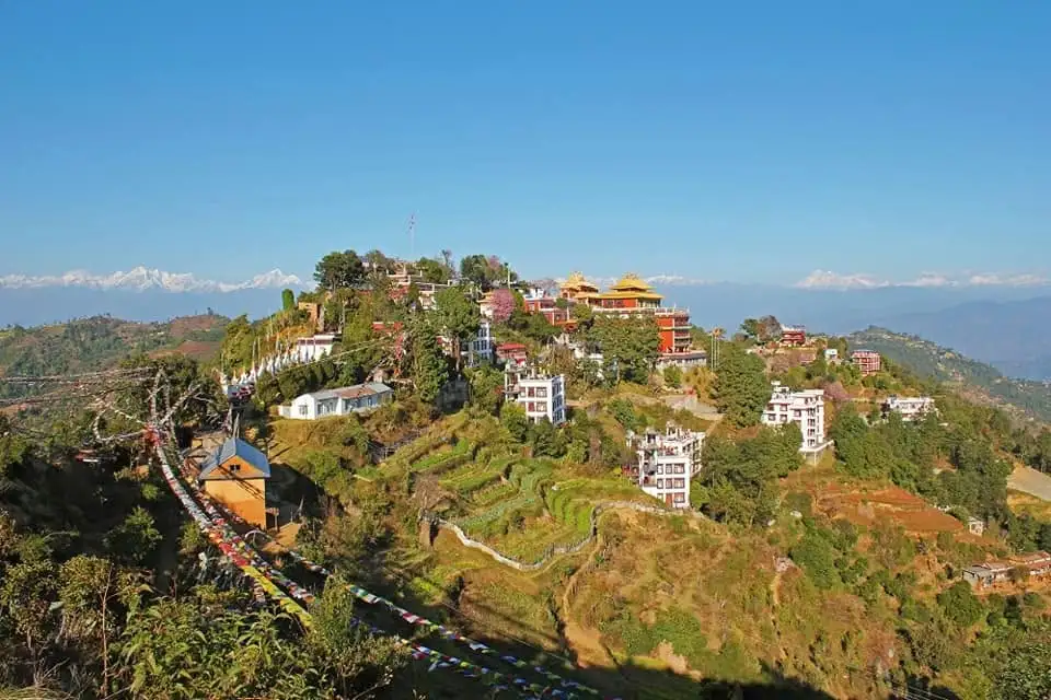
The Dhulikhel to Namobuddha route is the most consistently recommended day walk east of Kathmandu and for good reason. It combines mountain views, authentic Newari villages, rice and wheat terraces, pine forest sections, and a significant Buddhist pilgrimage site into a single day that you can reach by public bus for NPR 60 to 100. The trail starts from Dhulikhel’s old town area, where a viewpoint on the eastern edge of town gives you a first look at the Himalayan chain: Ganesh Himal, Langtang, Dorje Lakpa, Jugal Himal, and on clear days the distant outline of Rolwaling peaks.
The trail drops from Dhulikhel through terraced fields and small farming settlements before entering a section of pine forest. This middle section of the walk is the most peaceful: you’re in the forest away from the road, the trail is well worn clay and stone, and the views open occasionally to the south over the Panauti valley. Several teahouses along the route sell tea, soft drinks, and simple food. The trail emerges from the forest and climbs to the Namobuddha hilltop monastery complex, where you can eat, rest, and visit the ancient stupa and the newer monastery buildings.
A circular return route is possible by descending from Namobuddha to Panauti town and then hiring a vehicle back to Dhulikhel or taking a local transport. Panauti is only about 6km from Dhulikhel by road. The Indreshwar Mahadev temple in Panauti, dating to around the 14th century, is one of the oldest intact temples in Nepal and the town’s medieval street layout is largely unchanged. If you’re doing this route, the combination of the walk from Dhulikhel, the monastery visit, and an hour in Panauti makes for a genuinely full and varied day.
- Start from Dhulikhel old town viewpoint for the best mountain panorama at the beginning
- Trail passes through 4 to 5 named villages: each has a simple tea shop
- Pine forest section in the middle: quietest and coolest part of the trail
- Namobuddha monastery: plan 45 minutes to explore the stupa and monastery buildings
- Circular option: descend to Panauti, visit Indreshwar Mahadev temple, transport back to Dhulikhel
- No permits required anywhere on this route
- Best done as a full day; start before 9am from Dhulikhel to have time for everything
7. Kakani, 2,073m: Quiet Trails and Strawberry Farms Northwest of Kathmandu
| Kakani Quick Stats | |
|---|---|
| Difficulty | Easy |
| Distance | 5 to 8km on forest trails |
| Duration | 3 to 4 hours including exploration |
| Starting Point | Kakani village (24km northwest of Kathmandu) |
| Elevation Gain | 200 to 400m on trails around the village |
| Transport from Kathmandu | Taxi: NPR 1,000 to 1,500 (24km, about 1 hour) |
| Entry Fee | No permit required |
| Best Season | March to April and October to November |
Kakani is one of the quietest and most overlooked day trip destinations northwest of Kathmandu. At 2,073 meters, the hill village sits above the Trishuli River valley on the road toward Trisuli Bazaar, and the drive there takes you through an increasingly rural landscape as the Kathmandu sprawl falls away. Kakani is famous locally for two things: the strawberry farms that have operated here for decades (and sell directly to Kathmandu restaurants) and the rhododendron forests that turn the hillside red in March and April. The mountain views from the Kakani ridge look directly at Ganesh Himal (7,422m) and the Manaslu range (8,163m) to the north, with a long horizontal line of Himalayan peaks stretching east toward Langtang.
The hiking here is gentler than Shivapuri or Phulchoki. There are no dramatic summit scrambles or 1,000 meter ascents. Instead, you’re wandering through rhododendron and pine forest on broad trails, passing the occasional Tamang farming settlement, and finding viewpoints on the ridge above the village. It’s ideal for families with young children, people recovering from illness, or anyone who wants a pleasant green day without a hard physical effort. In March and early April, the entire forest above Kakani village is rhododendron in bloom, and the contrast between the red flowers and the snow peaks behind is genuinely special.
Kakani has a small government resort on the ridge, originally built for official functions, which now operates as a basic guesthouse and restaurant with an excellent mountain view. The food is simple Nepali fare and the prices are reasonable. It’s a good place to stop for lunch before exploring the forest trails in the afternoon. The area around Kakani also has some of the best preserved community forest management in the Kathmandu Valley: the local committee has maintained the rhododendron and pine forest for decades and you can see the results in the density and health of the trees.
- 24km from Kathmandu via the Trisuli road: taxi NPR 1,000 to 1,500, about 1 hour
- Best in March to April for rhododendrons or October to November for mountain views
- Strawberry farms sell fresh strawberries from February through April
- Government resort on the ridge: basic guesthouse and restaurant with mountain views
- Very easy trails: suitable for families, older travellers, and those wanting a gentle day
- No permits or entry fees
- Views of Ganesh Himal (7,422m) and Manaslu (8,163m) on clear mornings
- Less crowded than Nagarkot even on weekends; genuinely tranquil
8. Balthali Village Trek: Rice Terraces and Authentic Newari Life
Kakani is one of the quietest and most overlooked day trip destinations northwest of Kathmandu. At 2,073 meters, the hill village sits above the Trishuli River valley on the road toward Trisuli Bazaar, and the drive there takes you through increasingly rural landscape as the Kathmandu sprawl falls away. Kakani is famous locally for two things: the strawberry farms that have operated here for decades (and sell directly to Kathmandu restaurants) and the rhododendron forests that turn the hillside red in March and April. The mountain views from the Kakani ridge look directly at Ganesh Himal (7,422m) and the Manaslu range (8,163m) to the north, with a long horizontal line of Himalayan peaks stretching east toward Langtang.
The hiking here is gentler than Shivapuri or Phulchoki. There are no dramatic summit scrambles or 1,000 meter ascents. Instead, you’re wandering through rhododendron and pine forest on broad trails, passing the occasional Tamang farming settlement, and finding viewpoints on the ridge above the village. It’s ideal for families with young children, people recovering from illness, or anyone who wants a pleasant green day without a hard physical effort. In March and early April, the entire forest above Kakani village is rhododendron in bloom, and the contrast between the red flowers and the snow peaks behind is genuinely special.
Kakani has a small government resort on the ridge, originally built for official functions, which now operates as a basic guesthouse and restaurant with an excellent mountain view. The food is simple Nepali fare and the prices are reasonable. It’s a good place to stop for lunch before exploring the forest trails in the afternoon. The area around Kakani also has some of the best preserved community forest management in the Kathmandu Valley: the local committee has maintained the rhododendron and pine forest for decades and you can see the results in the density and health of the trees.
- 24km from Kathmandu via the Trisuli road: taxi NPR 1,000 to 1,500, about 1 hour
- Best in March to April for rhododendrons or October to November for mountain views
- Strawberry farms sell fresh strawberries from February through April
- Government resort on the ridge: basic guesthouse and restaurant with mountain views
- Very easy trails: suitable for families, older travellers, and those wanting a gentle day
- No permits or entry fees
- Views of Ganesh Himal (7,422m) and Manaslu (8,163m) on clear mornings
- Less crowded than Nagarkot even on weekends; genuinely tranquil
8. Balthali Village Trek: Rice Terraces and Authentic Newari Life
| Balthali Quick Stats | |
|---|---|
| Difficulty | Easy to Moderate |
| Distance | 10 to 15km (Panauti to Balthali one way) |
| Duration | Full day (for day trip from Kathmandu) |
| Starting Point | Panauti (35km southeast of Kathmandu) |
| Elevation Gain | 400 to 600m undulating terrain |
| Transport from Kathmandu | Taxi to Panauti: NPR 1,000 to 1,500 (35km, about 1 hour) |
| Entry Fee | No permit required |
| Best Season | October to November and March to May |
Balthali is a small Newari village perched on a ridge above the Roshi River valley, about 35km southeast of Kathmandu. It’s most commonly done as an overnight or 2 to 3 day trek from Panauti, but it’s also entirely possible as a full day trip from the city if you start early. The walk from Panauti takes about 4 to 5 hours one way, passing through terraced rice and wheat fields, over a forested ridge, and through the village of Khopasi. Balthali itself sits at around 1,700 meters with views of the surrounding hills and, on clear mornings, glimpses of the higher peaks to the north.
The main draw of this route is the agricultural landscape and the authenticity of the Newari villages along the way. Unlike the tourist infrastructure that now lines the Annapurna or Everest trail in parts, Panauti to Balthali is a farming route that visitors have joined only relatively recently. You’ll walk past women planting paddy in July, harvesting in October, and threshing on stone floors in November. Goats and chickens share the trail. There are no signs advertising filtered coffee or apple pie, but there are small teahouses in most villages where you can get tea and basic food.
Balthali Jungle Resort is a small community lodge at the village that offers accommodation for those doing it as an overnight trip. The rooms are simple and the food is home cooked dal bhat. If you’re going as a day trip, you’ll need to arrange a vehicle pickup from the Balthali side, which requires some coordination in advance. Alternatively, the circular route back via Khopasi and Panauti is possible if you’re happy walking 20 to 25km total in a day. This is a physically realistic objective if you’re reasonably fit and start from Panauti before 8am.
- Best as an overnight or 2 day trip, but doable as a full day with an early start
- Panauti is 35km from Kathmandu: taxi NPR 1,000 to 1,500
- The agricultural landscape is the main draw: rice and wheat terraces, working farming villages
- No tourist facilities between Panauti and Balthali: carry your lunch and extra water
- Balthali Jungle Resort at the village: simple community accommodation
- For a day trip: arrange vehicle pickup at Balthali in advance, or walk the circular route (20 to 25km total)
- No permits required anywhere on this route
- October is the best time: harvest season in the fields and clear mountain views
9. Hattiban Forest Area and Champadevi Loop: 30 Minutes from Thamel
| Hattiban Forest Quick Stats | |
|---|---|
| Difficulty | Easy |
| Distance | 4 to 6km on forest loop trails |
| Duration | 2 to 3 hours |
| Starting Point | Hattiban Resort, Kirtipur area |
| Elevation Gain | 150 to 250m |
| Transport from Kathmandu | Taxi: NPR 300 to 500 (8km from Thamel) |
| Entry Fee | No permit required |
| Best Season | Year round (best after rain) |
The Hattiban area is the closest you’ll get to proper forest walking from central Kathmandu. The community forest here begins about 8km south of Thamel and the trail network within it gives you 4 to 6km of pine and mixed forest walking before you’ve even started climbing toward Champadevi. For people staying in Kathmandu who want a morning walk before a day of sightseeing, this is the practical choice. You can be in the forest by 7am, do a loop, and be back in Thamel for breakfast by 10am.
The Hattiban forest is a community managed conservation area. The trees are mostly pine, with some mixed woodland on the lower slopes, and the trail surface varies from dirt to stone depending on recent weather. It’s used by Kathmandu residents for morning runs and walks, particularly on weekends. There are viewpoints within the forest that look north toward the city and the Himalayan backdrop. It’s not a dramatic mountain view, but it’s pleasant forest walking within 30 minutes of Thamel, which counts for a lot when you need to clear your head after a day of temple visits and traffic.
If you have more time and energy, you can continue from Hattiban directly to the Champadevi summit. The trail from the forest edge to the Champadevi top takes another 1.5 to 2 hours and adds about 400 to 500 meters of additional elevation gain. This makes the combined Hattiban forest plus Champadevi summit hike a full morning activity of 4 to 5 hours total. The combined route gives you genuine forested walking followed by an actual summit with views, all within 30 minutes of the city center by taxi.
- Closest forest walking to central Kathmandu: 8km south of Thamel, NPR 300 to 500 by taxi
- Trail network of 4 to 6km within the community forest: ideal for morning walks
- Can be extended to Champadevi summit: adds 1.5 to 2 hours and 400 to 500m elevation
- Popular with Kathmandu joggers and walkers on weekend mornings
- No permits required; the forest is community-managed and free to enter
- Pine forest stays green year-round but is particularly fresh after rain
- Return to Thamel by 10am is realistic if you start by 7am
Want to go hiking around Kathmandu?
We can help you plan an easy day hike, village walk, or viewpoint hike near Kathmandu.
WhatsApp Us Email Us10. Jamacho Peak in Nagarjun Forest Reserve, 2,096m: Valley Views from the West
| Jamacho Peak Quick Stats | |
|---|---|
| Difficulty | Moderate |
| Distance | 10 to 12km round trip |
| Duration | 4 to 5 hours round trip |
| Starting Point | Nagarjun Forest Reserve gate, northwest Kathmandu |
| Elevation Gain | 700m from the reserve gate |
| Transport from Kathmandu | Taxi: NPR 300 to 500 from Thamel (6km to gate) |
| Entry Fee | NPR 250 foreigners / NPR 50 Nepalis |
| Best Season | October to November and March to April |
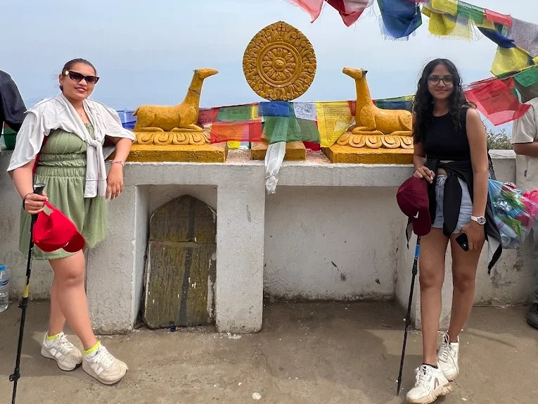
Jamacho Peak in the Nagarjun Forest Reserve (also called the Rani Ban or Royal Forest) is the best hill hike on the western side of Kathmandu. The reserve gate is only about 6km from Thamel, which means NPR 300 to 500 by taxi, and the entry permit at the gate costs NPR 250 for foreign nationals and NPR 50 for Nepalis. From the gate, a forested trail climbs 700 meters through dense oak and rhododendron woodland to the Jamacho summit at 2,096 meters. At the top, a small Buddhist stupa marks the highpoint and there’s a terrace with a clear view south over the entire Kathmandu Valley, east toward Bhaktapur and the Changu Narayan ridge, and north toward the Langtang peaks.
The Nagarjun Forest Reserve covers the isolated forested hill that rises steeply from the northwestern edge of Kathmandu city. It’s part of the same protected ecosystem as the Shivapuri Nagarjun National Park that covers the northern hills, though the two sections are managed separately. The forest here is one of the few places where you can see the Himalayan gray langur, a large monkey distinct from the more commonly seen rhesus macaque that fills the streets around Swayambhunath. You’ll also find peacocks in the lower forest sections near the gate, and the bird list for the reserve is substantial.
The trail from the gate to the Jamacho summit is steep in sections but manageable for anyone reasonably fit. It takes about 2 to 2.5 hours up and 1.5 hours down. The trail surface is generally good: stone steps in the lower section, dirt trail above. There’s a small tea stall at the summit during trekking season (October to May) selling tea, soft drinks, and instant noodles. The summit area around the stupa is a popular spot for local pilgrims on full moon days and Nepali holidays, when you’ll hear the bells and chanting from below.
Jamacho is a genuinely good alternative to Shivapuri if you want a shorter day or if Shivapuri is your plan for tomorrow. The two parks are different experiences: Shivapuri is denser and wilder, Jamacho is more accessible and urban in its feel, though the forest quality inside is excellent. The round trip to Jamacho and back fits comfortably into a morning: leave Thamel at 7am, arrive at the gate by 7:30, summit by 10am, back at the gate by noon, lunch in Thamel.
- Entry permit: NPR 250 foreigners, NPR 50 Nepalis. Gate is 6km from Thamel
- 700m elevation gain over 5 to 6km: steep in sections but well maintained trail
- Buddhist stupa at summit with panoramic views of Kathmandu Valley
- Himalayan gray langur and peacocks in the lower forest near the gate
- Tea stall at summit during trekking season (October to May)
- Round trip possible in a morning: leave Thamel at 7am, back by noon
- Good alternative to Shivapuri for a shorter day or if doing both parks on consecutive days
Getting to the Trailheads from Thamel
| Destination | Distance from Thamel | Taxi Fare | Public Bus Option | Drive Time |
|---|---|---|---|---|
| Nagarkot | 32km | NPR 2,500 to 3,500 | Bus from Bhaktapur bus park: NPR 40 | 1.5 hours |
| Hattiban (Champadevi) | 8km | NPR 400 to 600 | Limited | 25 to 35 min |
| Budhanilkantha (Shivapuri) | 10km | NPR 400 to 600 | Minibus from Ratna Park: NPR 30 | 30 to 45 min |
| Godavari (Phulchoki) | 16km | NPR 600 to 900 | Bus from Lagankhel: NPR 30 | 40 to 55 min |
| Dhulikhel (Namobuddha) | 30km | NPR 1,500 to 2,000 | Bus from old bus park: NPR 60 to 100 | 50 to 70 min |
| Kakani | 24km | NPR 1,000 to 1,500 | Limited | 50 to 70 min |
| Panauti (Balthali start) | 35km | NPR 1,000 to 1,500 | Via Banepa: NPR 80 to 120 | 1 to 1.5 hours |
| Nagarjun gate (Jamacho) | 6km | NPR 300 to 500 | Limited | 20 to 25 min |
Taxi fares in Kathmandu are negotiated before you get in the vehicle. Meters are rarely used. The fares listed above are typical for 2026 but will vary with traffic conditions, time of day, and your negotiation. Day trip fares are usually higher than local fares because the driver waits at the trailhead. You can negotiate a return trip with the same driver, which is often more cost effective than finding a separate taxi at the trailhead. For longer destinations like Nagarkot, Dhulikhel, or Kakani, it’s worth agreeing a return trip price before you leave Thamel.
What to Pack for Day Hikes Near Kathmandu
Most day hikes near Kathmandu don’t require specialist equipment. You don’t need the full trekking kit you’d bring on an Everest or Annapurna trek. But there are a few things that make a real difference and some items that people regularly wish they’d brought.
Footwear is the most important decision. Trail running shoes or light hiking boots work well on all ten hikes listed here. The trails are a mix of stone steps, dirt paths, and clay in wet conditions. If you’re going during or just after monsoon, the clay sections can be extremely slippery. Waterproofed boots and trekking poles help significantly in these conditions. Flip flops and standard sneakers are fine for the Hattiban forest loop but not for Shivapuri summit or Phulchoki.
- Footwear: trail runners or light hiking boots for most hikes; waterproof for post monsoon season
- Water: at least 1.5 liters per person; 2 to 3 liters for Shivapuri or Phulchoki full day hikes
- Water purification: tablets or a filter (Sawyer Squeeze or SteriPen) for any water from streams
- Sunscreen: the altitude increases UV exposure; SPF 40 or higher
- Sunglasses: polarized if possible, particularly for Nagarkot and high viewpoints
- Rain jacket: even in October, afternoon cloud buildup can bring brief rain showers above 2,000m
- Warm layer: a fleece or light down jacket for any hike above 2,000m, particularly early morning starts
- Snacks: carry enough food for the day; teahouses are not guaranteed on every route
- Headlamp: essential if you’re doing a predawn Nagarkot sunrise start
- First aid basics: blister plasters, ibuprofen, rehydration salts
- Binoculars: highly recommended for Phulchoki (birdwatching) and any high viewpoint
- Offline maps: download the Khumbu or Kathmandu Valley area in Maps.me before leaving your hotel
- Cash: all teahouses and entry checkpoints are cash only; carry NPR 1,000 to 2,000 per day
Permits and Entry Fees
Most hikes near Kathmandu are free to access with no permit required. There are only two national park or reserve entry fees in the ten hikes covered in this guide, and both are straightforward to pay at the entry checkpoint. Here’s the full breakdown for 2026:
| Hike / Area | Foreigners | SAARC Nationals | Nepali Citizens | Notes |
|---|---|---|---|---|
| Shivapuri Nagarjun NP | NPR 250 | NPR 100 | NPR 50 | Paid at Budhanilkantha or Sundarijal gate |
| Nagarjun Forest Reserve (Jamacho) | NPR 250 | NPR 100 | NPR 50 | Paid at reserve entrance gate, northwest Kathmandu |
| Nagarkot | Free | Free | Free | No permit; village road access |
| Champadevi | Free | Free | Free | No permit from either Hattiban or Pharping |
| Phulchoki | Free | Free | Free | No permit; road and trail access from Godavari |
| Namobuddha / Dhulikhel | Free | Free | Free | No trail permit; monastery donation welcome |
| Kakani | Free | Free | Free | No permit required |
| Balthali | Free | Free | Free | No permit required |
Entry permits at Shivapuri and Nagarjun are paid in cash at the checkpoint. The permit includes the day of entry only. If you’re staying overnight (for example at Bagdwar or doing a multi day route through Shivapuri), you’ll need to pay for each additional day or arrange a multi day pass at the main Kathmandu office of the Department of National Parks and Wildlife Conservation. For a standard day hike, the single day payment at the gate is all that’s required. The TIMS card (Trekkers Information Management System) is not required for any of the ten hikes in this guide.
Best Hiking Seasons Month by Month
| Month | Conditions | Mountain Views | Recommendation |
|---|---|---|---|
| January | Cold, possible snow above 2,500m, crisp air | Excellent on clear days | Good for lower hikes (Namobuddha, Kakani). Dress warm for Shivapuri |
| February | Cold but warming, rhododendrons starting at lower elevations | Very good | Good month, early rhododendrons at Kakani and forest edges |
| March | Warm days, rhododendrons in full bloom above 1,800m | Very good, some haze building | One of the best months: Shivapuri, Phulchoki, and Kakani are spectacular |
| April | Warm, rhododendrons still blooming, increasing haze | Good (best in early April) | Excellent for forest hikes; mountain views start to haze by mid month |
| May | Hot and humid, pre monsoon thunderstorms | Poor, heavy haze | Possible but not ideal; start very early (5am) to beat heat and afternoon storms |
| June | Monsoon begins, heavy rain, leeches in forest below 2,000m | Very poor | Not recommended; trails muddy and slippery, leeches on lower forest sections |
| July | Heavy monsoon, trails very slippery, leeches | Almost zero visibility | Avoid hill hiking; rice fields are green but mountain views are gone |
| August | Heavy rain continues, occasional brief clear spells | Poor | Not recommended; some urban walks (Hattiban forest in dry spells) are possible |
| September | Monsoon ending, improving but still some rain, trails drying | Improving | Late September can be very good after final monsoon rains clear |
| October | Clear, cool, post monsoon freshness, best visibility of year | Outstanding | The single best month for hiking near Kathmandu; all ten hikes are at their best |
| November | Clear, increasingly cold, peak season crowds | Excellent | Second best month; weekday hiking recommended to avoid weekend crowds |
| December | Cold, possible snow above 2,500m, very clear air | Very good | Good for lower hikes; bring proper winter gear for Shivapuri and Phulchoki |
Safety Tips for Hiking Near Kathmandu
The hikes near Kathmandu are relatively safe compared to higher altitude routes in Nepal, but there are a few specific things to know. The most common incidents on these trails are not altitude related (the elevations are too low for serious altitude sickness) but rather trail falls, particularly in wet conditions, and getting lost after dark. Most hikes listed here are out and back routes on well marked trails, which reduces the navigation risk significantly.
Solo female travellers are generally comfortable on these trails, particularly on the busier routes like Shivapuri from Budhanilkantha and the Dhulikhel to Namobuddha trail. The most isolated sections are the upper Phulchoki forest above 2,400 meters and parts of the Shivapuri interior above 2,500 meters. On these sections it’s worth having a hiking companion or letting someone know your planned route and return time. Shouting for help would likely be heard by other hikers within 30 minutes on Shivapuri during peak season.
The wildife risk at Shivapuri is worth understanding without exaggerating. Leopards live in the park and have occasionally been sighted on trail in the pre dawn hours. They don’t typically attack humans, but disturbing one at close range is not a situation you want. Don’t hike in the Shivapuri interior before dawn or after dusk. Monkeys near the Budhanilkantha temple area can be aggressive if you’re carrying visible food. Keep snacks in your pack.
- Carry at least 1.5 liters of water per person for any hike; 2 to 3 liters for all day routes
- Tell someone your planned route and expected return time before every hike
- Download offline maps (Maps.me or Google Maps offline) before leaving your hotel
- Don’t hike in Shivapuri interior before dawn or after dusk (leopards active in low light)
- Keep food in your pack around monkey territory near Budhanilkantha and Swayambhunath
- In wet or post rain conditions, trails above 2,000m can be very slippery: trekking poles help
- For solo female travellers: Shivapuri (Budhanilkantha gate), Dhulikhel to Namobuddha, and Nagarkot are well trafficked and considered safe
- Carry NPR 1,000 to 2,000 cash: no card payment at trailhead teahouses or checkpoints
- Mobile signal exists on most trails up to about 2,200m; above that it becomes intermittent
- In an emergency, your hotel can contact mountain rescue; the Kathmandu based rescue number is 1144
Guided vs Solo Hiking Near Kathmandu
The honest answer for most trails near Kathmandu is that you don’t need a guide. The popular routes (Shivapuri from Budhanilkantha, Dhulikhel to Namobuddha, Nagarkot, Champadevi from Hattiban) are well marked and heavily trafficked enough that you’ll rarely be the only person on the trail. Maps.me and Google Maps offline have reasonable coverage of these trails. For confident hikers with navigation experience, solo hiking is the normal approach for day hikes near Kathmandu.
That said, there are three situations where hiring a guide genuinely adds value. First, if you’re doing Phulchoki for birdwatching, a local birdwatching guide knows exactly where to look and what to listen for, and will significantly increase the number of species you see. Second, if you want to combine a hike with cultural context (the history of Newari villages on the Dhulikhel to Namobuddha route, or the significance of the sites at Pharping on the Champadevi approach), a local guide provides information that no guidebook fully captures. Third, if you’re hiking with children, older adults, or people who have never hiked before, a guide can better manage group dynamics and logistics.
A local day hiking guide from a reputable Kathmandu company costs approximately USD 30 to 60 per day depending on the route and the guide’s experience. This is separate from transport costs. Our team at Next Trip Nepal can arrange guided day hikes on any of these routes, including the Champadevi day hike and Kathmandu day tours that combine sightseeing with walking. For something more involved, our Kathmandu and Nagarkot tour includes a Nagarkot sunrise and valley exploration.
Want to Hike Near Kathmandu With a Guide?
We arrange guided day hikes on all routes in this guide, from the Champadevi hill hike to full day Shivapuri or Phulchoki trips. Private or small group options. Transport included.
Frequently Asked Questions
What is the easiest day hike near Kathmandu for beginners?
The easiest options for complete beginners are the Hattiban forest loop, the Nagarkot viewpoint walk (if you’re already staying at Nagarkot), and the Kakani ridge trails. All three involve minimal elevation gain, well marked paths, and easy access to transport. The Hattiban forest loop is particularly convenient because the trailhead is only 8km from Thamel and you can do the whole walk in 2 to 3 hours. Kakani is slightly further (24km) but the trails are flat to gently rolling and suitable for people who don’t do much regular exercise. If you want a bit more of a challenge without a difficult trail, Champadevi from Hattiban is a step up that remains well within range for a reasonably healthy person who doesn’t regularly hike.
Can I hike near Kathmandu during monsoon season?
It’s technically possible but not recommended for most of the trails listed here. The monsoon runs from roughly June through August, with September bringing improved conditions as the rains taper off. During peak monsoon, the forest trails above 2,000 meters are muddy and very slippery, leeches are active on all forest sections below about 2,000 meters, and mountain views are essentially zero because of cloud and haze. The Hattiban forest loop remains accessible on days between rain showers and is the most practical option for a monsoon walk. The Dhulikhel to Namobuddha route stays passable in light rain because the clay sections are not as problematic as the steeper forest trails. If you’re in Kathmandu during monsoon and want to walk, early morning (5 to 7am) before the daily rain buildup is your best window.
Do I need a guide for hiking near Kathmandu?
You don’t legally need a guide for any of the ten hikes covered in this article. The popular trailheads are well marked and you’ll have cell phone signal on most trails up to about 2,200 meters. For Shivapuri (the longest and most complex route), a guide helps with navigation in the interior and is particularly useful if you want to do the point to point route from Budhanilkantha to Sundarijal. For Phulchoki birdwatching, a specialist birding guide will dramatically increase the quality of your experience. For the cultural routes (Dhulikhel to Namobuddha, Balthali), a guide with local knowledge adds significant value for understanding what you’re seeing in the villages. The standard day hiking guide fee in Kathmandu is approximately USD 30 to 60 per day depending on experience and route.
Can you see Everest from Kathmandu or the nearby hills?
Yes, but only from specific high viewpoints and only on very clear days. Nagarkot is the most reliable location for Everest views near Kathmandu. From the Nagarkot viewpoint tower at 2,175 meters, Everest appears as a dark pyramid above the nearer ridges to the northeast, at a distance of about 145km. It’s clearly visible on the very clearest October and November mornings but disappears behind haze or cloud much of the year. From Shivapuri (2,732m), the view is primarily of the Langtang range directly north, and Everest is not typically visible from there due to intervening ridges. Dhulikhel and Namobuddha give views of the eastern Himalayan chain including the Mahalangur range where Everest sits, but the distance and angle don’t isolate it as clearly as Nagarkot does.
What is the best hike near Kathmandu for mountain views?
Nagarkot gives the broadest Himalayan panorama and is specifically cited for the range of peaks visible from a single viewpoint, from Annapurna in the west to Kanchenjunga in the east. Shivapuri peak offers a close view of the Langtang range (Langtang Lirung, Dorje Lakpa, Ganesh Himal) and is impressive for how close the peaks look from 2,732 meters. Kakani is good for the Ganesh Himal and Manaslu views to the northwest. For the eastern Himalayan chain including the Jugal, Rolwaling, and Mahalangur (Everest) ranges, Dhulikhel and the Namobuddha viewpoint give a long horizon view that’s different in character from the more pointed views at Nagarkot. If you can only do one hike for mountain views, Nagarkot in October or November is the correct choice.
How do I get to Nagarkot without a private taxi?
The public bus option is to take a local bus or minibus from Kathmandu to Bhaktapur (the old bus park near Ratna Park, or the City Bus Park) and then change to a separate local bus from Bhaktapur toward Nagarkot. The Bhaktapur to Nagarkot bus costs about NPR 40 and runs several times a day. However, service is infrequent and the last bus from Nagarkot back to Bhaktapur typically runs in the early afternoon, which can be a problem if you want to stay for sunset. The most practical public transport approach is to use a bus to Bhaktapur and then a shared jeep (which run more regularly than public buses on the Nagarkot road) from Bhaktapur to Nagarkot. Shared jeep fare is approximately NPR 100 to 150 per person.
Are there any hikes near Kathmandu suitable for children?
Several of the hikes in this guide work well for children, depending on age and fitness. The Hattiban forest loop is excellent for young children: it’s short, flat, forested, and close to the city. The Nagarkot village to viewpoint walk is also easy for children if you’re already staying there. Kakani with its gentle forest trails and strawberry farms is a popular family day trip from Kathmandu. The Dhulikhel to Namobuddha walk is suitable for children aged 8 and up who are comfortable with 3 to 4 hours of walking. The routes that are not suitable for young children are Shivapuri (too long and with significant elevation gain), Phulchoki (steep in sections), and the longer Balthali village route. For family hiking near Kathmandu, the key is keeping the day short: 3 to 4 hours maximum for most children.
Want to Hike Near Kathmandu With a Guide?
We arrange guided day hikes on all routes in this guide, from the Champadevi hill hike to full day Shivapuri or Phulchoki trips. Private or small group options. Transport included.
Is altitude sickness a risk on these hikes?
Altitude sickness is not a significant risk on the hikes listed in this guide. The highest point is Phulchoki at 2,760 meters, which is well below the threshold where altitude sickness becomes a concern (typically above 3,000 to 3,500 meters). Shivapuri at 2,732 meters and Jamacho at 2,096 meters are also well within a safe range for most people coming from Kathmandu city (1,400m). You may feel slightly more breathless than usual on steep sections above 2,000 meters, particularly if you’ve just arrived from sea level and haven’t acclimatized yet. Mild headaches are occasionally reported after a day at Nagarkot or Shivapuri summit. Drinking plenty of water (2 to 3 liters through the day) addresses this in most cases. None of these hikes require the altitude acclimatization protocols that apply on EBC or Annapurna Circuit.
What is the best way to combine two hikes into one day trip?
The most natural pairings are: Shivapuri from Budhanilkantha with a visit to the Budhanilkantha sleeping Vishnu temple (20 minutes before or after the hike); Champadevi summit from Hattiban continued into the Hattiban forest loop on the descent; Dhulikhel to Namobuddha continued to Panauti with its medieval temples; and Nagarkot sunrise followed by the Bhaktapur to Nagarkot walking route in reverse (descend from Nagarkot to Bhaktapur, explore the Durbar Square). The Namobuddha and Panauti combination is particularly satisfying as a full day from Kathmandu because it gives you both physical walking and cultural content.
How much does a typical day hike near Kathmandu cost in total?
For an independent day hike without a guide, the typical all in cost for a single person is NPR 1,500 to 5,000 depending on the destination. The main cost is usually the taxi, which ranges from NPR 300 to 500 for Nagarjun (Jamacho) up to NPR 2,500 to 3,500 for Nagarkot. Permit fees where applicable are NPR 250. Food and drink on the trail costs NPR 300 to 800 depending on how many teahouse stops you make. If you’re using public buses to destinations like Dhulikhel, the total cost drops dramatically: bus to Dhulikhel is NPR 60 to 100, permit is zero, trail food is NPR 300 to 500, and you’re looking at a full day hike for under NPR 1,000 per person. Adding a local guide adds approximately USD 30 to 60 (NPR 4,000 to 8,000) to the day’s cost.
Ready to Explore the Hills Around Kathmandu?
We run guided day hikes and full day tours to Nagarkot, Champadevi, Shivapuri, Dhulikhel, and beyond. Private departures year round. Ask about our Kathmandu and Nagarkot tour package or our Kathmandu Buddhist day tour.