The 7-day Langtang Valley Trek itinerary is what most trekkers follow — it’s the version that includes the drive from Kathmandu, four days of walking to reach Kyanjin Gompa, a day at the top for acclimatization and side hikes, then the return. It’s long enough to reach the valley’s best viewpoints without being so extended that it requires taking weeks off work. This day-by-day breakdown uses real distances, real altitudes, and honest time estimates based on what the trail is actually like.
A note on timing: the hours given below are for a reasonably fit trekker walking at a moderate pace with short breaks. Slower trekkers should add 1–2 hours per day. If you’re prone to taking long lunch breaks or photography stops, plan accordingly.
Day 1: Kathmandu to Syabrubesi (Drive: 7–8 hours, 1,460m)
There’s no trekking today — just a long drive. Buses depart from Machha Pokhari bus park in Kathmandu at around 7am (tourist buses) or earlier (local buses). The 117km road to Syabrubesi passes through Trishuli Bazaar and follows the Trishuli River gorge for much of its length. The scenery is good. The road quality is variable — perfectly fine on the paved sections, rough on the stretches through landslide-prone gorge terrain.
Arrive in Syabrubesi by mid-afternoon if the road is in reasonable condition. Check into a lodge, eat well, drink extra water, and get to bed early. You have your first proper walking day tomorrow. Syabrubesi has reliable electricity, hot showers, and a range of guesthouses — use the extra comfort before you’re on the trail.
If you haven’t sorted permits in Kathmandu (you should have), there’s a national park permit counter in Syabrubesi. TIMS cards must be obtained in Kathmandu — there’s no counter at the trailhead.
| Detail | Information |
|---|---|
| Trek duration | 7 days (standard) / 8–9 days recommended |
| Maximum altitude | 3,870 m (Kyanjin Gompa) / 4,773 m optional (Kyanjin Ri) |
| Total trekking distance | ~65–75 km round trip |
| Start/end point | Syabrubesi (1,467 m) |
| Drive from Kathmandu | 6–8 hours (local bus) or 5–6 hours (private jeep) |
| Difficulty | Moderate |
| Best seasons | March–May (spring) and October–November (autumn) |
| Permits required | Langtang National Park Entry Permit (NRs 3,000). TIMS card not required. |
| Guide requirement | Mandatory licensed guide (since Feb 15, 2025) |
| Day | Route | Distance | Max Altitude | Walking Time |
|---|---|---|---|---|
| Day 1 | Kathmandu → Syabrubesi | ~120 km drive | 1,467 m | 6–8 hrs drive |
| Day 2 | Syabrubesi → Lama Hotel (via Bamboo) | ~12 km | 2,470 m | 5–6 hrs |
| Day 3 | Lama Hotel → Langtang Village (via Ghodatabela) | ~14 km | 3,430 m | 5–6 hrs |
| Day 4 | Langtang Village → Kyanjin Gompa | ~7 km | 3,870 m | 3–4 hrs |
| Day 5 | Kyanjin Gompa — acclimatisation day (optional Kyanjin Ri 4,773 m or Tserko Ri 4,984 m) | 6–10 km (side hike) | 4,773 m or 4,984 m | 5–7 hrs (side trip) |
| Day 6 | Kyanjin Gompa → Lama Hotel (return) | ~21 km | 2,470 m | 6–7 hrs |
| Day 7 | Lama Hotel → Syabrubesi | ~12 km | 1,467 m | 4–5 hrs |
| Day | Route |
|---|---|
| Day 1 | Kathmandu → Syabrubesi |
| Day 2 | Syabrubesi → Lama Hotel |
| Day 3 | Lama Hotel → Langtang Village (via Ghodatabela checkpoint) |
| Day 4 | Langtang Village → Kyanjin Gompa |
| Day 5 | Kyanjin Gompa — Kyanjin Ri or Tserko Ri |
| Day 6 | Kyanjin Gompa — Glacier viewpoint / rest day |
| Day 7 | Kyanjin Gompa → Lama Hotel (return) |
| Day 8 | Lama Hotel → Syabrubesi → Kathmandu drive |
Day 2: Syabrubesi to Lama Hotel (5–6 hours, 2,470m, +1,010m elevation gain)
The first trekking day starts with a river crossing on a suspension bridge at Syabrubesi’s northern edge. From there, the trail climbs steadily through dense subtropical forest — rhododendron, oak, and bamboo — following the Langtang Khola river upstream through a deep gorge. The trail is well-marked and relatively shaded, which helps in warmer weather.
The first significant stop is Bamboo/Riverside (1,960m), roughly 2–3 hours from Syabrubesi. Good place for an early lunch if you started at 7am. The trail continues climbing more steeply from Bamboo, with a few steeper sections on rocky trail before it levels as you approach Lama Hotel.
Lama Hotel (2,470m) is not a hotel — it’s the name of the settlement, a cluster of teahouses on a flat section of trail. You’ve gained 1,010m today and your legs will know it. Rest, order dal bhat, and resist the urge to push higher. Acclimatization starts here — spending the night at 2,470m before continuing to higher elevations is the correct approach.
Planning a Langtang Valley Trek? Contact our local team for expert advice and trip planning.
Trek the Langtang Valley with Next Trip Nepal. 8-day package from USD 650, covering all permits, guide, porter and teahouse accommodation. Langtang National Park, Kyanjin Gompa and Tserko Ri viewpoint included.
Day 3: Lama Hotel to Langtang Village (5–6 hours, 3,430m, +960m elevation gain)
The valley character changes on day 3. As you gain altitude, the forest shifts from subtropical to subalpine — rhododendrons become more dominant, the canopy opens, and you start getting views of the surrounding ridges. The gorge widens into a broader valley past Ghoda Tabela (3,010m), about 2–3 hours from Lama Hotel.
Ghoda Tabela has an army checkpoint — permits are checked here, so have your national park permit and TIMS card accessible in a top pocket rather than buried in your pack. The checkpoint log takes 5 minutes to complete. There are a few lodges here for lunch; it’s also where the rhino patrol for Langtang National Park operates.
From Ghoda Tabela, the trail continues up the increasingly open valley to Langtang Village (3,430m). The rebuilt village is tidy and well-organized after its 2015 reconstruction. The views of Langtang Lirung (7,227m) from the lodge terraces are extraordinary in clear conditions — the mountain fills the head of the valley and catches alpenglow in the late afternoon. Arrive, check in, and spend time outside before the light goes.
You may feel the first signs of altitude here — a mild headache, slight fatigue beyond what the walking warrants. This is normal at 3,430m. Drink 3–4 liters of water today, eat well, and if the headache is significant, consider an extra acclimatization day before continuing to Kyanjin.
| Day | Route | Night at |
|---|---|---|
| Day 1 | Kathmandu → Syabrubesi | Syabrubesi (1,467 m) |
| Day 2 | Syabrubesi → Lama Hotel | Lama Hotel (2,470 m) |
| Day 3 | Lama Hotel → Ghodatabela | Ghodatabela (3,020 m) |
| Day 4 | Ghodatabela → Langtang Village | Langtang Village (3,430 m) |
| Day 5 | Langtang Village → Kyanjin Gompa | Kyanjin Gompa (3,870 m) |
| Day 6 | Kyanjin — Kyanjin Ri or Tserko Ri | Kyanjin Gompa (3,870 m) |
| Day 7 | Kyanjin → Langtang Village | Langtang Village (3,430 m) |
| Day 8 | Langtang Village → Syabrubesi | Syabrubesi (1,467 m) |
| Day 9 | Syabrubesi → Kathmandu | Kathmandu |
| Location | Altitude | Gain from Previous |
|---|---|---|
| Syabrubesi | 1,467 m | Starting point |
| Bamboo | 1,960 m | +493 m |
| Lama Hotel (Changdam) | 2,470 m | +510 m |
| Ghodatabela (Army Checkpoint) | 3,020 m | +550 m |
| Langtang Village | 3,430 m | +410 m |
| Kyanjin Gompa | 3,870 m | +440 m |
| Kyanjin Ri (optional) | 4,773 m | +903 m day hike |
| Tserko Ri (optional) | 4,984 m | +1,114 m day hike |
| Day | Route | Key Addition vs 7-Day |
|---|---|---|
| Day 1 | Kathmandu → Syabrubesi | — |
| Day 2 | Syabrubesi → Lama Hotel | — |
| Day 3 | Lama Hotel → Langtang Village | — |
| Day 4 | Langtang Village → Kyanjin Gompa | — |
| Day 5 | Kyanjin: Kyanjin Ri day hike | Sunrise summit views |
| Day 6 | Kyanjin: Langshisa Kharka day hike | Deep valley, glacier views, wildlife |
| Day 7 | Kyanjin: Tsergo Ri day hike (optional) or rest | Near-5,000 m summit experience |
| Day 8 | Kyanjin Gompa → Langtang Village | — |
| Day 9 | Langtang Village → Syabrubesi | — |
| Day 10 | Syabrubesi → Kathmandu | — |
Day 4: Langtang Village to Kyanjin Gompa (3–4 hours, 3,870m, +440m elevation gain)
The shortest walking day is also the day that matters most for acclimatization. You’re arriving at Kyanjin Gompa (3,870m) — the highest point most trekkers sleep at on the Langtang route. The 440m elevation gain from Langtang Village is modest but lands you well above the 3,500m threshold where altitude sickness becomes a real consideration.
The trail follows the wide valley floor, crossing the Langtang Khola on a bridge and climbing gently past yak pastures and stone walls. On a clear morning, Gangchenpo (6,387m), Langtang Lirung (7,227m), and Dorje Lakpa (6,966m) are visible ahead and to both sides. The scale of the valley becomes apparent from this approach — you’re walking through genuinely massive mountain terrain.
Arrive at Kyanjin by noon at the latest. Check in, eat lunch, and then walk around the village — the Kyanjin Gompa monastery, the cheese factory, and the surrounding pastures. Don’t do any significant altitude gain today. Your body needs the afternoon to adjust before tomorrow’s higher excursion.
Planning a Langtang Valley Trek? Contact our local team for expert advice and trip planning.
Trek the Langtang Valley with Next Trip Nepal. 8-day package from USD 650, covering all permits, guide, porter and teahouse accommodation. Langtang National Park, Kyanjin Gompa and Tserko Ri viewpoint included.
Day 5: Kyanjin Gompa Acclimatization + Kyanjin Ri (4,773m)
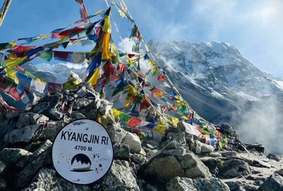
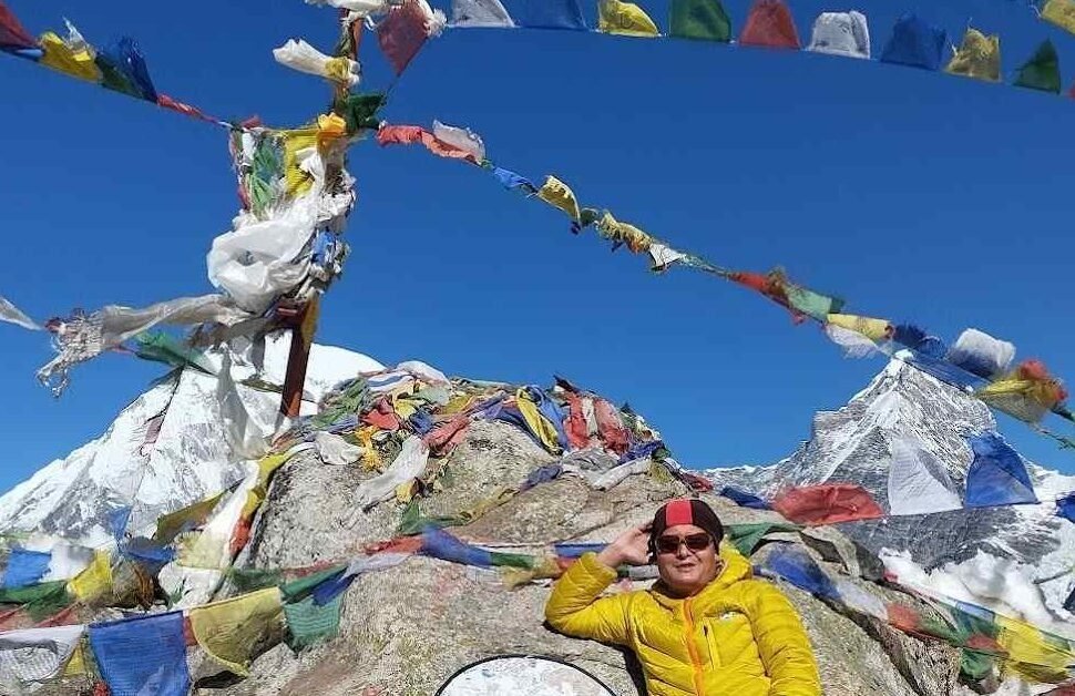
Day 5 is spent at Kyanjin Gompa, with a morning hike to Kyanjin Ri (4,773m) for acclimatization and views. Kyanjin Ri is a 2–3 hour round trip from the village, gaining about 900m. The trail climbs steeply behind the village on good trail, passing through rocky pastures to the ridge summit.
The view from Kyanjin Ri is the reason to be here. Looking down the Langtang Valley, you can see the full length of the route you’ve walked. Looking up, Langtang Lirung and Yala Peak (5,520m) fill the eastern horizon. It’s a clear, uncomplicated 360-degree view with no obstructions — and you’re at almost 4,800m.
Start by 7am for the best visibility before afternoon clouds build. Bring water, a warm layer, snacks, and sun protection. The UV at this altitude is intense even in overcast conditions.
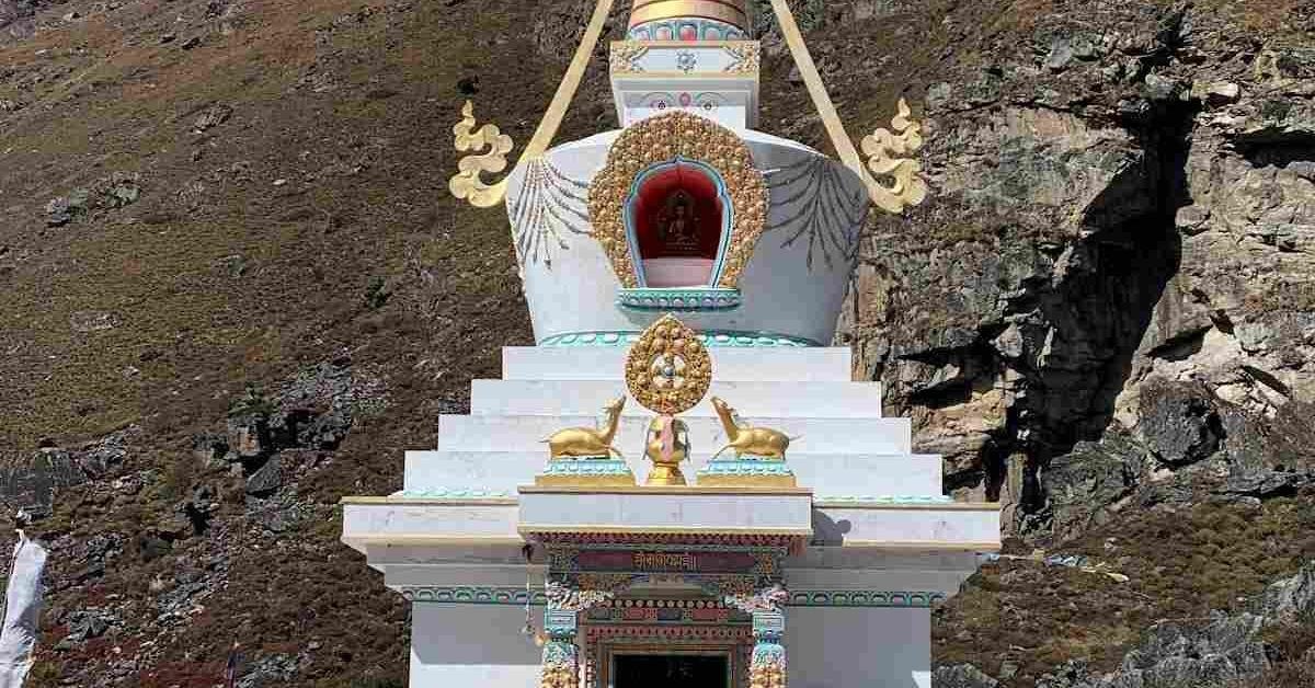
Return to Kyanjin Gompa by 11am or noon for lunch. Rest in the afternoon. Visit the cheese factory (open in the morning and afternoon) and buy a block of yak cheese. Walk around the village and the nearby chortens. Let your body consolidate the altitude gain from the last four days.
Day 6: Tsergo Ri Summit (4,984m) and Descent to Lama Hotel
This is the longest and most demanding day of the trek. Tsergo Ri (4,984m) is a 5–6 hour round trip from Kyanjin Gompa, gaining 1,114m in altitude. Start by 5:30–6am.
The trail climbs steeply northeast from Kyanjin, initially on clear path through pastures, then on looser rocky trail as you gain altitude. Above 4,500m, the gradient steepens on scree and loose grass — there’s no technical difficulty, but it’s demanding on legs and lungs at this altitude. The final push to the summit involves loose rocky terrain.
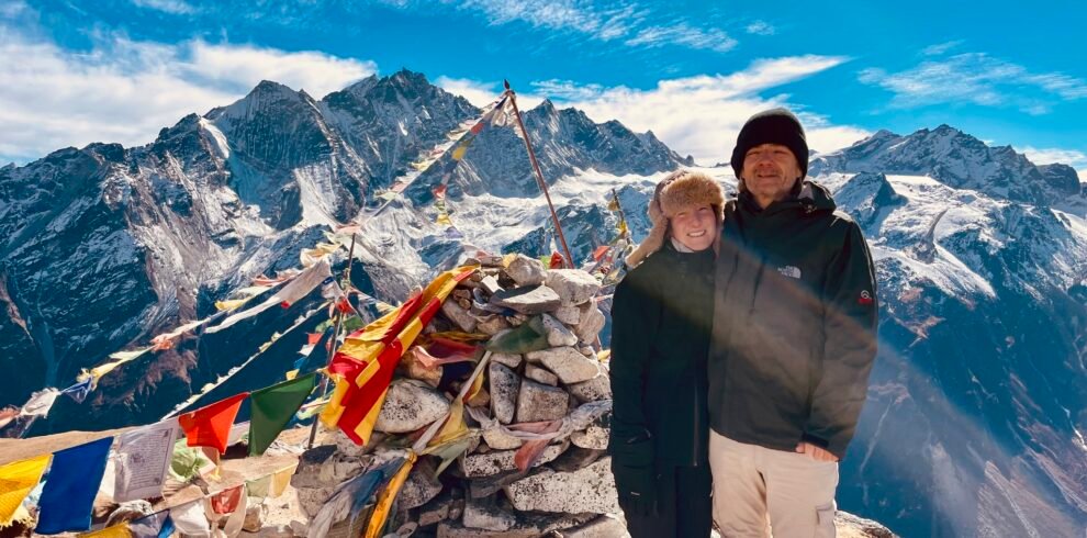
At the summit (4,984m), the panorama includes Langtang Lirung directly across the valley, Gangchenpo to the north, Dorje Lakpa to the east, and a sweep of peaks extending into Tibet. On a clear October morning, it’s one of the best viewpoints accessible without technical gear in the entire Nepal Himalaya.
Descend to Kyanjin Gompa (1–2 hours), eat a late breakfast or early lunch, pack your bags, and begin the descent toward Lama Hotel. The descent from Kyanjin to Lama Hotel (1,400m of descent) takes 4–5 hours. Your knees will work hard. Use trekking poles. Arrive at Lama Hotel in the late afternoon.
| Trail Section | Altitude Zone | Animals Commonly Seen |
|---|---|---|
| Syabrubesi to Bamboo | 1,400–1,970 m | Langur monkeys, birds (Himalayan Monal, minivets), butterflies |
| Bamboo to Lama Hotel | 1,970–2,470 m | Red panda (best section — dawn/dusk), woodpeckers, leopard cat (rare) |
| Lama Hotel to Ghodatabela | 2,470–3,020 m | Himalayan tahr, blood pheasant, Himalayan Monal, red panda (lower end) |
| Ghodatabela to Langtang Village | 3,020–3,430 m | Tahr, musk deer (rare, shy), griffon vultures overhead |
| Langtang Village to Kyanjin | 3,430–3,870 m | Blue sheep (bharal), yaks (domestic/semi-wild), snow pigeons |
| Kyanjin to Langshisa / Tsergo Ri | 3,870–4,984 m | Blue sheep herds, snow leopard (rare, especially winter), Himalayan wolf (very rare) |
Day 7: Lama Hotel to Syabrubesi and Bus to Kathmandu
The final walking day descends 1,010m from Lama Hotel back to Syabrubesi — the reverse of day 2, taking 3–4 hours. The descent is steeper than you remembered from the climb. Trekking poles remain valuable throughout.
Aim to reach Syabrubesi by 11am at the latest to catch the bus to Kathmandu. Buses and jeeps depart early morning — 7am to 9am typically. If you can’t make the morning departures, you’ll wait until the next day or arrange a private jeep. Plan this day’s descent accordingly: don’t count on catching a 7am bus if you’re leaving Lama Hotel at 7am. Either leave Lama Hotel at first light (6am) and push hard, or overnight in Syabrubesi and take the morning bus the following day.
Most trekkers choose to overnight in Syabrubesi on day 6 of trekking and catch the 7am bus on day 7 — making it an 8-day trip total including drive days. Both approaches work. The 7-day version is a tight schedule that requires disciplined morning starts on descent days.
Planning a Langtang Valley Trek? Contact our local team for expert advice and trip planning.
Trek the Langtang Valley with Next Trip Nepal. 8-day package from USD 650, covering all permits, guide, porter and teahouse accommodation. Langtang National Park, Kyanjin Gompa and Tserko Ri viewpoint included.