Knowing the price of the Everest Base Camp trek with helicopter return only answers half your questions. The other half is what each day actually looks like, how many hours you walk, where you sleep, and what altitude you are dealing with as the days go on. This is the real day by day itinerary we run at Next Trip Nepal for our 10 day helicopter return package, written out so you can picture exactly what your trip involves before you book. Alongside the walking times and altitudes, we cover the terrain, the villages, the culture, the acclimatization science behind why the schedule is built the way it is, and a few honest notes on what surprises first time trekkers the most.
Day 1: Arrival In Kathmandu
Your trip begins with arrival in Kathmandu at 1,400 meters. Our team meets you at the airport and transfers you to your hotel. This first day is a chance to rest after your international flight, sort out any last minute gear, and meet your guide for a trip briefing. If your visa is not already arranged, this is also when you will process it at the airport.
Kathmandu itself is worth a slow first evening rather than rushing straight to sleep. The Thamel district, where most trekkers stay, is a dense grid of gear shops, restaurants and small guesthouses, and a short walk through it is a genuinely useful way to pick up any last minute item you forgot to pack. During your trip briefing, your guide will check your gear, confirm your Lukla flight time for the following morning, and answer any questions about the days ahead. This is the right moment to raise any medical conditions, dietary needs or concerns about altitude, since a guide who knows about these in advance can plan around them far more effectively than one who finds out on day 6.
Day 2: Fly To Lukla And Trek To Phakding
Your trek starts with an early morning flight from Kathmandu to Lukla, landing on the famously short mountain runway at 2,840 meters. From Lukla, you begin walking almost immediately, descending gently through Sherpa villages to Phakding at 2,610 meters, a walk of roughly 3 to 4 hours. This first day is intentionally gentle, letting your body adjust before the terrain gets more demanding.
The flight itself, into what is officially named Tenzing-Hillary Airport after the two men who first summited Everest, is one of the more talked about airstrips in the world, a short sloped runway set against a mountainside, and it sets the tone for how dramatic the scenery becomes almost immediately. Once you are walking, the trail follows the Dudh Kosi river valley, crossing your first suspension bridges and passing through small settlements where prayer flags stretch between rooftops and mani stones, carved with Buddhist prayers, line the path. Guesthouses in Phakding are simple but comfortable, usually with a shared dining room heated by a wood or dung burning stove in the evening, which quickly becomes the social center of every teahouse you stay in for the rest of the trek.
Day 3: Phakding To Namche Bazaar
Day 3 is a genuine step up in effort, climbing from 2,610 meters to Namche Bazaar at 3,440 meters over 5 to 6 hours. The trail crosses several suspension bridges over the Dudh Kosi river and enters Sagarmatha National Park, where your permit is checked. The final climb into Namche is steep, and this is usually the first day trekkers feel the altitude gain in their legs and their breathing.
One crossing in particular, the Hillary Suspension Bridge high above the Dudh Kosi gorge near Namche, tends to stick in people’s memory, strung with thousands of prayer flags and swaying gently as porters, yaks and trekkers cross it together. Namche Bazaar itself is the unofficial capital of the Khumbu, a horseshoe shaped town built into a natural amphitheater in the hillside, with bakeries, gear shops, a Saturday market where traders from lower villages and sometimes from Tibet sell produce and goods, and your first real look at how developed this part of the Himalaya has become for trekkers over the past several decades. Many trekkers underestimate this day, since the altitude gain from 2,610 to 3,440 meters in a single push is the steepest single day increase of the early trek, and it is common to feel noticeably more out of breath on the final switchbacks into town than you expected based on the walking hours alone.
Day 4: Acclimatization Day In Namche Bazaar
This is a scheduled rest day, but not a day spent sitting still. The standard approach is a 3 hour hike up to the Everest View Hotel at around 3,880 meters, which gives you your first real look at Everest itself along with Ama Dablam and the surrounding peaks, before returning to sleep back down in Namche. Climbing higher during the day and sleeping lower at night is one of the most effective acclimatization strategies at this altitude, and it is why this day exists in the itinerary rather than being skipped.
The science behind this climb high, sleep low approach comes down to how your body responds to reduced oxygen availability at altitude. Above roughly 2,500 meters, the air holds meaningfully less oxygen per breath, and your body needs time to increase red blood cell production and adjust its breathing patterns to compensate. Spending a few hours at a higher elevation during the day exposes your body to that lower oxygen environment and triggers early adaptation, while returning to sleep at a lower elevation lets your body recover overnight, which is when acute mountain sickness symptoms are most likely to worsen if you have climbed too fast. Some trekkers instead use this day to visit the Sherpa Culture Museum in Namche or the Sagarmatha National Park visitor center, both of which offer a genuinely interesting look at Sherpa history, mountaineering history and the ecology of the park, though we still recommend at least a partial climb higher during the day if your energy allows it.
Day 5: Namche Bazaar To Tengboche
From Namche, the trail continues to Tengboche at 3,860 meters, a walk of 5 to 6 hours through rhododendron and pine forest with regular views of Ama Dablam. Tengboche is home to the largest and most famous monastery in the Khumbu region, and many groups arrive in time to sit in on the evening prayer ceremony, which is one of the more memorable stops on the whole trek.
The walk out of Namche first descends before climbing again, which surprises trekkers expecting steady upward progress, and this pattern of descending into a river valley before climbing back out becomes a recurring feature of the trail through the Khumbu. Along the way you are likely to spot Himalayan tahr, a wild goat like animal native to the region, and if you are fortunate, a Himalayan monal, Nepal’s colorful national bird, in the forested sections below Tengboche. Tengboche Monastery, formally known as Dawa Choling Gompa, was originally built in 1916 and has been rebuilt more than once after an earthquake and a fire, and it remains an active monastery where resident monks conduct daily prayers. Sitting inside during the evening ceremony, with the low tone of chanting and the smell of juniper incense, is a genuinely different kind of experience from the physical effort of the walking, and most trekkers describe it as one of the most memorable parts of the entire trip.
Day 6: Tengboche To Dingboche
Day 6 takes you from Tengboche to Dingboche at 4,360 meters over 4 to 5 hours. The landscape changes noticeably here, with trees giving way to open, high altitude terrain and views that stretch further across the valley. This is also where the air starts to feel noticeably thinner, and pacing yourself becomes more important than pushing hard.
You pass through Pangboche, one of the oldest Sherpa settlements in the Khumbu, home to a monastery said to hold relics linked to local legends, before the trail opens out into drier, rockier terrain shaped by wind and altitude rather than rainfall. Dingboche itself sits in a wide valley beneath the peak of Ama Dablam, and its fields are surrounded by stone walls originally built to protect barley and potato crops from wind and grazing animals, a farming tradition still visible today even though most of the village’s income now comes from trekking rather than agriculture. This is also roughly the point in the trek where trekkers commonly begin noticing early signs of altitude adjustment, such as slightly disrupted sleep or a mild headache, which is entirely normal and is precisely why the schedule includes a second acclimatization day immediately after this one.
Day 7: Second Acclimatization Day In Dingboche
A second acclimatization day is built in here, typically a 4 hour hike up Nagarjun Hill to around 4,900 meters and back down to Dingboche to sleep. This is the higher of your two acclimatization hikes, and it plays a direct role in how well your body copes with the altitude over the following days, since Gorakshep and Everest Base Camp itself sit well above 5,000 meters.
Nagarjun Hill offers one of the widest panoramic views of the entire trek, with Makalu, the fifth highest mountain in the world, visible to the east alongside Lhotse, Ama Dablam and a long stretch of the Imja Valley. Some trekkers with more time occasionally use this day for a side trip toward Chukhung instead, though for our standard 10 day itinerary Nagarjun Hill remains the most efficient acclimatization option, since it delivers meaningful altitude exposure without adding significant extra walking distance. It is worth being honest with your guide about exactly how you are feeling on this day. Genuine acute mountain sickness symptoms, such as a persistent headache that does not resolve with rest and hydration, nausea, dizziness or unusual fatigue, are a signal to communicate clearly rather than push through silently, since your guide is trained to recognize the difference between normal altitude discomfort and something that needs a different plan.
Day 8: Dingboche To Lobuche
From Dingboche, you walk to Lobuche at 4,910 meters over 4 to 5 hours. The trail passes memorials to climbers who lost their lives on Everest, a sobering and quiet stretch of the route that many trekkers find genuinely moving. Lobuche itself is a small, basic settlement, and this is where the trek starts to feel like a true high altitude expedition rather than a hike.
This stretch of trail, known as the Thukla Pass memorials, includes stone chortens and plaques dedicated to Sherpas and foreign climbers who died attempting Everest and the surrounding peaks over the decades, including some well known names in mountaineering history. It is common for groups to walk this section quietly, and many guides pause here to explain the history behind a few of the memorials. Beyond Thukla, the trail crosses onto the lateral moraine of the Khumbu Glacier, and the terrain becomes rockier and starker, with far less vegetation than anywhere earlier in the trek. Lobuche’s guesthouses are simple, and by this point most trekkers notice their appetite decreasing slightly, which is a normal altitude response, though your guide will continue to encourage regular eating and drinking regardless, since maintaining hydration and calorie intake meaningfully reduces altitude related symptoms over the following two days.
Day 9: Lobuche To Gorakshep To Everest Base Camp And Back To Gorakshep
This is the longest and most demanding day of the entire trip, typically 7 to 8 hours of walking. You first reach Gorakshep at 5,140 meters, drop your main bag, and continue on to Everest Base Camp itself at 5,364 meters before returning to sleep in Gorakshep. Standing at Base Camp, surrounded by the Khumbu Icefall and the sheer scale of the Everest massif, is the moment most trekkers say the entire trip was built around, and it is worth every hour of the climb to get there.
Gorakshep itself sits on a flat, sandy plain that was once a lake bed, and it is the highest settlement with functioning teahouses on this route. The final push to Base Camp winds across the shifting rock and ice of the Khumbu Glacier’s lateral moraine, and the trail is not always obvious, which is one of several reasons a trained guide matters on this specific day. Everest Base Camp itself is seasonal. Outside the spring climbing season, when hundreds of tents, ropes and equipment belonging to mountaineering expeditions fill the site, you will find a relatively open, rocky plain marked mainly by prayer flags and a scattering of memorial stones, with the genuinely dramatic feature being the Khumbu Icefall directly above, a chaotic, constantly shifting field of ice towers and crevasses that climbers must cross to begin their ascent of Everest itself. Note that Everest’s summit is not actually visible from Base Camp, since Nuptse blocks the direct line of sight, which surprises many first time visitors. That clear summit view comes the following morning, from Kala Patthar.
Day 10: Kala Patthar Sunrise And Helicopter Flight To Kathmandu
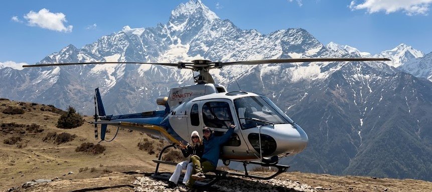
Your final morning starts early with a climb to Kala Patthar, the highest point of the entire trip, for sunrise over Everest. This viewpoint gives you a direct, unobstructed view of the summit itself, which Base Camp does not actually offer since Everest is partially hidden behind Nuptse from that angle. After returning to Gorakshep, your helicopter departs, typically between 7:00 and 9:00 AM, for the roughly 90 minute flight straight to Kathmandu at 1,400 meters. You go from nearly 5,500 meters of thin mountain air to the warmth of the Kathmandu valley in under 2 hours, which is genuinely one of the most dramatic transitions in any trek in the world.
Kala Patthar, whose name simply means black rock in Nepali, sits at 5,545 meters, making it higher than Everest Base Camp itself, and the pre dawn climb in the dark and cold is genuinely one of the harder short pushes of the entire trip, made worthwhile by watching the first sunlight hit Everest’s summit pyramid while the surrounding peaks, including Nuptse, Lhotse and Pumori, catch the same early light. Once you are back at Gorakshep and your helicopter lifts off, the flight itself follows the Khumbu valley back down past Pheriche, Tengboche and Namche Bazaar from the air, giving you an entirely different perspective on terrain you walked over the previous week, before Kathmandu’s terraced hillsides and dense urban sprawl come into view as you descend into the valley.
How This Itinerary Differs From A Classic Walking Trek
A classic Everest Base Camp trek follows this exact same route up, but instead of flying out from Gorakshep, it walks back down through Pheriche, Tengboche, Namche Bazaar and Lukla again, adding 3 to 4 more days on the trail. Those days are not wasted, since descending slowly is genuinely enjoyable and gives you a second look at villages you rushed through on the way up, but they also mean more time, more cumulative strain on your knees, and a higher chance of catching a Lukla flight delay on the way home. The helicopter return itinerary compresses the trip into 10 days without cutting a single meter of altitude gain or a single day of acclimatization.
How Much Walking You Should Expect Each Day
Across the 10 days, you are walking between 3 and 8 hours a day on rocky, uneven mountain terrain between 2,610 meters and 5,555 meters, with 2 dedicated acclimatization hikes built into the schedule. No technical climbing skills or equipment are required at any point, but a solid level of aerobic fitness makes a real difference in how much you enjoy the trek rather than simply endure it.
The Acclimatization Science Behind This Specific Schedule
This itinerary is not built arbitrarily. It follows widely accepted high altitude medicine guidance that recommends limiting sleeping altitude gain to roughly 300 to 500 meters per night once above 3,000 meters, with a rest day built in for every 1,000 meters of additional elevation gained. Our schedule includes two dedicated acclimatization days, at Namche Bazaar and at Dingboche, positioned at exactly the points where the cumulative altitude gain would otherwise outpace what most bodies can safely adjust to. This is also why the itinerary does not simply walk straight up the valley as fast as possible, even though the physical distance could technically be covered in fewer days. Rushing this specific route is one of the most common causes of acute mountain sickness among first time Everest region trekkers, and a properly paced schedule like this one meaningfully reduces that risk without adding unnecessary extra days.
Your guide carries a pulse oximeter and will check your blood oxygen saturation and pulse periodically from Namche Bazaar onward, which gives an objective, numeric way to track how well you are adjusting alongside how you subjectively feel. If your readings or symptoms suggest a problem, your guide is trained to recommend rest, a controlled descent, or in a genuine emergency, evacuation, and this trained judgment is one of the most valuable and least visible parts of what you are paying for on this trek.
What You Will See Along The Way: Flora, Fauna And Landscape Changes
One of the most striking parts of this itinerary is how dramatically the landscape changes over just 10 days. The lower stretches around Phakding and Namche Bazaar sit within a forested zone of pine, fir and rhododendron, Nepal’s national flower, which blooms in vivid red and pink through March and April. Above Tengboche, forest gradually gives way to alpine shrub and juniper, and by Dingboche you are walking through open, treeless high altitude terrain where only hardy grasses and lichen survive. Above Lobuche, the landscape becomes almost lunar, dominated by glacial moraine, rock and ice with little to no vegetation at all.
Wildlife sightings become rarer as you climb, but the lower and middle sections of the trek offer a real chance of spotting Himalayan tahr, musk deer, and a wide range of birdlife including the Himalayan monal and, for the fortunate, a golden eagle or lammergeier riding the thermals above the valley. Domesticated yaks and their hybrid cousins, dzopkyo, become a constant and useful presence from Namche Bazaar upward, carrying supplies between villages and teahouses along trails they know intimately better than any human guide.
Sherpa Culture And Village Life Along The Route
This itinerary passes through the heart of Sherpa homeland, and the villages you walk through are living communities, not tourist sets built for trekkers. Prayer flags, mani walls carved with the Om Mani Padme Hum mantra, and chortens mark the trail at regular intervals, and Buddhist tradition asks that you pass these on your left side, walking clockwise, a small custom that costs you nothing to observe and is genuinely appreciated by local residents. Sherpa families have lived and farmed in this valley for centuries, originally migrating from Tibet, and the modern trekking and mountaineering economy has transformed daily life here dramatically over the past 60 years, bringing schools, electricity in some villages, and a level of prosperity uncommon in much of rural Nepal, while many families continue traditional practices around farming, yak herding and Buddhist religious life alongside their guesthouse and guiding businesses.
How To Prepare Your Body Before You Arrive
You do not need to be an athlete to complete this itinerary, but the trekkers who enjoy it most tend to arrive with a genuine base of cardiovascular fitness built over the 2 to 3 months before departure. Regular walking or hiking, ideally with a loaded daypack on hilly terrain, is the single most useful preparation you can do, since it trains the exact muscles and movement patterns you will use for 10 days straight. Stair climbing, either outdoors or on a stepper machine, is a strong substitute if hills are not available where you live, and building toward sessions of 60 to 90 minutes several times a week in the final month before your trip tends to translate directly into how comfortable the daily walking feels on the trail.
Strength training for your legs and core, particularly exercises that build stability on uneven ground such as lunges and step ups, helps protect your knees during the steeper descents lower on the trail. None of this preparation changes how your body responds to altitude, which is governed by the pace of the itinerary and your own physiology rather than fitness level, but a stronger cardiovascular base does mean the walking itself demands less of your energy, leaving more in reserve for your body to focus on acclimatizing properly.
How This Itinerary Can Be Customized
While our standard 10 day schedule is built around the pacing that works best for the widest range of trekkers, a few adjustments come up often enough to mention. Trekkers who want extra acclimatization margin, whether due to age, a slower natural adjustment to altitude on past trips, or simply personal preference, can add an additional rest day, most commonly at Dingboche, extending the trip to 11 days. Trekkers with more time available sometimes add a side excursion toward Chukhung, beneath Island Peak and Lhotse, before continuing on the standard route toward Lobuche and Gorakshep. Families or small private groups occasionally request a slightly slower daily pace with shorter walking hours split across a couple of additional days, which we are happy to arrange during the planning stage.
What we do not recommend is compressing this itinerary further than our standard 10 days, since the acclimatization days are doing real physiological work, not simply padding the schedule, and cutting them meaningfully increases the risk of altitude sickness serious enough to end your trip early.
What A Typical Day On The Trail Actually Feels Like
Most trekking days follow a similar rhythm regardless of the specific distance. Mornings start early, usually with a 6:30 or 7:00 breakfast, since mountain weather tends to be clearest earlier in the day before afternoon cloud builds up in the valleys. Walking pace is deliberately unhurried, especially above Namche Bazaar, where your guide will actively slow the group down if anyone is pushing too hard, since a slow, steady pace is far more effective for both energy conservation and acclimatization than a fast pace with frequent long breaks. Lunch is usually taken at a teahouse along the route rather than as a packed meal, giving you a proper hot meal and a real rest in the middle of the day. Afternoons are typically shorter than mornings, and most groups arrive at their overnight teahouse by early to mid afternoon, leaving time to rest, wash up, journal, read or simply sit in the dining room and talk with other trekkers before dinner.
Frequently Asked Questions About The Itinerary
How many days is the Everest Base Camp trek with helicopter return. Our standard itinerary is 10 days total, including 2 days in Kathmandu and 8 days on the trail and in the air.
How many acclimatization days are built in. Two, one in Namche Bazaar on day 4 and one in Dingboche on day 7, both designed around the climb high, sleep low principle.
Which day is the hardest. Day 9, from Lobuche to Gorakshep, on to Everest Base Camp, and back to Gorakshep, is the longest and most physically demanding day of the trip.
Do I see Everest itself from Base Camp. Not directly. Base Camp sits close under the Khumbu Icefall, and Everest’s summit is actually blocked from view by Nuptse at that specific spot. Kala Patthar on the final morning is where you get the clearest direct view of the summit.
Can the itinerary change. Yes, occasionally due to weather affecting the Lukla flight or the final helicopter flight. We build the schedule with enough flexibility to absorb minor delays without derailing the whole trip.
Do I need previous trekking experience for this itinerary. No technical climbing skills are required, but a genuine base level of aerobic fitness from regular walking, hiking or cardio training in the months before your trip makes a real difference in how much you enjoy the daily walking rather than simply surviving it.
Is the itinerary the same in every season. The walking route and daily distances stay the same year round, though winter conditions can mean more snow underfoot on higher sections, and monsoon season brings a higher risk of both trail mud and flight delays, covered in detail in our separate guide to the best time to trek.
What happens if I cannot continue partway through. Your guide will assess the situation and arrange a safe descent, and in a genuine medical emergency, a helicopter evacuation, which is one of the key reasons proper travel insurance covering high altitude evacuation is essential for this trip.
Will I have phone signal or internet access along the route. Nepal Telecom and NTC mobile signal reaches most of the lower villages, and wifi is available for a small fee at nearly every teahouse up to and including Gorakshep, though speed and reliability drop noticeably the higher you climb, so treat any connectivity above Dingboche as a bonus rather than something to rely on.
What is the youngest or oldest age suitable for this itinerary. There is no strict age limit, and we have guided trekkers ranging from their teens into their seventies on this route, since the deciding factor is genuine cardiovascular fitness and a realistic personal assessment of how your body handles altitude, not age on its own.
Food And Accommodation Standards Along The Route
Teahouse standards shift gradually as you climb, and it helps to know what to expect at each stage. Around Phakding and Namche Bazaar, guesthouses often feel closer to a proper mountain lodge, with attached bathrooms available in some rooms, reliable hot showers, bakeries selling fresh bread and cake, and menus offering everything from dal bhat, the traditional Nepali rice, lentil and vegetable meal, to pizza and pasta aimed at trekkers. From Tengboche upward, rooms become simpler, typically twin bed rooms with shared bathroom facilities down the hall, thinner walls, and menus that narrow toward heartier, simpler food such as noodle soups, fried rice, porridge and the same reliable dal bhat, which many experienced trekkers actually prefer at altitude since it is freshly cooked, filling and included as an unlimited refill at most teahouses.
By the time you reach Lobuche and Gorakshep, accommodation is basic by design, prioritizing warmth and shelter over comfort, with shared bathrooms, no reliable hot shower, and heating limited to the communal dining room stove in the evening. This is normal for the altitude and is the same for every trekker on this route regardless of which company they book with, since building materials and supplies become progressively harder to transport the higher you climb. Bottled water becomes more expensive as you ascend, which is why we recommend a reusable bottle and water purification tablets, refilling with boiled water provided at each teahouse rather than buying bottled water at every stop.
See The Full Itinerary And Book Your Dates
This day by day breakdown is exactly how our guides run the trip on the ground, not a simplified version written for marketing. If you want to see current departure dates, full pricing and everything included, visit the Everest Base Camp Trek With Helicopter Return package page, or read more about why trekkers choose us for this specific trip in our guide to the best Everest Base Camp trek with helicopter return company.