The Langtang Valley Trek sits close to Kathmandu yet feels far removed from anything urban. Within a week of walking, trekkers move from terraced farmland and dense forest into a glacier fed valley ringed by peaks over 6,000m and 7,000m, without the long flight and permit hurdles that come with restricted regions such as Manaslu or Upper Mustang.
This guide pulls together the practical facts trekkers actually need: distance, altitude, difficulty, permits, seasons, food, accommodation and the small details that only become obvious once you are on the trail. If you already know you want to go and are looking for the complete itinerary, cost breakdown and trip inclusions, our Langtang Valley Trek package page covers everything needed to book. This article is written to answer the questions that come before that decision.
Most of what follows comes from how the trek actually runs on the ground rather than generic descriptions repeated across travel sites. Where fees, rules or regulations are mentioned, treat the figures as a guide and confirm current rates before booking, since permit costs and trekking regulations in Nepal do get revised from time to time.
Langtang Valley Trek at a Glance
| Fact | Information |
|---|---|
| Region | Langtang, north of Kathmandu |
| Starting point | Syabrubesi (also spelled Syabru Besi) |
| Main destination | Kyanjin Gompa |
| Highest common point | Tserko Ri, around 4,984m |
| Trek duration | Typically 7 to 10 days including Kathmandu transport |
| Trek difficulty | Moderate, with some genuinely challenging days |
| Conservation area | Langtang National Park |
| Distance from Kathmandu to Syabrubesi | About 122km by road |
| Maximum altitude at main village | Kyanjin Gompa, around 3,870m |
| Guide requirement | Licensed guide required under current Nepal trekking rules |
| Best seasons | March to May and late September to November |
Where Is the Langtang Valley?
The Langtang Valley lies in Rasuwa district, roughly north of Kathmandu and close enough to the Tibet border that the culture and landscape carry a strong Tibetan influence. It is often described as the closest true Himalayan trekking region to the capital, which is exactly why it suits travelers who do not have two or three weeks to spare.
- Kathmandu to the trailhead at Syabrubesi is about 122km by road, though the drive takes far longer than that distance suggests.
- Syabrubesi, at roughly 1,460m, is where the trek on foot begins.
- The valley itself runs east from Syabrubesi up the Langtang Khola (river) toward Kyanjin Gompa and the peaks beyond.
- Langtang shares its northern and eastern edges with the Gosainkund and Helambu areas, and some itineraries combine all three into a longer circuit.
- The entire trekking route falls inside Langtang National Park, which was Nepal’s first Himalayan national park, established in 1976.
How Long Is the Langtang Valley Trek?
Total walking distance depends heavily on which side trips you add, so treat any single number with some skepticism. As a rough guide, the standard route to Kyanjin Gompa and back covers approximately 60 to 77km, and that range widens further if you add Tserko Ri, Kyanjin Ri or an extension toward Langshisha Kharka.
| Section | Approximate distance | Walking time | Altitude range |
|---|---|---|---|
| Syabrubesi to Lama Hotel | 7 to 8km | 6 to 7 hours | 1,460m to about 2,380m |
| Lama Hotel to Langtang Village | 13 to 15km | 6 to 7 hours | 2,380m to about 3,430m |
| Langtang Village to Kyanjin Gompa | 8km | 3 to 4 hours | 3,430m to about 3,870m |
| Kyanjin Gompa acclimatization day | Optional side hikes | 4 to 9 hours depending on the hike | Up to 4,984m on Tserko Ri |
| Kyanjin Gompa back to Lama Hotel | 21 to 23km | 6 to 7 hours | 3,870m down to about 2,380m |
| Lama Hotel to Syabrubesi | 7 to 8km | 5 to 6 hours | 2,380m down to 1,460m |
A few honest points worth knowing before you commit to any printed itinerary:
- Walking hours listed on itineraries are estimates based on an average pace with normal rest stops, not a target to beat.
- The descent often takes less time than the ascent, since less altitude gain means less need to stop and catch your breath.
- Trail distance figures vary between agencies because GPS tracking and route measurement are not standardized across the industry.
- Adding Tserko Ri, the Ganja La pass, or a Langshisha Kharka side trip can extend the trek by two to four days.
How High Does the Langtang Valley Trek Go?
Altitude gain is gradual for the first two days, then becomes more noticeable from Langtang Village upward. It helps to separate where you sleep each night from where you might walk during the day, since day hikes to a higher point and returning to sleep lower is a standard acclimatization technique.
| Location | Altitude | Type |
|---|---|---|
| Syabrubesi | 1,460m | Trailhead, overnight |
| Lama Hotel | 2,380m | Overnight |
| Langtang Village | 3,430m | Overnight |
| Kyanjin Gompa | 3,870m | Overnight, main base |
| Kyanjin Ri | 4,773m to 4,850m (two viewpoints) | Day hike only |
| Tserko Ri | 4,984m | Day hike only |
The highest point most trekkers sleep at is Kyanjin Gompa, around 3,870m. Tserko Ri and Kyanjin Ri are day hikes from there and back, meaning you gain and lose well over 1,000m of elevation in a single outing without ever spending the night that high, which is exactly the kind of controlled exposure that helps the body adjust.
How Difficult Is the Langtang Valley Trek?
Langtang is generally graded moderate, though a few sections genuinely test your legs and lungs. It does not require any climbing or technical skill, but it is not a casual walk either.
- Daily walking typically runs 5 to 7 hours, occasionally longer on the day up to Langtang Village or on Tserko Ri.
- The trail between Syabrubesi and Lama Hotel climbs steadily through forest with several steep, stepped sections.
- Trail surfaces range from packed dirt and stone steps to sections that turn muddy and slippery after rain.
- Altitude becomes the main factor above Langtang Village, where the air is noticeably thinner and pace naturally slows.
- No prior trekking experience is strictly required, but a reasonable level of everyday fitness, meaning comfortable walking for several hours on consecutive days, makes the trip far more enjoyable.
- People who hike regularly, cycle, or simply walk often in daily life tend to manage the trek without major difficulty, provided they pace themselves and acclimatize properly.
Distance alone does not tell you how hard a day will feel. A short 8km stretch with a steady 500m climb at 3,500m altitude can feel harder than a flat 15km walk near sea level, so judge difficulty by elevation gain and altitude together, not by kilometers on a map.
What Is Special About Langtang National Park?
Langtang National Park covers roughly 1,710 square kilometers and was Nepal’s first national park established specifically to protect a Himalayan ecosystem. The trekking route passes through several distinct vegetation zones as it climbs.
- Lower elevations near Syabrubesi are covered in subtropical and broadleaf forest.
- Mid elevations shift into oak, rhododendron and pine forest, which turns spectacular with blooms in spring.
- Higher up near Langtang Village and beyond, forest gives way to birch, fir and juniper, then alpine scrub.
- Above Kyanjin Gompa the landscape opens into high pasture, moraine and glacial terrain beneath Langtang Lirung.
Wildlife that can be found within the park includes red panda, Himalayan tahr, musk deer, langur monkeys, and occasionally Himalayan black bear at lower elevations. Snow leopard also inhabit the higher reaches, though they are rarely seen. Over 250 bird species have been recorded in the park, including several pheasant species. None of this guarantees a sighting on any given trip, and that is worth being upfront about rather than promising wildlife that may not appear.
What Is Langtang Village Like?
Langtang Village holds a significant place in the trek both as a scenic overnight stop and as a place with a difficult recent history. On 25 April 2015, the earthquake that struck Nepal triggered a massive avalanche from Langtang Lirung that buried most of the original village, resulting in one of the single deadliest incidents of that disaster outside the Kathmandu valley. Many residents and a number of foreign trekkers lost their lives that day.
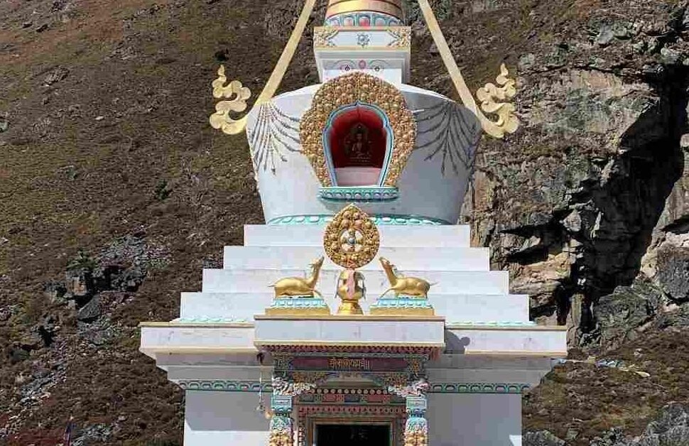
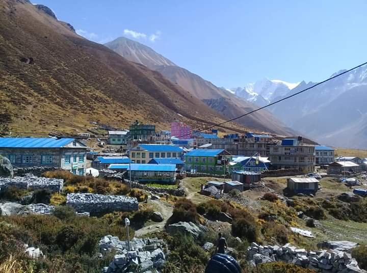
The village has since been rebuilt a short distance from the original site, with support from the local community, the Nepal government and international donors. A memorial chorten stands near the settlement in remembrance of those who died. Rebuilding has brought sturdier construction alongside traditional Tamang building styles, and the village today functions again as a working stop along the trekking route, with teahouses, a school, and a monastery among its buildings.
Walking through Langtang Village today, you see a community that has deliberately continued living and working in a place tied to genuine loss, and most trekkers find that context adds a quiet weight to the walk through the valley that guidebooks alone cannot convey.
Who Are the People of Langtang?
The Langtang region is home mainly to Tamang communities, along with families of Tibetan origin who settled in the valley generations ago. Their culture, language and religious practice draw heavily from Tibetan Buddhism, which shows up clearly along the trail.
- Prayer flags, mani walls and chortens appear regularly from Langtang Village upward.
- Kyanjin Gompa itself is named after the monastery that sits at its center, still an active place of worship.
- Traditional homes use stone and timber construction suited to the cold, with flat or gently pitched roofs.
- Yak and yak crossbreed herding remains part of the local economy, alongside potato and barley farming at lower elevations and tourism related work.
- Local cheese production at Kyanjin Gompa, using milk from yaks and crossbred cattle, has been a small but notable local industry for decades.
Trekkers can realistically expect to see daily life continuing around them rather than a performance staged for visitors. Conversations with teahouse owners, a look inside a working monastery, or watching cheese being made at the small factory in Kyanjin Gompa are typical, low key ways the culture comes through on this trek.
What Is Kyanjin Gompa?
Kyanjin Gompa, at around 3,870m, is the main destination of the standard Langtang Valley Trek. It is a small settlement built around its namesake monastery, with a cluster of teahouses, a cheese factory, and views of Langtang Lirung directly above.
- Accommodation here consists of basic teahouses with twin sharing rooms and shared facilities, similar in style to lower villages but generally more limited in what is available.
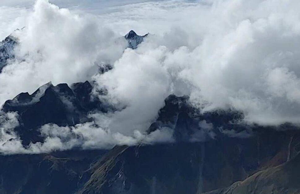
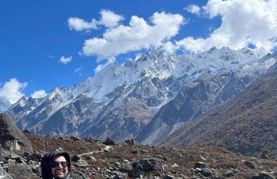
- Mountain views from Kyanjin Gompa include Langtang Lirung, Langtang II, and a wall of surrounding peaks that dominate the skyline in almost every direction.
- Two popular day hikes leave from here: Kyanjin Ri, a shorter and steeper climb, and Tserko Ri, a longer and higher viewpoint.
- Kyanjin Gompa also works as the natural acclimatization base for the trek, since most itineraries build in a rest day here before any further ascent or descent.
- Trekkers with more time can continue past Kyanjin Gompa toward Langshisha Kharka for a quieter, more remote extension.
The reason Kyanjin Gompa functions so well as the acclimatization point is simple: it sits high enough to matter for altitude adjustment, yet has enough infrastructure, food and shelter that resting there for a day is comfortable rather than something to endure.
Kyanjin Ri vs Tserko Ri
Both peaks are reached as day hikes from Kyanjin Gompa and both are commonly climbed on the same acclimatization day, though few trekkers manage both in one outing given the effort involved.
| Factor | Kyanjin Ri | Tserko Ri |
|---|---|---|
| Difficulty | Moderate to challenging, steep in sections | Challenging, longer and steeper overall |
| Approximate altitude | 4,773m (lower point) to 4,850m (upper point) | 4,984m |
| Typical duration | 4 to 6 hours round trip | 7 to 9 hours round trip |
| Views | Wide panorama of Langtang Lirung and the valley | Broader panorama including Langtang Lirung, Langshisha peaks and glaciers |
| Suitable for | Most trekkers with reasonable fitness who are acclimatizing well | Trekkers who are acclimatizing well and want a longer, higher outing |
Neither hike is mandatory, and choosing between them, or skipping both in favor of a gentler walk around Kyanjin Gompa, should depend on how you are feeling that morning rather than a plan made days earlier at sea level.
What Is the Best Time for the Langtang Valley Trek?
Nepal’s two main trekking seasons, spring and autumn, both work well for Langtang. Winter and monsoon are possible but come with real tradeoffs worth understanding before you book dates.
| Season | Months | Weather | Visibility | Trail conditions | Advantages | Disadvantages |
|---|---|---|---|---|---|---|
| Spring | March to May | Mild, warming through the season | Good, with some afternoon haze | Dry, generally firm underfoot | Rhododendron blooms, comfortable temperatures | Can be hazy for photography, especially in April |
| Autumn | Late September to November | Stable, clear, cool | Excellent, often the clearest of the year | Dry and firm | Best mountain views, reliable weather | Busiest season on the trail and in teahouses |
| Winter | December to February | Cold, especially above Langtang Village | Often very clear | Possible snow at higher elevations | Quiet trails, dramatic snow scenery | Very cold nights, some high passes may be closed |
| Monsoon | June to September | Wet, humid, frequent rain | Poor, clouds obscure peaks most days | Muddy, slippery, leeches at lower elevations | Lush greenery, fewer trekkers | Landslide risk on the road, limited mountain views |
Trail conditions change quickly after rain in this region. A dry, dusty path in the morning can turn into a slick, muddy one by afternoon if clouds build up over the ridgelines, which they often do even outside monsoon season, so waterproof boots and trekking poles earn their keep here regardless of season.
What Is the Weather Like?
Weather in Langtang shifts with both season and altitude, and the difference between Syabrubesi and Kyanjin Gompa on the same day can be dramatic.
| Location | Spring daytime | Autumn daytime | Winter daytime | Night temperatures (autumn to winter) |
|---|---|---|---|---|
| Syabrubesi (1,460m) | 15 to 22 degrees C | 15 to 20 degrees C | 8 to 15 degrees C | 3 to 10 degrees C |
| Langtang Village (3,430m) | 8 to 15 degrees C | 8 to 14 degrees C | Minus 2 to 8 degrees C | Minus 8 to 0 degrees C |
| Kyanjin Gompa (3,870m) | 5 to 12 degrees C | 5 to 12 degrees C | Minus 5 to 5 degrees C | Minus 12 to minus 2 degrees C |
These figures are approximate averages and should be treated as a general guide rather than a forecast. Mountain weather changes quickly in this region regardless of season, and a clear morning at Kyanjin Gompa can turn cloudy and cold within an hour, so packing layers matters more than trusting any single temperature number.
What Are the Teahouses Like?
Accommodation along the Langtang route is entirely in teahouses, family run lodges that provide a room and meals. Standards are consistent enough to plan around, but facilities do get simpler as you climb.
- Room types are almost always twin sharing, with basic beds, a mattress, pillow and usually a blanket, though bringing your own sleeping bag liner or bag is still recommended, especially above Langtang Village.
- Toilets are typically shared, ranging from Western style at lower elevations to squat style more often as you climb.
- Hot showers are usually available for an extra fee at lower and mid altitude villages, either gas or solar heated, and become less reliable and more expensive from Langtang Village upward.
- Dining rooms are the social center of every teahouse, usually heated in the evening with a wood or dung burning stove, and this is where most trekkers spend their evenings.
- Electricity is generally available via solar power, though outlets may be limited to the dining room rather than in guest rooms.
- Charging phones, cameras or power banks is usually possible for a small fee per device.
- WiFi is available in many teahouses for a fee, often through a prepaid card system, though signal quality drops noticeably at higher elevations.
- Heating outside the dining room is rare, so rooms themselves are typically unheated and cold at night, particularly above Langtang Village.
- Bedding provided is usually a mattress and blanket, adequate at lower altitude but not warm enough on its own higher up, which is why most trekkers carry a rated sleeping bag.
The general pattern to expect: facilities get more basic the higher you go, and Kyanjin Gompa, while comfortable enough, offers less choice and higher prices for hot showers, WiFi and charging than villages lower down the valley.
What Food Can You Eat?
Teahouse menus along the Langtang route are fairly standardized, built around what can realistically be cooked and carried at altitude.
| Dish type | What to expect |
|---|---|
| Dal bhat | Rice, lentil soup, vegetable curry, often with a pickle, the standard Nepali meal and usually the best value |
| Noodles | Instant noodle soup and fried noodle dishes, widely available at every stop |
| Rice dishes | Fried rice, vegetable rice, sometimes with egg or cheese added |
| Tibetan bread | Fried flatbread, often eaten with honey, jam or eggs for breakfast |
| Soups | Garlic soup, vegetable soup, and other simple broths, popular at higher altitude |
| Momos | Steamed or fried dumplings, usually vegetable or cheese filled this high up |
| Breakfast options | Porridge, eggs in various styles, pancakes, muesli, Tibetan bread |
| Tea and coffee | Milk tea, black tea, ginger tea, lemon tea, and instant coffee, with fresh coffee less common higher up |
A few practical points on food:
- Dal bhat is often recommended by guides because most teahouses offer free refills, which matters on a trek burning significant calories each day.
- Meat becomes less advisable the higher you go, since fresh supply chains are longer and refrigeration is limited.
- Boiled or treated water, or water purified with tablets or a filter, is the safer and cheaper option compared to buying bottled water at every stop, which also reduces plastic waste in a fragile environment.
- Prices for food and drinks rise gradually with altitude, since everything above the roadhead has to be carried in by porter or mule.
What Permits Are Required?
Trekking regulations in Nepal have changed in recent years, and the current requirement is that all foreign trekkers, including those on Langtang, must trek with a licensed guide arranged through a registered trekking agency. Independent, guideless trekking permits are no longer issued for this route.
| Permit or document | Approximate cost for foreign nationals | Notes |
|---|---|---|
| Langtang National Park entry permit | Around NPR 3,000 (roughly USD 22 to 25) | Reduced rate for SAARC nationals, free for children under 10 |
| TIMS card | Issued through your registered trekking agency | Independent TIMS is no longer available since the guide requirement took effect |
| Licensed trekking guide | Arranged through your trekking agency | Mandatory under current regulations for national parks, conservation areas and restricted areas |
Because permit fees, VAT and regulations are the kind of thing Nepal’s tourism authorities revise periodically, always confirm current rules with your trekking agency or the Nepal Tourism Board before finalizing your trip dates. Our Langtang Valley Trek package includes all required permits and the mandatory guide as part of the trip, so this is one area you do not need to arrange separately if booking with an agency.
How Much Does the Langtang Valley Trek Cost?
There is no single correct price for this trek, since cost depends on group size, season, service level and how many extra days or side trips you add. Rather than quote one number as universal, it is more useful to understand what actually drives the price up or down.
| Cost factor | How it affects price |
|---|---|
| Guide | A mandatory cost under current rules, generally built into package pricing |
| Porter | Optional but recommended if you prefer to carry a light daypack only |
| Accommodation | Teahouse costs are modest but rise with altitude and remoteness |
| Meals | Usually included in package trips, otherwise budgeted separately and increasing with altitude |
| Transportation | Kathmandu to Syabrubesi and back, by bus, shared jeep or private vehicle |
| Permits | Langtang National Park entry and TIMS, generally bundled into agency packages |
| Insurance | Not included in trek packages, arranged separately by the trekker |
| Personal expenses | Snacks, hot showers, WiFi, charging, souvenirs, tips |
Organized trips covering guide, permits, transport, accommodation and meals for a standard 7 to 9 day Langtang itinerary commonly range from around USD 600 up to USD 1,200 or more, depending on group size, season and the level of service chosen. Full pricing, group discounts and exactly what is included appear on the Langtang Valley Trek package page rather than being repeated here, since inclusions vary between operators and it is worth comparing what is actually covered rather than comparing headline prices alone.
How Do You Travel From Kathmandu to Syabrubesi?
The road distance from Kathmandu to Syabrubesi is about 122km, yet the journey regularly takes 7 to 9 hours by road. That gap between distance and time surprises a lot of first time visitors, and it comes down entirely to the road itself.
- The route follows the Prithvi Highway partway, then turns onto a narrower road that hugs the Trishuli River valley toward Dhunche and Syabrubesi.
- Sections of this road are paved, but stretches remain rough, winding and occasionally affected by landslides, particularly during and after monsoon.
- Traffic through the Kathmandu valley rim and the winding mountain sections slows average speed well below what the raw distance would suggest.
Transportation options:
- Local bus, the cheapest option, departing early morning from Kathmandu’s Machha Pokhari or Balaju area, generally taking 7 to 8 hours.
- Shared jeep, a faster and more comfortable option than the local bus at a moderate price increase.
- Private jeep or car, the most comfortable and flexible option, useful if your schedule is tight or you prefer not to wait for a full vehicle.
A drive that looks short on a map can end up taking most of a day once you account for the road surface, traffic leaving Kathmandu, and stops along the way, so it is worth building this into your schedule as a full travel day rather than a quick transfer.
What Is Mobile Network and Internet Like?
Both major Nepali telecom providers have some coverage along parts of the Langtang route, though it is inconsistent rather than continuous.
- Signal is generally reliable in Syabrubesi and reasonably good through the lower villages.
- Coverage becomes patchy through the forested gorge between Syabrubesi and Langtang Village, with dead zones in places.
- Signal often improves again around Langtang Village and Kyanjin Gompa, though it can still drop depending on weather and which network you use.
- Nepal Telecom has historically had a slight edge in coverage in this region compared to other providers, though this can change.
- Teahouse WiFi, where available, works through prepaid cards and tends to be slow, especially when several trekkers are online at once.
Do not plan on dependable connectivity throughout the trek. Weather, terrain and network maintenance all affect signal strength day to day, and treating any connectivity as a bonus rather than a guarantee will save frustration.
Is There Electricity and Charging?
Electricity along the route comes almost entirely from small hydro or solar systems run by individual teahouses, not a connected grid extending the whole way.
- Charging is usually available in the dining area for a per device fee that increases with altitude.
- Outlets in guest rooms are uncommon, particularly above Langtang Village.
- Power can be unreliable on cloudy or low sun days at solar dependent lodges.
Quick charging checklist:
- Carry a fully charged power bank, ideally 10,000mAh or larger.
- Bring a universal or Nepal compatible plug adapter if traveling from outside the region’s standard sockets.
- Pack spare camera or phone batteries if you plan to take a lot of photos, since charging spare batteries takes time and costs money at altitude.
- Keep devices in an inner jacket pocket in cold weather, since battery life drops faster in the cold.
What Should You Pack?
Packing for Langtang means preparing for a range of temperatures in a short trip, from warm lower valley days to freezing nights at Kyanjin Gompa. The list below covers what is genuinely useful rather than everything available in a trekking shop.
Clothing
- Moisture wicking base layers, both top and bottom
- Fleece or insulated mid layer
- Waterproof and windproof outer jacket
- Waterproof trekking trousers or a rain shell
- Insulated down jacket for evenings and higher altitude
- Trekking trousers, quick drying rather than cotton
- Warm hat and sun hat
- Gloves, a lighter pair and a warmer insulated pair
- Wool or synthetic hiking socks, several pairs
- Thermal sleep layers for cold nights
Trekking equipment
- Broken in trekking boots with ankle support
- Trekking poles
- Sleeping bag rated to at least minus 10 degrees C
- Headlamp with spare batteries
- Daypack, around 30 to 40 liters
- Duffel bag for porter carried items, if using a porter
Documents
- Passport with sufficient validity
- Passport photos for permits
- Printed or digital copies of permits, TIMS and insurance
- Travel insurance details and emergency contact numbers
Personal items
- Water bottle or hydration bladder
- Water purification tablets or a filter
- Basic toiletries and a quick dry towel
- Sunscreen and lip balm with sun protection
- Sunglasses with good UV protection
- Snacks such as energy bars or dried fruit
Health and safety
- Personal first aid kit including blister care
- Any personal prescription medication
- Diamox or other altitude medication, only after discussing with a doctor before travel
- Hand sanitizer and basic hygiene supplies
Do not overpack. Excess weight in your own bag or your porter’s load adds strain without adding benefit, and most items beyond this list can either be rented or bought in Kathmandu before departure.
Is Altitude Sickness a Concern?
Yes, and it deserves honest attention rather than being treated as a minor inconvenience. Kyanjin Gompa at 3,870m and the optional peaks above it sit high enough that altitude related illness is a real possibility for some trekkers, regardless of fitness level.
- Gradual acclimatization is the single most effective tool available, which is why the standard itinerary spaces out altitude gain and includes a rest day at Kyanjin Gompa.
- Hydration matters more at altitude than most people expect, and drinking 3 to 4 liters of water a day is a reasonable target during the trek.
- Rest and an honest pace, rather than trying to keep up with a faster group, reduce risk significantly.
- Early symptoms of acute mountain sickness include headache, nausea, dizziness, loss of appetite and difficulty sleeping.
- Mild symptoms usually mean resting at the same altitude rather than continuing to climb until they ease.
- Worsening symptoms, confusion, severe headache, loss of coordination or breathlessness at rest, are signs to descend immediately and are never something to push through.
- A qualified guide is trained to recognize these signs, which is one of the practical reasons the current guide requirement exists alongside the safety benefit it provides.
This is general awareness information, not medical advice. Anyone with underlying health conditions, or anyone experiencing symptoms during the trek, should follow their guide’s guidance and seek proper medical attention rather than relying on information from an article.
Is Travel Insurance Necessary?
Yes. Trekking insurance is not just a formality for this trip, it is a practical safeguard given the terrain and altitude involved.
- Choose a policy that specifically covers trekking at altitude, ideally rated to at least 5,000m given the region’s peaks such as Tserko Ri.
- Emergency helicopter evacuation coverage is important, since rescue from higher parts of the Langtang valley in a genuine emergency is realistically only feasible by helicopter.
- Confirm the policy covers medical treatment, not just evacuation, since a rescue flight without hospital cover afterward leaves a significant gap.
- Read the policy’s altitude limit carefully, since some standard travel insurance policies exclude trekking above a certain height entirely.
- Keep a copy of your policy details and emergency contact number accessible during the trek, not just stored in an email you cannot access without signal.
What Wildlife Can You See?
Langtang National Park supports a genuine range of Himalayan wildlife, though seeing any of it on a given trek is never guaranteed and should not be treated as an expectation.
- Red panda inhabit the forested mid elevations of the park, though they are shy and rarely encountered.
- Himalayan tahr can occasionally be spotted on rocky slopes, particularly around higher sections of the valley.
- Musk deer and langur monkeys are present in forested areas, though sightings depend heavily on timing and luck.
- Snow leopard live in the park’s higher, more remote terrain, but they are elusive by nature and sightings are extremely rare even for researchers who study them.
- Birdlife is the most consistently visible wildlife, with pheasants and numerous other species recorded through the forested sections of the trail.
Treat any wildlife encounter as a bonus rather than a planned part of the trip. The scenery, culture and physical experience of the trek stand on their own regardless of what animals happen to appear.
How Does Langtang Compare With Everest and Annapurna?
Langtang, Everest Base Camp and Annapurna Base Camp are the three treks most commonly compared by first time visitors to Nepal, and each suits a different kind of trip.
| Factor | Langtang Valley Trek | Everest Base Camp Trek | Annapurna Base Camp Trek |
|---|---|---|---|
| Typical duration | 7 to 10 days | 12 to 14 days | 10 to 13 days |
| Accessibility from Kathmandu | Road access, about 7 to 9 hours drive | Requires a flight to Lukla, weather dependent | Road or short flight to Pokhara, then drive |
| Maximum altitude | Around 4,984m at Tserko Ri | Around 5,555m at Kala Patthar | Around 4,130m at base camp |
| Difficulty | Moderate | Moderate to hard | Moderate |
| Crowds | Lighter, noticeably quieter than the other two | Busiest of the three, especially in peak season | Busy, though slightly less than Everest |
| Landscape | Forested valley opening into glacial terrain | High alpine, dramatic and stark above Namche | Deep gorge opening into a dramatic amphitheater of peaks |
| Culture | Tamang and Tibetan influenced communities | Sherpa communities, strong mountaineering heritage | Gurung and Magar communities, more mixed lowland influence lower down |
| Accommodation | Teahouses, simpler at higher altitude | Teahouses, generally more developed given trekker volume | Teahouses, well established along most of the route |
| Cost | Generally the most affordable of the three | Typically the most expensive due to flights and longer duration | Mid range, between Langtang and Everest |
| Overall experience | Best short trip into genuine Himalayan terrain | The classic, iconic high altitude trekking experience | Dramatic mountain scenery with a shorter overall commitment than Everest |
None of these treks is objectively better, they simply suit different amounts of time, budget and altitude tolerance. Langtang stands out specifically for trekkers who want authentic high altitude scenery without committing 12 or more days or relying on a mountain flight that can be delayed by weather.
Who Is the Langtang Valley Trek Best For?
- Trekkers with limited time who still want a genuine high altitude Himalayan experience.
- First time trekkers in Nepal who have reasonable everyday fitness and want a moderate introduction rather than an extreme one.
- Travelers who prefer quieter trails compared to Everest or Annapurna during peak season.
- Anyone specifically interested in Tamang and Tibetan influenced culture rather than the Sherpa heritage found around Everest.
- Trekkers who want to avoid the cost and weather uncertainty of a mountain flight, since Langtang is reached entirely by road.
This trek may not be the right fit for:
- Travelers looking for a very short one or two day walk, since even the shortest realistic Langtang itinerary involves several consecutive trekking days.
- Anyone with significant mobility limitations, given the sustained climbing on the second and third days.
- Trekkers specifically seeking the Everest region’s mountaineering history and higher altitude extremes, which Langtang does not replicate.
Common Mistakes Trekkers Make
- Underestimating altitude. Trekkers who are otherwise fit sometimes assume fitness alone prevents altitude sickness, when pace and acclimatization matter just as much as physical condition.
- Packing too much. An overloaded bag slows you down and adds unnecessary strain, especially on the steeper stretches between Syabrubesi and Langtang Village.
- Ignoring acclimatization. Skipping or rushing the rest day at Kyanjin Gompa to save a day increases risk for no meaningful benefit on a trek this length.
- Choosing an unrealistic itinerary. Compressing the trek into fewer days than recommended leaves little margin if weather, health or road conditions cause a delay.
- Not preparing for changing weather. A warm, clear morning can turn cold and cloudy by early afternoon, and trekkers without layers on hand feel this quickly.
- Expecting city level facilities. Reliable hot water, fast WiFi and varied menus become less consistent the higher you climb, and expecting otherwise leads to unnecessary frustration.
- Not carrying enough water. Dehydration at altitude worsens fatigue and headache symptoms that are easy to mistake for simple tiredness.
- Ignoring travel insurance. Assuming a rescue will not be needed is a reasonable hope but a poor plan, since altitude and mountain terrain carry genuine risk regardless of experience level.
Practical Langtang Valley Trek Facts Travelers Should Know
A short summary of details that experienced trekkers know but first timers often miss.
- Langtang was closed to trekkers for a period after the 2015 earthquake and has been open and functioning again for years, with rebuilt infrastructure along the route.
- The trek can be done as a standalone trip or combined with Gosainkund and the Helambu region for trekkers with more time and a higher fitness level.
- Cash is essential. There are no ATMs beyond Syabrubesi, so carry enough Nepali rupees for the entire trek before leaving Kathmandu.
- Tipping guides and porters is customary in Nepal’s trekking industry, though it is not compulsory and amounts vary by group and service.
- Boiled or filtered water is significantly cheaper than buying bottled water at every teahouse, and better for the environment in a region without waste disposal infrastructure.
| Quick fact | Detail |
|---|---|
| Nearest major town before the trailhead | Dhunche, the district headquarters of Rasuwa |
| Typical group trek size | Small groups, often between 2 and 12 trekkers |
| Currency needed on trail | Nepali rupees in cash, carried from Kathmandu |
| Mobile signal reliability | Inconsistent, better at lower villages and Kyanjin Gompa, patchy in between |
| Primary local language | Tamang and Nepali, with basic English common in teahouses |
Frequently Asked Questions About the Langtang Valley Trek
How many days do you need for the Langtang Valley Trek?
Most itineraries run 7 to 10 days including road travel to and from Kathmandu, with 5 to 6 days spent actually trekking. Adding Tserko Ri, Ganja La or a Langshisha Kharka extension adds two to four extra days.
How difficult is the Langtang Valley Trek?
It is rated moderate. There is no technical climbing involved, but the climb from Syabrubesi through to Langtang Village is steady and demanding, and altitude becomes a real factor from Langtang Village upward.
What is the highest point of the Langtang Valley Trek?
Tserko Ri, at around 4,984m, is the highest point most itineraries include as an optional day hike. Kyanjin Gompa, around 3,870m, is the highest point most trekkers actually sleep at.
Is Langtang Valley Trek suitable for beginners?
Yes, for beginners who have reasonable everyday fitness and take acclimatization seriously. It is a common choice for a first Himalayan trek because it is shorter and less remote than Everest Base Camp or Annapurna Circuit.
What is the best month for Langtang Valley Trek?
October and November typically offer the clearest skies and most stable weather, closely followed by March through May for milder temperatures and rhododendron blooms.
How far is Langtang from Kathmandu?
Syabrubesi, the trailhead, is about 122km from Kathmandu by road, though the drive usually takes 7 to 9 hours due to road conditions.
Do I need a guide for Langtang Valley Trek?
Yes. Current Nepal trekking regulations require a licensed guide for treks in national parks, conservation areas and restricted areas, and Langtang falls under this requirement.
What permits are required?
A Langtang National Park entry permit and a TIMS card are required, with TIMS now issued through your registered trekking agency as part of the mandatory guide arrangement rather than independently.
How much does Langtang Valley Trek cost?
Organized trips covering guide, permits, accommodation, meals and transport commonly range from around USD 600 to USD 1,200 or more for a standard itinerary, depending on group size, season and service level.
Is WiFi available?
In many teahouses, yes, usually through a paid card system, though speed and reliability drop noticeably at higher altitude and cannot be relied on for anything beyond basic messaging.
Can you trek Langtang in winter?
Yes, though it is significantly colder, with nighttime temperatures well below freezing at Langtang Village and Kyanjin Gompa. Trails are usually still passable but check current snow conditions with your agency before booking a winter departure.
What is the difference between Kyanjin Ri and Tserko Ri?
Kyanjin Ri is shorter, at around 4,773m to 4,850m, taking roughly 4 to 6 hours round trip. Tserko Ri is higher, at around 4,984m, and takes roughly 7 to 9 hours round trip with a longer, steeper approach.
Is travel insurance required for the Langtang Valley Trek?
It is strongly recommended and often required by trekking agencies, particularly insurance that covers emergency helicopter evacuation and treatment at the altitudes reached on this trek.
Can you see Mount Everest from the Langtang Valley Trek?
No. Langtang’s views are dominated by Langtang Lirung and the surrounding Langtang range rather than the Everest massif, which sits in a different region entirely to the east.
Is there a chance of altitude sickness at Kyanjin Gompa?
Yes, altitude sickness is possible at 3,870m, which is why a rest and acclimatization day here is standard practice on most itineraries rather than an optional extra.
Final Thoughts: Is the Langtang Valley Trek Worth It?
Langtang earns its reputation as one of the most practical high altitude treks in Nepal. It delivers real glacier scenery, genuine cultural depth in the Tamang and Tibetan influenced communities along the route, and a summit level viewpoint at Tserko Ri, all within a trip that fits into little more than a week away from Kathmandu.
It suits travelers who want an authentic Himalayan experience without the extended time commitment, flight uncertainty and higher cost of Everest Base Camp, and without needing prior high altitude trekking experience. It is not the right choice for someone seeking the absolute highest altitudes or the specific cultural history tied to Everest and Sherpa communities, but for most trekkers weighing their first or second trip to Nepal, it offers a genuinely strong balance of accessibility, scenery and culture.
If the details here match what you are looking for, our Langtang Valley Trek package page has the full itinerary, current pricing and everything included, so you can see exactly what a trip through this valley looks like day by day.
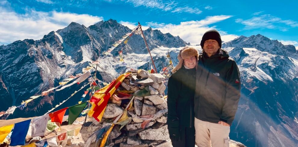
Trek the Langtang Valley with Next Trip Nepal. 8-day package from USD 650, covering all permits, guide, porter and teahouse accommodation. Langtang National Park, Kyanjin Gompa and Tserko Ri viewpoint included.