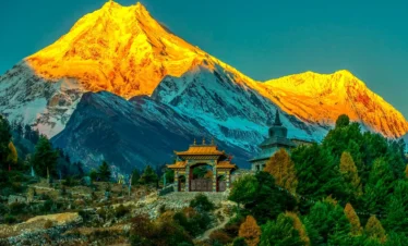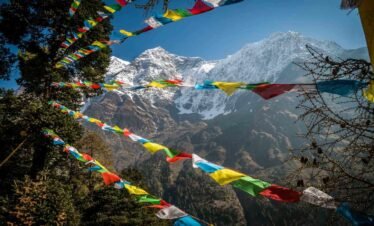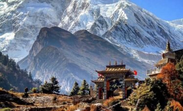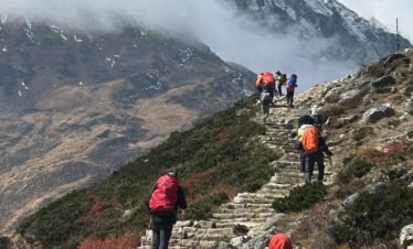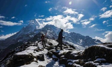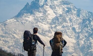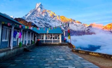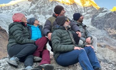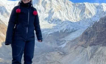
The Everest Base Camp with Gokyo Lake Trek is the most complete single journey through the Khumbu region. In 17 days, you experience the emerald Gokyo Lakes, summit Gokyo Ri (5,360 m) for views of four eight-thousanders, cross Cho La Pass (5,420 m), stand at Everest Base Camp (5,364 m), and watch Everest sunrise from Kala Patthar (5,555 m). Book with Next Trip Nepal, no advance payment required.

Overview
Everest Base Camp with Gokyo Lake Trek Overview
The Everest Base Camp with Gokyo Lake Trek is the most complete single journey through the Khumbu region. In 17 days, you walk from the Sherpa gateway town of Namche Bazaar into two entirely different mountain worlds: the emerald lakes of the Gokyo Valley and the glacier-ringed amphitheater of Everest Base Camp. Very few trekking routes in the world give you this combination of contrasts, solitude, altitude, and raw visual spectacle in a single continuous journey.
The route begins with a short mountain flight into Lukla at 2,840 meters, the entry point to the Khumbu. The first three days follow the Dudh Koshi River valley, crossing suspension bridges decorated with prayer flags and passing through Sherpa villages surrounded by dense pine and rhododendron forest. After an acclimatization day in Namche Bazaar, the trail splits. Rather than heading directly toward Everest Base Camp on the classic route, the EBC with Gokyo Lake itinerary turns northwest toward the Gokyo Valley through the quieter and less traveled path via Phortse Thanga and Machhermo.
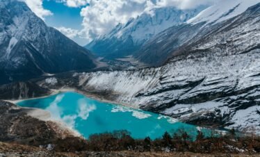
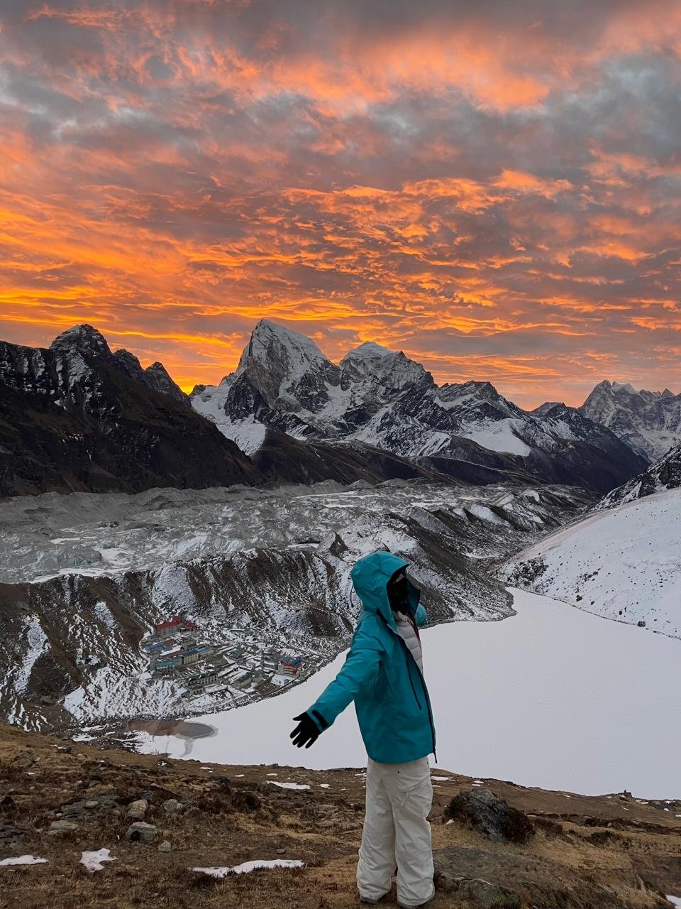
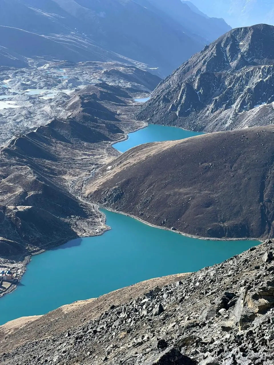
Gokyo sits at 4,790 meters beside the third of six interconnected glacial lakes that stretch along the edge of the Ngozumpa Glacier, the longest glacier in Nepal. The village is small and the air is clear and still in a way that feels genuinely rare at this altitude. The lakes themselves are a deep turquoise that shifts color with the light. In the afternoon they reflect Cho Oyu, at 8,188 meters one of the tallest mountains in the world. In the morning they are mirror calm. On Day 8, an early start leads to the summit of Gokyo Ri at 5,360 meters, one of the best panoramic viewpoints in the entire Himalayas. From the top you can identify four of the world’s fourteen eight thousanders: Everest at 8,848.86 meters, Lhotse at 8,516 meters, Makalu at 8,485 meters, and Cho Oyu at 8,188 meters.
The character of the trek changes sharply on Day 9 and Day 10 when the route turns east toward Cho La Pass at 5,420 meters. This is the most physically demanding section. The approach from Thangnak involves loose rock and a steady climb that begins in darkness. The upper section crosses glaciated terrain where crampon-style micro spikes and careful footing matter. The pass is crossed by mid morning when the ice is still firm and stable. The descent to Dzongla on the eastern side is steep and requires concentration. By the time trekkers reach Dzongla in the afternoon, they have crossed from one world into another.
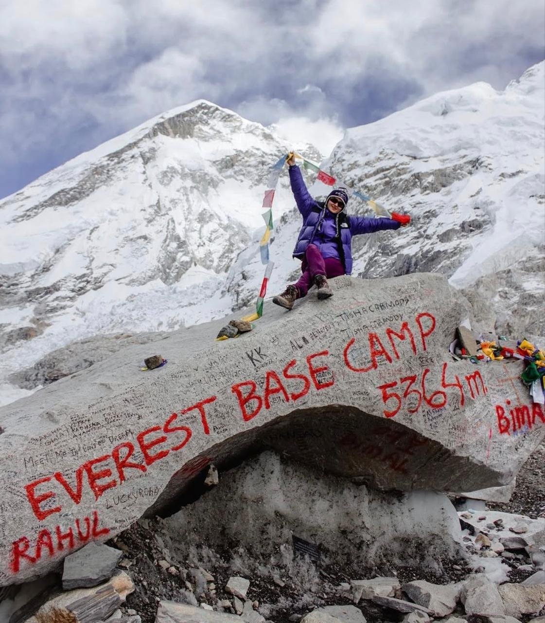
From Lobuche on Day 11, the route joins the classic Everest Base Camp trail. Day 12 is the long walk along the lateral moraine of the Khumbu Glacier to Everest Base Camp at 5,364 meters. Standing at the base of the Khumbu Icefall looking directly up at the route the world’s greatest climbers have used since 1953 is one of those rare moments where the scale and significance of where you are hits with full force.
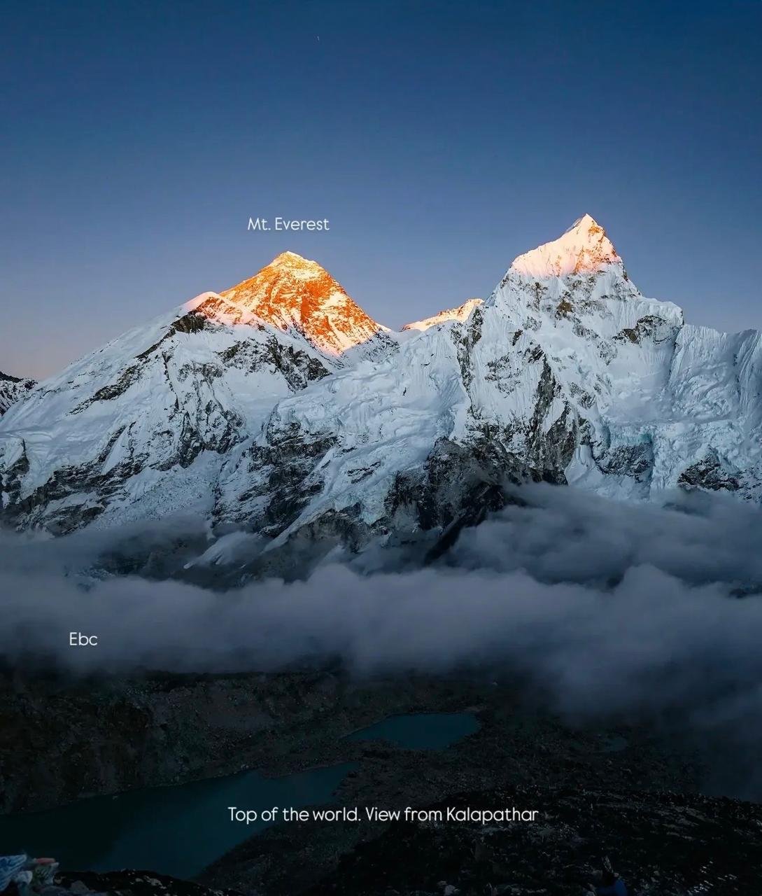
Day 13 begins before first light with the ascent of Kala Patthar at 5,555 meters, the highest point of the trek. The view from the top at sunrise is the view that appears on the cover of every Nepal trekking book ever printed. Mount Everest’s south face rises directly in front of you, catching the first gold light of morning while the surrounding peaks and glaciers are still in shadow. It is the most celebrated sunrise in trekking.
This is the best EBC with Gokyo Lake trek itinerary available for experienced trekkers who want to see everything the Khumbu has to offer without attempting the more technical Everest Three Passes route. It is well within reach of fit trekkers with no prior Himalayan experience, provided acclimatization is respected and a licensed local guide is with the group throughout.
Why Take the Gokyo Route Instead of the Direct EBC Trail
The standard Everest Base Camp Trek follows the Dudh Koshi River directly from Lukla to Namche, then northeast through Tengboche, Dingboche, and Lobuche to EBC. It is a beautiful trail with millions of trekkers completing it successfully each year. But it has one limitation: the route is the same going in and coming out. You see the same villages, the same valleys, the same trail twice.
The EBC with Gokyo Lake route solves this. By splitting the journey, you travel the Gokyo side of the Khumbu on the way in and the classic EBC trail on the way out. You cross Cho La Pass to link the two halves. The total experience is broader, the landscapes are more varied, and the two highlight moments of Gokyo Ri and Kala Patthar offer different but equally spectacular panoramas.
There is also the matter of solitude. The Gokyo Valley receives a fraction of the foot traffic of the main EBC trail. Teahouses at Gokyo, Machhermo, and Phortse Thanga are quieter and more relaxed than the lodges at Dingboche or Lobuche. If you have ever wanted the feel of genuine mountain remoteness alongside the main Everest experience, this route provides it.
The Gokyo Lakes
The Gokyo Lakes are a system of six high altitude glacial lakes formed by the retreat of the Ngozumpa Glacier. They sit in a north to south chain between 4,700 and 5,000 meters, each connected by a narrow stream to the next. The area is protected under Sagarmatha National Park and listed as a Ramsar Wetland Site, one of the highest Ramsar sites in the world.
The third lake, known as Dudh Pokhari at 4,790 meters, is the one beside Gokyo village where trekkers base for two nights. It is also the largest and the most photographed. On a still morning before the wind picks up, the reflection of Cho Oyu in the lake surface is one of the most extraordinary sights in Nepal.
Everest Base Camp with Gokyo Lake Trek Cost 2026 / 2027
All prices are per person and include accommodation, all meals on trek, guides, porters, permits, and Lukla flights.
| Group Size | Price Per Person | Send Inquiry |
|---|---|---|
| 1 Person Solo | USD 1,865 | |
| 2 to 3 Persons Popular | USD 1,715 | |
| 4 to 9 Persons Best Value | USD 1,615 | |
| 10 to 14 Persons Group Rate | USD 1,515 |
Group of 15 or more? Message us for a special group rate. · Prices valid for 2026 and 2027 departures.
Gokyo Ri, the peak rising above the village, was considered one of the best non technical viewpoints for Everest long before Kala Patthar became famous. From the summit at 5,360 meters you have a wider view than from Kala Patthar: four eight thousanders in a single field of vision, the entire Gokyo Lake chain below you, and the vast grey and white expanse of the Ngozumpa Glacier stretching south for nearly 36 kilometers.
Cho La Pass: The Heart of This Trek
Cho La Pass at 5,420 meters is what makes the EBC with Gokyo Lake Trek more challenging and more memorable than either route done separately. It is not technically difficult in the mountaineering sense but it requires a full day of sustained effort on terrain that demands respect.
The approach from Thangnak is steep and rocky. The final section below the pass is glaciated. Micro spikes or crampons are standard equipment and our guides carry rope for any sections where the group needs assistance. The pass itself, when you reach it, is a narrow rocky crest with views east toward Lobuche and west toward the Gokyo Valley you have just left. The crossing usually takes seven to eight hours including all rest stops.
The reason we cross from Gokyo to the EBC side and not the other way is important. When you cross from west to east, you descend toward Dzongla with the main Khumbu ahead of you. Psychologically it works better. The hardest physical section of the trek comes midway through the itinerary, and the reward of Everest Base Camp and Kala Patthar is still ahead.
Who Should Do the Everest Base Camp with Gokyo Lake Trek
- Fit trekkers with no prior Himalayan experience: This is achievable for anyone in good cardiovascular health who follows the acclimatization schedule. No prior altitude experience is required but good fitness is essential.
- Anyone who wants more than the standard EBC route: This route adds the Gokyo Lakes and Cho La Pass to what would otherwise be an out and back journey.
- Those comfortable walking 5 to 8 hours per day: Daily stages range from 4 to 8 hours. The longest days are the Cho La Pass crossing (Day 10) and the EBC to Kala Patthar day (Day 12 to 13).
- Trekkers who want mountain solitude alongside the famous destinations: The Gokyo side of the route is noticeably quieter than the main EBC trail.
- People seeking the best sunrise view in the Himalayas: Kala Patthar at dawn is the singular most celebrated viewpoint for Mount Everest.
- Those with 17 to 20 days available: The standard itinerary is 17 days. We strongly recommend one or two buffer days in Kathmandu for Lukla flight delays.
Not recommended for: Trekkers who have not been active in the months before departure, anyone with untreated heart or lung conditions, or those unable to commit to the full 17 days including proper rest and acclimatization days.
Why Book the EBC with Gokyo Lake Trek with Next Trip Nepal
- Local Everest region expertise: Our guides have led groups through Gokyo Valley and over Cho La Pass for many years. They know the pass in different weather, different snow conditions, and different seasons.
- No advance payment required: Book now and pay after you arrive in Kathmandu. Full transparency, no pressure, no hidden charges.
- Proper acclimatization built in: The itinerary includes a full rest day in Namche on Day 4 with an acclimatization hike. This is the difference between a trekker who reaches Kala Patthar and one who has to turn back at Lobuche.
- Licensed government certified guides: All Next Trip Nepal guides hold government certification and are first aid trained. They carry pulse oximeters and monitor the group at altitude.
- Flexible departure dates: We operate this trek year round on private and group departure dates.
- All permits and logistics handled: Sagarmatha National Park permit, Pasang Lhamu entry fee, Lukla flight booking, teahouse reservations, and all transport fully managed.
- One porter for every two trekkers: Porter service is included. The standard bag weight limit is 10 kilograms per trekker for your porter to carry.
- Direct contact, fast response: Available seven days a week on WhatsApp at +977 9869225929 and by email at nexttripnepal@gmail.com.
EBC with Gokyo Lake Trek vs Other Everest Region Treks
| Trek | Duration | Max Altitude | Difficulty | Best For |
|---|---|---|---|---|
| EBC with Gokyo Lake Trek | 17 days | 5,555 m | Challenging | Complete Khumbu experience, Gokyo and EBC combined |
| Standard EBC Trek | 12 to 14 days | 5,555 m | Moderate to Challenging | First Everest region trip |
| Gokyo Lake Trek Only | 12 to 14 days | 5,360 m | Moderate | Quieter lakes experience without EBC |
| Everest Three Passes Trek | 20 days | 5,535 m | Strenuous | Full Khumbu circuit for experienced trekkers |
| EBC with Island Peak Climbing | 19 days | 6,189 m | Technical | Adding a certified peak summit to EBC |
Book This Trek
We are an established Everest trekking agency and EBC with Gokyo lake trek company that has organized this route for trekkers from more than 40 countries. Our guides know this trail in spring snow, autumn clarity, and winter cold. No advance payment required. Book your place and pay after arriving in Kathmandu.
WhatsApp: +977 9869225929
Email: nexttripnepal@gmail.com
Senior Trek Leader Note — Pasang Sherpa, Lead Guide, Next Trip Nepal: I have guided the EBC with Gokyo Lake route 19 times. What surprises people most is not the altitude or the distance. It is the transition from the silence of Gokyo Lakes on Day 7 to the energy of Everest Base Camp on Day 12. These are two completely different emotional experiences and this route gives you both in one journey. The Cho La Pass crossing on Day 10 is where the two worlds meet. Leave Gokyo before 5am. You want to be on the glaciated section before 8am when the ice is still firm. We have never had a group fail this crossing when properly paced and timed.
Live Trail and Permit Status
Permits required: Sagarmatha National Park Entry Permit (NPR 3,000 for foreigners) + Pasang Lhamu Rural Municipality Entry Fee (NPR 2,000) + TIMS Card
Trail status: OPEN. Cho La Pass (5,420 m), Gokyo Valley, and all Khumbu approach routes confirmed operational as of July 2026.
Lukla flight protocol: Flights operating from Manthali Airport (Ramechhap) during April through June and September through November due to Kathmandu air traffic. Depart Kathmandu by 2am on flight days. One buffer day in Kathmandu strongly advised.
Verified by Next Trip Nepal operations team, July 2026
Highlights
- Scenic mountain flight to Lukla (2,840 m) with aerial views of the Himalayan range
- Namche Bazaar, the Sherpa capital of the Khumbu, with first views of Everest above the ridgeline
- Acclimatization hike to Hotel Everest View (3,880 m) with panoramic Himalayan views
- Tengboche Monastery, the largest monastery in the Khumbu with Ama Dablam as backdrop
- Six Gokyo Lakes between 4,700 and 5,000 m, listed as a Ramsar Wetland of global importance
- Summit of Gokyo Ri (5,360 m) with simultaneous views of four eight thousanders: Everest, Lhotse, Makalu, and Cho Oyu
- Cho La Pass crossing (5,420 m) linking the Gokyo Valley to the classic EBC trail
- Khumbu Glacier, the longest glacier in Nepal, walked alongside on approach to Base Camp
- Everest Base Camp (5,364 m), the starting point for all Everest expeditions since 1953
- Kala Patthar (5,555 m) at sunrise for the most celebrated Everest panorama in trekking
Itinerary
Next Trip Nepal representative meets you at Tribhuvan International Airport and transfers you to your hotel in Thamel in a private vehicle. The rest of the morning is free to rest and recover. In the afternoon, our trek leader visits for the pre-trek briefing covering the full itinerary, permit paperwork, packing review, Cho La Pass expectations, and Lukla flight protocols.
During peak season, flights to Lukla operate from Manthali Airport in Ramechhap, about 5 to 6 hours east of Kathmandu. Outside peak season, the 35 minute flight operates directly from Kathmandu. After breakfast in Lukla and meeting your porter, the trail descends through Chaurikharka village and follows the Dudh Koshi River downstream on suspension bridges hung with prayer flags. Phakding is reached in 3 to 4 hours.
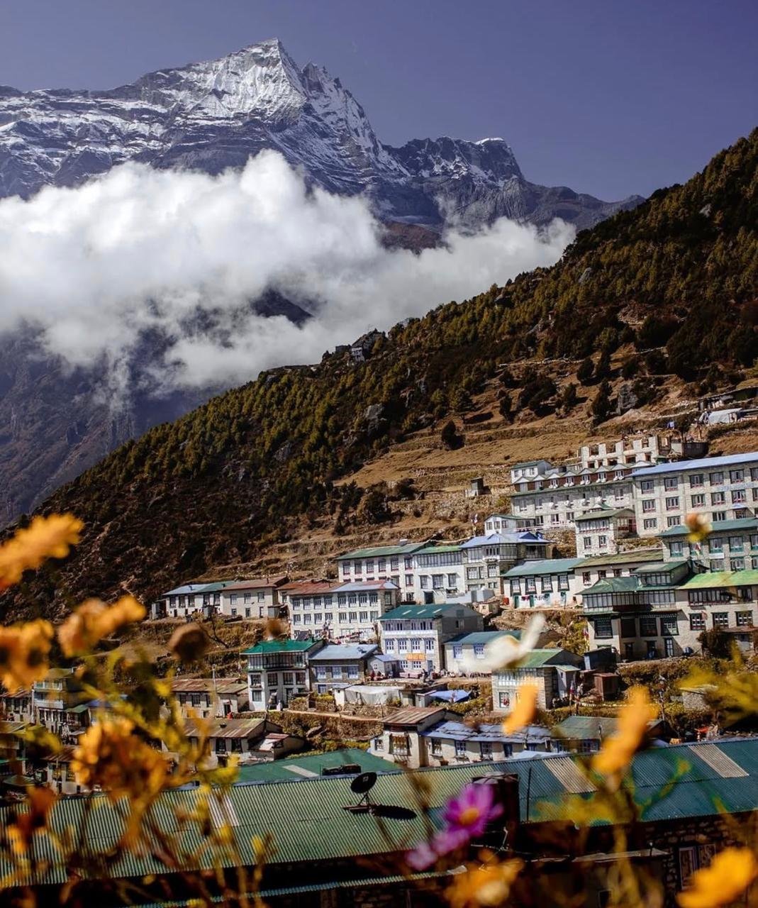
The trail crosses three major suspension bridges including the famous Hillary Bridge over the Dudh Koshi gorge. Yak trains share the narrow walkways so you learn quickly to step aside and give way. After passing the Sagarmatha National Park checkpoint, the trail climbs 600 vertical meters to Namche Bazaar, which appears suddenly as a dense horseshoe of stone buildings terraced into a natural amphitheater with the first clear view of Everest above the ridge to the north.
Acclimatization does not mean rest. We hike up to Hotel Everest View at 3,880 meters on the Syangboche plateau for one of the most recognized views in Nepal: Everest appearing directly above the ridgeline with Lhotse and Ama Dablam on either side. The hike takes about 2 hours. The descent returns to Namche for lunch and an afternoon exploring the town or visiting the Sagarmatha National Park Museum.
Today the route diverges from the main EBC trail. At Kenjoma the Gokyo route turns northwest, climbing to the ridge at Mong La before dropping steeply into the valley below. The descent follows a well graded trail through rhododendron and juniper forest to Phortse Thanga beside a river with a small cluster of teahouses. Traffic drops noticeably from this point on as the Gokyo Valley attracts far fewer trekkers than the EBC route.
The trail climbs steadily north along the lateral moraine of the Ngozumpa Glacier system. Cho Oyu, the sixth highest mountain in the world at 8,188 meters, appears for the first time directly ahead to the north. Machhermo at 4,470 meters is a small collection of teahouses at the edge of the high alpine zone. Snow is possible at any time of year above this point.
Within the first two hours you pass the First Lake and Second Lake of the Gokyo system, each one a shade of blue green that looks too vivid to be real. Gokyo village sits at the south end of the Third Lake, the largest of the six. The evening view across the lake toward Cho Oyu is one the most rewarding moments of the entire trek. Eat well and drink at least 3 liters of water to prepare for tomorrow’s ascent of Gokyo Ri.
Leave Gokyo before 6am. The summit takes 2 to 3 hours. The view from 5,360 meters is widely considered one of the five best panoramic mountain views in the world: four eight thousanders visible simultaneously, the full Gokyo Lake chain below, and the vast Ngozumpa Glacier stretching south for nearly 36 kilometers. Descend for a late breakfast. The afternoon is free to explore the Fourth or Fifth Lake or simply sit at the lakeside.
The direction reverses today, heading south then east beside the Ngozumpa Glacier toward Thangnak. This is a shorter walking day of 4 to 5 hours but the terrain is rougher. Thangnak is one of the most remote overnight stops on the trek. The evening is for final kit check, eating a solid dinner with extra carbohydrates, and sleeping as early as possible. Your guide will review the morning Cho La plan in detail before bed.
Wake at 4am. The morning starts with headlamps in the dark. The trail from Thangnak climbs steeply on rock, then transitions to a snowfield approach to the pass. The final section involves a short glaciated section where the footing must be placed carefully. Guides rope the group through any icy sections. Cross by 9am to avoid softening snow. The view from the pass: Gokyo Valley to the west, the main Khumbu below to the east. You have crossed from one world into another.
A shorter and more straightforward day follows the dramatic Cho La crossing. The trail crosses open plateau terrain with views of the Khumbu glacier system to the north. Lobuche at 4,910 meters is a collection of teahouses along a moraine ridge at the edge of the Khumbu Glacier. A short walk from the teahouses is a memorial to climbers who have died on Everest. Stone chortens carry their names and prayer flags flutter above them.
From Lobuche the trail climbs to Gorak Shep at 5,164 meters, the last human settlement before Base Camp. Leave your heavy bags here and continue to Everest Base Camp with only a small daypack. The trail follows the lateral moraine beside the Khumbu Glacier for about 2 hours. Everest Base Camp at 5,364 meters is an area of rocky moraine at the edge of the Khumbu Icefall. Looking up, the Icefall rises in a chaotic tumble of ice seracs and crevasses. The route to the summit of Everest begins here.
The alarm goes at 4am. Begin the ascent of Kala Patthar before the sun rises. The ascent takes 90 minutes to 2 hours from Gorak Shep. The sunrise from Kala Patthar is the singular most celebrated moment in Himalayan trekking. When the first light catches Everest’s summit at 8,848.86 meters and turns the snow and ice of the upper face into something that looks lit from inside, most people go silent. After the sunrise, descend back to Gorak Shep for hot breakfast, then a long descent through Lobuche and Pangboche to Dingboche.
The trail drops south through Pangboche to Tengboche Monastery at 3,860 meters, the largest monastery in the Everest region, set on a ridgeline with Ama Dablam directly to its south. The prayer hall interior with its painted murals, carved wooden altars, and smell of juniper incense is worth spending time in. From Tengboche the trail drops into the Dudh Koshi valley before the long climb back up to Namche Bazaar.
The last full day of trekking reverses the Day 2 and Day 3 journey, from Namche back through Phakding and the suspension bridge sections to Lukla. The trail is familiar now and the pace tends to be faster. Arriving in Lukla in the afternoon marks the end of the trail. The evening is for celebration: a proper dinner with the guide and porter and the kind of conversation that happens when a group of people have shared 15 days in the mountains together.
Morning flights from Lukla typically depart between 6am and 9am depending on weather. During peak season the return goes to Manthali Airport with a 5 to 6 hour vehicle ride to Kathmandu. In off peak months the flight returns directly to Kathmandu in 35 minutes. That evening, Next Trip Nepal hosts a farewell dinner.
Transfer to Tribhuvan International Airport for your departure. Our vehicle picks you up at the hotel at the agreed time. If you have extra time before your flight, Thamel has a concentrated stretch of trekking gear shops, souvenir stalls, and cafes worth exploring.
Includes
Cost Includes
- Airport pickup and drop by private tourist vehicle.
- Two nights hotel in Kathmandu at 3-star category on twin sharing basis with breakfast.
- Kathmandu to Lukla to Kathmandu flights by economy class (10 kg luggage allowance per person).
- Three meals a day during the trek — breakfast, lunch, and dinner.
- Teahouse accommodation throughout the entire trek.
- An experienced, English-speaking, government-licensed trekking guide.
- One porter for every two trekkers (carrying up to 25 kg per porter).
- Guide and porter wages, equipment, insurance, and daily allowances.
- Sagarmatha National Park entry permit.
- Khumbu Pasang Lhamu Rural Municipality entry fee.
- Nepal Tourism Board TIMS card (Trekkers' Information Management System).
- Emergency high-altitude rescue insurance for guide and porter.
- Pulse oximeter to monitor blood oxygen levels during the trek.
- First aid kit and basic medical supplies.
- All government taxes and official service charges.
Cost Excludes
- International airfare to and from Kathmandu.
- Nepal entry visa fee: USD 30 for 15 days, USD 50 for 30 days, USD 125 for 90 days (visa available on arrival at Tribhuvan International Airport).
- Travel Insurance
- Travel and medical insurance for the trekker (must cover helicopter evacuation above 5,000 m).
- Personal trekking gear and equipment (sleeping bag, trekking poles, etc.).
- Excess baggage charges on the Lukla flight.
- Meals in Kathmandu — lunch and dinner during your hotel nights.
- Alcoholic beverages, energy drinks, and soft drinks during the trek.
- Hot showers, charging fees, and Wi-Fi costs at teahouses.
- Tips and gratuities for guide and porter (customary: USD 100 to 150 for guide, USD 50 to 80 for porter).
- Any additional nights in Kathmandu due to flight delays or early arrival.
- Helicopter rescue or evacuation costs not covered by travel insurance.
- Personal expenses such as laundry, phone calls, and souvenirs.
- Any costs arising from natural disasters, political unrest, or flight cancellations beyond our control.
365 Days Fixed Departure
Planning a private trip? Fill out the form and our travel experts will be in touch shortly.
-
Guaranteed Group Discount Available Available PackagesTuesdayJuly 28, 2026ThursdayAugust 13, 2026$1,865Available
-
Guaranteed Group Discount Available Available PackagesWednesdayJuly 29, 2026FridayAugust 14, 2026$1,865Available
-
Guaranteed Group Discount Available Available PackagesThursdayJuly 30, 2026SaturdayAugust 15, 2026$1,865Available
Packing List
Packing for the EBC with Gokyo Lake Trek takes more thought than most Himalayan routes. You are covering 130 to 140 km over 17 days, crossing three passes above 5,300 m, and spending multiple nights above 4,500 m. Every item needs to earn its weight. This list is built from real experience on this specific route — not a generic high-altitude checklist.
Clothing System: The Three-Layer Principle
The Khumbu weather changes fast. At 3,000 m you may be trekking in a t-shirt; four hours later at 4,500 m you are putting on every layer you packed. The three-layer system is not optional — it is the only reliable way to manage heat and cold across this altitude range.
Base Layer (Next-to-Skin)
Choose merino wool or high-quality synthetic (Polartec Power Dry or similar). Merino wool is warmer, odour-resistant, and feels better against skin after multiple days without washing. Synthetic dries faster and is cheaper. Bring two complete sets: top and bottom.
- Long-sleeve merino wool base top (200g weight) — works from Lukla to high camp without feeling bulky
- Short-sleeve moisture-wicking t-shirt for warmer lower-elevation days (Days 1 to 3)
- Merino wool thermal leggings — essential above 4,000 m at night
- Lightweight trekking underwear, moisture-wicking (3 to 4 pairs minimum)
- Avoid cotton entirely — cotton holds moisture against skin and accelerates heat loss
Mid Layer (Insulation)
This is your primary warmth layer. You will put it on and take it off multiple times each day depending on cloud cover, wind, and elevation.
- Fleece jacket 200-weight (Patagonia R2, Arc’teryx Kyanite, or equivalent) — versatile from 2,500 m to 5,000 m when combined with shell
- Synthetic or down mid-layer vest (optional but useful for layering on pass days)
- Down jacket 700-fill or higher — must have for evenings at Namche and above, and for Kala Patthar pre-dawn start. This is the single most important piece of gear on this trek
- If using a down jacket, ensure it has a water-resistant shell (hydrophobic down or DWR-coated outer fabric) — down loses all insulation value when wet
Outer Shell (Protection)
Wind and rain protection is critical. Even in dry October, wind speeds on Cho La and Renjo La can exceed 60 km/h and significantly accelerate heat loss.
- Waterproof hardshell jacket — Gore-Tex or equivalent 2.5L to 3L construction. Must be fully seam-sealed
- Waterproof hardshell pants — must fit over your trekking pants without restricting movement on steep terrain
- Consider a softshell jacket as an alternative to fleece plus shell for moderate conditions (lighter, quieter, more packable)
Trekking Pants and Lower Body
- Trekking pants (2 pairs) — zip-off convertible style is useful but not required. Nylon-spandex blend for movement and quick drying
- Insulated or softshell pants for pass days and summit days — regular trekking pants are insufficient at Cho La or Kala Patthar in wind
- Gaiters (low or high) — useful on snowy or wet trail sections above 4,500 m. Essential if trekking November to February
Footwear: The Most Important Decision You Make
More trekkers abandon the EBC with Gokyo Lake Trek due to foot problems than any other physical issue. Blisters, ankle rolls, and wet feet are all preventable with the right footwear choice and preparation.
- Waterproof ankle-support trekking boots — the single most important gear purchase. Full waterproof membrane (Gore-Tex or equivalent) is mandatory. Leather or leather-synthetic combination lasts better than pure synthetic on rocky trails
- Break them in for a minimum of 3 to 4 weeks before your trek date. Walk uphill and downhill, not just on flat ground. Blisters on Day 2 in the Khumbu are a serious problem
- Fit boots with the socks you plan to trek in. Feet swell at altitude — boots that feel perfect at sea level may feel tight above 4,000 m
- Wool or synthetic trekking socks (bring 5 to 6 pairs) — merino wool socks can be worn 2 to 3 days before washing without discomfort. Avoid thin dress socks
- Camp sandals or lightweight shoes (Crocs, flip-flops, or trail runners) for teahouse evenings — never walk around camp in your trekking boots if you can avoid it
- Microspikes (YakTrax or Kahtoola style) — strongly recommended for the Cho La glacier section from October onwards. Not full crampons but significantly safer on icy sections
- Trekking poles (collapsible, 2 poles) — non-negotiable for the Cho La descent and the long downhills from Gorak Shep. Carbon poles are lighter; aluminium is more durable and cheaper
Headwear and Gloves
At Kala Patthar at 5 AM, the wind and cold combined will test every piece of headwear you own. The pre-dawn start is when trekkers most regret underpacking warm accessories.
- Warm fleece or wool hat covering ears fully — not a thin running beanie
- Balaclava or fleece neck gaiter (Buff) — protects face and neck on high exposed passes
- Sun hat or baseball cap with full brim — UV at 5,000 m is approximately 50% more intense than at sea level
- Lightweight liner gloves (touch-screen compatible if possible for phone use)
- Heavy insulated gloves or mittens (down-filled or synthetic insulated) for Cho La, Renjo La, and Kala Patthar. These are separate from liner gloves and layer over them
Pack and Luggage
You carry a day pack; your porter carries your duffel. The maximum porter load is 25 kg per porter but we assign one porter per two trekkers carrying up to 10 kg of your gear each. Pack your duffel accordingly.
- Day pack 25 to 30 litres — this is what you carry yourself every trekking day. It holds: water (2 litres), rain layers, camera, snacks, documents, first aid essentials, and anything you need during the day
- Duffel bag 60 to 70 litres — keep total weight to 10 to 12 kg. This is what your porter carries and what stays in teahouses during day hikes
- Waterproof rain cover for both packs — even in dry season, brief afternoon showers occur below 3,500 m
- Dry bags or heavy-duty zip-lock bags — protect sleeping bag, down jacket, electronics, and documents inside your packs
- Small padlocks for duffel bag zippers — not for security from theft (teahouses are honest) but to prevent zippers opening during porter carry
Sleeping System
Teahouse blankets above 4,000 m are thin and inadequate on cold nights. Temperatures in Lobuche, Gorak Shep, and Gokyo drop to -15°C to -20°C at night during October and November. Your sleeping bag is what stands between comfortable rest and a miserable, sleepless night that degrades your performance the next day.
- Sleeping bag rated to -15°C comfort (not limit) — down-filled bags (600-fill or higher) pack smaller and are warmer per gram than synthetic; synthetic bags retain some warmth even when damp
- Sleeping bag liner (silk, fleece, or thermal) — adds 3 to 8°C of warmth and keeps your sleeping bag cleaner across 17 nights
- Inflatable or foam sleeping pad insert (optional) — some high-altitude teahouse mattresses are thin and cold from below; a closed-cell foam sit pad placed under your torso makes a significant difference
Electronics and Power
Power is scarce and expensive above 4,000 m. Plan your charging strategy before you leave Kathmandu. Teahouses charge NPR 200 to 800 per device per charge. Solar panels stop working in heavy cloud cover. Cold significantly reduces battery capacity at altitude.
- Power bank 20,000 mAh — enough for 6 to 8 full phone charges. Keep it in your sleeping bag at night above 4,500 m to prevent battery drain in the cold
- Solar charger (optional) — useful on sunny days at altitude. The Anker 21W and BioLite SolarPanel 10 are reliable options. Must be strapped to outside of pack to charge while walking
- Headlamp with lithium batteries (not alkaline) — lithium batteries perform at -20°C where alkaline batteries fail. Petzl Actik Core and Black Diamond Spot are reliable choices. Bring spare batteries even if rechargeable
- Camera with spare batteries and extra memory cards (128 GB minimum) — the photographic opportunities on this route are extraordinary and you will take more photos than you expect
- Universal travel adapter for Kathmandu (Nepal uses Type C, D, and M sockets)
- Smartphone with offline maps — download Maps.me, OsmAnd, or Gaia GPS with the Khumbu region before leaving Kathmandu. Offline navigation has saved trekkers who got separated from their guide on cloud-covered pass days
- Waterproof case or dry bag for phone — absolutely essential for crossing wet trail sections and river crossings on suspension bridges
Health, Safety and Medical
This is not an area to cut weight. The medical items you carry are there for emergencies, and at altitude you need them to work fast.
- Personal first aid kit: assorted bandages, sterile gauze pads, medical tape, antiseptic wipes, blister plasters (Compeed brand), moleskin, small scissors, and safety pins
- Diamox (acetazolamide) 125 mg or 250 mg tablets — consult your doctor before departure. Standard dosage is 125 mg twice daily starting 24 hours before ascending above 2,500 m. Common side effects include increased urination, tingling in fingertips, and mild blurred vision. Do not take if allergic to sulfa drugs
- Ibuprofen 400 mg — for altitude headache and muscle pain. Do not mask a severe headache with ibuprofen and continue ascending; a worsening headache above 4,000 m is a signal to assess for AMS
- Paracetamol (acetaminophen) 500 mg — alternative to ibuprofen for pain relief without anti-inflammatory effects
- Oral rehydration salts (ORS packets, 6 to 8 sachets) — essential for diarrhoea, vomiting, or poor hydration at altitude
- Loperamide (Imodium) — for short-term management of traveller’s diarrhoea on trek days when you cannot rest
- Sunscreen SPF 50 or higher — apply on all exposed skin every 2 hours above 3,000 m. UV radiation at 5,000 m is approximately 50% more intense than at sea level
- SPF lip balm — sun-induced lip cracking is painful and persistent; prevent it from Day 1
- Glacier sunglasses (Category 4 lens with side shields or wraparound style) — not optional above 5,000 m on snow. Standard Category 2 or 3 sunglasses used on glaciated terrain cause snow blindness within hours
- Throat lozenges — cold dry high-altitude air causes Khumbu cough in most trekkers above 4,500 m; lozenges and a neck buff over the nose and mouth while walking help
- Hand sanitiser and wet wipes — toilets and hand-washing facilities at high-altitude teahouses are basic
Water and Nutrition
Staying hydrated at altitude is one of the most effective altitude sickness prevention strategies. The target is 4 litres of water per day during active trekking days. Bottled water above Namche costs NPR 200 to 500 per 500 ml and creates enormous plastic waste — the Khumbu plastic waste problem is severe.
- Reusable 1-litre water bottles (2) — Nalgene wide-mouth bottles are indestructible and can handle boiling water if needed. Hydration bladders (Camelbak etc.) freeze at altitude — not recommended above 4,500 m
- Water purification: Steripen UV purifier (fast, effective, requires batteries) or Sawyer Squeeze filter (no batteries, long-lasting) or iodine/chlorine tablets (cheap backup)
- Electrolyte powder or sachets (10 to 15 sachets) — add to water on active days to replace sodium and potassium lost through sweat and urination (Diamox increases urination significantly)
- High-energy trail snacks for between meals: roasted nuts, dark chocolate (80% cocoa stays solid at altitude), protein bars, dried mango or apricot, rice crackers
- Instant coffee sachets or tea bags if you are particular about your morning drink — teahouse coffee quality varies widely
Documents and Money
Photocopy all documents before departure and store digital copies in cloud storage accessible offline (Google Drive, Dropbox, or email to yourself).
- Original passport — required at every permit checkpoint
- Travel insurance policy document showing helicopter evacuation coverage above 5,000 m — carry printed and digital copy
- Emergency contact card with your insurer’s 24-hour number, your guide’s number, and a family contact — laminate it or put it in a waterproof bag
- Cash: NPR 15,000 to 25,000 for personal trek expenses plus USD 100 to 200 emergency reserve. Withdraw in Kathmandu
- Small ziplock for documents inside your pack — waterproofing
What to Rent or Buy in Kathmandu
Thamel in Kathmandu has dozens of trekking gear shops selling both genuine and replica equipment. Quality has improved significantly and budget-conscious trekkers can assemble a complete kit for USD 200 to 400. Key items worth buying in Kathmandu if you do not already own them: trekking poles (USD 15 to 30 replica, USD 80 to 120 genuine), sleeping bag rental (USD 1 to 3 per day), down jacket rental (USD 1 to 2 per day), and microspikes (USD 10 to 20).
What Not to Bring
- Cotton clothing of any kind — cotton absorbs moisture and does not dry, creating hypothermia risk
- Jeans or heavy casual trousers — far too heavy and slow to dry
- Multiple books — one Kindle with a full battery serves better than three paperbacks
- Expensive jewellery or valuables — leave them in your hotel safe in Kathmandu
- More than 1 to 2 full sets of clothing — you will not need them and porters’ health suffers from overloaded bags
- Any electronic device you are not committed to using daily — dead weight at altitude
Travel Note
The notes below cover what experienced trekkers know before arriving in Nepal and what first-timers discover the hard way. Read through every section — even the parts that seem obvious often contain Khumbu-specific details that change how you plan.
When to Trek: Season by Season
Autumn: September to November (Best Season)
This is the peak trekking season in Nepal and for good reason. The monsoon clears by mid-September, leaving washed, brilliant skies. October delivers the most reliable visibility and mountain views. Daytime temperatures at 3,500 m are comfortable (10°C to 18°C) and trails are dry and firm. The main downsides are trail congestion on the main EBC route and teahouse bookings that fill early at popular stops. Book at least 4 to 6 weeks before departure in October. November is quieter, colder at altitude (night temperatures at Gorak Shep drop to -20°C), and offers excellent clear views with fewer trekkers above Namche.
Spring: March to May
Spring is the second trekking season and the preferred season for Everest summit expeditions. Trail traffic on the main EBC route is significant from mid-April through May because Base Camp is active with expedition teams. Views are generally good but afternoon clouds are common from late April, often clearing the next morning. Rhododendrons bloom in the lower forests (2,500 m to 3,500 m) from late March through April, making the approach through Phakding and Namche particularly beautiful. Snow on Cho La Pass is more likely in March but mostly clear by late April.
Monsoon: June to August (Not Recommended)
The South Asian monsoon brings sustained heavy rain to the Khumbu from June through August. Trails above 3,500 m are muddy and slippery. Cloud cover obscures mountain views for days at a time. Leeches infest lower-elevation trail sections. River crossings are more dangerous. Lukla flights are cancelled frequently due to cloud. Some teahouses close. The Gokyo valley and Three Pass routes are significantly more dangerous in monsoon conditions. We do not operate the EBC with Gokyo Lake Trek during June, July, and August.
Winter: December to February
Winter trekking is possible for experienced cold-weather trekkers who accept the tradeoffs. Trail traffic drops dramatically — you may have teahouses entirely to yourself. Some lodges above Namche close. Snow on Cho La and Renjo La makes these passes dangerous without crampons and cold-weather experience. Temperatures at Kala Patthar and the high camps can drop to -30°C at night with wind chill. Lukla flight reliability also decreases in winter fog. If you trek in December or January, ensure your sleeping bag is rated to -25°C and your guide has specific winter pass experience.
Lukla Flights: What You Must Know
The Kathmandu to Lukla flight is the start and end point of this trek and the element most likely to disrupt your schedule. Understanding how it works prevents stress and poor decisions.
- Flights operate only in daylight and only in clear visibility conditions. This means early morning departures (6:00 AM to 10:00 AM) with afternoon cancellations if cloud builds
- Delays cascade: if morning fog grounds flights, afternoon slots are filled by delayed morning departures. One bad morning can strand trekkers for 24 to 72 hours
- The airport has no radar approach capability — pilots fly visually and abort if the valley is obscured
- We book your flights and handle all communication with the airline. If your flight is delayed, we manage rebooking and alternative options including helicopter charter to Phaplu or Ramechhap for an alternative Lukla-bypass route
- Always build minimum 2 buffer days between your final Lukla flight and any international connection from Kathmandu
- Helicopter charter from Namche or Lukla to Kathmandu costs approximately USD 500 to 700 per person (shared helicopter) and bypasses weather delays — we can arrange this if needed
- The return flight from Lukla usually departs between 6:00 AM and 9:00 AM. Your guide escorts you to the airport and handles all check-in procedures
Money, Cash and Costs on the Trail
The Khumbu runs almost entirely on cash. Planning your money correctly avoids stress and unnecessary expense.
- Withdraw all trek cash in Kathmandu before departure. The exchange rate at Tribhuvan International Airport is poor — use a bank or exchange office in Thamel
- Namche Bazaar has ATMs (Standard Chartered, Global IME Bank) but they frequently run out of cash in peak October. Bring Kathmandu cash as your primary and treat Namche ATMs as backup only
- No ATMs exist anywhere above Namche
- Teahouses above Namche do not accept credit or debit cards. Everything is cash-only
- USD is accepted in some teahouses and lodges but at a poor exchange rate. Nepali rupees (NPR) are always preferred
- Budget NPR 1,500 to 3,000 per day for personal expenses on the trail (hot drinks NPR 200 to 500 each, Wi-Fi NPR 300 to 800/hour, charging NPR 200 to 500/device, hot shower NPR 300 to 600)
- Set aside NPR 10,000 to 15,000 for guide and porter tips at the end of the trek (customary: NPR 15,000 to 20,000 for guide, NPR 7,000 to 10,000 for porter per group)
- Currency declaration: you can bring up to USD 5,000 cash into Nepal without declaration. Above this amount, declare at the airport on arrival
Physical Preparation Before You Leave Home
Altitude fitness and trekking fitness are different things. You can be aerobically fit for running or cycling and still struggle on the sustained steep descents and multi-hour days at altitude. Begin preparation 8 to 12 weeks before your trek date.
- Cardiovascular base: Run, cycle, or swim 4 to 5 days per week. Build to sustained sessions of 60 to 90 minutes at moderate effort. Your aerobic capacity determines how well your body tolerates reduced oxygen at altitude
- Leg strength and endurance: Weighted stair climbing, hiking with a loaded pack, and lunges build quad and glute strength essential for the long descents from Gorak Shep to Pheriche and from the pass descents
- Trek-specific training: Complete at least two 6 to 8 hour hikes in the 4 weeks before departure, ideally with elevation gain of 800 to 1,200 m, wearing your actual trekking boots with the socks you plan to use
- Break in your boots during these training hikes — this is non-negotiable
- Core strength reduces back fatigue from carrying a day pack. Planks, dead bugs, and bird-dogs for 15 minutes daily are sufficient
- If you have access to altitude training (altitude tents, training camps above 2,500 m), this is beneficial but not essential for trekkers who follow a proper acclimatisation schedule
Cultural Etiquette in the Khumbu
The Khumbu is home to the Sherpa people, Tibetan Buddhist in faith and deeply respectful of their sacred geography. Respectful behaviour costs nothing and is deeply appreciated.
- Remove shoes before entering monasteries, gompas, and many teahouses (a shoe rack outside the door signals this)
- Walk clockwise around chortens (Buddhist stupas), mani stone walls, and prayer wheels — always keep sacred structures on your right
- Ask permission before photographing local people, monks, or religious ceremonies. Always ask, always respect a refusal
- Do not touch or disturb mani stones — these are carved prayer stones placed with spiritual intention
- Keep your voice down inside monasteries and during prayer sessions (puja). Evening puja at Tengboche Monastery is open to respectful observers
- The Sherpa people are exceptional mountaineers and professionals — do not talk down to guides or porters or make assumptions about their knowledge
- Dress modestly in villages and at religious sites — shoulders and knees covered is appropriate
Environmental Responsibility
The Khumbu faces serious environmental pressure from trekking tourism. Plastic waste, deforestation for teahouse cooking fuel, and trail erosion are all ongoing issues that trekkers can directly influence.
- Bring a reusable water bottle and purification method — every plastic bottle you avoid is one fewer that ends up on the trail or in a fire pit
- Use biodegradable soap and shampoo and do not wash directly in or near streams
- Pack out all non-biodegradable rubbish. Do not leave wrappers, batteries, or plastic on the trail
- Stick to established trails — shortcutting switchbacks causes erosion
- Do not give sweets or money to children along the trail — it creates dependency and affects school attendance
- Support teahouses that use solar or micro-hydro power rather than kerosene or wood burning where you have a choice
Photography Rules and Tips
The EBC with Gokyo Lake Trek is one of the most photogenic routes on earth. A few guidelines help you get the best shots and stay on the right side of local customs.
- Best light for mountain photography is within 30 minutes of sunrise. This is why Kala Patthar and Gokyo Ri are climbed pre-dawn
- Permit photography: Sagarmatha National Park does not charge a photography permit fee for trekkers with personal cameras. Professional film crews require a separate permit
- Inside monasteries: photography is usually permitted in outer courtyards and some prayer halls. Flash photography is disrespectful and usually prohibited. Ask the monk in charge
- Portrait photography: always ask. Many Sherpa women prefer not to be photographed; others are happy to pose for a small tip (NPR 100 to 200 is appropriate if offered)
- Cold kills batteries: keep your camera warm inside your jacket between shots above 4,000 m. A dead battery at Kala Patthar sunrise is one of trekking’s bitterest disappointments
- The best Everest view from Kala Patthar is in the first 30 to 60 minutes after dawn before lenticular cloud builds on the summit. Your guide sets your wake-up time accordingly
Altitude Sickness
Altitude sickness is the most serious and most preventable health risk on the EBC with Gokyo Lake Trek. This route spends more consecutive days above 4,000 m than almost any other non-technical trek in Nepal, crossing three passes above 5,300 m. Understanding altitude medicine before you leave home is not an academic exercise — it is a practical safety skill that every person on this trek must have before departure.
The Science: Why Altitude Affects the Body
At sea level, air pressure is 101.3 kPa and each breath delivers a full dose of oxygen to the lungs. At 5,000 m, atmospheric pressure drops to approximately 54 kPa — meaning each breath delivers roughly 53% as much oxygen as at sea level. The body responds to this oxygen deficit through a process called acclimatisation: breathing rate increases, red blood cell production accelerates, blood chemistry adjusts to deliver more oxygen to tissues, and the cardiovascular system works harder. This process begins within hours of arriving at altitude but takes days to weeks to complete meaningfully.
The problem is that the acclimatisation process cannot be rushed. Ascending too quickly — gaining more than 500 m of sleeping altitude per day above 3,500 m — overwhelms the body’s adaptive capacity. The result is fluid leaking from blood vessels into spaces where it should not be: the brain (causing cerebral oedema) or the lungs (causing pulmonary oedema). These are the two life-threatening endpoints of untreated altitude sickness.
The Three Stages of Altitude Sickness
Stage 1: Acute Mountain Sickness (AMS)
AMS is the most common form of altitude sickness and affects approximately 25% of trekkers arriving in Namche Bazaar (3,440 m) without prior acclimatisation. The Lake Louise Scoring System is the standard clinical tool for diagnosing AMS: a headache plus at least one of fatigue, gastrointestinal symptoms (nausea, vomiting, loss of appetite), dizziness, or poor sleep, at a score of 3 or higher.
- Headache — the hallmark symptom. Usually throbbing, worsened by exertion and bending forward, and may not respond well to ibuprofen alone
- Fatigue and weakness disproportionate to the day’s effort
- Loss of appetite or nausea, sometimes with vomiting
- Dizziness or lightheadedness
- Difficulty sleeping — insomnia and periodic breathing (Cheyne-Stokes pattern of breathing that stops and restarts during sleep) are common
- AMS symptoms typically appear 6 to 12 hours after arriving at the new altitude and peak at 24 to 48 hours
Mild AMS is managed by stopping ascent, resting at the same altitude, staying hydrated, and taking ibuprofen or paracetamol for headache. Do not ascend to a higher sleeping altitude until all symptoms resolve. Most mild AMS resolves within 1 to 2 days of proper rest without requiring descent.
Stage 2: High Altitude Pulmonary Oedema (HAPE)
HAPE occurs when fluid accumulates in the lung tissue, reducing the lungs’ ability to transfer oxygen to the blood. It is the leading cause of altitude-related death and can develop rapidly, sometimes overnight. HAPE can occur without prior AMS symptoms.
- Dry persistent cough that progressively becomes wet or produces pink frothy sputum — this is a medical emergency
- Shortness of breath at rest (not just during exertion) — a critical distinction from normal altitude breathlessness
- Crackling or gurgling sounds in the chest when breathing deeply
- Blue or grey discolouration of lips, fingernails, or fingertips (cyanosis)
- Extreme fatigue and inability to perform basic tasks
- Blood oxygen saturation (SpO2) typically drops below 70% in HAPE — your guide’s pulse oximeter will detect this
HAPE treatment: immediate descent of at least 500 to 1,000 m, supplemental oxygen if available, and nifedipine 30 mg extended release (carried in our medical kit for emergencies). Helicopter evacuation should be requested immediately. Do not wait for symptoms to worsen. HAPE is fatal within hours if descent is delayed.
Stage 3: High Altitude Cerebral Oedema (HACE)
HACE occurs when the brain swells due to fluid accumulation. It is less common than HAPE but equally dangerous and can progress from mild AMS to loss of consciousness within 24 hours in severe cases.
- Severe headache not responding to ibuprofen or paracetamol
- Loss of coordination — inability to walk in a straight line (ataxia). The “tandem gait test” (walking heel-to-toe on a straight line) is a simple diagnostic: inability to do this is a red flag
- Confusion, disorientation, and altered mental state
- Extreme fatigue and drowsiness
- Vision changes or photophobia
- In severe cases: loss of consciousness and coma
HACE treatment: immediate descent regardless of time of day or weather, supplemental oxygen, dexamethasone 8 mg immediately (steroid carried in emergency medical kit), and Gamow bag (portable hyperbaric chamber) if available and descent is impossible due to weather. Helicopter evacuation is mandatory.
The Acclimatisation Schedule on This Trek
Our 17-day itinerary is specifically designed around acclimatisation science. The schedule follows a strict “climb high, sleep low” principle and builds in two dedicated acclimatisation days at key altitude thresholds:
- Day 3 rest day at Namche Bazaar (3,440 m): We hike to the Everest View Hotel (3,880 m) or Khumjung village (3,790 m), gaining 400 to 450 m in the day while returning to sleep at 3,440 m. This stimulates physiological adaptation without adding sleeping altitude stress
- Day 7 rest day at Dingboche (4,410 m): We hike to the Nagarjun Hill viewpoint (5,100 m), gaining nearly 700 m in the day and triggering significant red blood cell production while returning to the lower sleeping altitude. This is the single most important acclimatisation day on the trek
- The gentle progression from Gokyo (4,750 m) to Cho La (5,420 m) and then to Lobuche (4,940 m) allows the body a natural sleep-low descent after each high point
Diamox: Facts, Dosage and Side Effects
Diamox (acetazolamide) is a carbonic anhydrase inhibitor that accelerates acclimatisation by stimulating the kidneys to excrete bicarbonate, making the blood slightly more acidic and triggering a compensatory increase in breathing rate. More breaths per minute means more oxygen uptake. It is not a cure for AMS once it develops — it is a preventive aid.
- Standard preventive dose: 125 mg twice daily (morning and evening). Some doctors prescribe 250 mg twice daily but the lower dose has fewer side effects with comparable effectiveness
- Start 24 hours before ascending above 2,500 m and continue until you have been sleeping at your highest planned altitude for 2 days without symptoms
- Common side effects: increased urination (stay hydrated), tingling or numbness in fingers, toes, and lips, altered taste of carbonated drinks (they taste flat), and mild blurred vision
- Contraindications: do not take Diamox if you are allergic to sulfa drugs (sulphonamide antibiotics), have severe kidney disease, or are in the first trimester of pregnancy
- Consult your doctor 4 to 6 weeks before departure to discuss Diamox and any personal health factors relevant to high-altitude trekking
- Diamox is available in Kathmandu at pharmacies in Thamel without a prescription for approximately NPR 100 to 200 per strip, but buy it at home so you can discuss with your doctor first
Pulse Oximetry: How We Monitor You
A pulse oximeter is a small clip-on device that measures blood oxygen saturation (SpO2) and pulse rate painlessly through the fingertip. Your guide carries one and checks all group members each morning and evening from Namche onwards. The readings tell us your body’s acclimatisation status in real time.
- Normal SpO2 at sea level: 98 to 99%
- Acceptable SpO2 at 3,500 m: 90 to 95% (the body has naturally adapted to extract oxygen at lower partial pressure)
- Acceptable SpO2 at 5,000 m: 80 to 88% (this is physiologically normal at this altitude)
- Action threshold: SpO2 below 80% combined with worsening symptoms = immediate response required
- SpO2 alone without symptoms does not mandate descent — some individuals naturally run lower readings at altitude without distress
- Your guide records readings in a trekking health log and tracks trends over multiple days. A falling SpO2 trend over 24 hours is more significant than a single low reading
The Golden Rule of High-Altitude Safety
Never ascend to a new sleeping altitude with AMS symptoms. This single rule, rigorously applied, prevents almost all altitude-related deaths on trekking routes. If you wake with a headache, nausea, or significant fatigue, the day is a rest day regardless of the itinerary. We build two scheduled rest days into the route specifically so that unplanned extra rest days do not ruin the entire trek for the group. Communicate every symptom to your guide, no matter how minor it seems.
Emergency Contacts and Helicopter Evacuation
Helicopter evacuation from the Khumbu is faster than most trekkers expect. Rescue operators in Kathmandu can dispatch within 30 to 60 minutes of a confirmed request in good weather. The helicopter can reach most points on the route within 45 to 90 minutes. Most rescues are completed within 2 to 4 hours of the emergency call.
- Your guide carries a satellite communicator or emergency radio on all trek days
- Emergency helicopter insurance is included for your guide and porter in our package. Your personal travel insurance must cover helicopter evacuation for you
- Cost of uninsured helicopter evacuation: USD 3,000 to 7,000 depending on pick-up point
- Key helicopter rescue operators: Fishtail Air (+977-1-4111068), Simrik Air, Air Dynasty — your guide knows who to call
- Save the HRA Pheriche clinic number: +977-38-540080 (seasonal, open autumn and spring)
- Save the CIWEC Clinic Kathmandu number: +977-1-4424111 — available 24 hours for altitude sickness advice by phone
Accommodation & Food
Accommodation and food on the EBC with Gokyo Lake Trek vary significantly from the first day to the last. What you find in Phakding (2,610 m) on Day 2 is very different from what you find at Gorak Shep (5,160 m) on Day 13. Setting the right expectations for each section of the route makes the experience far more enjoyable.
Village by Village: Accommodation Overview
Phakding (2,610 m) — Day 2
Phakding has well-established teahouses with relatively comfortable rooms, often with attached bathrooms and hot showers. This is the staging village for Day 1 of the trek and accommodation quality here is good. Rooms have proper beds with pillows and basic but adequate blankets. Most lodges have solar-heated water for showers. Electrical charging points are available in dining rooms.
Namche Bazaar (3,440 m) — Days 3 and 4
Namche is the most developed trekking town in the Khumbu and offers the widest range of accommodation on this trek — from basic teahouses to proper lodge hotels with attached bathrooms, hot showers, flush toilets, and Wi-Fi. The Yeti Mountain Home and similar upscale lodges are available for trekkers who want more comfort at the cost of a significant premium. Standard teahouses have clean twin rooms with good beds. Namche also has bakeries (famous for cinnamon rolls, pizza, and espresso), ATMs, trekking gear shops, a police check post, and a pharmacy. There is even a small museum dedicated to Sherpa culture and the history of Everest expeditions.
Dole (4,200 m) and Machhermo (4,470 m) — Gokyo Approach
These smaller villages on the Gokyo approach route are noticeably quieter than the main EBC corridor. Teahouses are family-run and more basic but consistently warm and hospitable. The Sherpa family lodges in Dole are particularly welcoming. Rooms are simpler — wooden panelling, thin mattresses, shared bathrooms. This is where the real high-altitude teahouse experience begins. Hot water for showers is available but less reliable. Bring your sleeping bag confidence here.
Gokyo (4,750 m) — Days 8 and 9
Gokyo village sits directly on the shore of the third Gokyo Lake (Dudh Pokhari) with a front-row view of the lake, the Ngozumpa Glacier moraine, and the peaks surrounding the valley. It has around 20 to 25 teahouses, ranging from basic to surprisingly good. The better lodges (Gokyo Resort, Everest Summit Lodge, Namaste Lodge) have dining rooms with panoramic lake and mountain views, decent food menus, and rooms with views of the lake. Evening temperatures here drop sharply — the solar water heaters do not function well after 3 PM at this altitude. Charging costs NPR 400 to 600 per device. Wi-Fi is available but slow (NPR 500 to 800 per hour).
Dzonghla (4,830 m) — Cho La Base
Dzonghla has a small cluster of teahouses that serve as the base camp before the Cho La crossing. This is a very basic settlement — rooms are simple wooden boxes, bathrooms are outdoor pit toilets, and food options are limited to the standard altitude menu. The compensation is spectacular mountain views, particularly of Cholatse (6,440 m) and Taboche (6,367 m). Arrive early to secure the better rooms as there are few options and traffic builds on Cho La crossing days.
Lobuche (4,940 m) — Days 11 and 12
Lobuche has improved significantly over the last decade. It now has a dozen teahouses, some with solar panels and reasonable dining rooms. The higher-end lodges (Eco Lodge Lobuche, Summit Lobuche Lodge) have rooms with more insulation and proper blankets. At 4,940 m, nights are very cold regardless of season — your sleeping bag is essential. The memorial stones on the ridge above Lobuche mark climbers who have died on Everest and surrounding peaks, and make for a sobering afternoon walk.
Gorak Shep (5,160 m) — Days 13 and 14
Gorak Shep is the last permanent settlement before EBC and the highest teahouse cluster on this route. Accommodation here is the most basic of the entire trek — thin mattresses, cold rooms, outdoor pit toilets with no heating, and minimal water for washing. This is altitude survival accommodation and trekkers accept it with that mindset. The dining room stove is the social centre of the lodge. Expect to spend your evenings here huddled around the stove with other trekkers sharing stories. Food options are limited: dal bhat, soup, noodles, eggs, and tea. No hot showers. Charging is available at NPR 600 to 800 per device.
Food on the Trek: A Complete Guide
Nutrition at altitude is both more important and more difficult than at sea level. Appetite suppression is a common AMS symptom and caloric intake often drops precisely when the body needs energy most. Eating regularly, even when not hungry, is part of acclimatisation management.
What Is Available on the Menu
Teahouse menus on the EBC route are surprisingly broad given the logistics of supplying food to villages where everything arrives on a porter’s back or by yak. The staple dishes available at every village from Phakding to Gorak Shep are:
- Dal Bhat — lentil soup with rice, seasonal vegetable curry, and pickles. This is the most nutritious, calorically dense, and safest meal on the trail. Most teahouses offer free refills of rice and dal. Your guide eats this daily for good reason
- Tibetan Bread — a thick fried flatbread served with jam, honey, or peanut butter. Excellent breakfast or snack
- Tsampa porridge — roasted barley flour porridge, traditional Sherpa breakfast food, high in carbohydrate and fibre
- Oatmeal or muesli with hot milk — safe, nutritious breakfast choice
- Pasta with tomato, garlic, or cheese sauce — available from Phakding to Dingboche; less common above that
- Pizza — available up to Namche with good quality; above that it declines significantly
- Fried rice or fried noodles — reliable, quick, safe at any altitude
- Momos (steamed or fried dumplings) — available in most villages up to Dingboche. Vegetable, potato, or yak cheese fillings
- Thukpa — Tibetan noodle soup, excellent for warming up after a cold day
- Soups: garlic soup, lemon soup, tomato soup — garlic soup has a traditional reputation for altitude adaptation support
- Eggs: boiled, fried, scrambled, omelette — available everywhere and a reliable protein source
- Pancakes — American-style pancakes with jam or honey are a popular breakfast on lower sections of the route
- Potatoes: boiled, roasted, chips — widely available and good for carbohydrate loading on pass days
What to Avoid
- Raw salads and unpeeled fruit above 3,500 m — washing water is often untreated and bacteria survive cold temperatures
- Meat (chicken, buffalo) above Namche — the supply chain is unreliable and meat at high altitude is more likely to cause food poisoning. Many experienced trekkers go vegetarian above Namche
- Undercooked eggs
- Ice or cold water at teahouses — use boiled, filtered, or chemically treated water only
- Overeating at dinner — at altitude the digestive system slows and a heavy dinner leads to poor sleep and discomfort
Vegetarian and Vegan Trekkers
The EBC with Gokyo Lake Trek is excellent for vegetarian trekkers. The traditional Sherpa and Tibetan diet is largely plant-based (with some yak dairy) and dal bhat is entirely vegetarian in most teahouses. Vegan trekkers will find options limited above Namche but manageable with advance communication through your guide. Alert us to any dietary requirements at booking and we will brief your guide accordingly.
Water Safety
Water safety is non-negotiable on this trek. Glacier and stream water in the Khumbu contains bacteria, parasites (Giardia, Cryptosporidium), and at lower elevations faecal contamination from the dense teahouse concentration. Do not drink untreated tap or stream water under any circumstances.
- Boiled water: ask teahouses for hot water (NPR 50 to 100 per litre) and allow it to cool — safe and cheap
- Treated water: use water purification tablets (iodine or chlorine, effective but slow) or a UV SteriPen (fast, battery-dependent)
- Sawyer Squeeze or similar filter: removes bacteria and protozoa, does not remove viruses (combine with iodine tablets for complete protection)
- Bottled water: available and safe but NPR 200 to 500 per 500 ml above Namche and creates plastic waste — use as a backup only
- Drink 3 to 4 litres per day minimum on active trekking days. Add electrolytes to 1 to 2 litres daily to compensate for Diamox-induced urination
Price Guide: What Things Cost Above Namche
As a general rule, prices increase by approximately 30 to 50% for each major altitude step above Namche. Items that cost NPR 500 in Namche may cost NPR 1,200 to 1,500 in Lobuche. Budget accordingly and carry enough cash for personal expenses for the entire section above Namche without relying on finding another ATM.
- Accommodation: NPR 100 to 300 per person per night (teahouses earn profit on food, not rooms)
- Dal bhat: NPR 600 to 1,500 depending on altitude and village
- Pasta or fried noodles: NPR 500 to 1,200
- Eggs (2, fried): NPR 300 to 600
- Hot tea or coffee: NPR 150 to 400
- Boiled water per litre: NPR 50 to 150
- Bottled water 1 litre: NPR 200 to 500
- Hot shower: NPR 300 to 800 (bucket shower, 10 to 15 minutes)
- Wi-Fi per hour: NPR 300 to 800
- Phone/battery charging per device: NPR 200 to 600
Permits
Trekking in the Khumbu requires three separate permits, each issued by a different authority. Next Trip Nepal arranges all three before your departure — no queuing at government offices in Kathmandu. This page explains each permit in detail: what it is, what it costs, where it is checked, and what happens if there are problems.
Permit 1: Sagarmatha National Park Entry Permit
What It Is
Sagarmatha National Park was established in 1976 under the National Parks and Wildlife Conservation Act of Nepal. In 1979 it was designated a UNESCO World Heritage Site, recognised for its outstanding natural beauty, significant ongoing geological processes, and the presence of globally important ecosystems. The park covers 1,148 km² of the Khumbu Himalaya — the area from Monjo in the south to the Nepali border with Tibet in the north. It protects the Gokyo Lakes valley, the approach to Everest Base Camp, and the high-altitude ecosystems of the entire Khumbu region.
What It Costs
The current entry fee is NPR 3,000 per person (approximately USD 22). This fee was increased in recent years and may be subject to further revision. SAARC nationals (India, Bangladesh, Sri Lanka, Pakistan, Bhutan, Maldives, Afghanistan) receive a discounted rate. The fee is included in your Next Trip Nepal package.
Where It Is Checked
The park gate and main permit checkpoint is located at Monjo (2,840 m), which you pass through on Day 3 of the trek after the Dudh Kosi bridge crossing. This is a staffed ranger post open during daylight hours. Rangers inspect all permits and passports and enter details into a trekker register. A second checkpoint is maintained at Namche Bazaar police post. Your guide carries all permit paperwork and handles the checkpoint process. You are required to have your original passport for inspection at Monjo.
What the Fee Funds
Entry fees collected at Sagarmatha National Park are allocated to park management, trail maintenance, waste management infrastructure, wildlife protection, and community development programs in buffer zone villages. The park management system involves local Sherpa communities in conservation governance through the Sagarmatha Pollution Control Committee (SPCC) and the park buffer zone user committees.
Permit 2: TIMS Card (Trekkers’ Information Management System)
What It Is
The TIMS card system was introduced by the Trekking Agencies’ Association of Nepal (TAAN) and the Nepal Tourism Board in 2003 to register trekkers for safety and statistical purposes. In the event of an accident or disappearance, the TIMS register allows search and rescue teams to identify who is on which route and when they were last checked in. It also gives the Nepal government accurate data on trekking volumes to support tourism policy decisions.
What It Costs
Trekkers travelling through a registered company pay NPR 1,000 per person. Independent trekkers (not using a registered agency) pay NPR 2,000 per person. This difference reflects the government’s policy of encouraging the use of licensed agencies for safety reasons. Next Trip Nepal is a fully licensed and registered trekking agency and registers your TIMS card at the agency rate.
Where It Is Checked
TIMS cards are checked at multiple points throughout the trek. There are check posts at Lukla, Phakding, Monjo (combined with park permit check), Namche Bazaar, and periodically at tea house settlements further along the route. Your guide carries the TIMS card and presents it at each check post. You must also have your passport available as TIMS registration is tied to your passport number.
TIMS Card vs. Permit: What Is the Difference?
The TIMS card is a personal trekker registration document — it identifies you as a registered trekker with a specific route and emergency contact information. The Sagarmatha National Park permit is an entry permit for a protected area — it authorises you to enter the park. Both are required independently and serve different administrative purposes.
Permit 3: Khumbu Pasang Lhamu Rural Municipality Entry Fee
What It Is
Nepal’s 2017 federal restructuring created new local government units called Rural Municipalities. The Khumbu Pasang Lhamu Rural Municipality covers the upper Khumbu region — the area where the Gokyo Lakes and the EBC route are located. Since 2019, this local government authority has charged a separate entry fee for all foreign trekkers entering the municipality’s jurisdiction. The municipality is named in honour of Pasang Lhamu Sherpa, the first Nepali woman to summit Everest in April 1993.
What It Costs
The current fee is NPR 2,000 per person per entry (approximately USD 15). This fee is separate from the national park permit and goes directly to the local municipal government rather than the national government. Fee revenue is used for trail maintenance, porter rest shelters, waste management, local schools, and emergency rescue support within the municipality’s jurisdiction.
Where It Is Checked
The entry fee is collected at checkpoints in Lukla or at the Monjo area. Since 2022, it has been progressively integrated with the national park permit checkpoint to reduce multiple stops. Your guide pays this fee on your behalf before departure or manages it at the checkpoint. A receipt is issued and must be carried throughout the trek as it may be checked at further points in Namche or above.
Total Permit Cost Summary
- Sagarmatha National Park Permit: NPR 3,000 per person (approx. USD 22)
- TIMS Card (agency rate): NPR 1,000 per person (approx. USD 7)
- Khumbu Pasang Lhamu Municipality Entry Fee: NPR 2,000 per person (approx. USD 15)
- Total: NPR 6,000 per person (approx. USD 44) — all included in your Next Trip Nepal package
Checkpoint Locations on the Full Route
Below are the main permit checkpoints you will pass through in order. Your guide handles all procedures — you simply have your passport ready when asked:
- Lukla (2,860 m): TIMS check and Khumbu municipality entry fee collection
- Phakding (2,610 m): TIMS check post
- Monjo (2,840 m): Sagarmatha National Park gate — full permit and passport inspection
- Namche Bazaar (3,440 m): Police check post — TIMS and permits may be spot-checked
- Dole / Machhermo area (4,200 m to 4,470 m): Checkpoint for the Gokyo valley branch
- Renjo La approach: Checkpoint near the pass base in some seasons
- Tengboche / Pangboche area: Periodic spot checks
- Dingboche (4,410 m): Police check post
- Lobuche (4,940 m): Check post
What Happens If a Permit Is Lost
If a permit is lost or damaged, replacement is possible but time-consuming. Your guide keeps the original paperwork and acts as custodian. Losing a TIMS card at a checkpoint can result in being held at the checkpoint while replacement paperwork is processed — this is why all permit documents stay with your guide throughout the trek. Photocopies of permits are not accepted at checkpoints. If you are carrying any permits personally, keep them in a waterproof bag inside your day pack at all times.
Additional Permits for Climbing Extensions
The standard EBC with Gokyo Lake Trek requires only the three permits listed above. No climbing permit is needed for EBC trekking or Gokyo Ri, which is a trekking peak in practice but not on the official climbing peak list.
If you choose to extend your trek with a peak climb, the following additional permits are required and must be arranged in advance:
- Island Peak (Imja Tse, 6,189 m): Nepal Mountaineering Association (NMA) permit — approximately USD 250 per person in autumn, USD 125 in winter. Requires a licensed climbing guide in addition to your trekking guide
- Lobuche East (6,119 m): NMA permit — approximately USD 250 per person in autumn
- Mera Peak (6,476 m): NMA permit — USD 250 in spring and autumn (this peak requires a separate route from the EBC with Gokyo trek)
- Ama Dablam (6,812 m): This is an expedition peak requiring a full mountaineering permit from the Department of Tourism, which costs several thousand USD and requires full expedition logistics
Contact Next Trip Nepal at least 6 to 8 weeks before your departure if you want to include any peak climbing extension. Permit availability, especially for popular peaks in October, is limited and securing permits early is essential.
This trek is classified as challenging due to the combination of high altitude, the Cho La Pass crossing at 5,420 m, and the 17-day duration. Maximum altitude is 5,555 m at Kala Patthar. Daily walking ranges from 4 to 8 hours. You do not need prior Himalayan experience but good cardiovascular fitness is essential. The hardest single day is Day 10, the Cho La Pass crossing, which requires 7 to 8 hours of sustained effort on mixed terrain including a glaciated section.
Cho La Pass is not technically dangerous for a properly guided and prepared group, but it requires respect and good judgment on the crossing day. The glaciated section near the summit may require crampons or micro spikes. Our guides assess conditions on the morning of the crossing and make the call on timing and equipment. We always aim to cross by 9am when the ice is firm. Groups in poor weather or bad visibility are turned back to Thangnak to try the next day.
October is the single best month. Post monsoon skies are clearest and mountain views are most reliable. November is also excellent but colder, with early snow possible on Cho La from mid November. Spring from late March through May is the second best window, with April offering the most stable weather. March can have significant snow on Cho La. The monsoon months of June through August are not suitable for this route.
Yes. As of current Nepal government regulations, a certified guide is mandatory for trekking above 4,000 meters in the Khumbu region. Beyond the legal requirement, a guide is genuinely necessary on this specific route for the Cho La Pass crossing, route finding in the Gokyo Valley, and altitude safety management throughout the 17 days.
Two permits are required: the Sagarmatha National Park Entry Permit at NPR 3,000 and the Khumbu Pasang Lhamu Rural Municipality Fee at NPR 2,000. A TIMS card is also required. All permits are arranged by Next Trip Nepal as part of the package. You bring passport photos and a photocopy of your passport to the pre trek meeting on Day 1.
Budget approximately USD 15 to 20 per person per day for personal expenses, covering hot showers, extra snacks, bottled water, phone charging, and personal purchases. Total personal spending for 17 days is typically USD 300 to 400. Tips for the guide and porter are separate and typically amount to USD 150 to 250 for the full trek.
Yes. Travel insurance covering helicopter evacuation from altitudes up to 6,000 meters is non negotiable for this trek. Helicopter evacuation from Gorak Shep to Kathmandu costs approximately USD 4,000 to 6,000. Standard travel insurance often does not cover high altitude rescue. Check your policy specifically for helicopter evacuation above 5,000 meters.
Yes, with qualification. You do not need prior Himalayan experience but you do need genuine physical fitness. If you have been doing cardio exercise four to five times per week for at least three months before departure, and you are in good general health, this trek is achievable. Physical preparation targeting cardiovascular fitness, leg strength, and aerobic endurance gives you the best chance of completing the trek comfortably.
During March, April, May, September, October, and November, Lukla flights operate from Manthali Airport in Ramechhap, meaning a 5 to 6 hour drive from Kathmandu departing between 1am and 3am, followed by a 20 minute flight to Lukla. In non peak months the flight operates directly from Kathmandu in 35 minutes. Adding one buffer day in Kathmandu before your international departure is strongly advised.
The trek rises gradually from Kathmandu (1,400 m) through Phakding (2,610 m), Namche Bazaar (3,440 m), Machhermo (4,470 m), Gokyo (4,790 m), Gokyo Ri (5,360 m), and over Cho La Pass (5,420 m) to Lobuche (4,910 m), Gorak Shep (5,164 m), Everest Base Camp (5,364 m), and finally Kala Patthar at 5,555 meters, the highest point of the entire trek. Two acclimatization opportunities are built in: the rest day in Namche on Day 4 and the shorter walking day to Phortse Thanga on Day 5.
From Gokyo Ri on Day 8 you can see four eight thousanders simultaneously: Everest (8,848.86 m), Lhotse (8,516 m), Makalu (8,485 m), and Cho Oyu (8,188 m). From Kala Patthar on Day 13 you have the closest unobstructed view of Everest available to trekkers. Additional peaks visible include Ama Dablam (6,812 m), Nuptse (7,861 m), Pumori (7,161 m), Cholatse (6,440 m), Thamserku (6,618 m), and Kantega (6,685 m).
The highest point is Kala Patthar at 5,643 m (18,514 ft), which stands above Gorak Shep and gives the most direct view of Everest’s summit. Everest Base Camp itself sits at 5,364 m. On the Gokyo side, Gokyo Ri reaches 5,357 m and the Cho La Pass crosses at 5,420 m. Renjo La, the third pass, tops out at 5,340 m.
There are six named lakes in the Gokyo Lakes system. They sit between 4,650 m and 5,030 m altitude. The most visited is Dudh Pokhari (4,750 m), the third lake, where Gokyo village is located. The system is a Ramsar-listed wetland of international importance — one of the highest such protected wetland complexes on earth. The sixth lake at 5,030 m requires a separate day hike from Gokyo village.
Gokyo Ri (5,357 m) is considered one of the finest viewpoints in the Himalayas. From the summit you can see four of the world’s six highest peaks simultaneously: Everest (8,849 m), Lhotse (8,516 m), Makalu (8,485 m), and Cho Oyu (8,188 m). You also have a direct view of the Ngozumpa Glacier — the longest glacier in Nepal at 36 km — and Gyachung Kang (7,952 m) and Kantega (6,782 m). The panorama from Gokyo Ri on a clear morning rivals any viewpoint on the EBC route.
The Ngozumpa Glacier is approximately 36 km long, making it the longest glacier in Nepal and one of the longest in the Himalayas. It originates below Cho Oyu (8,188 m) and flows south into the Gokyo valley. Trekkers walk along its debris-covered lateral moraine for much of the approach to the Gokyo Lakes. The glacier has retreated significantly over the past 30 years due to climate change, and the Gokyo Lakes themselves are partially fed by glacial meltwater.
Namche Bazaar sits at 3,440 m (11,286 ft) and is the main commercial hub of the Khumbu. Two nights are spent here because the body needs a minimum of 24 to 48 hours to begin meaningful physiological adaptation above 3,000 m. On the acclimatisation day, trekkers hike to the Everest View Hotel (3,880 m) or Khumjung village (3,790 m), applying the climb-high-sleep-low principle. Skipping the Namche rest day is the leading cause of AMS evacuations above Tengboche.
The flight takes approximately 30 to 35 minutes. Small propeller aircraft — typically 18-seat Twin Otters or similar — fly between Kathmandu (1,400 m) and Tenzing-Hillary Airport in Lukla (2,860 m). Flights depart between 6:00 AM and 9:00 AM and are strictly weather-dependent. Delays and cancellations are common, especially in early morning fog during spring and in pre-monsoon cloud buildup. Always book two buffer days after your last trekking day before any international flight connection.
No. The last reliable ATMs on the route are in Namche Bazaar. During peak season (October and April), even Namche ATMs frequently run out of cash. Withdraw the full amount you need in Kathmandu before departure. Above Namche, all transactions are cash-only. Budget NPR 15,000 to 25,000 per person for personal expenses (hot showers, Wi-Fi, drinks, charging, tips) for the full trek above Namche.
Tenzing-Hillary Airport in Lukla (2,860 m) was built by Sir Edmund Hillary in 1964. It has a single 527-metre runway with a 12% gradient that ends in a cliff drop on one end and a mountain wall on the other. There is no go-around option — every landing is committed. The airport has been listed among the world’s most challenging airports due to weather dependence and the terrain. Modern safety procedures and experienced mountain pilots have made it considerably safer in recent decades, but weather delays remain common.
It is possible but not recommended without preparation. The EBC with Gokyo Lake Trek is rated strenuous and involves sustained altitude above 4,000 m for approximately 10 consecutive days plus three passes above 5,300 m. There is no way to predict altitude sickness susceptibility before arriving. If you have never trekked above 4,000 m, consider completing the standard EBC Trek (without the Gokyo loop) or the Annapurna Base Camp Trek (4,130 m) first to test your acclimatisation response.
Most airlines operating the Lukla route allow 10 kg per person in checked luggage plus a small 5 kg hand baggage. Excess baggage is charged per kilogram and space is limited. We recommend keeping your total luggage to 15 kg or under. Your porter carries your main duffel bag (up to 10 kg of your belongings). You carry your own day pack (5 to 8 kg with water, layers, camera, and documents) each day on the trail.
Tengboche Monastery (3,867 m) is the most important Tibetan Buddhist monastery in the Khumbu region, founded in 1916 and home to approximately 60 monks. It sits on a ridge above the Imja and Dudh Kosi river confluence with a direct view of Ama Dablam (6,812 m). The monastery is open to trekking visitors during daylight hours. Photography inside the main prayer hall is permitted without flash. Morning and evening prayer sessions (puja) are often open to respectful observers. The annual Mani Rimdu festival is celebrated here each October or November.
Approximately 5 to 6 trekking days are spent at or above 5,000 m on this route. These include the Renjo La Pass crossing (5,340 m), Cho La Pass (5,420 m), Lobuche (4,940 m) to Gorak Shep (5,160 m), Everest Base Camp (5,364 m), and the Kala Patthar ascent (5,643 m). The Gokyo Ri hike (5,357 m) and fifth Gokyo lake (4,990 m) also exceed or approach the 5,000 m mark. This is why acclimatisation days at Namche and Dingboche are non-negotiable.
The Himalayan Rescue Association (HRA) is a Nepali NGO that has operated high-altitude medical support in the Khumbu since 1973. They run a permanent clinic in Namche Bazaar (open year-round) and a seasonal clinic in Pheriche (4,371 m), open during spring (March to May) and autumn (September to November) trekking seasons. The HRA clinics offer free altitude sickness consultations and medication. Attending the free daily AMS talk in Namche or Pheriche is strongly recommended for all trekkers.
Yes, noticeably so. The Gokyo valley receives significantly fewer trekkers than the Namche to EBC corridor. While the main EBC route passes 40,000 to 50,000 trekkers per year, the Gokyo side sees a fraction of that traffic. Above Dole, teahouses are smaller and less crowded. The Gokyo Ri summit is rarely as packed as Kala Patthar at sunrise. This is one of the main reasons trekkers choose the combined route — the Gokyo section feels more remote while still offering Himalayan views that match anything on the standard EBC route.
Kala Patthar (5,643 m) provides a direct, unobstructed view of Everest’s summit pyramid and the Khumbu Icefall. It is the better viewpoint for photography of the mountain. Everest Base Camp (5,364 m) sits in a valley and Everest itself is not visible from the camp — you see the upper Khumbu Glacier and the base of the Icefall, but the summit is hidden by surrounding ridges. EBC is significant as the launch point for all Everest expeditions. Most trekkers visit both on consecutive days to experience each for a different reason.
Yes, yaks and dzopkyo (yak-cattle hybrids) regularly share the trail throughout the Khumbu. They carry supplies, gas cylinders, food, and luggage for teahouses and expeditions. When a yak or yak train approaches on a narrow path, always step to the uphill side of the trail and stand still. Never position yourself on the downhill cliff side — a yak will push past without warning. Do not stand directly in their path or make sudden loud noises. Your guide will alert you when a yak train is approaching.
The full EBC with Gokyo Lake Trek covers approximately 130 to 140 km on trail over 17 days, not counting the Lukla to Phakding descent at the end. Daily distances range from 8 km on acclimatisation days to 18 km on full trekking days. The Cho La Pass crossing day involves about 12 km with 600 m of ascent and 800 m of descent. The total elevation gain across the entire trek (cumulative ascent) exceeds 8,000 m when all high points are added together.
Three permits are required: the Sagarmatha National Park Permit (NPR 3,000, approximately USD 22), the TIMS card through a registered agency (NPR 1,000 per person), and the Khumbu Pasang Lhamu Rural Municipality entry fee (NPR 2,000 per person). Total permit cost is approximately NPR 6,000 (around USD 45) per person. All permits are arranged by Next Trip Nepal before your trek begins — you do not need to queue at any government office in Kathmandu.
Nepal visa fees for most nationalities are USD 30 for 15 days, USD 50 for 30 days, and USD 125 for 90 days. Visas are available on arrival at Tribhuvan International Airport in Kathmandu. You need a valid passport with at least 6 months remaining validity, one passport photo, and the fee in US dollars (exact change is not required — change is given in Nepali rupees). Online pre-registration at the Department of Immigration website can speed up the process. Indian nationals do not need a visa.
Flight delays at Lukla are common and can last 1 to 3 days in bad weather. We strongly recommend booking your international onward flight from Kathmandu at least 2 full days after your scheduled Lukla return flight. If flights are cancelled for an extended period, a helicopter charter from the high Khumbu to Kathmandu is available at approximately USD 500 to 700 per person (shared). We help coordinate any such arrangements. Travel insurance should cover additional accommodation costs in Kathmandu due to flight delays.
Ncell has the better coverage track record in the Khumbu and is the network most trekkers and guides use. Signal is reliable in Phakding, Namche, Tengboche, Dingboche, and Gokyo village. Coverage becomes intermittent at Lobuche and Gorak Shep. There is essentially no signal on the passes themselves. Nepal Telecom (NTC) also works in most villages. Buy and activate a SIM card in Kathmandu and load enough data for the full trip — top-up vouchers are sometimes available in Namche but not reliably.
Tips are not included in the package price but are customary and represent a significant portion of guide and porter income. The standard tip at the end of the trek is USD 100 to 150 per group for the guide and USD 50 to 80 per group for the porter, adjusted by group size. For a 2-person group the guide tip would typically be USD 100 to 150 total, and for a 6-person group USD 200 to 250 total. Tips are usually given in an envelope on the last trekking day before reaching Lukla. There is no obligation, but it is a meaningful gesture.
There is no official government minimum age for trekking in Nepal. However, we recommend a minimum age of 14 to 16 for this specific route due to the high altitude (above 5,600 m), the 17-day duration, and the technical Cho La Pass crossing. Younger teenagers have successfully completed the standard EBC Trek but the Gokyo loop adds considerable challenge. We assess fitness and altitude experience on a case-by-case basis for younger trekkers. Parents should consult their child’s doctor before booking.
The Khumbu Icefall is the heavily crevassed, rapidly moving section of the Khumbu Glacier that falls between Everest Base Camp (5,364 m) and the Western Cwm above. It is the most dangerous section of any Everest summit attempt due to collapsing seracs and shifting ice blocks. Trekkers on a standard permit cannot enter the icefall — it is off-limits without a mountaineering permit and proper equipment. From EBC you can view the icefall up close and see the ropes, ladders, and fixed lines used by summit teams. It is an extraordinary sight from the safe viewing distance at Base Camp.
Yes. The EBC with Gokyo Lake Trek is safe for solo female trekkers, particularly when travelling with a registered guide. The Khumbu is one of the most internationally well-trodden trekking regions in the world and incidents involving female trekkers are rare. Teahouses are shared communal spaces and most lodge owners are Sherpa families. We assign experienced female or senior male guides for solo female clients upon request. Standard safety precautions apply: keep emergency contacts informed of your route, share your itinerary, and avoid walking sections alone at night.


Write a Review
You must be logged in to post a comment.