
Manaslu Circuit Trek

13 Days

Manaslu Circuit Trek Overview

Local Guide Note — Susam Suywal, Senior Trek Leader, Next Trip Nepal: I have led the Manaslu Circuit 14 times, and the section most groups underestimate is the approach to Larkya La (5,160m) — not the pass itself, but the 04:00 am start from Dharmasala that makes or breaks the crossing before afternoon wind hits. We carry supplemental oxygen on every Larkya La crossing as a non-negotiable team standard, not an optional upgrade.

Live Trail and Permit Status

Permits required: Manaslu Restricted Area Permit (USD 75 to 100 per week) + Manaslu Conservation Area Permit (NPR 3,000)
Current rule: 2024 RULE CHANGE: Solo trekker applications now accepted. The mandatory two-person minimum group requirement has been officially removed by the Nepal government.
Trail status: OPEN. River crossing advisory at Budhi Gandaki above Philim after monsoon. Larkya La open and dry as of June 2026.
Entry point: Road from Kathmandu to Soti Khola or Arughat, 7 to 9 hours by private vehicle. No air access to trailhead.
Verified by Next Trip Nepal operations team, June 2026

Critical Safety and Logistics
  • Larkya La Pass (5,106m) crossing window: 04:00 to 09:00 daily. Total crossing day covers 14 km from Dharmasala to Bimtang. Allow 8 to 10 hours.
  • Mobile network ends at Samagaon (3,530m). Satellite communication device carried by guide throughout. Evening check-in with Kathmandu operations at 19:00 daily.
  • Restricted area permit checkpoint at Samagaon requires original documents, guide licence, and agency registration. Photocopies not accepted.

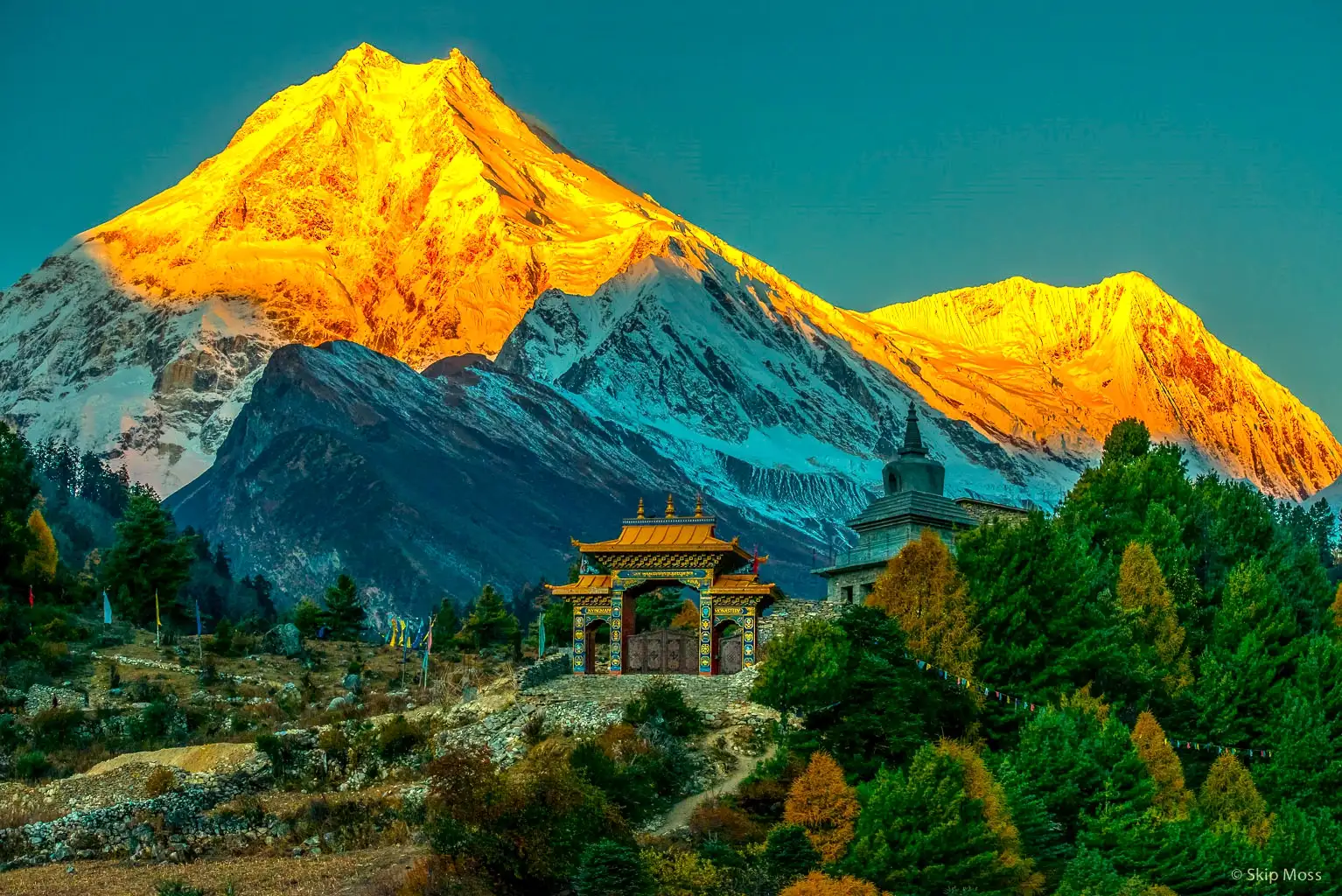
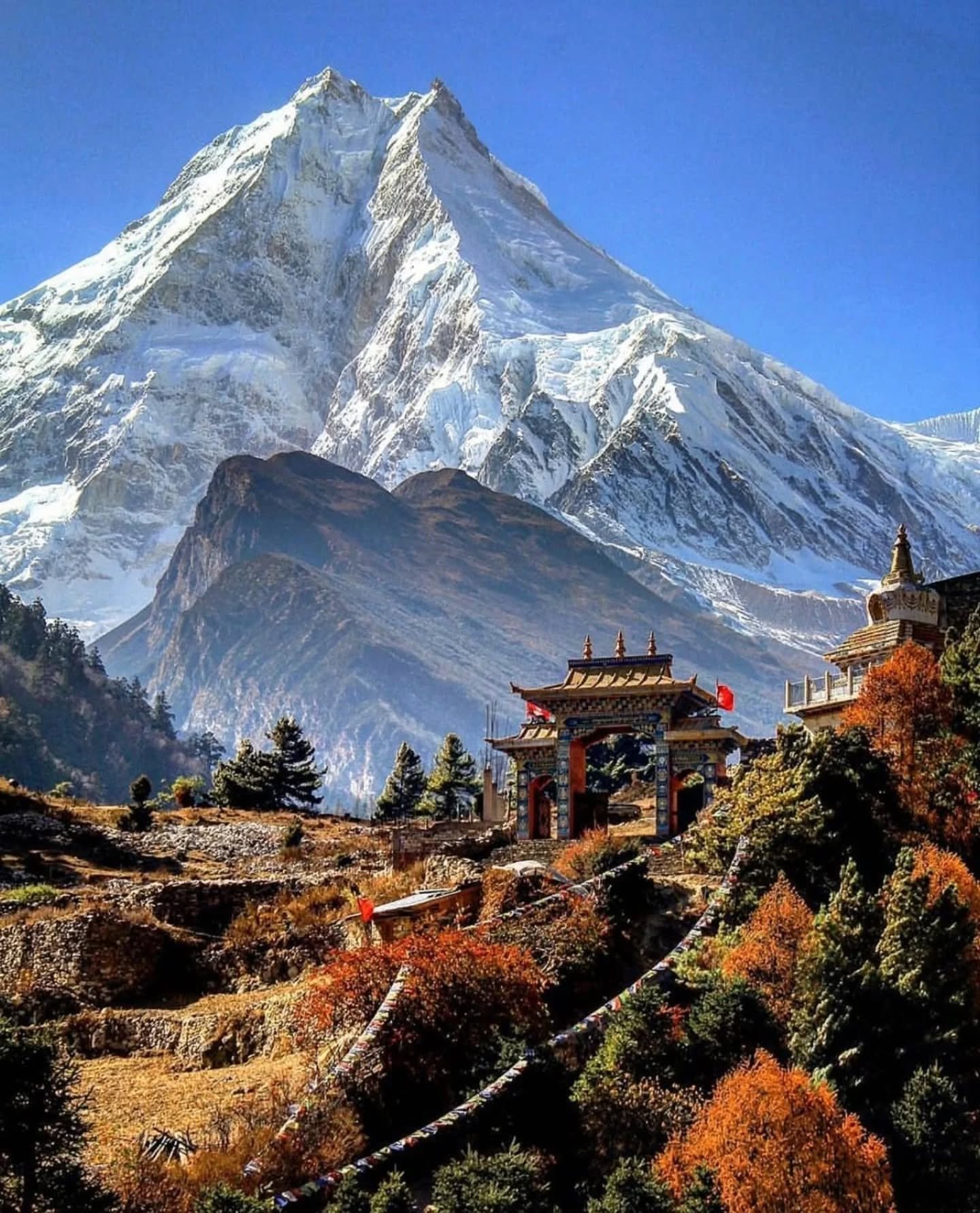
The Manaslu Circuit Trek is one of Nepal’s classic long distance trekking routes. The trail follows the border area between Nepal and Tibet and circles Mount Manaslu, the eighth highest mountain in the world at 8,163 meters. Trekking in this region officially opened in the early 1990s, making it one of the newer trekking routes compared to Everest and Annapurna.

Over the past three decades, the Manaslu Circuit Trek has been gaining steady popularity. Many trekkers now compare it with the Everest Base Camp Trek because both offer high altitude landscapes and long Himalayan journeys. However, Manaslu remains quieter and more remote. This is one of the main reasons experienced trekkers choose this route.

The 13 day Manaslu Circuit Trek starts after a drive from Kathmandu to Machha Khola. From here, the trail follows the Budhi Gandaki River and passes through villages such as Jagat, Deng, Namrung, Samagaon, and Samdo. The route then continues to Dharamsala before crossing the Larkya La Pass at 5,160 meters. After the pass, the trek descends through Bimthang and Dharapani, followed by a jeep drive back to Kathmandu.

This itinerary is designed with safety and acclimatization in mind. Unlike many standard itineraries, this package includes two acclimatization days to help the body adjust to altitude. In total, the journey includes nine trekking days, two acclimatization days, and two days of road travel. This balance makes the trek suitable even for fit first time high altitude trekkers when guided properly.

The Manaslu region lies in west central Nepal and is one of the closest remote trekking areas from Kathmandu. The drive to the trailhead takes around 8 to 10 hours and passes through rural towns, terraced farmland, rivers, and hills. Facilities along the trail are simple, which allows trekkers to experience mountain life in a more natural and traditional way.

If you are looking for a quieter alternative to Everest or Annapurna and want a well planned trek around one of the world’s highest mountains, the 13 day Manaslu Circuit Trek is a strong choice.

Manaslu Circuit Trekking – 13 Days Itinerary Outline

  • Day 01: Drive from Kathmandu to Machha Khola, taking approximately 8–9 hours by road.
  • Day 02: Trek from Machha Khola to Jagat in about 6–7 hours along the Budhi Gandaki River.
  • Day 03: Trek from Jagat to Deng, which takes around 6–7 hours through forested trails and villages.
  • Day 04: Trek from Deng to Namrung in approximately 6–7 hours, entering the upper Manaslu region.
  • Day 05: Trek from Namrung to Lho in about 4–5 hours with clear views of Manaslu.
  • Day 06: Trek from Lho to Sama Gaon, taking around 4–5 hours at a steady pace.
  • Day 07: Acclimatization day at Sama Gaon with an optional 3–4 hour hike to Pungyen Gumba.
  • Day 08: Trek from Sama Gaon to Samdo in approximately 3–4 hours.
  • Day 09: Acclimatization day at Samdo with an optional 4–5 hour hike toward the Tibet border.
  • Day 10: Trek from Samdo to Dharamshala in about 4–5 hours.
  • Day 11: Trek from Dharamshala to Bhimthang via Larkya La Pass, taking around 8–9 hours.
  • Day 12: Trek from Bhimthang to Dharapani in approximately 6–7 hours.
  • Day 13: Drive from Dharapani to Kathmandu, taking around 9–10 hours by road.

Why Book the Manaslu Circuit Trek With Next Trip Nepal?

  • Hassle free trekking experience with all required permits, transport, meals, and accommodation arranged
  • No advance payment required, pay after arrival in Nepal by card, bank transfer, or cash
  • Well planned itinerary designed by experienced local Manaslu trekking guides
  • 24/7 personal support before and during the trek via WhatsApp, email, or phone
  • Licensed guides and trained porters with first aid and altitude safety knowledge
  • Private trek option with flexible pace and additional rest days if needed
  • Carefully selected teahouses with clean rooms and reliable food along the route
  • Strong focus on safety, clear communication, and personal care throughout the journey

How to Book the Manaslu Circuit Trek

1Choose Your Trip. First, choose the Manaslu Circuit Trek package that matches your travel plan, budget, and travel style.
2Check Availability. Go to the Availability section on this trip page. There you can see our departure dates for different months.
3Group Departure or Private Trip. Join one of our group departures, or choose a private trip for more flexibility, personal care, and your own travel date.
4Customize If Needed. Want to change the itinerary, add extra days, upgrade transport or accommodation, or include a porter? Contact us directly.
5Contact Us. Reach us anytime on WhatsApp at +977 9869225929 or email nexttripnepal@gmail.com.
6Book Your Trip. Choose your package and date, then book. No advance payment is required. Confirm first, pay after arrival in Nepal.
7Use the Booking Box. On a laptop or desktop, use the booking box on the right side of this page to book your trip or send us your question.

Manaslu Circuit Trek Highlights

  • Trek around Mount Manaslu (8,163 m), the world’s eighth highest peak, with close mountain views throughout the route.
  • Experience a quieter trekking route compared to Everest and Annapurna, with fewer trekkers and a more remote trail.
  • Walk through forests, rivers, alpine meadows, and terraced farmland while following the Budhi Gandaki River
  • Cross more than 25 suspension bridges, including the well known cantilever bridge at Yarubagar above the river gorge.
  • Visit traditional villages such as Sama Gaon and Samdo, influenced by both Nepalese and Tibetan cultures.
  • Explore important cultural sites, including Pungyen Monastery and other centuries old monasteries along the trail.
  • Take an acclimatization hike to Manaslu Base Camp (4,800 m) and visit Birendra Lake near Sama Gaon. Cross Larkya La Pass (5,160 m), the highest point of the trek, offering wide views of surrounding Himalayan peaks.
  • Enjoy panoramic views of major mountains such as Himlung Himal, Himalchuli, Ganesh Himal, and Annapurna II.
  • Spot Himalayan wildlife like Himalayan tahr, pika, marmots, and diverse birdlife, with rare chances of seeing snow leopard signs.
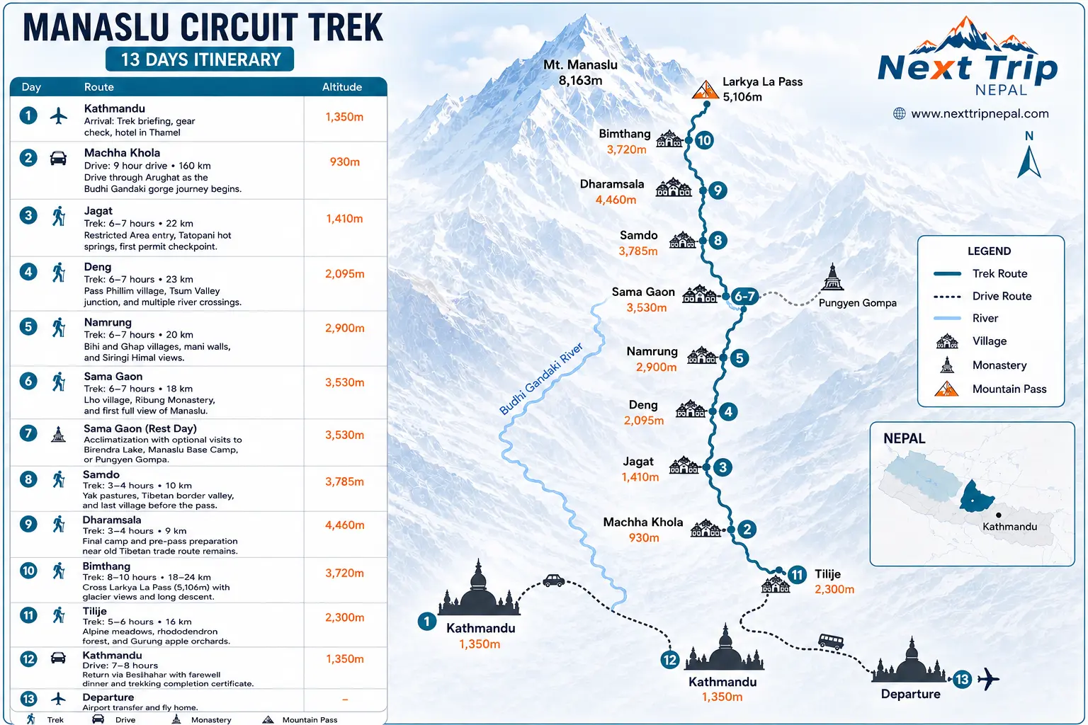
Manaslu Circuit Trek 13 Day Itinerary

  • Day
    01

    Drive from Kathmandu to Machha Khola (900 m) | 160 km | approx. 8 to 9 hours

    The Manaslu Circuit Trek begins with an early morning overland journey from Kathmandu to Machha Khola. After breakfast, your trekking guide meets you at the hotel around 8:00 a.m., and the drive starts toward the trailhead.

    The journey follows the main highway briefly before turning toward the hill districts of Dhading and Gorkha. As the road leaves the valley, the scenery gradually changes to terraced farmland, river valleys, and rural settlements.

    After Besisahar, the drive continues on narrower mountain roads with rough sections as you travel deeper into remote farming areas. Short stops are made along the way to rest, enjoy local tea, and observe village life outside the city.

    By late afternoon, you arrive at Machha Khola, a small riverside settlement with basic trekking lodges. You check into the best available lodge, have time to rest after the long drive, and enjoy dinner before preparing for the first trekking day.

    Day Highlights

    • Scenic drive through the hills of Dhading and Gorkha
    • First views of rural villages, rivers, and terraced farmland
    • Arrival at the Manaslu trekking trailhead in Machha Khola

    9 hour
    Tea House
  • Day
    02

    Trek from Machha Khola to Jagat (1,340 m) via Dovan (1,070 m) | 22 km | approx. 6 to 7 hours

    After breakfast, you begin trekking from Machha Khola, leaving the road behind and following the Budhi Gandaki River upstream. It feels good to start walking after the long drive of the previous day, and the trail quickly settles into a steady rhythm.

    The path passes through scattered farms and small settlements before entering shaded forest sections. Walking along the river on a narrow trail, the route includes gentle climbs and descents. You cross the Tharo Khola and reach Khorla Besi, then continue through a series of ups and downs to Tatopani, known for its natural hot springs, where a short rest is usually taken.

    From Tatopani, the trail climbs over a ridge and crosses a suspension bridge over the Budhi Gandaki River. Beyond this point, the route becomes more structured, with stone-paved steps and clearly defined trekking paths. You continue to Dovan, a small riverside settlement with basic lodges, where lunch is normally taken.

    In the afternoon, the trail crosses another suspension bridge over the Yaru Khola and climbs stone steps to Tharo Bhanjyang. You then pass through traditional Gurung villages surrounded by green forests before following the western bank of the Budhi Gandaki River toward Jagat.

    By late afternoon, you arrive at Jagat, a pleasant village with good lodges and small shops. Jagat is the official entry checkpoint to the restricted Manaslu region, where trekking permits are checked. After checking into the lodge, you have time to rest and enjoy dinner.

    Day Highlights

    • First full day of trekking along the Budhi Gandaki River
    • Multiple suspension bridges and traditional Gurung villages
    • Arrival at Jagat, the official gateway to the Manaslu restricted area

    7 hour
    Breakfast + Lunch + Dinner
    Tea House
  • Day
    03

    Trek from Jagat to Deng (1,860 m) via Philim village | 20 km | approx. 7 to 8 hours

    After breakfast, you begin today’s trek from Jagat on a moderate trail with a mix of gentle uphill and downhill walking. For the first two to two and a half hours, the route follows wider tracks and short road sections, passing through terraced fields, river valleys, and small villages.

    The trail crosses a long rocky ridge before descending to Sirdibas, where the valley gradually opens. Continuing onward, you follow the path toward Ghatta Khola, crossing a suspension bridge before reaching Philim, one of the largest and most important villages in the region. Philim has a school, government offices, and a checkpoint, marking a clear transition deeper into the Manaslu area.

    Beyond Philim, the walk becomes noticeably quieter as you leave the road behind and enter a proper trekking trail. The path passes through cultivated millet fields and the small settlement of Ekle Bhatti. Waterfalls, green hillsides, and a narrow trail carved into the mountainside add to the changing scenery.

    In the afternoon, the trail descends through a narrow gorge before opening onto grassy slopes. Passing through a bamboo forest, you cross the Deng Khola and make the final climb of the day to Deng.

    Deng is a small and peaceful village where you spend the night. From here onward, Tibetan cultural influence becomes more visible in local architecture, lifestyle, and traditions. Mule caravans carrying supplies are common along the trail, and trekkers are advised to step to the inside of the path to allow them to pass safely.

    After reaching the lodge, you have time to rest, enjoy dinner, and prepare for the higher and more remote sections of the Manaslu Circuit Trek ahead.

    Day Highlights

    • Walk through Philim, a key village with schools and government offices
    • Shift from road sections to quieter mountain trekking trails
    • Bamboo forest, waterfalls, and narrow gorge landscapes
    • First clear signs of Tibetan cultural influence and mule caravans

    8 hour
    Breakfast + Lunch + Dinner
    Tea House
  • Day
    04

    Trek from Deng to Namrung (2,660 m) | 19 km | approx. 7 to 8 hours

    After an early morning start, today’s walk from Deng to Namrung becomes more scenic and culturally rich as you move deeper into the Manaslu region. This is a slightly longer trekking day, but the gradual ascent and changing landscapes make the walk enjoyable and steady.

    Shortly after leaving Deng, the trail crosses the Budhi Gandaki River and climbs gradually toward the small settlement of Bihi, surrounded by forest. The path then follows the northwestern side of the valley through dense vegetation and quiet forest trails, passing a few scattered farming villages along the way.

    As the walk continues, clear views of Sringi Himal begin to appear. The trail crosses the Budhi Gandaki several times and passes mani walls, prayer wheels, and small gompas, showing the strong Tibetan Buddhist influence that becomes more noticeable from this point onward.

    A short stop is often made at Bhur village, a good place for tea or coffee with mountain views. After another steady walk of around one and a half hours, you reach Ghap, where lunch is usually taken.

    In the afternoon, the trail continues through the Manaslu Conservation Area, with a quieter and more remote feel. The final section includes a steady uphill climb leading to Namrung, a well-established mountain village where you stay overnight.

    Namrung is known for its comfortable lodges and better food options compared to lower villages. After checking into the lodge, you have time to relax, enjoy dinner, and prepare for the higher altitude sections ahead.

    Day Highlights

    • Gradual transition into stronger Tibetan Buddhist culture
    • Views of Sringi Himal and surrounding mountain landscapes
    • Walk through forested trails and traditional villages
    • Overnight stay in Namrung with improved lodge facilities

    8 hour
    Tea House
  • Day
    05

    Trek from Namrung to Shayala Gaun (3,180 m) | 11 km | approx. 5 to 6 hours

    As you trek from Namrung toward Shyala, the valley gradually opens and the landscape becomes wider and more alpine. This section of the trail is known for its open views and steady walking, making it one of the more visually engaging days of the trek.

    After passing through Lho village, the north face of Mount Manaslu (8,163 m) comes clearly into view for the first time. As the trail continues toward Shyala, the mountain appears closer and more prominent, rising directly above the valley and dominating the surrounding landscape.

    Several other Himalayan peaks are visible along this section. Himal Chuli and Ngadi Chuli (Peak 29) stand nearby, while Baudha Himal and Shiringi Himal add depth to the scenery. On clear days, parts of the Ganesh Himal range can also be seen from sections of the trail.

    Shyala lies in a wide glacial valley and is known for its open setting and uninterrupted mountain views. The village offers a broad panorama of the Manaslu range and surrounding peaks, making it a popular overnight stop for trekkers who want time to enjoy the scenery.

    Shyala has comfortable lodges and a quiet atmosphere. After reaching the village, you have time to rest, explore the area, visit the local monastery, and enjoy the views before dinner.

    Day Highlights

    • First close and clear views of Mount Manaslu
    • Wide glacial valley and open alpine landscapes
    • Panoramic views of Manaslu, Himal Chuli, and Ngadi Chuli
    • Overnight stay in Shyala, one of the best viewpoint villages on the route

    6 hour
    Breakfast + Lunch + Dinner
    Tea House
  • Day
    06

    Trek from Shayala Gaun to Sama Gaun (3,500 m) | 5 km | approx. 1.5 to 2 hours

    After breakfast, the trek from Shyala to Sama Gaun is a short and relaxed walk, making it one of the easier days on the Manaslu Circuit. The trail has minimal elevation change and usually takes around one and a half hours, leaving plenty of time to enjoy the surroundings and settle comfortably into the village.

    The path follows an open valley with wide mountain views, passing yak pastures, mani walls, and traditional stone houses as you approach Sama Gaun. With the short walking time, this day is well suited for rest, photography, and gentle acclimatization.

    For trekkers who prefer a longer and more active walk, an optional hike via Pungyen Gompa is available. This route takes around four hours and offers close views of Mount Manaslu, surrounding glaciers, and high alpine terrain. It is a good option for those feeling strong and well acclimatized.

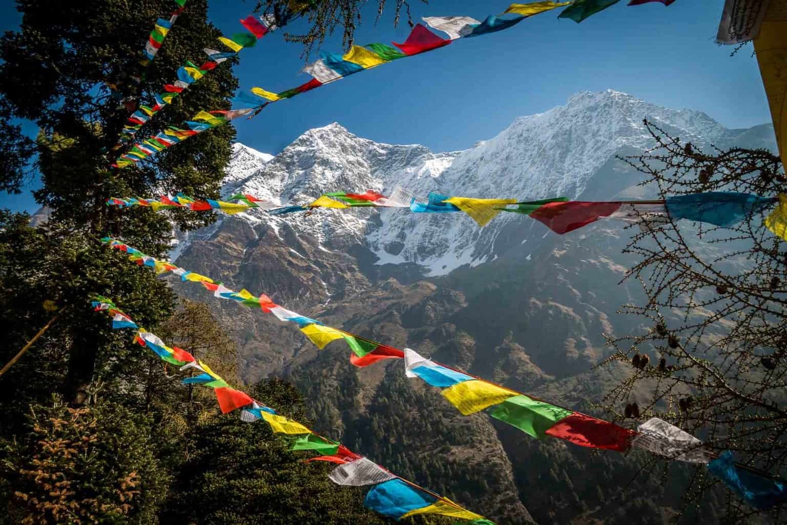
    Sama Gaun is one of the main villages in the Manaslu region and sits below the Manaslu Glacier. The village has comfortable lodges, small cafés, and bakeries, making it one of the most pleasant places to stay on the trek. Tibetan influenced culture is clearly visible through monasteries, prayer flags, mani walls, and daily village life.

    You spend the night in Sama Gaun, enjoying the peaceful atmosphere and preparing for the higher altitude days ahead.

    Day Highlights

    • Short and easy walk with wide valley and mountain views
    • Optional hike to Pungyen Gompa with close glacier scenery
    • Arrival at Sama Gaun, a key village beneath the Manaslu Glacier
    • Comfortable lodges and strong Tibetan cultural presence

    2 hour
    Breakfast + Lunch + Dinner
    Tea House
  • Day
    07

    Acclimatization day at Sama Gaun with optional short hikes | 5 to 10 km | approx. 3 to 4 hours

    Today is a rest and acclimatization day in Sama Gaun, an ideal location to help your body adjust to the altitude before heading toward the highest point of the trek, Larkya La Pass. Taking this day seriously is important for a safe and comfortable Manaslu Circuit Trek.

    Sama Gaun is a traditional mountain village with strong Tibetan influenced culture. You can spend time walking around the village, visiting local monasteries, observing daily life, or relaxing at cafés. It is also a good place to check gear, do light stretching, and recover energy.

    Several optional hikes are available today, and your guide will help you choose based on your fitness and acclimatization:

    • Pungyen Gompa hike: Around 4 to 5 hours round trip, offering close views of the Manaslu Glacier and surrounding peaks
    • Manaslu Base Camp hike: Around 7 to 8 hours round trip, physically demanding and suitable for strong trekkers only
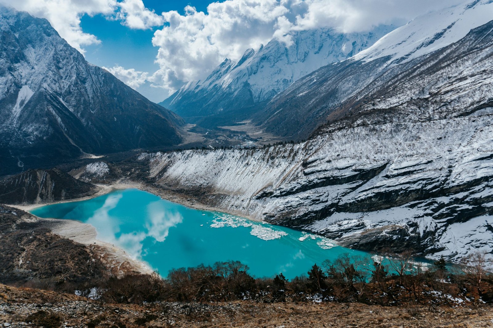
    • Birendra Lake hike: An easy option taking about 1.5 to 3 hours round trip, ideal for light movement and recovery

    Day Highlights

    • Acclimatization day at Sama Gaun, an ideal altitude for safe adjustment before Larkya La Pass
    • Optional hike to Birendra Lake, an easy and relaxing walk with views of Manaslu Glacier
    • Optional hike to Manaslu Base Camp, a challenging but rewarding day trip for strong trekkers
    • Optional hike to Pungyen Gompa, offering close views of glaciers and a quiet alpine setting
    • Time to enjoy good coffee and rest at local cafés in Sama Gaun, including popular mountain cafés

    4 hour
    Breakfast + Lunch + Dinner
    Tea House
  • Day
    08

    Trek from Sama Gaun to Samdo (3,875 m) | 8 km | approx. 2 to 3 hours

    After a peaceful morning in Sama Gaun, the trek begins with a gentle descent toward the Budhi Gandaki River. The trail crosses a small bridge and passes long mani walls and Buddhist monuments, creating a calm and spiritual start to the day.

    After about an hour of walking, the valley opens wider and the trail becomes broad and comfortable. This section is one of the most pleasant walks of the trek, with open terrain and steady gradients. Yaks are often seen grazing in the fields, and with some luck, you may spot blue sheep on the surrounding hillsides or mountain birds circling above.

    As you continue toward Samdo, the trail offers continuous views of snow-covered peaks. Along the way, you will see local villagers collecting grass, firewood, and yak dung, which is traditionally used as fuel in this high-altitude region, offering insight into daily mountain life.

    A short final climb brings you to Samdo, the last permanent settlement in the Manaslu region. The village sits on a high plateau near the Nepal–Tibet border and lies on the historic trade route toward Manang via Larkya La Pass.

    After reaching Samdo, you have time to rest, walk around the village, and enjoy the quiet high Himalayan surroundings before the higher altitude days ahead.

    Day Highlights

    • Easy and scenic walk with wide valley views
    • Mani walls and Buddhist monuments along the trail
    • Chances to see yaks, blue sheep, and mountain birdlife
    • Arrival at Samdo, the last village before the high mountain pass

    3 hour
    Breakfast + Lunch + Dinner
    Tea House
  • Day
    09

    Trek from Samdo to Dharamsala (4,450 m) | 7 km | approx. 3 to 4 hours

    After breakfast, you begin a short morning walk from Samdo to Dharamsala, the final settlement before crossing Larkya La Pass (5,106 m). Although the distance is not long and the walk usually takes around three hours, the high altitude makes the pace slower and more demanding.

    The trail follows the edge of the valley and gradually descends to a wide riverbed, crossing small streams along the way. As you continue, the landscape becomes more open and rugged, with clear views of surrounding peaks and glaciers flowing down from the Larkya Pass area.

    Dharamsala is a small and basic stop with limited teahouses that serve as the last overnight point before the pass crossing. During peak seasons, accommodation here can be crowded, and some trekkers may stay in simple dorm rooms or tented shelters arranged by the lodge. Meals are taken together in a shared dining area.

    The afternoon is spent resting, hydrating, and preparing for the next day’s early start. Your guide will brief you on the pass crossing, weather conditions, and safety measures. Walking slowly and conserving energy is important at this altitude.

    You spend the night at Dharamsala, ready for the most challenging and rewarding day of the Manaslu Circuit Trek.

    Day Highlights

    • Short but important high altitude walk toward Larkya La Pass
    • Open alpine terrain with glacier and mountain views
    • Overnight stay at Dharamsala, the final stop before the pass
    • Preparation and rest for the Larkya La crossing day

    4 hour
    Breakfast + Lunch + Dinner
    Tea House
  • Day
    10

    Trek from Dharamsala to Bimthang (3,590 m) via Larkya La Pass (5,106 m) | 24 km | approx. 8 to 9 hours

    Today is the most demanding day of the Manaslu Circuit Trek. You wake up very early, usually around 3:00 a.m., have a light breakfast, and begin walking in the dark with your headlamp, following your guide toward Larkya La Pass (5,160 m). An early start is essential to cross the pass safely before afternoon winds and changing weather conditions.

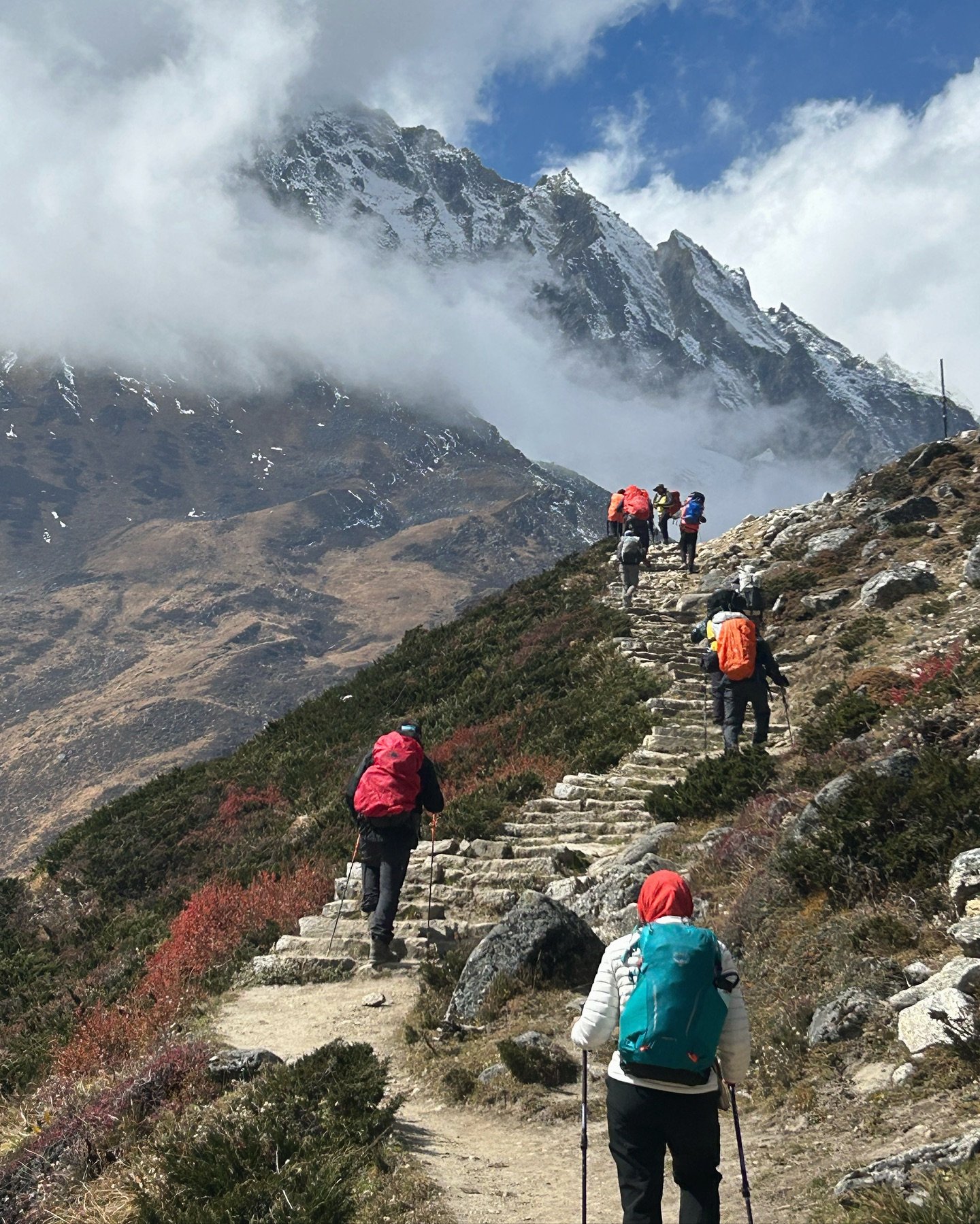
    Leaving Dharamsala behind, the trail climbs gradually across rocky moraine, glacial terrain, and uneven paths. The ascent is long and physically demanding, but with a slow and steady pace and regular short breaks, the climb is manageable. In cold, windy, or snowy conditions, careful footing and guidance are especially important.

    After several hours of ascent, you reach the top of Larkya La Pass, marked by prayer flags, stone cairns, and an altitude signboard. From the pass, wide mountain views open in every direction. Peaks such as Himlung Himal, Cheo Himal, Kang Guru, and Annapurna II, III, and IV dominate the horizon. On clear days, the views extend toward the Ganesh Himal range.

    After a short rest at the pass, the trail begins a long descent. You pass Cheo Danda and small yak herder settlements before reaching the area around Pongkar Tal, a beautiful high altitude lake set between the Pongkar and Salpu Danda glaciers. The scenery here feels stark and remote, with glaciers and ice fields nearby.

    As you descend further on the western side of the pass, the landscape changes noticeably. You enter the Manang district and gradually return to forests of rhododendron, pine, and oak. The walking becomes easier as you approach Bimthang, a scenic settlement located in a wide grassy valley surrounded by forest and mountains.

    Bimthang offers some of the most comfortable lodges on the Manaslu Circuit. After a long day, you can rest, enjoy a warm meal, and relax with tea or coffee while reflecting on the successful crossing of the pass.

    You spend the night in Bimthang, resting and recovering after completing the highest and most challenging section of the trek.

    Day Highlights

    • Early morning ascent to Larkya La Pass (5,160 m), the highest point of the trek
    • Panoramic views of Himlung Himal, Cheo Himal, Kang Guru, and Annapurna II, III, and IV
    • Descent past glaciers and Pongkar Tal into changing landscapes
    • Comfortable overnight stay in Bimthang after a demanding day

    9 hour
    Breakfast + Lunch + Dinner
    Tea House
  • Day
    11

    Trek from Bimthang to Tilije (2,535 m) | 13 km | approx. 4 to 5 hours

    After breakfast, you begin the descent from Bimthang to Tilije, walking through a noticeably different landscape as you now see the mountains from the opposite side of the Manaslu range. The views change throughout the day, offering new perspectives of the peaks crossed during the Larkya La Pass.

    The trail descends through forests of rhododendron and juniper, creating a calm and refreshing walking environment. During spring, this section is especially pleasant when rhododendron forests are in bloom. After the high alpine terrain of the previous day, the lower altitude and forested trails feel comfortable and relaxed.

    As you continue downhill, the surroundings become greener, with small streams, wooden bridges, and open meadows along the route. The walking is mostly downhill and steady, allowing time for short breaks and enjoying the scenery.

    Gradually, the trail enters the Marsyangdi Valley, where the climate becomes warmer and villages appear more settled. By afternoon, you reach Tilije, a traditional village with stone houses, cultivated fields, and a peaceful atmosphere.

    Tilije offers comfortable lodges and is a pleasant place to rest, marking a smooth transition from the remote Manaslu region toward the Annapurna area.

    Day Highlights

    • Descending from high alpine terrain into forested landscapes
    • Rhododendron and juniper forests with greener surroundings
    • Entry into the Marsyangdi Valley and warmer climate
    • Overnight stay in Tilije, a traditional mountain village

    5 hour
    Breakfast + Lunch + Dinner
    Tea House
  • Day
    12

    Jeep drive from Tilije to Besisahar (760 m) via Dharapani (1,860 m) | approx. 45 km | approx. 5 hours

    After breakfast, you take a jeep drive from Tilije to Besisahar via Dharapani. The drive follows the Marsyangdi Valley, passing through settled villages, terraced fields, and river valleys as the landscape gradually becomes greener and warmer.

    The road includes both rough mountain sections and smoother tracks, offering views of hills, rivers, and local village life along the way. This drive marks the end of the remote trekking section and a return to easier travel conditions.

    By afternoon, you arrive in Besisahar at 760 meters, where you can relax after completing the Manaslu Circuit Trek and prepare for the final return journey.

    Day Highlights

    • Scenic jeep drive through the Marsyangdi Valley
    • Views of villages, rivers, and terraced farmland along the route
    • Passing through Dharapani, the meeting point of Manaslu and Annapurna trails
    • Arrival at Besisahar, marking the end of the trekking section

    Breakfast + Lunch + Dinner
    Tea House
  • Day
    13

    Drive from Besisahar to Kathmandu (1,320 m) | 175 km | approx. 6 to 7 hours

    After breakfast, you begin the jeep drive from Besisahar back to Kathmandu, enjoying the final journey through river valleys, rolling hills, and rural countryside. As the road follows the Marsyangdi and Trishuli river corridors, the scenery gradually changes from mountain terrain to lowland landscapes.

    By afternoon, you arrive in Kathmandu and are transferred to your hotel. You have time to freshen up, rest, or take a short walk around the city after the long drive.

    In the evening, Next Trip Nepal invites you to a farewell dinner to mark the successful completion of the Manaslu Circuit Trek. This is a relaxed opportunity to reflect on the journey, share experiences with your guide and trekking team, and celebrate the achievement together.

    During the dinner, you receive a trek achievement certificate as a small recognition of completing one of Nepal’s most rewarding long-distance treks. After the dinner, you return to your hotel for the night.

    Day Highlights

    • Scenic drive from the mountains back to Kathmandu
    • Comfortable hotel transfer and time to rest
    • Farewell dinner hosted by Next Trip Nepal
    • Trek achievement certificate and journey reflection

    8 hour
    Breakfast + Lunch + Dinner

Cost Includes

  • Airport pickup and drop-off by private vehicle
  • Ground transportation as per itinerary using comfortable local transportation, including:
  • Bus from Kathmandu to Machha Khola
  • Shared jeep from Tilije to Besisahar
  • Tourist bus from Besisahar to Kathmandu
  • Twin-sharing accommodation in the best available teahouses during the trek
  • All required trekking permits and fees, including Restricted Area Permit, Manaslu Conservation Area Permit, and Annapurna Conservation Area Permit
  • Full board meals during the trek, including breakfast, lunch, and dinner, with tea or coffee served with breakfast
  • Experienced, friendly English-speaking trekking guide
  • One porter to carry luggage (up to 20–22 kg total)
  • All expenses of the guide and porter, including salary, meals, accommodation, transportation, and insurance
  • Sleeping bag, down jacket, and duffle bag provided if required (to be returned after the trek)
  • Seasonal fresh fruits served after dinner during the trek
  • Well-equipped first aid kit and oximeter for altitude monitoring
  • Farewell dinner on the last night in Kathmandu
  • Trek completion certificate as a lifetime memory
  • All government taxes, VAT, and service charges

Cost Excludes

  • Nepal entry visa fee (easily obtainable on arrival at Tribhuvan International Airport, Kathmandu)
  • Travel insurance (compulsory and must cover high altitude trekking and emergency evacuation)
  • Personal expenses including bottled drinking water, hot and cold drinks, and bar bills
  • Laundry, telephone calls, hot showers, and internet or Wi Fi charges during the trek
  • Tips for the guide, porter

13 Day Manaslu Circuit Trek Map

13 Day Manaslu Circuit Trek Map by Next Trip Nepal

Best Time to Trek Manaslu

Best Time to Trek the Manaslu Circuit

The Manaslu Circuit has two main trekking seasons: spring (March to May) and autumn (September to November). Both seasons give you dry trails and a crossable Larkya La Pass (5,106 m), but they differ in temperature, visibility, and trail conditions. Outside these two windows, the Manaslu Circuit becomes significantly harder: monsoon brings landslides and trail damage between June and August, and winter closes most teahouses above Namrung from December to February.

Season Comparison Table

SeasonMonthsTrail ConditionsLarkya La PassRecommended
SpringMarch to MayWarm days, rhododendrons in bloom below 3,500 m, some afternoon cloud from late AprilSnow reducing from March; clear by late AprilYes
MonsoonJune to AugustHeavy rain, leeches below 2,500 m, risk of landslides and trail closuresPassable but dangerous in heavy snowfall yearsNo
AutumnSept to NovemberClearest skies of the year, stable weather, October is peak season at SamagaunBest conditions October to mid-NovemberYes — best month is October
WinterDecember to FebruaryVery cold, most teahouses above Namrung closed, few other trekkersDeep snow, technically demanding, risk of whiteoutExperienced only

Spring Trekking (March to May)

March starts cold at altitude but temperatures warm quickly. By mid-March the Larkya La Pass is crossable with crampons on the steeper sections. April is widely considered the best spring month: daytime temperatures at Samagaun (3,530 m) reach 10 to 15°C, nights drop to -5 to -10°C, and the pass is clear on most mornings. Rhododendron forests between 2,500 m and 3,500 m are in full flower through April. May brings warmer temperatures but also more afternoon cloud and some pre-monsoon precipitation, which can affect pass visibility by mid-afternoon. Start the Larkya La crossing by 4:00 AM in May to clear the summit before cloud builds.

Autumn Trekking (September to November)

October is the best single month for the Manaslu Circuit. The monsoon ends in mid-September and the sky clears quickly. Visibility from the Larkya La Pass in October is outstanding, with views of Manaslu (8,163 m), Himlung Himal (7,126 m), Cheo Himal (6,820 m), and Annapurna II (7,937 m) on clear mornings. Temperatures at Samagaun in October average 8 to 12°C daytime and -8 to -12°C at night. November stays clear but colder, and some higher teahouses begin to close after mid-November. September is possible but the trail can be muddy and leeches remain active below 2,500 m in the first two weeks.

Temperature Guide by Altitude Zone

Location / AltitudeAutumn Day (Oct)Autumn Night (Oct)Spring Day (Apr)Spring Night (Apr)
Machha Khola (900 m)28 to 32°C15 to 18°C25 to 30°C14 to 17°C
Namrung (2,630 m)15 to 20°C2 to 5°C14 to 18°C2 to 4°C
Samagaun (3,530 m)8 to 13°C-8 to -12°C10 to 15°C-5 to -10°C
Dharmashala (4,460 m)2 to 5°C-15 to -18°C3 to 7°C-12 to -15°C
Larkya La Pass (5,106 m)-5 to 0°C (wind chill -20°C)-8 to -2°C

Permits & Costs 2026

Manaslu Circuit Trek Permits and Costs 2026

The Manaslu Circuit Trek requires more permits than any other trek in Nepal. Because the route passes through a restricted conservation area bordering Tibet, all trekkers must hold valid permits before entering. Permits cannot be obtained at trailheads — they must be arranged in Kathmandu before the trek begins.

Required Permits

1. Restricted Area Permit (RAP)

The Manaslu Conservation Area is a government-designated restricted zone. This is the most important and expensive permit for the trek.

  • Autumn (September–November): USD 100 per person per week
  • All other seasons: USD 75 per person per week
  • Minimum group requirement: 2 trekkers (solo trekking is not permitted)
  • A licensed trekking guide is mandatory to obtain this permit
  • Issued by: Nepal Tourism Board (Bhrikuti Mandap, Kathmandu)

2. Manaslu Conservation Area Permit (MCAP)

  • Cost: NPR 3,000 per person (approximately USD 22)
  • Covers the entire Manaslu Conservation Area
  • Available at the Nepal Tourism Board office in Kathmandu

3. Annapurna Conservation Area Permit (ACAP)

Required for the final section of the trek connecting to the Annapurna region (if completing the full circuit via Dharapani).

  • Cost: NPR 3,000 per person (approximately USD 22)
  • Available at the ACAP office in Kathmandu or Besisahar

4. Chum Nubri Rural Municipality Entry Fee

  • Cost: NPR 1,000 per person (approximately USD 7.50)
  • Collected at checkpoints along the upper trail

Important Rules

  • Minimum 2 trekkers required — no solo trekking allowed
  • A licensed, registered guide is mandatory (not just a porter)
  • Carry all permits at all times — there are multiple checkpoints
  • Permits are checked at Jagat, Samagaon, Samdo, and Dharmasala

Estimated Permit Costs (14-Day Trek, Autumn)

PermitCost (Per Person)Currency
Restricted Area Permit (2 weeks)USD 200USD
Manaslu Conservation Area PermitNPR 3,000NPR (~USD 22)
Annapurna Conservation Area PermitNPR 3,000NPR (~USD 22)
Chum Nubri Municipal FeeNPR 1,000NPR (~USD 7.50)
Total Approximate~USD 250 per person (Autumn)

Note: Permit fees are set by the Nepal government and subject to change. Contact Next Trip Nepal for the latest updated fees before your trek.

Frequently Asked Questions (FAQs)

How difficult is the Manaslu Circuit Trek?

The Manaslu Circuit Trek is considered moderately challenging. It involves long walking days, changing terrain, and high altitude, with the highest point at Larkya La Pass (5,160 m). Good fitness and some prior trekking experience are recommended.

Do I need a guide for the Manaslu Circuit Trek?

Yes. The Manaslu region is a restricted area, and trekking without a licensed guide is not allowed. You must trek with a registered trekking agency and an authorized guide.

What permits are required for the Manaslu Circuit Trek?

You need three permits: the Manaslu Restricted Area Permit (RAP), Manaslu Conservation Area Permit (MCAP), and Annapurna Conservation Area Permit (ACAP). These permits are arranged by Next Trip Nepal.

What is the best time to do the Manaslu Circuit Trek?

The best seasons for the Manaslu Circuit Trek are spring (March to May) and autumn (September to November). These periods offer stable weather, good trail conditions, and clear mountain views. They also avoid the heavy rain of the monsoon and the deep snow of winter, which can block high passes.

Spring (March to May)

Spring is a popular time for the Manaslu Circuit Trek, especially for those who enjoy warmer days and blooming landscapes.

Pros

  • Rhododendron forests and wildflowers in bloom
  • Gradually warming temperatures
  • Clear mornings with good mountain visibility
  • Teahouses fully open along the route

Cons

  • Popular season, especially in April and May
  • Trails and lodges can be busier

Autumn (September to November)

Autumn is considered the most stable season for trekking in the Manaslu region.

Pros

  • Dry and stable weather
  • Excellent visibility of high Himalayan peaks
  • Clear trails after the monsoon
  • Cultural festivals such as Dashain and Tihar

Cons

  • Peak trekking season with more visitors
  • Advance booking recommended for permits and lodges

Off-Season Trekking

Winter (December to February)
Winter brings cold temperatures and snowfall. Trails are quiet, but Larkya La Pass may be blocked by snow, making the trek more challenging and suitable only for experienced trekkers.

Monsoon (June to August)
The monsoon season brings heavy rain, muddy trails, and difficult road conditions. However, the landscape is lush and green, with strong rivers and waterfalls. Trekking during this time is generally not recommended.

How high is Larkya La Pass?

Larkya La Pass is 5,160 meters above sea level and is the highest point of the Manaslu Circuit Trek.

Is altitude sickness a concern on this trek?

Yes, altitude sickness can be a risk due to the high elevation. The itinerary includes acclimatization days at Sama Gaun and Samdo to help your body adjust safely.

What kind of accommodation is available during the trek?

Accommodation is in local teahouses and lodges. Rooms are simple but comfortable, usually with twin beds. Facilities become more basic at higher altitudes.

What meals are provided during the Manaslu Circuit Trek?

Meals are taken at local teahouses along the Manaslu Circuit. Food is simple, freshly prepared, and designed to give enough energy for long trekking days. As altitude increases, menu choices become more limited, but hot meals are available in every village.

Typical Meals You Can Expect

Local Nepali Food

  • Dal Bhat (rice, lentil soup, seasonal vegetables, and pickles) – the most common and filling meal
  • Tibetan style bread, chapati, and rice dishes
  • Vegetable curries and local potatoes

International and Simple Trekking Food

  • Fried rice, noodles, and pasta
  • Vegetable soups and garlic soup (popular at higher altitude)
  • Pancakes, porridge, and eggs for breakfast

Drinks

  • Tea (black tea, milk tea, ginger tea, lemon tea)
  • Instant coffee and local style milk coffee
  • Hot chocolate and soup drinks in colder areas

Can beginners do the Manaslu Circuit Trek?

Fit beginners with good preparation can complete the trek, especially with a well planned itinerary and proper acclimatization. Prior hiking experience is helpful but not mandatory.

How long does the Manaslu Circuit Trek take?

The standard Manaslu Circuit Trek usually takes 11 to 15 days, depending on the itinerary, acclimatization days, and starting and ending points.

What happens if someone gets sick or injured during the trek?

If a trekker feels unwell, the guide first manages the situation on the trail using rest, hydration, and basic first aid. If symptoms do not improve, the trek plan is adjusted or descent is arranged. Safety always comes first.

Is helicopter rescue available on the Manaslu Circuit Trek?

Yes. Helicopter rescue is available in emergency situations such as severe altitude sickness or injury. Rescue depends on weather conditions and visibility.

Is travel insurance mandatory for this trek?

Yes. Travel insurance is mandatory and must cover high-altitude trekking and emergency helicopter evacuation up to at least 5,500 meters.

How do guides communicate during emergencies?

Licensed guides carry mobile phones and stay in contact where network is available. In remote areas, coordination is done through nearby villages and emergency services.

Is the Manaslu Circuit Trek safe?

Yes, when done with a licensed guide and proper acclimatization. The route is well established, but it is remote, so good planning, fitness, and following guide instructions are important.

Can the itinerary be changed if needed?

Yes. The itinerary can be adjusted due to weather, health conditions, or trail situations. Guides make decisions based on safety and group condition.

Can I add a side trek during the Manaslu Circuit Trek?

Yes, there are a few worthwhile side trips along the Manaslu Circuit, and one of the best is the Serang Gompa. This monastery sits in a quiet part of the Nubri Valley and offers a more cultural and less crowded experience compared to the main trail.

If you have extra time, you can extend your itinerary to include the Serang Gompa Trek, which adds a few days to the standard circuit and gives deeper insight into local Tibetan-influenced culture.