
Authentic 21 Days Everest Base Camp Trek via Jiri 2026: Hillary’s Original Route | Next Trip Nepal

21 Days

Authentic Everest Base Camp Trek via Jiri — 21 Days on Hillary's Original Route (2026)

Trek the original 1953 expedition route from Jiri to Everest Base Camp. Superior acclimatisation. Empty trails. The complete Khumbu experience walked by Hillary and Tenzing before the Lukla airstrip existed.

Trek at a Glance

Route: Jiri to Everest Base Camp Duration: 21 Days Max Altitude: 5,550m (Kala Patthar) Difficulty: Strenuous Best Season: Mar to May / Sep to Nov Price from: $1,449 Includes: Private Guide + Porter Permits: SNP + TIMS included

The Jiri Route vs the Standard Lukla Route: Why 21 Days Is the Better Trek

Most people who come to us asking about Everest Base Camp have already looked at the standard 14-day itinerary from Lukla. They ask: why would anyone want to spend an extra week walking through the hills when you can fly to 2,860 metres and be on the main trail the same afternoon? Here is what we tell them, honestly and from direct experience on this route.

Acclimatisation

The single most important advantage of starting from Jiri is what happens to your body in the first six to eight days. From Jiri at 1,905 metres, you walk east through a series of passes and valleys, gaining altitude gradually each day and losing some of it on descents, then gaining it again. By the time you reach Namche Bazaar at 3,440 metres on Day 9 of this trek, your body has had a full week to adapt through daily ascents rarely exceeding 700 to 800 metres. Doctors who work at the Himalayan Rescue Association clinic in Pheriche consistently observe that AMS rates among trekkers arriving via Jiri are measurably lower than among those who jump from Kathmandu at 1,400 metres to Lukla at 2,860 metres in a 30-minute flight. The Lukla jump is a 1,460-metre altitude gain in under an hour. For a human body, that is a provocation. The Jiri approach is a preparation.

Historical Significance

Jiri was the trailhead for every Everest expedition from 1953 until the Lukla airstrip opened in 1965. The road from Kathmandu to Jiri did not exist then either — pre-1984 expeditions walked from Kathmandu itself. But Jiri remained the standard approach for a decade after Lukla opened, simply because the airstrip was often closed and supplies could not depend on mountain aviation. Edmund Hillary walked this route. Tenzing Norgay walked it. Eric Shipton and Bill Tilman used the Solu Khumbu approach on their 1951 Everest reconnaissance. The expedition diaries of John Hunt, Charles Evans, and George Lowe describe these hills and these passes in the same terms we would use today. When you cross Lamjura Pass at 3,530 metres and look east toward Everest's summit on a clear morning, you are looking at what those men saw from that same ridge. That is not a small thing.

Trail Solitude

The Jiri to Phakding section carries fewer than 300 foreign trekkers per year. The Lukla to EBC route handles approximately 50,000. On most days of the Jiri section, your group will walk for 5 to 7 hours without encountering another trekking party. Teahouse owners know each guide by name. You eat the food the family is eating themselves. There are no menus printed in five languages. This is not nostalgia — it is simply what trekking was like before mountain aviation changed the economics of Himalayan tourism entirely.

Middle Hills Cultural Experience

The Solu region between Jiri and Namche is home to Rai and Sherpa communities who live almost entirely outside the trekking economy. Weekly markets at Salleri and Nunthala operate for the local population — produce, livestock, hardware, textiles. Schools are ordinary village schools, not the Hillary Foundation institutions of the Khumbu. Gompa are active community monasteries, not tourist sites. Thupten Chholing Monastery near Junbesi is one of the most important Nyingma Buddhist monasteries in Nepal, housing several hundred monks and nuns, with a prayer hall and accommodation buildings that form a small monastic village of their own. Most trekkers on the Lukla route never know it exists.

Physical Preparation Built Into the Route

The six passes of the Jiri section — Deurali (2,705m), Sete (2,575m), Lamjura (3,530m), Taksindu La (3,071m), Surki La (2,293m), and the sustained approach to Namche — build exactly the leg strength and cardiovascular capacity you need for the Khumbu section. Trekkers who reach Namche via Jiri consistently tell us that the high altitude section from Namche to Base Camp felt physically easier than they expected. That is the Jiri preparation working.

Honest Physical Cost

Days 3 to 8 of this trek involve 5 to 8 hours of walking daily with 800 to 1,200 metres of elevation change. The Jiri section is not hard because of altitude — none of those days go above 3,530 metres. It is hard because of the sustained up-and-over topography where you climb a full pass, descend to a river valley, and climb another pass the same afternoon. If you have done multi-day hiking with a daypack before, you can handle this. If you have not, you need 6 to 8 weeks of serious preparation — running, stair climbing, weekend hikes — before arrival. We will not tell you otherwise.

Jiri Route vs Standard Lukla Route: Direct Comparison

Factor Standard 14-Day EBC (Lukla) This 21-Day Route (Jiri) Why It Matters
Acclimatisation Kathmandu to Lukla (2,860m) in 30 min flight — rapid gain 7 days gradual gain from 1,905m to 3,440m on foot Lower AMS risk; body adapts at the physiologically recommended rate
Trail crowds ~50,000 trekkers per season on Lukla route <300 trekkers on Jiri section annually Days of solitary trail; teahouses with space and authentic village interaction
Physical challenge Moderate; altitude is the main challenge Strenuous; six passes + full Khumbu section Requires serious preparation; rewards with superior fitness on the Khumbu approach
Price From $1,250 (Lukla flights included) From $1,449 (return Lukla flight + Jiri drive included) 7 additional days, extra passes, deeper experience — the per-day cost is lower on the 21-day route

Permits and Costs: Full Breakdown

All permits are included in the package price. Here is exactly what you are paying for:

What to Expect: The Jiri to Namche Section Day by Day

The first eight days of this trek are unlike any section of the Lukla route. Here is what each stage actually involves, from our guides who have walked it dozens of times.

Day 2 — Drive Kathmandu to Jiri

Seven hours by private vehicle on the Lamosangu and Solu highways, climbing from the Kathmandu Valley floor through increasingly remote hill country. Jiri (1,905m) is the end of the paved road in this direction. The market town has pharmacies, a bank, and the last reliable source of gear and food before the trek begins. The drive itself is a transition — by the time you reach Jiri in the afternoon, you are already in a different Nepal from Thamel.

Days 3 to 4 — Jiri to Sete via Deurali

The trail climbs immediately from Jiri through terraced fields of millet and corn and into mixed oak and rhododendron forest. Almost no other trekkers. The villages of Thodung and Mali are Jirel communities — a small ethnic group related to both Tamang and Tibetan, found almost exclusively in this single valley. Deurali at 2,705 metres is a small pass village with basic teahouses. The second day drops steeply to the Khimti Khola river at 1,480 metres and climbs again to Sete — the up-and-over pattern that defines the entire Jiri section, and the reason your legs need to be ready before you arrive.

Day 5 — Sete to Junbesi via Lamjura Pass (3,530m)

The most dramatic day of the Jiri section. Lamjura is the highest point before Namche and the first crossing above 3,000 metres. Snow is possible on the pass from October to April. The forest below the pass is some of the finest rhododendron and fir forest in Nepal — in March and April, the rhododendron flowering on the approach to Lamjura rivals anything in the Annapurna region. From the summit, the view opens east toward Numbur at 6,957 metres, and on a completely clear morning you can identify Everest's summit above the intermediate ridges. Junbesi at 2,675 metres below the pass is a large, prosperous Sherpa village with a remarkable sense of its own history — the Thupten Chholing Monastery, 30 minutes walk above the village, was founded 500 years ago and is one of the most significant Nyingma establishments in the Himalayan region.

Days 6 to 7 — Junbesi to Bupsa via Taksindu and Surki La

These two stages mark the transition from the Solu to the Khumbu. Taksindu La at 3,071 metres gives views toward the Khumbu peaks and the Taksindu Monastery below it is one of the finest in the Solu region. Surki La is the last major pass of the Jiri section. From this point the trail enters the valley of the Dudh Koshi — the same river that runs through Namche and below the Khumbu Glacier. You are entering Sherpa territory, and the shift in culture and architecture is immediate.

Day 8 — Bupsa to Phakding: Bypassing Lukla

This is the day that makes the Jiri route geographically distinct. The trail from Bupsa descends to Chaurikharka and Phakding without going through Lukla at all. Lukla's airstrip is visible on the hillside above — you can see the planes landing and taking off — but the trail stays low and drops into Phakding on the standard Namche trail. At Phakding, trekkers who flew from Lukla that morning join the path. You will immediately notice the difference in trail density. We have been here dozens of times and it always produces the same reaction from our Jiri clients: they feel the weight of the crowds and wonder how the other trekkers could possibly be ready for what is coming, altitude-wise, after one afternoon at 2,860 metres.

Day 9 — Phakding to Namche Bazaar (3,440m)

The standard second day of the Lukla route, now your ninth day of walking. Hillary Bridge and the suspension bridges below Jorsalle, the park checkpoint at Monjo, the steep 600-metre final climb to Namche's amphitheatre of stone buildings. For Jiri-route trekkers, Namche feels genuinely urban after eight days in the Solu hills. The cafes, bakeries, gear shops, and Himalayan Rescue Association office all have a different quality when you have earned them on foot from Kathmandu's altitude level.

Accommodation on the Route

Jiri Section (Days 2 to 8)

Basic teahouses. Not the polished lodge infrastructure of the Khumbu, but the working guesthouses of Nepal's hill country. Rooms are typically small, with wooden walls, thin mattresses, and shared squat toilets in most places below Solu Khumbu. Dining rooms are heated by a single wood or yak-dung stove in the evenings. The food menu is limited — dal bhat, noodles, eggs, chapati, and local potato dishes. No WiFi below Salleri. No phone charging at most teahouses below Nunthala. Carry a 20,000mAh power bank and treat it as non-negotiable equipment for this section. Our guides carry a satellite communicator for emergency contact throughout the Jiri section.

Khumbu Section (Days 9 to 17)

Standard Khumbu teahouse infrastructure. WiFi available at most lodges in Namche and as far as Tengboche (slower and less reliable above 4,000 metres). Hot showers available for NPR 200 to 400 extra. Device charging in dining rooms typically available for NPR 200 to 400 per device at lodges above Namche, and often free at Namche-level teahouses. Our guides book ahead by phone to secure the best available rooms in each village, particularly important in October when Khumbu lodges fill quickly.

Customise This Trek

The 21-day Jiri itinerary is our standard structure, but we adapt it for individual fitness levels, interests, and schedules. We have extended the Jiri section by a day to allow time at Thupten Chholing Monastery. We have combined this trek with an Island Peak climbing permit for clients who want a summit after EBC. We have built photography schedules around Kala Patthar sunrise windows. If you want to discuss adjustments, our team in Kathmandu handles all customisation directly — start with our customisation page or contact us directly. Read what previous clients say about trekking with us on our reviews page before booking.

  • Private vehicle and domestic flight
  • All breakfasts, lunches, and dinners during the trek
  • All necessary permits included
  • March to May, September to November, and suitable for experienced trekkers in December to February.
  • Kalapathar (5,550m) and Everest Base Camp (5,364m)
  • Available all 365 days of the year

Everest Base Camp Trek Overview

Local Guide Note — Sunil Tiwari, Trekking Guide, Next Trip Nepal: I have guided the Gokyo Lakes and EBC combined route 14 times and Gokyo Ri (5,357m) consistently delivers a broader 360-degree Himalayan panorama than Kala Patthar — particularly clear views of Cho Oyu and Makalu. We always sequence Gokyo first then cross Cho La to EBC on every 21-day group, so the hardest terrain falls when acclimatisation is strongest.

Live Trail and Permit Status

Permits required: Sagarmatha NP Permit (NPR 3,000) + Khumbu Pasang Lhamu Fee (NPR 2,000)
Current rule: Same permit structure as standard EBC. Cho La Pass (5,420m) crossing on day 16 requires an experienced guide. No solo crossing permitted above 5,000m. Crampons required October to April.
Trail status: OPEN. Gokyo Lakes (4,750m to 5,000m) accessed via Dole and Machhermo. Cho La snow condition varies by month.
Entry point: Mountain flight to Lukla via Ramechhap (April to June) or Kathmandu (September onward).
Verified by Next Trip Nepal operations team, June 2026

Critical Safety and Logistics
  • Ascent above Namche Bazaar (3,440m) must not exceed 300 to 400m of net altitude gain per day to avoid acute mountain sickness.
  • Blood oxygen saturation monitored each morning and evening. Readings below 80 percent trigger mandatory rest day. Readings below 70 percent trigger immediate descent protocol.
  • Ramechhap (Manthali Airport) routing active April to June. Depart Kathmandu by 03:00 on flight days. Build one buffer day in Kathmandu for weather cancellation.

The 21-day Everest Base Camp trek via Jiri is the original route to Everest Base Camp — the path walked by every expedition team before the Lukla airstrip changed the mathematics of Himalayan trekking in 1965. What you get on this route is not simply an extra week of walking. You get a fundamentally different experience of the journey to the highest base camp on earth: gradual altitude gain that your body can actually manage, seven days of near-solitary trekking through one of Nepal's least-visited hill regions, and the full cultural arc from the Kathmandu Valley floor to the Khumbu Glacier in a single continuous journey.

We at Next Trip Nepal have been running this route for over a decade. Our guides who lead this itinerary have walked the Jiri section many times, not just the Lukla-to-EBC corridor that most Kathmandu trekking companies know. That distinction matters when a teahouse on Day 5 is full and you need to know which family in Junbesi will take four trekkers on short notice, or when the trail from Taksindu is washed out and you need a working alternative. The Jiri section rewards expertise in ways the main Khumbu trail does not.

The History of This Route

The 1953 British Everest Expedition under Colonel John Hunt used the Solu Khumbu approach from the Kathmandu Valley. Edmund Hillary and Tenzing Norgay, as members of that expedition, walked through the same passes and villages that form the first half of this 21-day itinerary. Shipton and Tilman had done the same on their 1951 reconnaissance expedition that confirmed the South Col as a viable summit route. The route from the Kathmandu valley through Solu Khumbu was so standard among mountaineers and explorers of that era that early expedition diaries describe it with the matter-of-fact tone of a commute — a necessary transit to be completed before the real work began at Namche.

The Lukla airstrip was completed in 1964 to 1965 under Hillary's own involvement, originally to serve local communities and his school-building projects in the Khumbu. Within a decade it had become the standard approach for virtually all Everest expeditions and commercial trekking groups. By the 1980s, the Jiri route had become a specialist choice — longer, harder, and commercially less convenient. Today, fewer than 300 foreign trekkers complete the full Jiri to Namche section in any given year. The route is not forgotten, but it is walked almost exclusively by people who have done their research and made a deliberate choice.

The Six Passes and What They Involve

The defining physical characteristic of the first eight days of this trek is the repeated pattern of climbing a mountain pass and then descending steeply to the next valley before climbing again. There are six significant crossings in the Jiri to Namche section, and each one has a distinct character.

Deurali Pass at 2,705 metres is the first, reached on Day 3 from Jiri. The climb from Jiri town takes 3 to 4 hours through terraced farmland and mixed forest. The view from the pass looks back toward the Kathmandu Valley in the west and east toward the Solu hills. It is a gentle introduction to what follows.

The descent to Kinja at 1,480 metres on Day 4 is the sharpest single descent of the entire 21-day trek — 1,200 metres of altitude lost in the space of a few hours, down a steep trail through forest to the Khimti Khola river. Immediately after crossing the river, the trail climbs again to Sete at 2,575 metres. This is the moment most trekkers understand that the Jiri section is not a gentle prelude to the main event.

Lamjura Pass at 3,530 metres is the high point of the Jiri section and the most significant crossing. The approach from Sete climbs through some of the finest rhododendron and fir forest in eastern Nepal. Above the treeline, the pass is exposed and can carry snow from October through April. From the summit cairn on a clear morning, the Everest massif is visible to the northeast — a distant white triangle above the eastern ridges that gives the crossing its particular psychological weight. Below the pass to the east, the trail drops through forest to Junbesi, one of the most pleasant villages in the entire Solu Khumbu region.

Taksindu La at 3,071 metres, crossed on Day 6, is lower than Lamjura but carries views that open further east toward the Khumbu. Taksindu Monastery, just below the pass on the eastern side, is a Nyingma Buddhist monastery in a setting of pine forest above a deep valley. The monastery compound includes accommodation used by retreatants and is one of the architecturally finest small monasteries in Nepal.

Surki La at 2,293 metres on Day 7 is the lowest of the named passes and the last of the Jiri section. After Surki La, the trail enters the watershed of the Dudh Koshi river and the character of the landscape shifts from Solu hill country to the narrow valleys and big suspension bridges of the Khumbu approach.

The Solu Khumbu as a Cultural Region

Most trekkers think of the Khumbu as the region between Lukla and Base Camp — the Sherpa heartland of Namche, Tengboche, and the upper glacier valleys. But the Solu Khumbu district is considerably larger and culturally more complex. The Solu region south of Namche is home to both Sherpa communities who came south from Khumbu over generations and Rai communities who have lived in these hills since long before Sherpa settlement. The two groups intermarried, traded, and built the village economies of the Solu plateau together.

The monastery culture of the Solu is distinct from the more famous Khumbu monasteries of Tengboche and Pangboche. Thupten Chholing Monastery near Junbesi, founded in 1959 by Trulshik Rinpoche, houses several hundred monks and nuns in a monastic village above Junbesi. It is not a tourist site in the way Tengboche is — there are no tour group schedules, no organized entry times. Visitors arrive and are received according to whatever the monastery schedule allows. Prayer halls, scripture study rooms, and retreat cabins occupy the hillside above the main buildings. If the timing of your visit coincides with a puja, you may sit in the courtyard and observe.

Chiwong Monastery above Phaplu is another significant Nyingma institution with a Mani Rimdu festival held in November that is attended by communities from across the Solu district. These are working monasteries in living communities, not heritage sites preserved for visitors.

The Psychological Arc of 21 Days

The experience of this trek changes in a way that is hard to fully describe to someone who has not done the Jiri section. The first six days are quiet — genuinely quiet in the way that remote hill travel is quiet. Long hours on trails where you may see no other foreign trekkers. Small villages where children run to the school gate to watch you pass. Teahouse owners who speak no English but make tea anyway and gesture to the benches by the stove. Your guide is your point of communication with this world, and the relationship between your guide and the people on this trail is a different kind of relationship than the commercial transaction of the standard Khumbu teahouse system.

By Day 8, as you approach Phakding, the character of the experience begins to shift. The first trekking groups from Lukla appear on the trail — groups who flew in that morning from Kathmandu and are now making their way to Namche with fresh legs and the slightly anxious energy of people who do not know what they are walking into. Our Jiri clients tell us they feel a strange combination of solidarity and alienation at this point. Solidarity because they are now on the same path toward the same destination. Alienation because the experience of that path is so different from what they have been doing for the past week.

Namche at 3,440 metres, reached on Day 9, feels like a city. Not because it is large — it is a small mountain town — but because it has cafes, a bakery, a gear shop with prices in dollars, and WiFi. After eight days in the Solu, this feels like an arrival in the developed world. The emotional weight of this contrast is part of what makes the Jiri route's final arrival at Base Camp feel different from the standard Lukla approach. You have genuinely traveled. You have earned each altitude metre on foot, from the valley floor, and you know it in your legs and your lungs in a way that a flight to Lukla simply cannot provide.

Who This Trek Is For, and Who It Is Not For

We are honest with prospective clients about the requirements for this trek. The 21-day Jiri route is appropriate for physically fit adults and older teenagers who have done multi-day hiking before, ideally with a pack and in hilly terrain. It is not appropriate for beginners, for people with less than six weeks to prepare, or for anyone who has not tested their body at altitude before and has a personal history of AMS. It is also not a good choice for people with tight schedules — the Jiri section does not permit easy exit if you fall behind pace, and the two planned acclimatisation rest days are not optional buffers.

If you are unsure whether this route is right for you, we recommend completing the standard 14-day Lukla route first and returning for the Jiri route on a second Nepal trip. The two treks are complementary rather than redundant — the Jiri route gives you everything the Lukla route gives you, plus a week of hill country that the Lukla route never touches.

What Our Team Provides

We assign a private guide with specific Jiri route experience to every client on this itinerary. This is not a guide who knows only the Lukla corridor — our Jiri guides have walked the full route from Jiri to Base Camp and know the teahouses, the trail conditions, and the community contacts along the entire length of it. Porter ratios are one porter per two trekkers, with the maximum porter load of 25kg respected without exception (we do not overload porters). Our Kathmandu office does a daily check-in via WhatsApp satellite message throughout the Jiri section where mobile signal is unavailable. All our guides carry a pulse oximeter for daily oxygen saturation monitoring from Day 5 onward and a first aid kit with altitude medication (Diamox available on advice). Helicopter evacuation can be arranged within 4 to 6 hours from most points on the Khumbu section and within 6 to 12 hours from the Jiri section, coordinated through our Kathmandu office with rescue insurance companies.

How to Book the Authentic 21 Days Everest Base Camp Trek via Jiri 2026: Hillary’s Original Route Next Trip Nepal

1Choose Your Trip. First, choose the Authentic 21 Days Everest Base Camp Trek via Jiri 2026: Hillary’s Original Route Next Trip Nepal package that matches your travel plan, budget, and travel style.
2Check Availability. Go to the Availability section on this trip page. There you can see our departure dates for different months.
3Group Departure or Private Trip. Join one of our group departures, or choose a private trip for more flexibility, personal care, and your own travel date.
4Customize If Needed. Want to change the itinerary, add extra days, upgrade transport or accommodation, or include a porter? Contact us directly.
5Contact Us. Reach us anytime on WhatsApp at +977 9869225929 or email nexttripnepal@gmail.com.
6Book Your Trip. Choose your package and date, then book. No advance payment is required. Confirm first, pay after arrival in Nepal.
7Use the Booking Box. On a laptop or desktop, use the booking box on the right side of this page to book your trip or send us your question.

14 Days Everest Base Camp Trek Highlights

  • Trek the original 1953 Hillary and Tenzing expedition route from Jiri to Everest Base Camp, the path used before the Lukla airstrip changed Himalayan trekking forever
  • Superior acclimatisation: 7 days of gradual altitude gain from Jiri (1,905m) to Namche (3,440m) on foot, reducing AMS risk vs the rapid altitude jump of the standard Lukla route
  • Six mountain passes in the first week including Lamjura La (3,530m) with views of Numbur (6,957m) and Everest summit visible on clear days
  • Near-empty trails on the Jiri section: fewer than 300 foreign trekkers per year compared to 50,000+ on the Lukla route
  • Authentic Solu Khumbu cultural experience: Sherpa and Rai villages, Thupten Chholing Monastery, Chiwong Monastery, and local weekly markets
  • Everest Base Camp (5,364m) at the foot of the Khumbu Icefall, the staging point for every Everest summit attempt with expedition tents visible in spring season
  • Kala Patthar sunrise (5,550m): the highest point on the itinerary and the best direct view of Mount Everest summit at 8,849m
  • Private guide with specific Jiri route experience (not just the Lukla corridor) for all 21 days, with daily check-in to the Kathmandu office
  • Optional Island Peak (6,189m) or Lobuche East (6,119m) climbing add-on from the Everest Base Camp area
  • Full Nepal experience: Kathmandu valley, remote Solu hill country, Sherpa cultural heartland, and the highest base camp on earth

14 Days Everest Base Camp Trek Itinerary

  • Day
    01

    Arrive Kathmandu (1,400m) — Airport Transfer, Guide Briefing, Gear Check

    Your guide from Next Trip Nepal meets you at Tribhuvan International Airport arrivals with a name sign. The drive to your hotel in Thamel takes 20 to 40 minutes depending on traffic. Thamel is Kathmandu's main tourist neighbourhood and the most practical base before the trek begins — pharmacies, gear shops, money changers, and restaurants are all within walking distance of most hotels.

    After checking in, your guide comes to the hotel for a full 21-day briefing session. We go through the daily schedule, explain the character of the Jiri section in detail (many clients have read about it but have not fully appreciated the pass-and-valley topography until we explain it with the topo map in hand), review the gear list and correct any gaps, check the fit of your trekking boots, and answer questions about altitude, food, water, and communication on the Jiri section. This briefing typically takes 90 minutes to 2 hours. We also weigh your main duffel bag at this point — anything over 25kg stays at the hotel or we arrange storage.

    Dinner at a local restaurant in Thamel. We recommend the Thamel House or Yak restaurant for a first evening in Kathmandu — Newari set meals in a restored Rana-era building. Sleep well. Tomorrow is a long drive.

    Dinner
  • Day
    02

    Drive Kathmandu to Jiri (1,905m) — 7 Hours, Last Resupply, Overnight Teahouse

    Depart from your Kathmandu hotel by 6:30 AM to 7:00 AM in a private vehicle. The drive follows the Arniko Highway east from Kathmandu, passes through the Sunkoshi valley at Lamosangu, and then climbs south through the Solu hill districts on the BP Highway toward Jiri. Total drive time is 6 to 7 hours including a lunch stop at Sunkoshi river, where several simple restaurants sit along the riverbank. The road is paved for most of its length and reasonably smooth except for occasional sections under repair.

    Jiri at 1,905 metres is a mid-sized market town at the end of the sealed road in this direction. The weekly market draws traders from many surrounding villages. There is a small hospital (the Swiss Development Corporation established a project here in the 1980s that built much of the town's infrastructure), a bank, several pharmacies, and basic gear shops. If you need to buy water treatment tablets, blister plasters, or extra snacks for the Jiri section, this is the last reliable place to do it.

    Arrive Jiri by 2:00 PM to 3:00 PM. Check in to the best available teahouse in town — rooms are simple but clean. Your guide confirms the start time for tomorrow (typically 6:30 AM), shows you the route on the map, and introduces you to the teahouse owner. Dinner at the teahouse. This is the last evening with vehicle access for the next 16 days. Overnight in Jiri.

    7 hour
    Breakfast + Lunch + Dinner
  • Day
    03

    Jiri (1,905m) to Deurali (2,705m) — 5 to 6 Hours, 800m Climb, First Mountain Views

    The first full trekking day begins immediately above Jiri town. The trail leaves the main bazaar and climbs through terraced fields of millet and corn on the hillside east of town. Within 30 minutes, Jiri is below you and you are on a stone path through forest with no other trekkers in sight. This is the immediate character of the Jiri section: you walk out of the town and into the hill country without a transition zone of lodges and tea stalls.

    The trail climbs steadily through several small villages — Thodung (where there is a Swiss-built cheese factory operating since the 1950s, still producing a distinctive hard cheese sold in Kathmandu) and Mali, where the community is predominantly Jirel, an ethnic group related to both Tamang and Tibetan found almost exclusively in this single valley system. Stone houses with carved wooden windows and slate roofs. Maize drying on the upper storeys. Water powered mills on the streams below the trail.

    Deurali at 2,705 metres is a small pass-top settlement with a handful of teahouses and a seasonal population that increases during the trading season. The pass looks back west toward the Kathmandu Valley direction and east toward the Solu hills. First views of significant peaks to the east on a clear afternoon. Overnight at Deurali.

    6 hour
    Breakfast + Lunch + Dinner
  • Day
    04

    Deurali (2,705m) to Sete (2,575m) via Kinja (1,480m) — 6 to 7 Hours, Major Descent and Re-ascent

    This day introduces the defining topographical pattern of the Jiri section: descend completely off one ridge into a river valley, cross the river, and climb completely back up to altitude on the next ridge. There is no contour traversing. You lose the altitude you gained yesterday, and you earn it back before you stop walking.

    From Deurali the trail descends steeply northeast through forest to Kinja at 1,480 metres — a drop of 1,225 metres in 2 to 3 hours. Kinja sits at the confluence of two streams and has several teahouses, a small gompa, and a water tap. This is your lunch stop. Rest your legs and drink water before the next 1,100-metre climb to Sete.

    The ascent from Kinja to Sete is not technically difficult but it is sustained — 3 to 4 hours of uphill on a forest trail with occasional clearings and views toward the valley you have just crossed. Sete at 2,575 metres is a single-ridge settlement with panoramic views of the Jiri valley to the west and the Solu hills to the east. The village has a monastery and several teahouses. Evening views looking back toward the first two days of walking are clear and orienting — you can see Deurali's ridge across the valley. Overnight at Sete.

    7 hour
    Breakfast + Lunch + Dinner
  • Day
    05

    Sete (2,575m) to Junbesi (2,675m) via Lamjura Pass (3,530m) — 6 to 7 Hours

    This is the most significant single day of the Jiri section and one of the most memorable days of the entire 21-day trek. From Sete, the trail climbs through rhododendron and fir forest toward Lamjura La at 3,530 metres — the highest point on the trek until you reach altitude in the Khumbu above 3,440 metres. The forest on the approach to Lamjura is some of the finest in eastern Nepal. In March and April the rhododendron flowering along this section produces dense colour at altitude that is genuinely hard to describe to someone who has only seen rhododendron as a garden shrub.

    The pass itself sits in an exposed saddle above the treeline. Wind is common. Snow covers the pass from October through April in varying amounts — ankle to knee depth depending on the winter. From the prayer flags at the summit, the view east opens toward Numbur at 6,957 metres, the dominant peak visible from the Solu region. On a completely clear morning (most likely in October and November, possible in March), Everest's summit triangle is visible above the intermediate ridges to the northeast. Your guide will point it out. Many clients see it for the first time from here, still six to seven days away on foot.

    The descent from Lamjura to Junbesi drops through forest and then open pastureland to the Junbesi valley. Junbesi at 2,675 metres is a prosperous Sherpa village with apple orchards, a cheese factory, a monastery, and a clinic. The village has the feel of settled, established Sherpa society — wider streets, better-built houses, a school with a functioning library. Thupten Chholing Monastery, one of the most significant Nyingma monasteries in Nepal, is 30 minutes above the village and can be visited on the morning of Day 6. Overnight Junbesi.

    7 hour
    Breakfast + Lunch + Dinner
  • Day
    06

    Junbesi (2,675m) to Nunthala (2,120m) via Taksindu La (3,071m) — 5 to 6 Hours

    Optional early start (6:00 AM) for a 30-minute walk above the village to Thupten Chholing Monastery before breakfast. The monastery compound houses several hundred monks and nuns in a monastic village of prayer halls, scripture study rooms, and retreat cabins. If the morning puja is in progress, you may enter the main prayer hall and observe from the back. This is not a tourist site in the standard sense — it is an active place of practice. Quiet respect is expected. Return to Junbesi teahouse for breakfast by 8:00 AM.

    The main trekking day heads east from Junbesi across the Junbesi Khola and up through the Solu plateau — wide-open high pastureland with views of Numbur and the Solu peaks above. The plateau feels vast and quiet, the most open terrain of the entire Jiri section. The trail crosses Taksindu La at 3,071 metres, where the Taksindu Monastery sits below the pass on the eastern side in a forest clearing. The monastery is a Nyingma institution of the Trulshik Rinpoche lineage and has resident monks. The courtyard is a good rest stop.

    From Taksindu the trail descends steeply northeast through mixed forest to Nunthala at 2,120 metres. Nunthala is a Sherpa village with a weekly market. The descent is steep and knee-intensive — trekking poles are useful. Overnight at Nunthala.

    6 hour
    Breakfast + Lunch + Dinner
  • Day
    07

    Nunthala (2,120m) to Bupsa (2,350m) via Surki La (2,293m) — 5 to 6 Hours

    The final named pass of the Jiri section. From Nunthala the trail descends to the Dudh Koshi — the river that runs from the Khumbu Glacier all the way through the lower Solu valleys. Crossing the Dudh Koshi marks a genuine geographic transition: you are now in the watershed of the river system that connects to the high Khumbu. The character of the hills on the east side of the river is different from what you have been walking through — the valleys are deeper, the peaks ahead are higher and closer, and the trail begins to show signs of the Khumbu approach: stone-carved mani walls appear more frequently, suspension bridges are larger and higher above the river.

    Surki La at 2,293 metres is a low, forested pass without the drama of Lamjura, but it serves as the topographical watershed between the Solu and the lower Khumbu. From the pass, the trail descends to Bupsa, a small Sherpa village with several teahouses and a monastery. The approach from Bupsa toward Phakding tomorrow passes below Lukla — you will be able to see the airstrip on the hillside above you as you descend. Many Jiri-route trekkers stop at this point on the trail and watch aircraft land and take off from the strip that most EBC trekkers consider their starting point. From your perspective, it is simply a landmark you are passing below. Overnight at Bupsa.

    6 hour
    Breakfast + Lunch + Dinner
  • Day
    08

    Bupsa (2,350m) to Phakding (2,610m) — 5 to 6 Hours, Bypass Lukla, Enter Khumbu Trail

    This is the day the Jiri route becomes the Khumbu route. From Bupsa, the trail descends to Chaurikharka and Phakding without going through Lukla airstrip at all. The Lukla strip is visible on the hillside above — aircraft visible landing and departing — but the trail bypasses it completely, dropping into Phakding on the eastern side of Chaurikharka village. At the junction below Chaurikharka, the standard Namche trail from Lukla joins your path from the left. This is typically mid-morning.

    From this junction onward, the trail is the same one walked by all 50,000 annual Lukla-route trekkers. The difference in trail density is immediately apparent. In the first 30 minutes after joining the main trail from Lukla, you will likely pass more trekking groups than you have seen combined in the previous six days. Groups who flew in from Kathmandu this morning are making their way toward Namche with fresh legs. Our Jiri clients universally notice the contrast and nearly all of them prefer the trail they have been on.

    Phakding at 2,610 metres is the standard first overnight stop on the Lukla route. It has well-developed teahouse infrastructure by Khumbu standards: reliable WiFi (the first you will have seen since Kathmandu), hot showers (NPR 300 extra), better menus. Stock up on water purification tablets here if you are running low. Overnight at Phakding.

    6 hour
    Breakfast + Lunch + Dinner
  • Day
    09

    Phakding (2,610m) to Namche Bazaar (3,440m) — 5 to 6 Hours, Hillary Bridge, Park Entry

    The most famous day of approach to Namche. From Phakding the trail follows the Dudh Koshi river through a series of high suspension bridges — the largest, the Hillary Bridge, is 110 metres long and hangs above a deep gorge of the river. Yak caravans use these bridges alongside trekkers, and passing a loaded yak train on a narrow suspension bridge is one of those Khumbu experiences that everyone who has done it remembers. Step aside, press against the cable rail, and let the yaks pass.

    The Sagarmatha National Park entry at Monjo is where permits are checked — all three documents (SNP permit, Khumbu municipality fee, TIMS card) are inspected here. Beyond Monjo, the trail enters the National Park boundary and the vegetation changes as the valley narrows and the peaks rise. Cholatse (6,440m) and Thamserku (6,608m) are visible ahead, flanking the upper valley.

    The final climb to Namche from Jorsalle is 600 vertical metres on a well-maintained stone trail through pine forest. For Lukla-route trekkers, this is a significant effort after two days of relatively flat trail. For Jiri-route trekkers on Day 9, it is another pass — steep but familiar in character. Namche Bazaar at 3,440 metres is a horseshoe of buildings on a steep hillside above the Dudh Koshi confluence. Cafes, bakeries, a gear shop, a Saturday market, and the Himalayan Rescue Association office. Overnight in Namche.

    6 hour
    Breakfast + Lunch + Dinner
  • Day
    10

    Acclimatisation at Namche Bazaar (3,440m) — Active Hike to Everest View Hotel (3,880m)

    A rest day that is not a rest day. The standard acclimatisation protocol above 3,000 metres is to sleep at the same altitude each night while making an active higher-altitude excursion during the day. At Namche, this means a 45-minute walk up the steep trail northwest of town to Syangboche airstrip (3,720m) and the Everest View Hotel at 3,880 metres.

    The Everest View Hotel was built in 1971 specifically for the view it provides — from the south-facing terrace, on a clear morning, you can see Everest (8,849m), Lhotse (8,516m), Nuptse (7,861m), and Ama Dablam (6,812m) in a single unobstructed panorama. This is the first proper view of Everest on the trek. Many clients who have been imagining this view for months find it somewhat disorienting — the mountain is clearly identifiable and larger than expected, but still distant, still many days away. The Khumbu Glacier, the Icefall, and the South Col are not visible from here. Only the upper mountain is.

    Return to Namche for lunch. Afternoon: Sherpa Culture Museum (documents the history and material culture of the Khumbu Sherpa community from the early 20th century to the present day, including expedition equipment, photographs and oral history), Saturday market if your timing aligns, and a walk through Namche's main shopping lane for any last-minute gear purchases (Namche has genuine Arc'teryx, North Face and Garmin products alongside cheaper local alternatives — inspect carefully for authenticity). Overnight Namche.

    5 hour
    Breakfast + Lunch + Dinner
  • Day
    11

    Namche (3,440m) to Tengboche (3,860m) — 5 to 6 Hours, Ama Dablam Views, Monastery

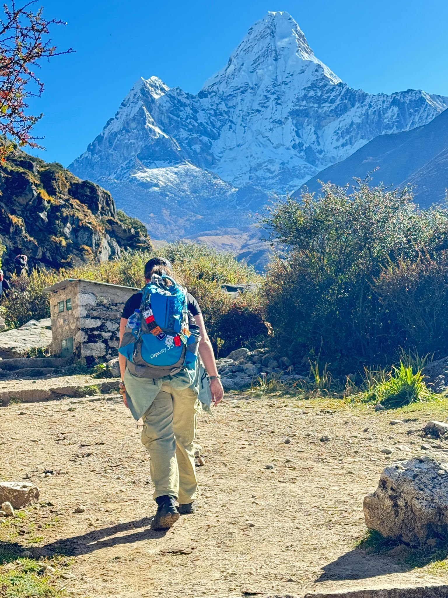
    The trail from Namche to Tengboche is one of the most photographed sections of the Khumbu and deservedly so. It climbs initially from Namche through pine and juniper forest, then emerges onto a wide south-facing slope with unobstructed views. Ama Dablam at 6,812 metres is the dominant feature of the view ahead — an extraordinary peak of mixed ice and rock ridges that looks disproportionately large relative to its actual height because of its sharp symmetry and the way it stands clear of the surrounding peaks. Photographers stop here for 20 to 30 minutes. Your guide will wait.

    The trail descends to the Dudh Koshi confluence at Phunki Tenga (3,250m) — there are several teahouses and good water here — then climbs steeply through rhododendron forest to the ridge on which Tengboche sits. The forest on this climb is the finest in the Khumbu: old-growth rhododendron trees with trunks 60 to 80 centimetres in diameter, covered in moss, with the forest floor open and light below the canopy. In October, the forest is in its autumn colours. In spring, it is in full flower.

    Tengboche Monastery at 3,867 metres is the most important religious site in the Khumbu — a Nyingma Buddhist monastery established in 1916, destroyed by earthquake in 1934, rebuilt, then destroyed by fire in 1989, and rebuilt again to its current form. The prayer hall is open to visitors. The evening puja (prayer ceremony) at around 3:00 PM is accessible to respectful visitors sitting at the back of the hall. The monks chant with drums and horns in a ceremony that runs approximately 45 minutes. Overnight Tengboche.

    6 hour
    Breakfast + Lunch + Dinner
  • Day
    12

    Tengboche (3,860m) to Dingboche (4,360m) — 4 to 5 Hours, Pangboche, First Real Cold

    From Tengboche the trail descends through Deboche, where the Ani Gompa (nunnery) sits in a rhododendron grove beside the river, then crosses the Imja Khola and climbs to Pangboche. Pangboche at 3,985 metres is the highest permanently inhabited Sherpa settlement in the upper Khumbu. The Lower Pangboche Monastery is the oldest in the Khumbu, containing what is claimed to be a yeti scalp and hand bones preserved in a wooden box inside the monastery — an object that has been examined by Western scientists on several occasions and remains officially unidentified. Whether you find this interesting or not, the monastery itself (believed to be 350 years old) is worth a 20-minute stop.

    From Pangboche the trail continues through yak pastures and rocky scrub to Dingboche at 4,360 metres. This is the first overnight above 4,000 metres on the trek. The shift in environment above this altitude is abrupt: the vegetation is sparse alpine scrub and bare earth, the temperature drops to near freezing after sunset year-round, and the silence is qualitatively different from the forested valley below. Sleep with an extra layer even in September. Dingboche has well-developed teahouse infrastructure, including the Himalayan Rescue Association post, which holds free altitude lectures every evening that we strongly recommend attending. Overnight Dingboche.

    5 hour
    Breakfast + Lunch + Dinner
  • Day
    13

    Acclimatisation at Dingboche (4,360m) — Hike to Nangkartshang Peak (5,083m)

    The second acclimatisation day on the trek and the most physically demanding of the two. Nangkartshang Peak at 5,083 metres is reached by a 3 to 4 hour round trip from Dingboche — a steep direct ascent on a clear trail above the village to a summit ridge marked by prayer flags. The hike is not technical but it is steep and the altitude is significant. Go slow. The effort of the climb will feel disproportionate to the gradient, which is exactly what altitude does to your aerobic capacity.

    From the Nangkartshang summit ridge, the panorama covers the full eastern Khumbu: Island Peak (6,189m) and its associated cwm, Amphu Lapcha Pass (5,780m), Makalu (8,485m) — the fifth highest mountain in the world, rarely seen from the standard EBC approach — and the south face of Lhotse (8,516m). Ama Dablam dominates the ridge to the southwest. This is genuinely one of the best views in the Khumbu region, better in some respects than Kala Patthar because of the eastern panorama.

    Return to Dingboche by noon. Afternoon rest — read, hydrate, sleep if possible. Your guide will check oxygen saturation readings with the pulse oximeter at midday and again at 4:00 PM. Saturation below 80% at rest, or symptoms of AMS (persistent headache, nausea, loss of appetite, confusion) at this altitude, are taken seriously and discussed immediately. Overnight Dingboche.

    5 hour
    Breakfast + Lunch + Dinner
  • Day
    14

    Dingboche (4,360m) to Lobuche (4,930m) — 4 to 5 Hours, Thukla Pass Memorials

    From Dingboche the trail follows the Khumbu valley north through yak grazing ground toward Thukla. The terrain is open, bare and stony — above the last scrub vegetation, the landscape has the quality of a high-altitude desert. Views of Lobuche Peak (6,119m) and Cholatse (6,440m) close the valley ahead. The walking is not technically difficult but the altitude makes every step cost more aerobic effort than it appears to deserve.

    Thukla at 4,620 metres (also called Dughla) is a small collection of teahouses at the base of the Thukla Pass. The pass above is not a mountain col but a steep lateral moraine ridge beside the Khumbu Glacier. On the ridge at 4,830 metres, a series of stone memorials has been built to climbers who died on Everest — Scott Fischer (1996), Rob Hall (1996), and many others including several Sherpas. The names and cairns are maintained by their families and by climbing teams. The memorial ridge is a significant and sobering place. Our guides always stop here for 10 to 15 minutes to explain the history and context.

    From Thukla Pass, the trail continues over moraine and glacial debris to Lobuche at 4,930 metres. Lobuche is the last teahouse settlement before Gorak Shep and consists of a handful of lodges clustered at the edge of the glacier. Cold nights are guaranteed — temperatures drop to minus 10 to minus 15 degrees Celsius even in October and November. Use your sleeping bag liner and your down jacket. Overnight Lobuche.

    5 hour
    Breakfast + Lunch + Dinner
  • Day
    15

    Lobuche (4,930m) to Gorak Shep (5,160m) to Everest Base Camp (5,364m) and Return

    The day the trek has been building toward. Depart Lobuche by 7:00 AM. The trail from Lobuche to Gorak Shep crosses the moraine and then a flat glacial plain called the Gorak Shep lake bed — dry and sandy, surrounded by moraines, with the Khumbu Glacier visible on the right and Pumori (7,145m) ahead. The walking is 2 to 3 hours at this altitude. Gorak Shep at 5,160 metres is the highest teahouse settlement in the world. Drop your main pack here and take only a small day pack for the Base Camp approach.

    The trail from Gorak Shep to Everest Base Camp follows the Khumbu Glacier moraine for 2 to 3 hours. The path crosses rocky moraine ridges with no technical difficulty but significant physical effort at altitude. Base Camp itself (5,364m) is not a single defined point — the camping ground shifts slightly each year as the glacier moves. In spring expedition season (April to May), the site holds 400 to 600 expedition members in tents, with fixed lines running up into the Khumbu Icefall above. In autumn (post-monsoon), the site is largely empty of expedition teams. The Khumbu Icefall is directly above you: seracs (ice towers) 10 to 20 metres high, crevasses, and the constant sound of ice movement. This is as close to Everest as most people will ever be on foot.

    Return from Base Camp to Gorak Shep: 2 to 3 hours. Dinner at Gorak Shep teahouse. Overnight Gorak Shep. Prepare for a very early start tomorrow.

    8 hour
    Breakfast + Lunch + Dinner
  • Day
    16

    Kala Patthar Sunrise (5,550m), then Descent to Pheriche (4,280m) — 7 to 8 Hours

    4:00 AM departure in darkness. Headlamp required. The trail from Gorak Shep to the Kala Patthar ridge (5,550m) climbs 390 metres on a steep but non-technical trail above the teahouses. Time the start to arrive at the summit ridge at first light — typically 5:30 AM to 6:00 AM in October and November, 5:00 AM to 5:30 AM in April. The sky above the summit to the north is already pale by the time you leave Gorak Shep.

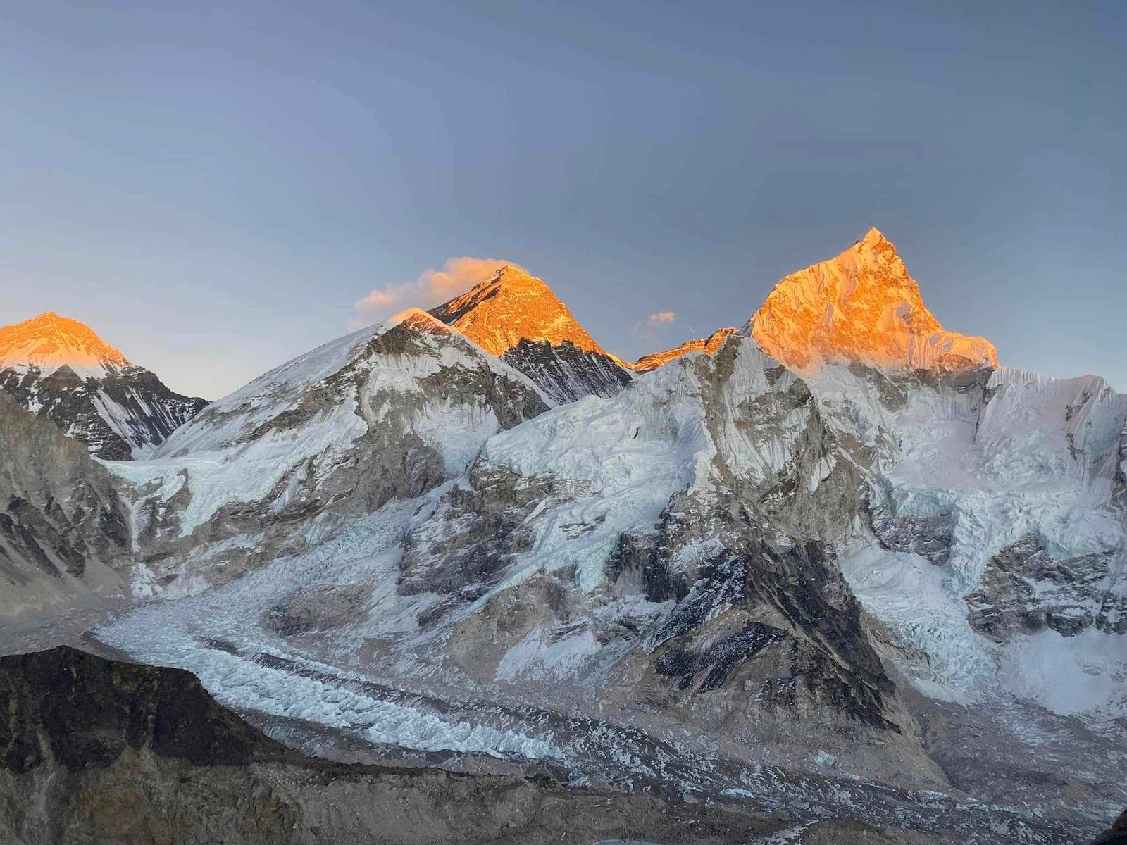
    The view from Kala Patthar at sunrise is the centrepiece of this entire trek. Mount Everest at 8,849m stands directly to the north, closer here than from any other point accessible without technical climbing. The South Summit at 8,748m and the Hillary Step above it are visible. Nuptse's south ridge (7,861m) rises directly east. Pumori (7,145m) towers overhead to the west. The Khumbu Glacier and Icefall lie below, the scale of the glacier comprehensible in a way it is not from ground level. The sun hits Everest's summit before it hits anything else in the field of view. That 60-second window of first light on the summit pyramid from this position is why this ridge is called one of the great viewpoints in the world.

    Spend 30 to 60 minutes on the ridge. Return to Gorak Shep for a late breakfast. Then begin the descent: from Gorak Shep all the way down to Pheriche at 4,280 metres — a drop of 880 vertical metres over 4 to 5 hours via Lobuche and Thukla. The descent is rapid and your body feels the oxygen returning with each 100 metres you drop. Pheriche has better teahouse facilities than Lobuche and the Himalayan Rescue Association clinic. Overnight Pheriche.

    8 hour
    Breakfast + Lunch + Dinner
  • Day
    17

    Pheriche (4,280m) to Namche Bazaar (3,440m) — 6 to 7 Hours, Long Descent

    The downward journey begins in earnest. From Pheriche the trail retraces the outbound route south through Tengboche, descending through the rhododendron forest and then climbing to Tengboche Monastery, then descending again to Phunki Tenga and climbing to the Namche ridge. The distances and elevation changes are identical to the upward journey but the physical experience is completely different. Going up, you were counting altitude metres. Going down, you feel the trail opening up beneath you and the oxygen increasing with each kilometre south.

    The forest between Tengboche and Namche is different on the way down: more visible, more dimensional. The upward push forced a level of tunnel-vision focus. Descending, you have attention to spare for the trees, the birds, the views across the valley to Ama Dablam's south face. October and November descents through the rhododendron forest on this section produce a quality of light in the late afternoon that is unlike anywhere else we take clients on any route.

    Namche at 3,440 metres on the descent feels like a city in a way it did not on the ascent. The bakery producing cinnamon rolls, the WiFi that actually loads video, the hot shower that is genuinely hot — these comforts register differently after 10 days above. Celebratory dinner at your guide's recommendation. Overnight Namche.

    7 hour
    Breakfast + Lunch + Dinner
  • Day
    18

    Namche (3,440m) to Lukla (2,860m) — 6 to 7 Hours, Final Descent, Celebration Dinner

    The last full walking day. From Namche the trail descends south through the pine forest and suspension bridges to Phakding, retracing the outbound approach trail. The descent from Namche to Phakding (2,610m) takes 2 to 3 hours. Phakding is worth a brief lunch stop — it is the last teahouse settlement before Lukla and the last chance to eat before the final climb.

    From Phakding the trail continues south through Jorsalle, Monjo and the park exit gate (permits checked again on exit), then the final approach to Lukla. From Jorsalle to Lukla, the trail climbs steadily — not steeply, but a continuous 250-metre gain over the last 2 hours that catches many trekkers by surprise on the final day. We have walked this section hundreds of times and the final approach to Lukla remains one of those deceptive climbs that feels longer than the map suggests.

    Lukla at 2,860 metres is a different kind of place on the way out than on the way in for standard Lukla-route trekkers. For Jiri-route trekkers, it is simply the place where you finish walking. Check in to a teahouse in Lukla main street. Your guide confirms tomorrow morning's flight details (Lukla flights depart very early — typically 6:00 AM to 9:00 AM, before afternoon cloud builds). End-of-trek celebration dinner with your guide and porter. Overnight Lukla.

    7 hour
    Breakfast + Lunch + Dinner
  • Day
    19

    Fly Lukla to Kathmandu (1,400m) — 30-Minute Flight, Hotel Check-in, City Rest

    Wake up by 5:00 AM for the Lukla airport check-in. Lukla's Tenzing-Hillary Airport is classified as one of the world's most technically demanding commercial airports: a single 527-metre runway on a 12-degree slope, surrounded by mountains, with approaches that require visual flying conditions. All flights are VFR (visual flight rules) — if morning cloud prevents the approach, the flight is delayed until conditions clear. In October and November, conditions are reliably clear most mornings. In March and May, conditions are slightly less predictable. We build Day 20 as a buffer for precisely this reason.

    Assuming standard weather, the flight departs Lukla between 6:00 AM and 8:30 AM and arrives Kathmandu Domestic Terminal in approximately 30 minutes. The flight itself is one of the most scenic short flights in aviation — the route south from Lukla descends rapidly through the Khumbu foothills and the aircraft arrives over the Kathmandu Valley from the east. Your guide meets you at the domestic terminal and transfers you to your Kathmandu hotel.

    The rest of the day is yours. Most clients who return to Kathmandu after 17 days on the trail want three things in order: a shower, a proper meal, and a bed. We recommend the Thamel area for proximity to restaurants and pharmacies. If you arrive early enough and feel well, an afternoon visit to Boudhanath Stupa — 20 minutes by taxi from Thamel — provides a calm and contemplative end-of-trek experience. Overnight Kathmandu hotel.

    2 hour
    Breakfast
  • Day
    20

    Kathmandu Free Day — Optional Sightseeing, Shopping, Flight Buffer

    This day serves two purposes: a buffer for any Lukla flight delay from yesterday, and a free day in Kathmandu for recovery, sightseeing, and shopping before your international departure. If the Day 19 Lukla flight was delayed to today, you transfer from Lukla to Kathmandu this morning and the sightseeing is compressed into the afternoon.

    For clients with a full day in Kathmandu, the most worthwhile options after 18 days of trekking are typically not intense sightseeing but gentle cultural visits. Pashupatinath Temple on the Bagmati River is 20 minutes from Thamel by taxi — a major Hindu pilgrimage site with morning and evening rituals and open-air cremation ghats along the river. Boudhanath Stupa is 5 minutes further east — one of the world's largest Buddhist stupas, with a circumambulation path, prayer wheels, and Tibetan coffee shops around the perimeter. Both sites together take 3 to 4 hours and work well as a half-day program without requiring significant walking.

    Afternoon: Thamel shopping. The main categories for EBC trekkers returning from the route are: singing bowls (USD 20 to 200 for a quality piece), pashmina (USD 40 to 120 for genuine cashmere), Tibetan jewelry, dried spice packets, and hand-made paper products. Your guide can direct you to shops with genuine merchandise and honest prices. Farewell dinner organised by Next Trip Nepal — we typically book a table at a restaurant with live Newari or folk music in Thamel. Overnight Kathmandu hotel.

    4 hour
    Breakfast + Dinner
  • Day
    21

    Departure from Kathmandu — Airport Transfer, End of Trek

    Your guide and driver transfer you to Tribhuvan International Airport (KTM) approximately 3 hours before your international flight departure. The international terminal is a 10-minute walk from the domestic terminal. Check-in counters open 3 hours before departure for most airlines. Departure tax is included in your international ticket for most carriers but worth confirming with your airline in advance.

    Before you leave Kathmandu, your guide will give you contact details for any follow-up questions, lost luggage assistance, or issues that arise after you arrive home. We also ask clients to send us their honest feedback after the trip — positive and critical. The Jiri route is a living itinerary that we refine based on what clients actually experience on the trail, and the feedback from returning trekkers is genuinely how we keep the quality of this route consistent.

    Your 21 Days Everest Base Camp Trek via Jiri ends here. You have walked from 1,905 metres to 5,550 metres on the same route used by the first expedition to the summit of Everest. That is not a small thing. Thank you for trekking with Next Trip Nepal.

    Breakfast

What’s Included & Excluded in Your 14 Days Everest Base Camp Trek?

  • Airport pickup and drop-off in Kathmandu
  • 2 nights 3-star hotel in Kathmandu (Day 1 pre-trek and Day 20 post-trek)
  • All teahouse accommodation on trek (Days 2 to 18), best available rooms in each village
  • Three meals daily throughout: teahouse food on trek days, hotel breakfast in Kathmandu
  • All permits: Sagarmatha National Park ($28), Khumbu Pashang Lhamu Rural Municipality fee ($22), TIMS Card ($15)
  • Private vehicle Kathmandu to Jiri (Day 2, approximately 7 hours)
  • Return flight Lukla to Kathmandu (Day 19): Jiri start means no inbound Lukla flight required
  • Experienced English-speaking private guide with Jiri route knowledge for all 21 days
  • Porter service: 1 porter per 2 trekkers, maximum 25kg load per porter
  • Guide and porter salaries, daily meals, accommodation, equipment, and insurance throughout
  • First aid kit and pulse oximeter for daily altitude monitoring from Day 5 onward
  • Next Trip Nepal duffel bag, trekking T-shirt, cap, and printed route map

Cost Excludes

  • International flights to and from Kathmandu
  • Nepal entry visa fee ($30 for 15 days, $50 for 30 days, payable on arrival at Kathmandu airport)
  • Travel and medical insurance including helicopter evacuation coverage (required)
  • Personal spending on trail: hot showers, device charging, WiFi at teahouses
  • Alcoholic drinks and carbonated beverages on the trek
  • Tips: guide $15 to $20 per day recommended, porter $10 to $12 per day recommended
  • Optional gear rental: sleeping bag ($2/day), down jacket ($2/day), trekking poles ($1/day)
  • Optional Island Peak or Lobuche East climbing add-on permit, guide, and equipment fees
  • Any personal medical expenses or pharmacy costs on route
  • Excess baggage above 25kg total porter load (excess charged at $5 to $10 per kg per day)

Route Overview and Comparison

Why Choose the 21-Day Jiri Route

  • Trek the same route used by Hillary, Tenzing, and every Everest expedition from 1953 to 1965
  • 7 days of gradual altitude gain from 1,905m to 3,440m — the physiologically correct acclimatisation rate
  • Fewer than 300 foreign trekkers on the Jiri section per year vs 50,000+ on the Lukla route
  • Six mountain passes including Lamjura La (3,530m) with Everest summit visible on clear days
  • Authentic Solu Khumbu: Sherpa and Rai villages, Thupten Chholing Monastery (500 years old), local markets
  • Full Khumbu section included: Tengboche, Dingboche, Lobuche, EBC (5,364m), Kala Patthar (5,550m)
  • Private guide with specific Jiri route experience, satellite communicator on the trail throughout
  • Fly out from Lukla — no need to walk back to Jiri
  • Optional Island Peak (6,189m) or Lobuche East (6,119m) climbing add-on available
  • All permits, meals, accommodation, and guide/porter included from $1,449

21-Day Jiri Route vs 14-Day Standard EBC (Lukla)

Factor 21-Day Jiri Route 14-Day Lukla Route
Starting point Jiri (1,905m) by road Lukla (2,860m) by flight
Days before Namche 8 days gradual gain 1 day from Lukla
Acclimatisation quality Gradual (physiologically ideal) Rapid (1,460m gain in 30 min)
Annual trekker count Under 300 on Jiri section ~50,000 per season
Mountain passes 6 passes (Jiri section) + Khumbu Khumbu only
Cultural depth Solu Khumbu + Khumbu Khumbu only
Max altitude Kala Patthar 5,550m + EBC 5,364m Kala Patthar 5,550m + EBC 5,364m
Difficulty Strenuous (fit trekkers only) Moderate to Strenuous
Price from $1,449 (Lukla return flight incl.) $1,250 (Lukla round trip incl.)

Day-by-Day Summary

Day Route Altitude Highlight
1Arrive Kathmandu1,400mGuide briefing, gear check
2Drive to Jiri1,905m7-hour road journey, last resupply
3Jiri to Deurali2,705mFirst pass, Jirel villages, empty trail
4Deurali to Sete via Kinja2,575m1,200m descent then re-ascent
5Sete to Junbesi via Lamjura (3,530m)2,675mHighest Jiri pass, Everest visible, Thupten Chholing
6Junbesi to Nunthala via Taksindu La2,120mTaksindu Monastery, Solu plateau views
7Nunthala to Bupsa via Surki La2,350mEnter Khumbu watershed, Lukla visible above
8Bupsa to Phakding (bypass Lukla)2,610mJoin main Khumbu trail at Chaurikharka
9Phakding to Namche Bazaar3,440mHillary Bridge, SNP entry, Namche arrival
10Acclimatisation — Namche3,440mEverest View Hotel hike (3,880m), museum
11Namche to Tengboche3,860mAma Dablam panorama, monastery puja
12Tengboche to Dingboche4,360mPangboche monastery, HRA altitude lecture
13Acclimatisation — Dingboche4,360mNangkartshang Peak hike (5,083m)
14Dingboche to Lobuche4,930mThukla Pass climber memorials
15Lobuche to Gorak Shep to EBC5,364mEverest Base Camp + Khumbu Icefall
16Kala Patthar sunrise, descend to Pheriche5,550mBest Everest summit view on earth at sunrise
17Pheriche to Namche3,440mLong descent, oxygen returning, Tengboche forest
18Namche to Lukla2,860mFinal walking day, end-of-trek dinner
19Fly Lukla to Kathmandu1,400m30-min mountain flight, hotel rest
20Kathmandu free day / flight buffer1,400mOptional sightseeing, farewell dinner
21DepartureAirport transfer, fly home

FAQs

Why is this called the authentic EBC trek?

The Jiri route is called the authentic or original EBC trek because it was the route used by every Everest expedition from the first summit attempt in 1953 until the Lukla airstrip opened in 1965. Edmund Hillary, Tenzing Norgay, John Hunt, Eric Shipton, and Bill Tilman all walked through the Solu Khumbu section that forms the first 8 days of this itinerary. The Lukla-based 14-day route is commercially efficient and suits the majority of trekkers, but the Jiri route preserves the full geographic experience of traveling from the Kathmandu Valley to the Khumbu on foot, with no shortcuts. The term authentic refers to historical fidelity and the completeness of the journey, not to any judgment about people who choose the Lukla approach.

How much harder is the Jiri route compared to the standard 14-day Lukla route?

Considerably harder in the first week, approximately equal in the Khumbu section. The Jiri section (Days 3 to 8) involves 5 to 8 hours of walking daily with 800 to 1,200 metres of elevation change per day, crossing six mountain passes. The terrain is technically straightforward (no scrambling, no ropes) but the sustained up-and-over topography is physically demanding in a way that pure altitude trekking is not. From Namche onward, the Jiri and Lukla routes are identical. Trekkers who have completed the Jiri section consistently report that the Khumbu section felt easier than they expected, which is partly fitness from the walk-in and partly superior acclimatisation.

What fitness level is required for the 21-day Jiri trek?

We require that clients have a genuine active fitness base before attempting this route. Specifically: you should be capable of walking 6 to 8 hours per day with a light daypack (3 to 5kg) for 5 consecutive days, preferably in hilly terrain. If you have done multi-day hiking or camping before, you understand the level of daily commitment required. If you have not, we recommend 6 to 8 weeks of preparation involving running, stair climbing, and weekend hikes with a loaded daypack. This is not a walk that rewards underprepared fitness — the Jiri section amplifies any weakness in your base fitness before altitude becomes the additional challenge.

How many trekkers do the Jiri route each year?

Fewer than 300 foreign trekkers complete the full Jiri to Namche section in any year, based on TIMS card data and Sagarmatha National Park entry records cross-referenced with the Jiri road checkpoint counts. In October, the peak month for EBC trekking, you might encounter 3 to 5 other trekking groups on the entire Jiri section across 7 days. The contrast with the Lukla route, which handles approximately 50,000 trekkers per season and often feels crowded between Phakding and Namche, could not be greater. The solitude of the Jiri section is one of its defining features and one of the reasons our regular clients specifically request it for a second Nepal trek.

Can I do the Jiri route if I have never trekked before?

No. We do not recommend the Jiri route for first-time trekkers. The combination of the physically demanding Jiri section with the altitude challenge of the Khumbu section makes this one of the more serious treks in Nepal. For first-time trekkers interested in Everest Base Camp, the standard 14-day Lukla route is appropriate and well-structured for people new to Himalayan trekking. Once you have completed that route and understand your own altitude response and multi-day trekking capacity, the Jiri version makes excellent sense as a return trip. Many of our Jiri-route clients have done the Lukla route previously.

What is the acclimatisation advantage of starting from Jiri?

When you fly to Lukla at 2,860m from Kathmandu at 1,400m, your body gains 1,460 metres of altitude in 30 minutes. That rate of ascent is physiologically stressful regardless of how fit you are. The Jiri approach begins at 1,905m and takes 7 days of walking to reach Namche at 3,440m, with daily altitude changes that include descents (which help acclimatisation by allowing partial recovery). By the time a Jiri-route trekker reaches the SNP checkpoint at Monjo, they have 7 days of progressive altitude adaptation behind them. The Himalayan Rescue Association clinic at Pheriche has documented lower rates of acute mountain sickness among trekkers arriving via the Jiri route, which reflects this difference in physiological preparation.

What are the altitude sickness risks on this route?

The Jiri section carries minimal AMS risk because altitudes stay below 3,530m (Lamjura Pass) for the first 7 days. AMS risk increases from Namche onward as the altitude rises continuously. The most common points for AMS symptoms on the EBC route are between 3,440m (Namche) and 4,930m (Lobuche). Our itinerary includes two planned acclimatisation days (Namche and Dingboche) following the standard trekking medicine guideline of one rest day for every 1,000m of altitude gain above 3,000m. Our guides carry a pulse oximeter for daily SpO2 readings, a first aid kit with Diamox (acetazolamide) for appropriate use, and are trained to recognize the progression from mild AMS to high-altitude cerebral or pulmonary edema. The rule on our treks: any two AMS symptoms at the same time mean we descend that day without argument.

What permits do I need and what do they cost?

Three permits are required, all included in the package price. The Sagarmatha National Park entry permit costs NPR 3,000 plus 13% VAT, approximately $28 per person, and is checked at the Monjo gate before Namche. The Khumbu Pashang Lhamu Rural Municipality conservation fee costs NPR 3,000, approximately $22 per person, and is collected at a separate checkpoint. The TIMS (Trekkers Information Management System) card costs NPR 2,000, approximately $15 per person, and is checked at the Jiri road checkpoint and again in the Khumbu. Total permit cost is approximately $65 per person. No Restricted Area Permit is needed for either the Jiri section or the standard Khumbu route, both of which are open trekking zones.

What is the accommodation like on the Jiri section versus the Khumbu section?

The difference is significant and worth understanding before you arrive. Jiri section teahouses (Days 2 to 8) are basic hill-country guesthouses: small rooms with thin mattresses, wooden walls, shared squat toilets in most villages below Solu, simple menus (dal bhat, noodles, eggs, chapati), no WiFi, and no phone charging at most places. Bring a 20,000mAh power bank and waterproof bags for your electronics. From Phakding and Namche onward, the Khumbu teahouse infrastructure is significantly better: en-suite rooms at some lodges, hot showers (NPR 200 to 400 extra), device charging (NPR 200 to 400 per device per night), WiFi at lodges up to approximately 4,300m (slower and less reliable above this altitude). Our guide books ahead to secure the best available rooms at each stop.

Can I get WiFi and phone signal on the Jiri section?

WiFi is not available at most teahouses on the Jiri section below Salleri. Mobile data signal (Ncell or NTC) is intermittent and often absent for stretches of 2 to 3 days on the Jiri section, particularly between Sete and Nunthala. Our guides carry a satellite communicator (Garmin inReach or equivalent) for emergency contact with our Kathmandu office throughout the Jiri section. We do a daily satellite check-in from the trail. If you need to contact family during the Jiri days, plan to communicate this schedule to them before departure: expect gaps of 12 to 48 hours with no message receipt, which is normal and expected on this route. From Phakding and Namche onward, WiFi and mobile data are consistently available.

What should I pack that I would not need for the 14-day Lukla version?

The main differences in packing for the Jiri route relate to the Jiri section's infrastructure gap. Bring a power bank of at least 20,000mAh (no charging for 2 to 3 days at a stretch). Pack a small water purification system (Steripen UV or iodine tablets) because boiled water is not always available in Jiri section teahouses. Bring extra blister plasters and foot care supplies for the first week before your boots are fully broken in. A lightweight sleeping bag liner is useful in Jiri section teahouses where mattress quality is basic. Bring more snacks than you would for Lukla — energy bars, nuts, dried fruit for the 5 to 7-hour Jiri walking days where lunch stops are sometimes 4 hours apart. Otherwise the packing list for Jiri is identical to the standard EBC list.

Is it possible to add Island Peak or Lobuche East climbing to this trek?

Yes. Both Island Peak at 6,189m and Lobuche East at 6,119m are straightforward climbing add-ons from the EBC area that can be incorporated into an extended itinerary. Island Peak requires a climbing permit (approximately $250 per person for the autumn season, $125 for spring), crampons, harness, and ice axe, and is climbed via fixed ropes through a glacier and up a headwall. Lobuche East is a more technical peak requiring prior high-altitude mountaineering experience. For clients interested in adding a summit, we recommend discussing this at the booking stage so we can adjust the itinerary, arrange a climbing guide (separate from the trekking guide), and ensure the timing works with Base Camp and Kala Patthar. Adding Island Peak typically extends the itinerary by 4 to 5 days.

What happens if I need to evacuate due to altitude sickness?

Our guides are trained in altitude sickness recognition and emergency response. If evacuation is needed, the procedure depends on location. From the Khumbu section (Namche and above), helicopter rescue can be arranged within 4 to 6 hours through our Kathmandu office working with CIWEC hospital and the major helicopter rescue operators (Fishtail, Summit, Simrik). From the Jiri section below Phakding, helicopter landing is possible at several points but may require a 30 to 60-minute walk to a suitable landing zone. We coordinate with our Kathmandu office by satellite communicator throughout the Jiri section. All helicopter rescue requires active travel insurance with helicopter evacuation coverage — this is not optional on our treks. We require proof of insurance before the trek begins.

What is the best time of year for the 21-day Jiri route?

October and November are the best months. The post-monsoon atmosphere gives the clearest mountain views, stable weather, firm dry trail conditions on the Jiri section, and excellent wildlife activity. Mountain views from Lamjura Pass and Kala Patthar are clearest in October and November. March to May is the second best season: rhododendron flowering on the Lamjura approach is at its best in March and April, views are generally good, and temperatures are moderate. June to September is monsoon season: the Jiri section trail can be muddy and leeches are active below 3,000m. The views are frequently cloud-obscured and the Khumbu section can have afternoon rain. Some experienced trekkers specifically choose the monsoon for the Jiri section's dramatic cloud formations and green landscapes, accepting the reduced visibility. December to February is cold and quiet: Lamjura Pass carries significant snow, Khumbu nights drop to minus 15 to minus 20 degrees Celsius, and fewer teahouses are fully operational above 4,000m.

Can I fly back from Lukla or do I have to walk back to Jiri?

You fly back from Lukla — you do not return to Jiri on foot. This is one of the logistical advantages of the Jiri route: you walk in from Jiri (no inbound Lukla flight, avoiding the busiest booking period for Lukla slots), complete the full Khumbu circuit, and fly out from Lukla at the end. The return Lukla to Kathmandu flight is included in the package price. The Lukla flight itself (approximately 30 minutes) replaces the 7-day Khumbu-back-to-Jiri return walk that would otherwise be required, and is the reason the 21-day itinerary can include both the full Jiri approach and the complete Khumbu section without extending to 35+ days.