

Authentic Everest Base Camp Trek via Jiri — 21 Days on Hillary’s Original Route (2026)
Trek the original 1953 expedition route from Jiri to Everest Base Camp. Superior acclimatisation. Empty trails. The complete Khumbu experience walked by Hillary and Tenzing before the Lukla airstrip existed.
Trek at a Glance
The Jiri Route vs the Standard Lukla Route: Why 21 Days Is the Better Trek
Most people who come to us asking about Everest Base Camp have already looked at the standard 14-day itinerary from Lukla. They ask: why would anyone want to spend an extra week walking through the hills when you can fly to 2,860 metres and be on the main trail the same afternoon? Here is what we tell them, honestly and from direct experience on this route.
Acclimatisation
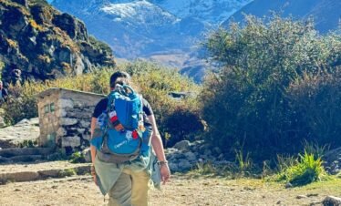
The single most important advantage of starting from Jiri is what happens to your body in the first six to eight days. From Jiri at 1,905 metres, you walk east through a series of passes and valleys, gaining altitude gradually each day and losing some of it on descents, then gaining it again. By the time you reach Namche Bazaar at 3,440 metres on Day 9 of this trek, your body has had a full week to adapt through daily ascents rarely exceeding 700 to 800 metres. Doctors who work at the Himalayan Rescue Association clinic in Pheriche consistently observe that AMS rates among trekkers arriving via Jiri are measurably lower than among those who jump from Kathmandu at 1,400 metres to Lukla at 2,860 metres in a 30-minute flight. The Lukla jump is a 1,460-metre altitude gain in under an hour. For a human body, that is a provocation. The Jiri approach is a preparation.
Historical Significance
Jiri was the trailhead for every Everest expedition from 1953 until the Lukla airstrip opened in 1965. The road from Kathmandu to Jiri did not exist then either — pre-1984 expeditions walked from Kathmandu itself. But Jiri remained the standard approach for a decade after Lukla opened, simply because the airstrip was often closed and supplies could not depend on mountain aviation. Edmund Hillary walked this route. Tenzing Norgay walked it. Eric Shipton and Bill Tilman used the Solu Khumbu approach on their 1951 Everest reconnaissance. The expedition diaries of John Hunt, Charles Evans, and George Lowe describe these hills and these passes in the same terms we would use today. When you cross Lamjura Pass at 3,530 metres and look east toward Everest’s summit on a clear morning, you are looking at what those men saw from that same ridge. That is not a small thing.
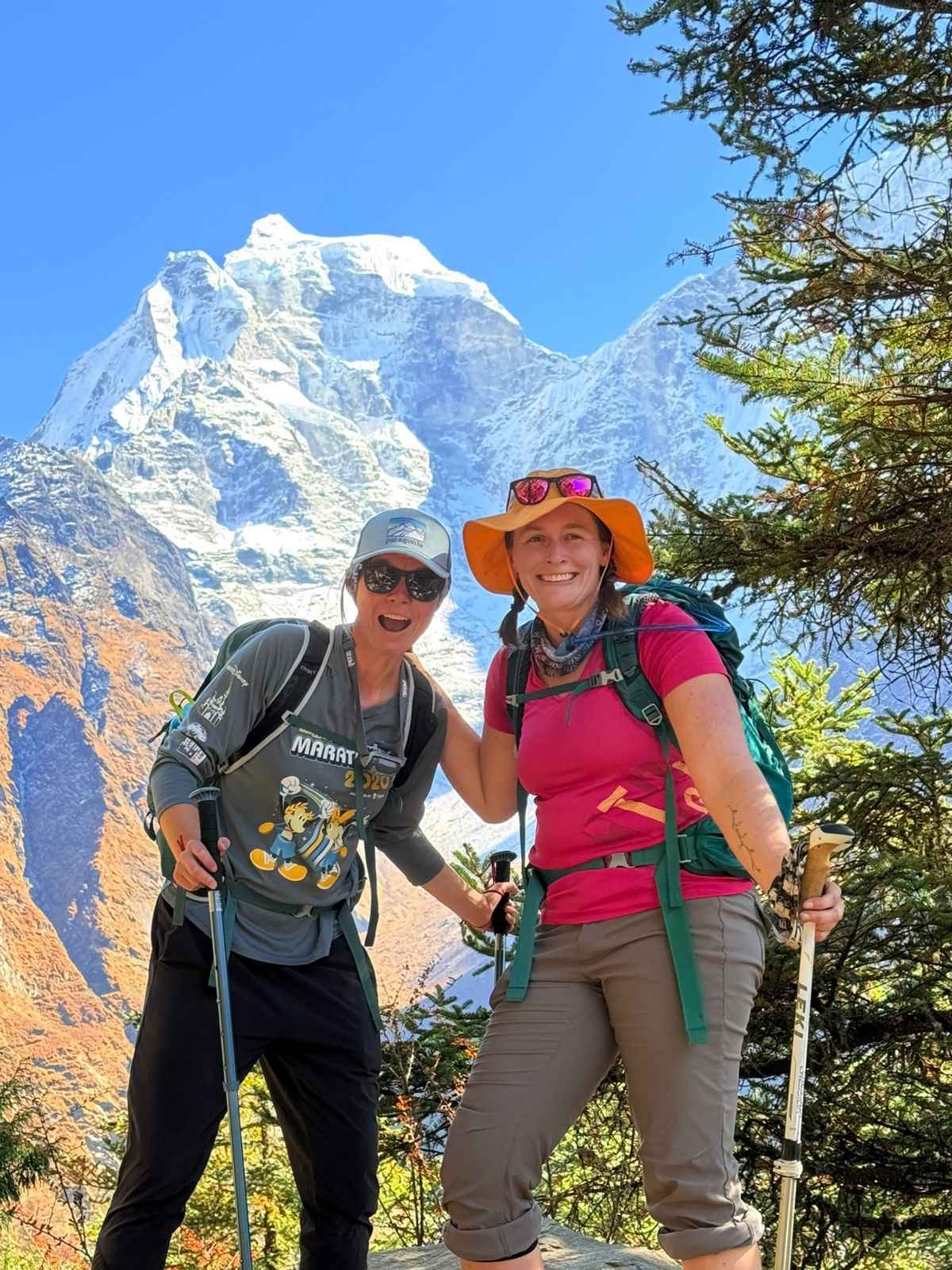
Trail Solitude
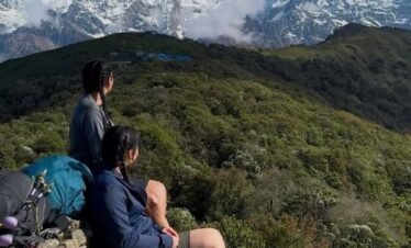
The Jiri to Phakding section carries fewer than 300 foreign trekkers per year. The Lukla to EBC route handles approximately 50,000. On most days of the Jiri section, your group will walk for 5 to 7 hours without encountering another trekking party. Teahouse owners know each guide by name. You eat the food the family is eating themselves. There are no menus printed in five languages. This is not nostalgia — it is simply what trekking was like before mountain aviation changed the economics of Himalayan tourism entirely.
Middle Hills Cultural Experience
The Solu region between Jiri and Namche is home to Rai and Sherpa communities who live almost entirely outside the trekking economy. Weekly markets at Salleri and Nunthala operate for the local population — produce, livestock, hardware, textiles. Schools are ordinary village schools, not the Hillary Foundation institutions of the Khumbu. Gompa are active community monasteries, not tourist sites. Thupten Chholing Monastery near Junbesi is one of the most important Nyingma Buddhist monasteries in Nepal, housing several hundred monks and nuns, with a prayer hall and accommodation buildings that form a small monastic village of their own. Most trekkers on the Lukla route never know it exists.
Physical Preparation Built Into the Route
The six passes of the Jiri section — Deurali (2,705m), Sete (2,575m), Lamjura (3,530m), Taksindu La (3,071m), Surki La (2,293m), and the sustained approach to Namche — build exactly the leg strength and cardiovascular capacity you need for the Khumbu section. Trekkers who reach Namche via Jiri consistently tell us that the high altitude section from Namche to Base Camp felt physically easier than they expected. That is the Jiri preparation working.
Honest Physical Cost
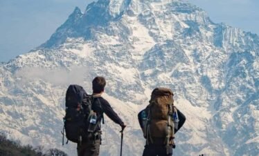
Days 3 to 8 of this trek involve 5 to 8 hours of walking daily with 800 to 1,200 metres of elevation change. The Jiri section is not hard because of altitude — none of those days go above 3,530 metres. It is hard because of the sustained up-and-over topography where you climb a full pass, descend to a river valley, and climb another pass the same afternoon. If you have done multi-day hiking with a daypack before, you can handle this. If you have not, you need 6 to 8 weeks of serious preparation — running, stair climbing, weekend hikes — before arrival. We will not tell you otherwise.
Jiri Route vs Standard Lukla Route: Direct Comparison
| Factor | Standard 14-Day EBC (Lukla) | This 21-Day Route (Jiri) | Why It Matters |
|---|---|---|---|
| Acclimatisation | Kathmandu to Lukla (2,860m) in 30 min flight — rapid gain | 7 days gradual gain from 1,905m to 3,440m on foot | Lower AMS risk; body adapts at the physiologically recommended rate |
| Trail crowds | ~50,000 trekkers per season on Lukla route | <300 trekkers on Jiri section annually | Days of solitary trail; teahouses with space and authentic village interaction |
| Physical challenge | Moderate; altitude is the main challenge | Strenuous; six passes + full Khumbu section | Requires serious preparation; rewards with superior fitness on the Khumbu approach |
| Price | From $1,250 (Lukla flights included) | From $1,449 (return Lukla flight + Jiri drive included) | 7 additional days, extra passes, deeper experience — the per-day cost is lower on the 21-day route |
Permits and Costs: Full Breakdown
All permits are included in the package price. Here is exactly what you are paying for:
- Sagarmatha National Park Entry Permit: NPR 3,000 + 13% VAT = approximately $28 per person. Required for all trekkers entering the park boundary at Monjo gate.
- Khumbu Pashang Lhamu Rural Municipality fee: NPR 3,000 = approximately $22 per person. This is the local government conservation fee introduced in 2019 and collected in addition to the national park permit.
- TIMS Card (Trekkers’ Information Management System): NPR 2,000 = approximately $15 per person. Required for all trekking routes. Checked at checkpoints on the Jiri road and in the Khumbu.
- Total permit cost: approximately $65 per person, fully included in the package.
- No Restricted Area Permit required. Both the Jiri section (Solu district) and the Khumbu are open trekking zones. No additional permits needed.
- Return Lukla flight: approximately $200 to $250 per person, included in the package. (The Jiri start means no inbound Lukla flight — you walk in and fly out.)
- Porter weight limit: 25kg maximum per porter. One porter is shared between two trekkers. Excess above 25kg is charged at $5 to $10 per kg per day.
- Optional gear rental from our Kathmandu store: sleeping bag ($2/day), down jacket ($2/day), trekking poles ($1/day).
What to Expect: The Jiri to Namche Section Day by Day
The first eight days of this trek are unlike any section of the Lukla route. Here is what each stage actually involves, from our guides who have walked it dozens of times.
Day 2 — Drive Kathmandu to Jiri
Seven hours by private vehicle on the Lamosangu and Solu highways, climbing from the Kathmandu Valley floor through increasingly remote hill country. Jiri (1,905m) is the end of the paved road in this direction. The market town has pharmacies, a bank, and the last reliable source of gear and food before the trek begins. The drive itself is a transition — by the time you reach Jiri in the afternoon, you are already in a different Nepal from Thamel.
Days 3 to 4 — Jiri to Sete via Deurali
The trail climbs immediately from Jiri through terraced fields of millet and corn and into mixed oak and rhododendron forest. Almost no other trekkers. The villages of Thodung and Mali are Jirel communities — a small ethnic group related to both Tamang and Tibetan, found almost exclusively in this single valley. Deurali at 2,705 metres is a small pass village with basic teahouses. The second day drops steeply to the Khimti Khola river at 1,480 metres and climbs again to Sete — the up-and-over pattern that defines the entire Jiri section, and the reason your legs need to be ready before you arrive.
Day 5 — Sete to Junbesi via Lamjura Pass (3,530m)
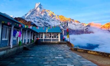
The most dramatic day of the Jiri section. Lamjura is the highest point before Namche and the first crossing above 3,000 metres. Snow is possible on the pass from October to April. The forest below the pass is some of the finest rhododendron and fir forest in Nepal — in March and April, the rhododendron flowering on the approach to Lamjura rivals anything in the Annapurna region. From the summit, the view opens east toward Numbur at 6,957 metres, and on a completely clear morning you can identify Everest’s summit above the intermediate ridges. Junbesi at 2,675 metres below the pass is a large, prosperous Sherpa village with a remarkable sense of its own history — the Thupten Chholing Monastery, 30 minutes walk above the village, was founded 500 years ago and is one of the most significant Nyingma establishments in the Himalayan region.
Days 6 to 7 — Junbesi to Bupsa via Taksindu and Surki La
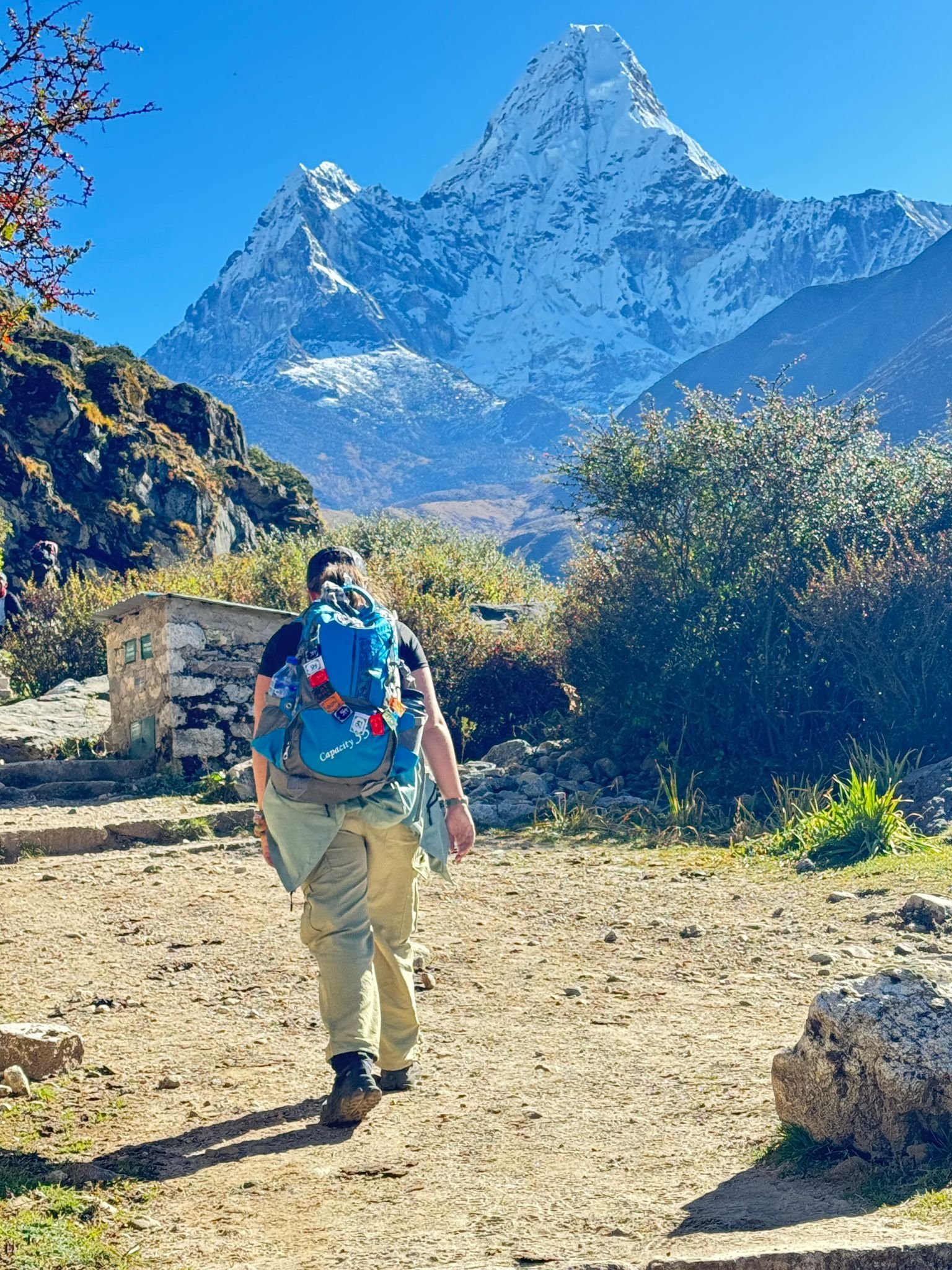
These two stages mark the transition from the Solu to the Khumbu. Taksindu La at 3,071 metres gives views toward the Khumbu peaks and the Taksindu Monastery below it is one of the finest in the Solu region. Surki La is the last major pass of the Jiri section. From this point the trail enters the valley of the Dudh Koshi — the same river that runs through Namche and below the Khumbu Glacier. You are entering Sherpa territory, and the shift in culture and architecture is immediate.
Day 8 — Bupsa to Phakding: Bypassing Lukla
This is the day that makes the Jiri route geographically distinct. The trail from Bupsa descends to Chaurikharka and Phakding without going through Lukla at all. Lukla’s airstrip is visible on the hillside above — you can see the planes landing and taking off — but the trail stays low and drops into Phakding on the standard Namche trail. At Phakding, trekkers who flew from Lukla that morning join the path. You will immediately notice the difference in trail density. We have been here dozens of times and it always produces the same reaction from our Jiri clients: they feel the weight of the crowds and wonder how the other trekkers could possibly be ready for what is coming, altitude-wise, after one afternoon at 2,860 metres.
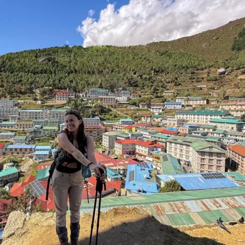
Day 9 — Phakding to Namche Bazaar (3,440m)
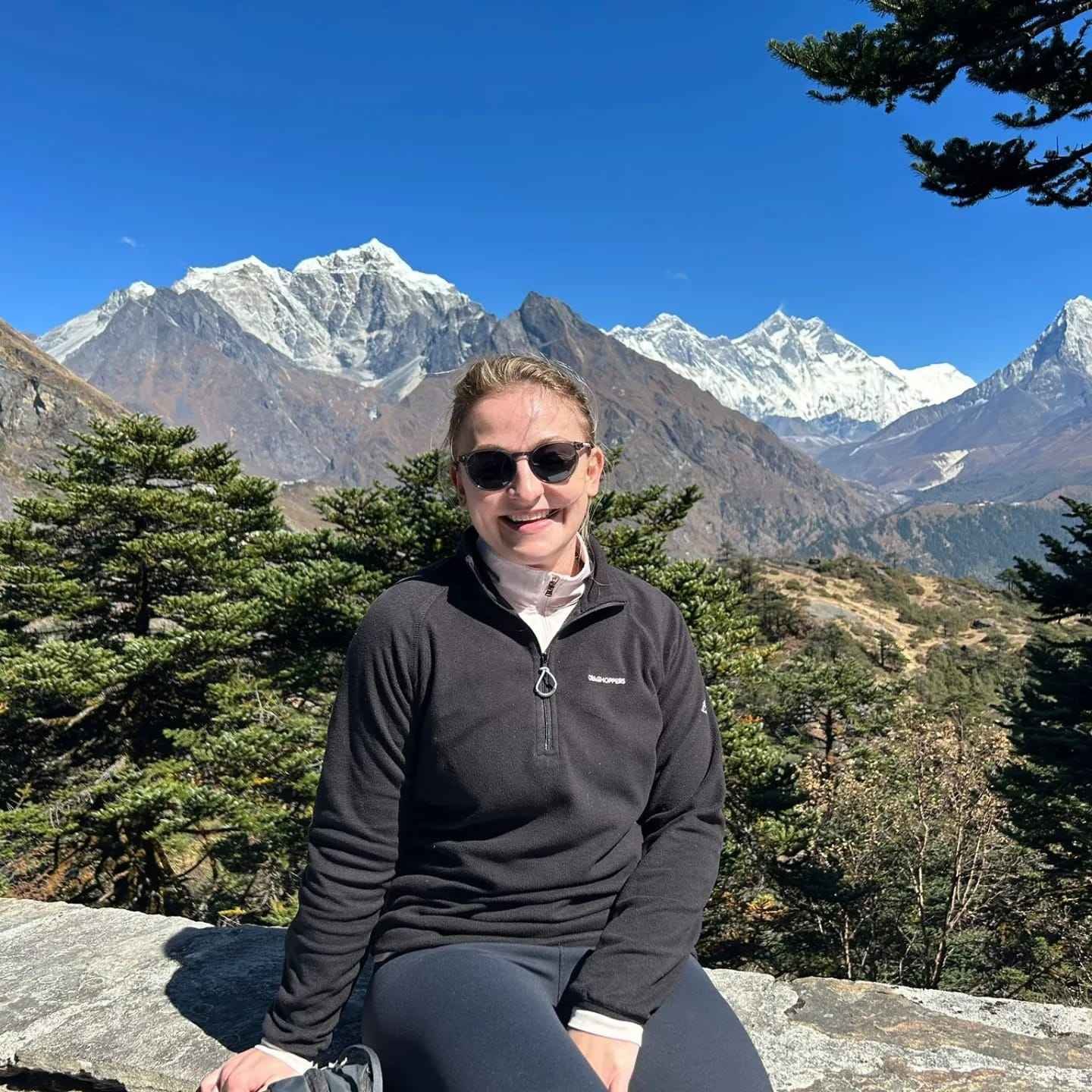
The standard second day of the Lukla route, now your ninth day of walking. Hillary Bridge and the suspension bridges below Jorsalle, the park checkpoint at Monjo, the steep 600-metre final climb to Namche’s amphitheatre of stone buildings. For Jiri-route trekkers, Namche feels genuinely urban after eight days in the Solu hills. The cafes, bakeries, gear shops, and Himalayan Rescue Association office all have a different quality when you have earned them on foot from Kathmandu’s altitude level.
Accommodation on the Route
Jiri Section (Days 2 to 8)
Basic teahouses. Not the polished lodge infrastructure of the Khumbu, but the working guesthouses of Nepal’s hill country. Rooms are typically small, with wooden walls, thin mattresses, and shared squat toilets in most places below Solu Khumbu. Dining rooms are heated by a single wood or yak-dung stove in the evenings. The food menu is limited — dal bhat, noodles, eggs, chapati, and local potato dishes. No WiFi below Salleri. No phone charging at most teahouses below Nunthala. Carry a 20,000mAh power bank and treat it as non-negotiable equipment for this section. Our guides carry a satellite communicator for emergency contact throughout the Jiri section.
Khumbu Section (Days 9 to 17)
Standard Khumbu teahouse infrastructure. WiFi available at most lodges in Namche and as far as Tengboche (slower and less reliable above 4,000 metres). Hot showers available for NPR 200 to 400 extra. Device charging in dining rooms typically available for NPR 200 to 400 per device at lodges above Namche, and often free at Namche-level teahouses. Our guides book ahead by phone to secure the best available rooms in each village, particularly important in October when Khumbu lodges fill quickly.
Customise This Trek
The 21-day Jiri itinerary is our standard structure, but we adapt it for individual fitness levels, interests, and schedules. We have extended the Jiri section by a day to allow time at Thupten Chholing Monastery. We have combined this trek with an Island Peak climbing permit for clients who want a summit after EBC. We have built photography schedules around Kala Patthar sunrise windows. If you want to discuss adjustments, our team in Kathmandu handles all customisation directly — start with our customisation page or contact us directly. Read what previous clients say about trekking with us on our reviews page before booking.

Everest Base Camp Trek Overview
Local Guide Note — Sunil Tiwari, Trekking Guide, Next Trip Nepal: I have guided the Gokyo Lakes and EBC combined route 14 times and Gokyo Ri (5,357m) consistently delivers a broader 360-degree Himalayan panorama than Kala Patthar — particularly clear views of Cho Oyu and Makalu. We always sequence Gokyo first then cross Cho La to EBC on every 21-day group, so the hardest terrain falls when acclimatisation is strongest.
Critical Safety and Logistics
- Ascent above Namche Bazaar (3,440m) must not exceed 300 to 400m of net altitude gain per day to avoid acute mountain sickness.
- Blood oxygen saturation monitored each morning and evening. Readings below 80 percent trigger mandatory rest day. Readings below 70 percent trigger immediate descent protocol.
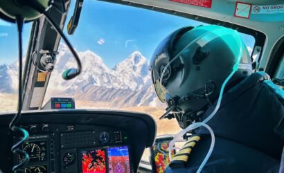
- Ramechhap (Manthali Airport) routing active April to June. Depart Kathmandu by 03:00 on flight days. Build one buffer day in Kathmandu for weather cancellation.
The 21-day Everest Base Camp trek via Jiri is the original route to Everest Base Camp — the path walked by every expedition team before the Lukla airstrip changed the mathematics of Himalayan trekking in 1965. What you get on this route is not simply an extra week of walking. You get a fundamentally different experience of the journey to the highest base camp on earth: gradual altitude gain that your body can actually manage, seven days of near-solitary trekking through one of Nepal’s least-visited hill regions, and the full cultural arc from the Kathmandu Valley floor to the Khumbu Glacier in a single continuous journey.
We at Next Trip Nepal have been running this route for over a decade. Our guides who lead this itinerary have walked the Jiri section many times, not just the Lukla-to-EBC corridor that most Kathmandu trekking companies know. That distinction matters when a teahouse on Day 5 is full and you need to know which family in Junbesi will take four trekkers on short notice, or when the trail from Taksindu is washed out and you need a working alternative. The Jiri section rewards expertise in ways the main Khumbu trail does not.
The History of This Route
The 1953 British Everest Expedition under Colonel John Hunt used the Solu Khumbu approach from the Kathmandu Valley. Edmund Hillary and Tenzing Norgay, as members of that expedition, walked through the same passes and villages that form the first half of this 21-day itinerary. Shipton and Tilman had done the same on their 1951 reconnaissance expedition that confirmed the South Col as a viable summit route. The route from the Kathmandu valley through Solu Khumbu was so standard among mountaineers and explorers of that era that early expedition diaries describe it with the matter-of-fact tone of a commute — a necessary transit to be completed before the real work began at Namche.
The Lukla airstrip was completed in 1964 to 1965 under Hillary’s own involvement, originally to serve local communities and his school-building projects in the Khumbu. Within a decade it had become the standard approach for virtually all Everest expeditions and commercial trekking groups. By the 1980s, the Jiri route had become a specialist choice — longer, harder, and commercially less convenient. Today, fewer than 300 foreign trekkers complete the full Jiri to Namche section in any given year. The route is not forgotten, but it is walked almost exclusively by people who have done their research and made a deliberate choice.
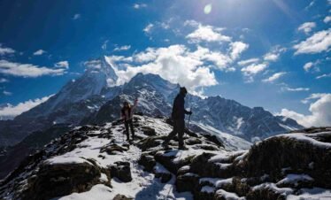
The Six Passes and What They Involve
The defining physical characteristic of the first eight days of this trek is the repeated pattern of climbing a mountain pass and then descending steeply to the next valley before climbing again. There are six significant crossings in the Jiri to Namche section, and each one has a distinct character.
Deurali Pass at 2,705 metres is the first, reached on Day 3 from Jiri. The climb from Jiri town takes 3 to 4 hours through terraced farmland and mixed forest. The view from the pass looks back toward the Kathmandu Valley in the west and east toward the Solu hills. It is a gentle introduction to what follows.
The descent to Kinja at 1,480 metres on Day 4 is the sharpest single descent of the entire 21-day trek — 1,200 metres of altitude lost in the space of a few hours, down a steep trail through forest to the Khimti Khola river. Immediately after crossing the river, the trail climbs again to Sete at 2,575 metres. This is the moment most trekkers understand that the Jiri section is not a gentle prelude to the main event.
Lamjura Pass at 3,530 metres is the high point of the Jiri section and the most significant crossing. The approach from Sete climbs through some of the finest rhododendron and fir forest in eastern Nepal. Above the treeline, the pass is exposed and can carry snow from October through April. From the summit cairn on a clear morning, the Everest massif is visible to the northeast — a distant white triangle above the eastern ridges that gives the crossing its particular psychological weight. Below the pass to the east, the trail drops through forest to Junbesi, one of the most pleasant villages in the entire Solu Khumbu region.
Taksindu La at 3,071 metres, crossed on Day 6, is lower than Lamjura but carries views that open further east toward the Khumbu. Taksindu Monastery, just below the pass on the eastern side, is a Nyingma Buddhist monastery in a setting of pine forest above a deep valley. The monastery compound includes accommodation used by retreatants and is one of the architecturally finest small monasteries in Nepal.
Surki La at 2,293 metres on Day 7 is the lowest of the named passes and the last of the Jiri section. After Surki La, the trail enters the watershed of the Dudh Koshi river and the character of the landscape shifts from Solu hill country to the narrow valleys and big suspension bridges of the Khumbu approach.
The Solu Khumbu as a Cultural Region
Most trekkers think of the Khumbu as the region between Lukla and Base Camp — the Sherpa heartland of Namche, Tengboche, and the upper glacier valleys. But the Solu Khumbu district is considerably larger and culturally more complex. The Solu region south of Namche is home to both Sherpa communities who came south from Khumbu over generations and Rai communities who have lived in these hills since long before Sherpa settlement. The two groups intermarried, traded, and built the village economies of the Solu plateau together.
The monastery culture of the Solu is distinct from the more famous Khumbu monasteries of Tengboche and Pangboche. Thupten Chholing Monastery near Junbesi, founded in 1959 by Trulshik Rinpoche, houses several hundred monks and nuns in a monastic village above Junbesi. It is not a tourist site in the way Tengboche is — there are no tour group schedules, no organized entry times. Visitors arrive and are received according to whatever the monastery schedule allows. Prayer halls, scripture study rooms, and retreat cabins occupy the hillside above the main buildings. If the timing of your visit coincides with a puja, you may sit in the courtyard and observe.
Chiwong Monastery above Phaplu is another significant Nyingma institution with a Mani Rimdu festival held in November that is attended by communities from across the Solu district. These are working monasteries in living communities, not heritage sites preserved for visitors.
The Psychological Arc of 21 Days
The experience of this trek changes in a way that is hard to fully describe to someone who has not done the Jiri section. The first six days are quiet — genuinely quiet in the way that remote hill travel is quiet. Long hours on trails where you may see no other foreign trekkers. Small villages where children run to the school gate to watch you pass. Teahouse owners who speak no English but make tea anyway and gesture to the benches by the stove. Your guide is your point of communication with this world, and the relationship between your guide and the people on this trail is a different kind of relationship than the commercial transaction of the standard Khumbu teahouse system.
By Day 8, as you approach Phakding, the character of the experience begins to shift. The first trekking groups from Lukla appear on the trail — groups who flew in that morning from Kathmandu and are now making their way to Namche with fresh legs and the slightly anxious energy of people who do not know what they are walking into. Our Jiri clients tell us they feel a strange combination of solidarity and alienation at this point. Solidarity because they are now on the same path toward the same destination. Alienation because the experience of that path is so different from what they have been doing for the past week.
Namche at 3,440 metres, reached on Day 9, feels like a city. Not because it is large — it is a small mountain town — but because it has cafes, a bakery, a gear shop with prices in dollars, and WiFi. After eight days in the Solu, this feels like an arrival in the developed world. The emotional weight of this contrast is part of what makes the Jiri route’s final arrival at Base Camp feel different from the standard Lukla approach. You have genuinely traveled. You have earned each altitude metre on foot, from the valley floor, and you know it in your legs and your lungs in a way that a flight to Lukla simply cannot provide.
Who This Trek Is For, and Who It Is Not For
We are honest with prospective clients about the requirements for this trek. The 21-day Jiri route is appropriate for physically fit adults and older teenagers who have done multi-day hiking before, ideally with a pack and in hilly terrain. It is not appropriate for beginners, for people with less than six weeks to prepare, or for anyone who has not tested their body at altitude before and has a personal history of AMS. It is also not a good choice for people with tight schedules — the Jiri section does not permit easy exit if you fall behind pace, and the two planned acclimatisation rest days are not optional buffers.
If you are unsure whether this route is right for you, we recommend completing the standard 14-day Lukla route first and returning for the Jiri route on a second Nepal trip. The two treks are complementary rather than redundant — the Jiri route gives you everything the Lukla route gives you, plus a week of hill country that the Lukla route never touches.
What Our Team Provides
We assign a private guide with specific Jiri route experience to every client on this itinerary. This is not a guide who knows only the Lukla corridor — our Jiri guides have walked the full route from Jiri to Base Camp and know the teahouses, the trail conditions, and the community contacts along the entire length of it. Porter ratios are one porter per two trekkers, with the maximum porter load of 25kg respected without exception (we do not overload porters). Our Kathmandu office does a daily check-in via WhatsApp satellite message throughout the Jiri section where mobile signal is unavailable. All our guides carry a pulse oximeter for daily oxygen saturation monitoring from Day 5 onward and a first aid kit with altitude medication (Diamox available on advice). Helicopter evacuation can be arranged within 4 to 6 hours from most points on the Khumbu section and within 6 to 12 hours from the Jiri section, coordinated through our Kathmandu office with rescue insurance companies.
Further Reading from Our Kathmandu Guides
14 Days Everest Base Camp Trek Highlights
- Trek the original 1953 Hillary and Tenzing expedition route from Jiri to Everest Base Camp, the path used before the Lukla airstrip changed Himalayan trekking forever
- Superior acclimatisation: 7 days of gradual altitude gain from Jiri (1,905m) to Namche (3,440m) on foot, reducing AMS risk vs the rapid altitude jump of the standard Lukla route
- Six mountain passes in the first week including Lamjura La (3,530m) with views of Numbur (6,957m) and Everest summit visible on clear days
- Near-empty trails on the Jiri section: fewer than 300 foreign trekkers per year compared to 50,000+ on the Lukla route
- Authentic Solu Khumbu cultural experience: Sherpa and Rai villages, Thupten Chholing Monastery, Chiwong Monastery, and local weekly markets
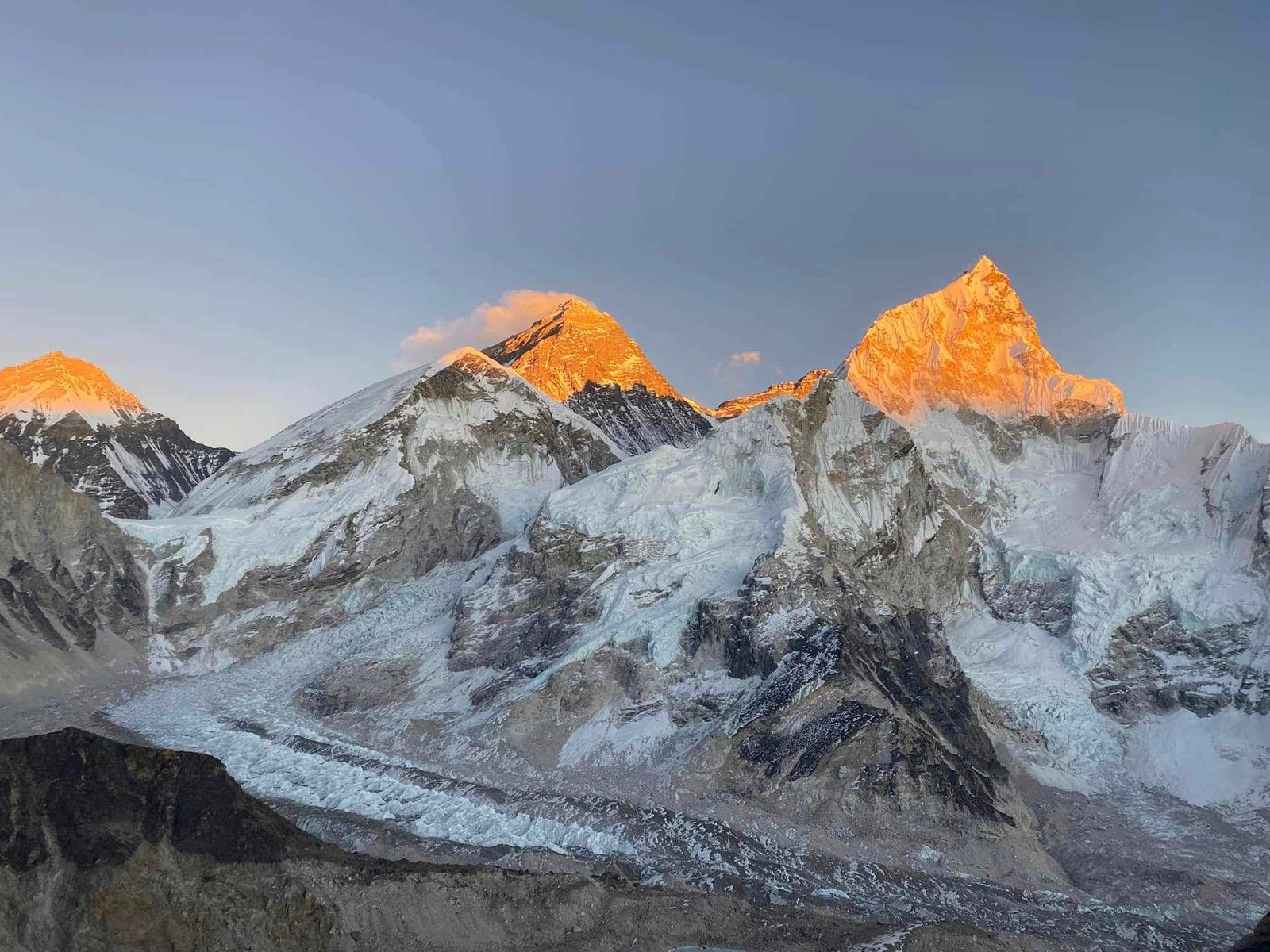
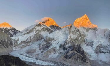
- Everest Base Camp (5,364m) at the foot of the Khumbu Icefall, the staging point for every Everest summit attempt with expedition tents visible in spring season
- Kala Patthar sunrise (5,550m): the highest point on the itinerary and the best direct view of Mount Everest summit at 8,849m
- Private guide with specific Jiri route experience (not just the Lukla corridor) for all 21 days, with daily check-in to the Kathmandu office
- Optional Island Peak (6,189m) or Lobuche East (6,119m) climbing add-on from the Everest Base Camp area
- Full Nepal experience: Kathmandu valley, remote Solu hill country, Sherpa cultural heartland, and the highest base camp on earth


Write a Review
You must be logged in to post a comment.