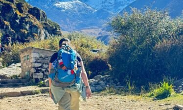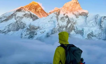
The Annapurna Circuit Trek is one of the most popular and diverse trekking routes in Nepal, offering a complete Himalayan experience in a single journey. ACT classic trek circles the Annapurna Massif, passing through traditional villages, lush valleys, and high-altitude landscapes before crossing the famous Thorong La Pass (5,416 m).
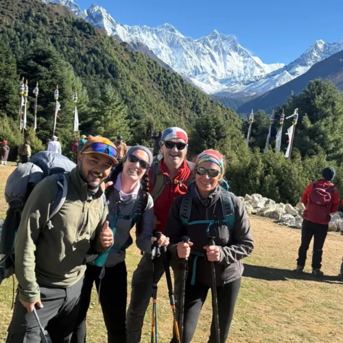
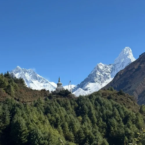
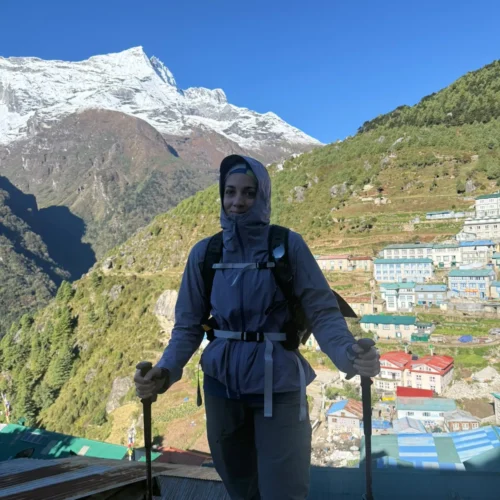
Known for its scenic beauty, cultural richness, and gradual altitude gain, the Annapurna Circuit trek is ideal for trekkers seeking a balanced mix of adventure and comfort. With flexible itineraries, tea house accommodation, and stunning views of peaks like Annapurna I and Dhaulagiri, it remains one of the best trekking options in Nepal.
Annapurna Circuit Trek Cost – 14 Days
| Group Size | Price Per Person | Duration | Action |
|---|---|---|---|
| 1 Person | USD 1445 | 14 Days | Inquiry |
| 2 Persons | USD 1375 | 14 Days | Inquiry |
| 3–5 Persons | USD 1275 | 14 Days | Inquiry |
| 6–8 Persons | USD 1175 | 14 Days | Inquiry |
| 9–12 Persons | USD 1075 | 14 Days | Inquiry |
| 13+ Persons | USD 975 | 14 Days | Inquiry |
The above cost includes permits, accommodation, meals during the trek, transportation, and an experienced guide. Contact us directly on WhatsApp for custom itinerary and best price.

Annapurna Circuit Trek Overview
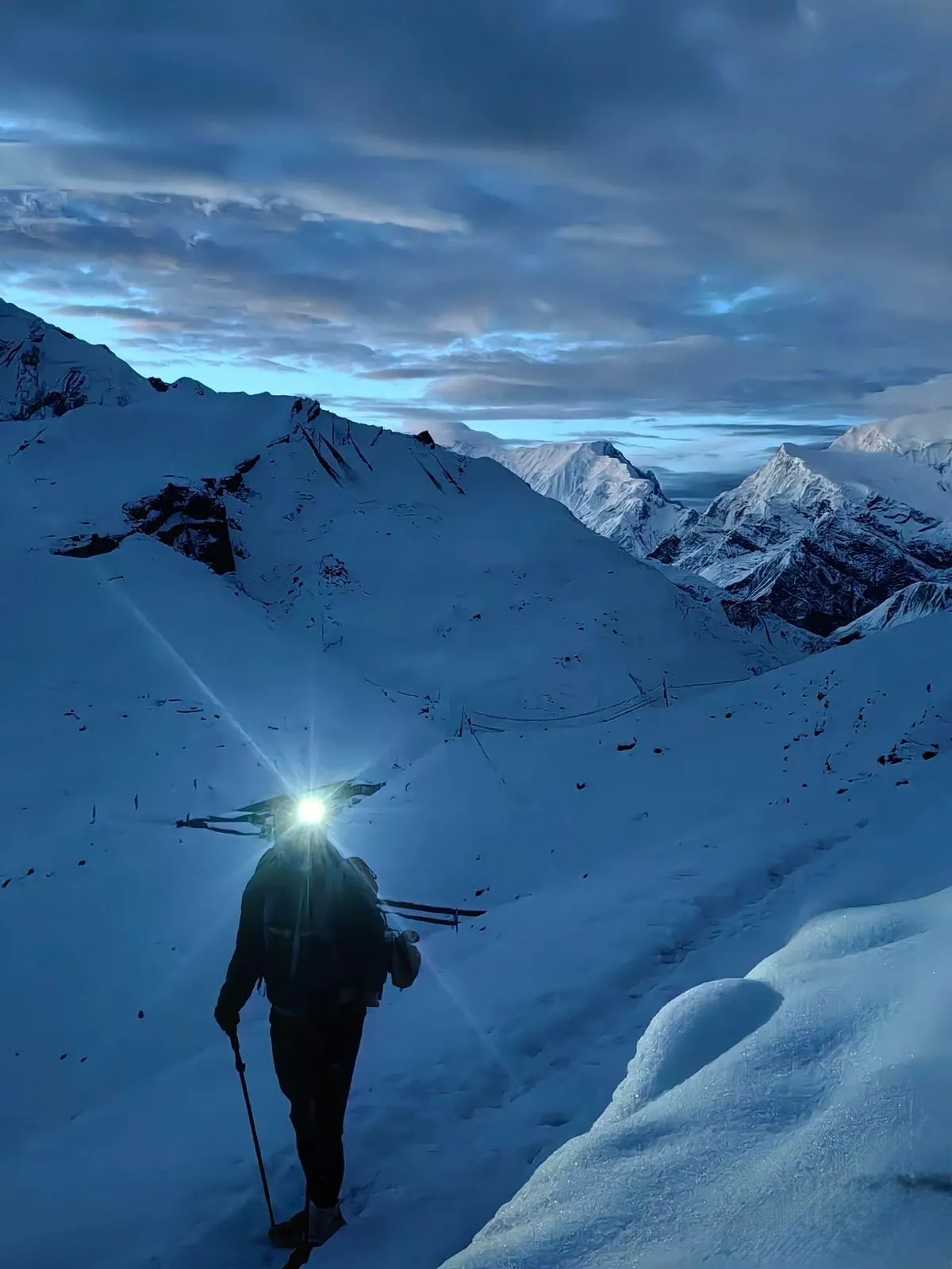
Local Guide Note — Sunil Tiwari, Trekking Guide, Next Trip Nepal: I have guided the Annapurna Circuit 17 times and the detail most itineraries understate is the wind on Thorong La (5,416m) — it routinely exceeds 50 km/h after 10:00 am, making the descent to Muktinath genuinely hazardous for late starters. We cross Thorong La before 09:30 am on every single circuit we lead, without exception.
Critical Safety and Logistics
- Thorong La Pass (5,416m) crossing window on the circuit: 04:30 to 10:00 from High Camp. Afternoon wind averages 50 to 60 km per hour on the western col after 10:00.
- Road construction impact: Besisahar to Chame motorable road active during peak months. Classic walking trail intact from Chame northward and throughout all sections above 3,000m.
- ACAP and TIMS permits must be carried at all times. Spot checks occur at Ghasa, Manang, and Jomsom checkpoints.
The Annapurna Circuit Trek is a 13-day circumnavigation of the Annapurna massif in north-central Nepal, crossing Thorong La Pass at 5,416m and descending through the rain-shadow desert of the Mustang district. The route begins at Besisahar (760m), climbs through subtropical forest and high-altitude grassland, passes the acclimatisation hub of Manang (3,519m), crosses Thorong La before dawn, and exits through the Kali Gandaki Valley to Pokhara. Covering 160 to 230 km depending on road sections used, the circuit passes through seven distinct vegetation zones and three living ethnic cultures in a single connected route.
What Sets the Annapurna Circuit Apart
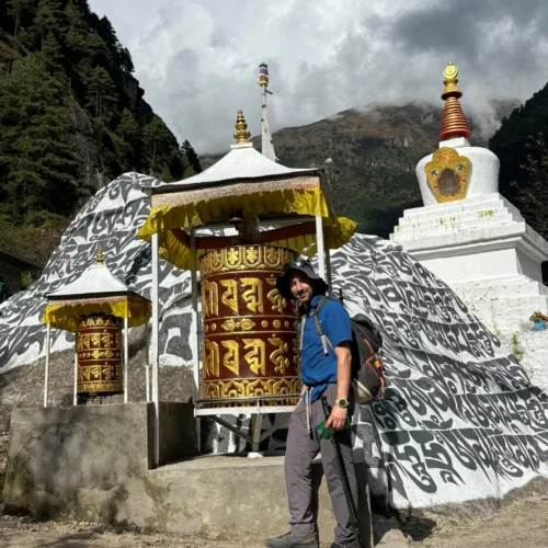
Three things separate the Annapurna Circuit from other Nepal treks of similar duration. First, the elevation profile is gradual enough on the approach that most trekkers complete the Thorong La crossing without prior high-altitude experience, provided the acclimatisation schedule is followed. Second, the route passes through seven distinct vegetation zones in 13 days, from tropical river forest below Besisahar to Tibetan-style high desert around Kagbeni. Third, the Mustang district villages of Kagbeni, Jomsom, and Marpha are living Thakali communities where apple orchards, stone-walled houses, and family-run teahouses have remained largely unchanged across generations.
No other Nepal trek of similar length combines the elevation of the Annapurna range, the ecological diversity of the lower valleys, and the cultural depth of the Mustang corridor in a single unbroken route.
Annapurna Circuit Trek Highlights
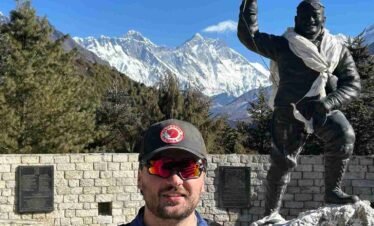
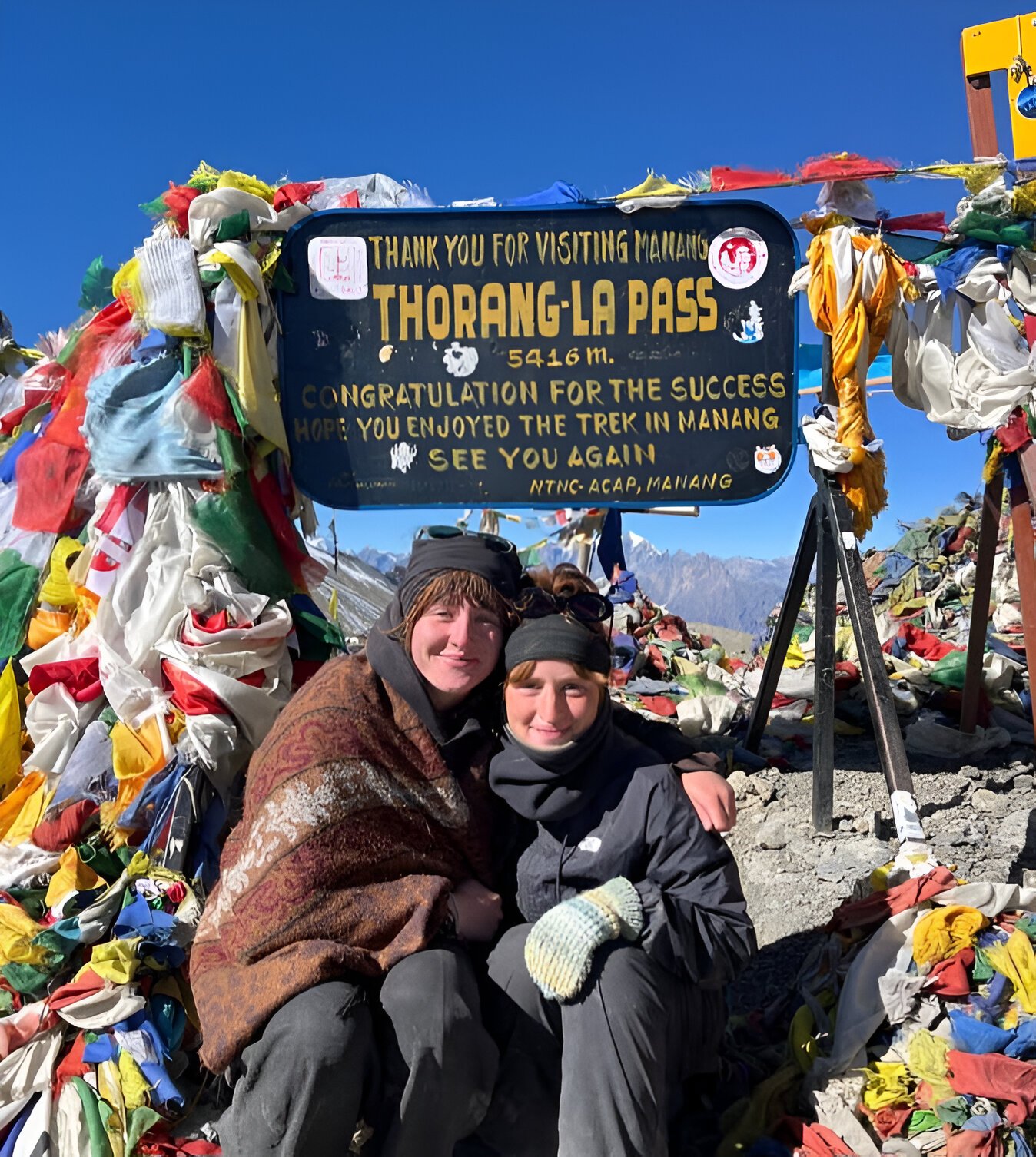
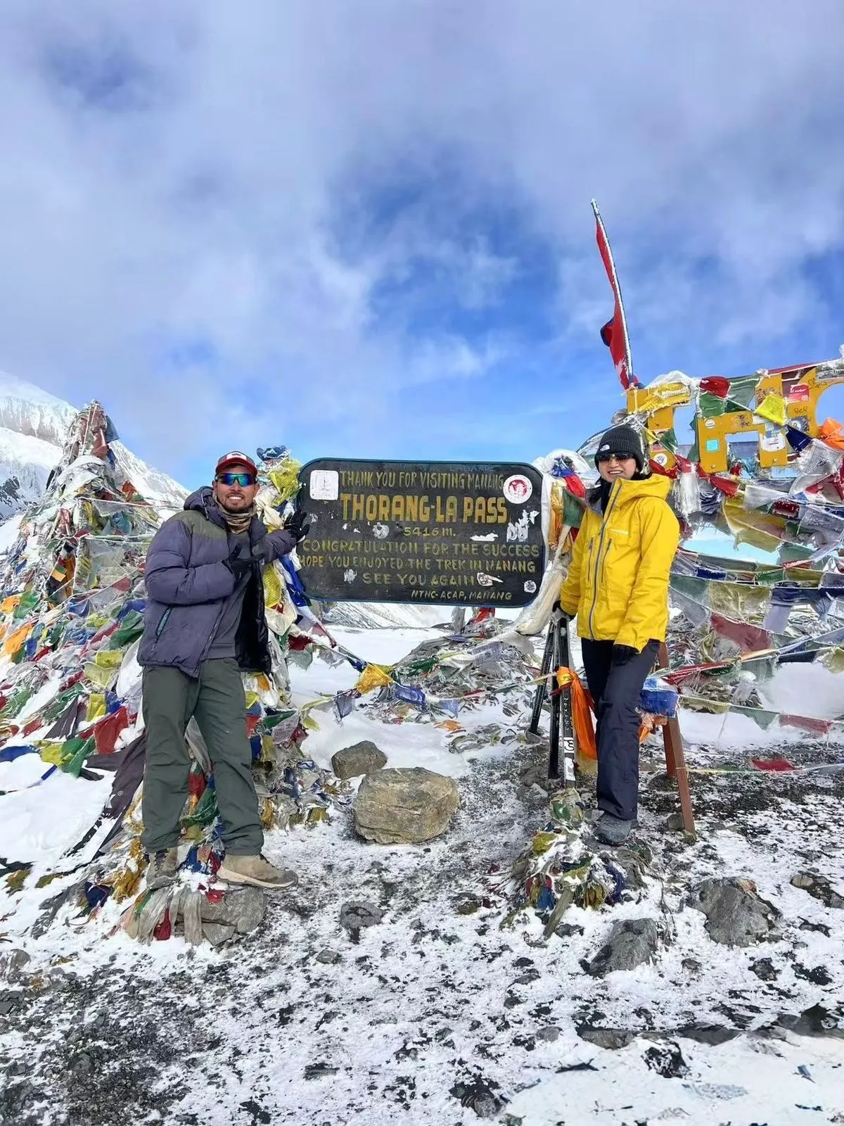
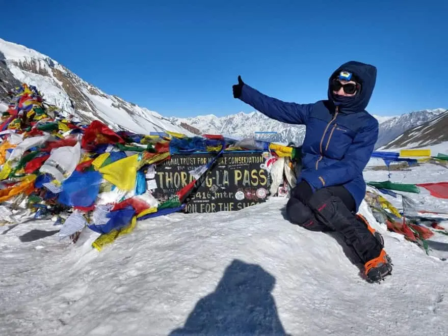
Thorong La Pass (5,416m)
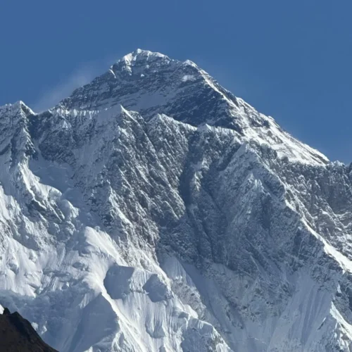
The Thorong La crossing is a single long day from Thorong High Camp (4,925m) to Muktinath (3,760m), covering 491m of ascent over 5 km and 1,656m of descent over 9 km. The descent places significantly more strain on the knees than the climb. Crossing day starts before 04:30 because afternoon wind on the western col regularly exceeds 50 km per hour after 10:00. Our team departs all groups from High Camp no later than 04:15 and targets the summit by 08:30. From the prayer-flag summit at 5,416m, Dhaulagiri (8,167m) and Annapurna I (8,091m) are visible simultaneously on either side of the Kali Gandaki valley below.
Manang (3,519m) and Acclimatisation Day
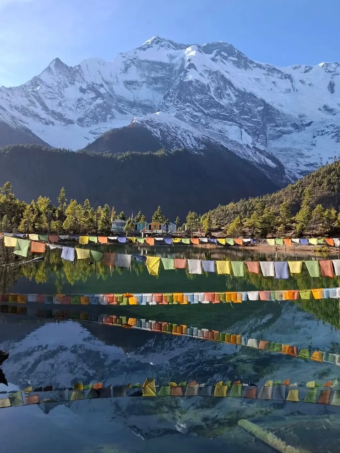
Manang is the acclimatisation hub of the circuit. After six days of steady climbing from Besisahar, trekkers spend a full rest day here before pushing to High Camp. The acclimatisation day is not optional: it is the stage that determines whether the Thorong La crossing is a controlled success or a forced turnaround. We use the rest day for a hike to the Gangapurna Lake viewpoint at 3,720m, returning to sleep low at Manang. The village has a Himalayan Rescue Association medical post staffed seasonally, offering free AMS consultations to trekkers.
Muktinath Sacred Site (3,760m)
Muktinath sits on the far side of Thorong La in the Mustang district and is one of the most important pilgrimage destinations in both Hinduism and Tibetan Buddhism. The Vishnu temple complex contains 108 stone water spouts arranged in a curved arc, all fed by a single natural source. The Jwala Mai shrine holds a natural gas flame and a spring in the same chamber, considered sacred by both traditions. For non-pilgrims, the ridge above Muktinath at dusk gives unobstructed views of Dhaulagiri (8,167m) and Nilgiri North (7,061m) lit in direct afternoon sun while the valley below falls into shadow.
Kali Gandaki Gorge and Mustang Villages
The descent from Muktinath follows the upper Kali Gandaki River through the deepest gorge on earth by vertical measurement between flanking summits: Dhaulagiri (8,167m) to the west and Annapurna I (8,091m) to the east, with a valley floor at Tukuche at approximately 2,590m. Villages passed in this section include Kagbeni (the walled medieval town marking the boundary of restricted Upper Mustang), Jomsom (the Mustang district capital with the region’s only airport), and Marpha (known across Nepal for its apple orchards and apple brandy). The Thakali people who run the lodges through this valley are consistently the most organised hosts on the circuit.
Best Season for the Annapurna Circuit Trek
The Annapurna Circuit has two reliable trekking windows each year. Spring, from March to May, brings rhododendron and magnolia bloom in the lower forest sections below Chame, settled weather above Manang, and good visibility on the Thorong La. Autumn, from September to November, brings the clearest mountain views of the year and dry, firm trail conditions across all sections. October is the single most reliable month across the full circuit.
Winter trekking from December to February is possible on the lower sections, but Thorong La closes for days at a time when snowfall accumulates above 5,000m. We confirm pass conditions via radio contact with our Manang-based team before any winter group commits to the High Camp push. Monsoon season from June to August is not recommended for the Thorong La section: the pass itself is snowless but landslide risk on the Besisahar to Chame approach road is high during peak monsoon months.
Difficulty and Fitness Requirements
The Annapurna Circuit is graded moderate to challenging. Daily walking time averages 5 to 7 hours, with maximum elevation gain per day kept to 400m above Manang on our itinerary. The single hardest element is the Thorong La crossing day: up to 14 hours of walking from pre-dawn cold at 4,925m to warm afternoon sun at 3,760m. Trekkers who can sustain 6 hours of continuous walking at sea level without distress, and who have no untreated respiratory or cardiac conditions, are appropriate candidates for this route.
No technical climbing, fixed ropes, or crampons are required at any point on the standard Annapurna Circuit itinerary.
Acclimatisation Schedule
Altitude-related illness is the primary risk on this trek and it is entirely preventable with a correctly structured schedule. Our 13-day itinerary follows the Wilderness Medical Society guideline of no more than 300 to 400m net gain in sleeping elevation per night above 3,000m. The critical altitude stages:
- Night 6 at Manang (3,519m): compulsory acclimatisation rest day, day hike to 3,720m and return to sleep low
- Night 7 at Ledar (4,200m) or Phedi: first high-camp elevation night, steady pace only
- Night 8 at Thorong High Camp (4,925m): one night only at this elevation, Thorong La crossing the following morning before 04:30
- Night 9 at Muktinath (3,760m): immediate post-crossing descent eliminates further altitude risk for the remainder of the trek
Blood oxygen saturation is measured each morning and evening with our team’s pulse oximeters from Manang onward. A reading below 80 percent triggers a mandatory extra acclimatisation day. A reading below 70 percent triggers immediate descent from current elevation.
Road Construction Impact in 2026
The motorable road from Besisahar to Chame is an active construction zone in 2026. Sections of the original trekking trail between Besisahar and Chame now run alongside or share the road surface. From Chame (2,710m) northward to Thorong La, and throughout the entire Mustang descent from Muktinath to Jomsom, the original foot trail is fully intact, unpaved, and free of road impact.
We begin all Annapurna Circuit groups on foot from Ngadi or Bhulbhule rather than Besisahar, adding 3 km of clean trekking trail and bypassing the most disrupted section of the approach road. This adjustment does not change the total day count of the itinerary.
Permits Required for the Annapurna Circuit
- Annapurna Conservation Area Permit (ACAP): NPR 3,000 per person (approximately USD 22). Funds conservation and trail maintenance within the Annapurna Conservation Area, the largest protected area in Nepal at 7,629 sq km.
- TIMS Card (Trekkers’ Information Management System): NPR 2,000 per person (approximately USD 15). Required for all trekking regions in Nepal and issued by the Nepal Tourism Board.
Both permits are arranged by our team in Kathmandu or Pokhara before departure. The ACAP office in Pokhara issues same-day permits from its Lakeside location. Checkpoint staff verify original documents at Ghasa, Manang, Muktinath, and Jomsom. Photocopies are not accepted.
Annapurna Circuit Trek: Frequently Asked Questions
How long is the Annapurna Circuit Trek?
Our standard Annapurna Circuit is 13 days from Kathmandu or Pokhara, including approach transfer and Pokhara exit. The trek covers 12 walking days and one mandatory acclimatisation rest day at Manang on Day 7.
How much does the Annapurna Circuit Trek cost in 2026?
Our 2026 Annapurna Circuit Trek starts from USD 1,449 per person. This covers a licensed English-speaking guide, a porter (shared between 2 trekkers), teahouse accommodation throughout, ACAP and TIMS permit fees, ground transport from the trailhead to Jomsom, and Kathmandu or Pokhara airport transfers. International flights and personal travel insurance are not included.
Is the Annapurna Circuit safe for first-time trekkers?
Yes, for trekkers with a good base fitness level. No technical climbing or prior high-altitude experience is required. Our group maximum is 10 trekkers per guide. Blood oxygen is monitored from Manang onward, and the itinerary includes a genuine acclimatisation day rather than the compressed 12-day schedule that causes most turnarounds at High Camp.
What is the highest point on the Annapurna Circuit?
Thorong La Pass at 5,416m is the highest point. The summit is reached after ascending from Thorong High Camp at 4,925m on crossing day. No other section of the standard 13-day circuit goes above 4,925m.
When is the best time to do the Annapurna Circuit?
October and early November give the most reliable weather and clearest views. March and April are excellent for lower-valley rhododendron season and fewer crowds on the Thorong La. December to February is possible but carries Thorong La closure risk. June to August (monsoon) is not recommended for the high-altitude sections.
Can I add Tilicho Lake to the Annapurna Circuit?
Yes. The Tilicho Lake side trip at 4,919m branches from the main circuit at Manang and requires 2 additional days. We offer a 15-day Annapurna Circuit with Tilicho Lake variant on request. Tilicho is among the highest lakes of its size in the world and the side trail receives far less foot traffic than the main Thorong La route.
Do I need a guide for the Annapurna Circuit?
The trail is well-marked from Chame onward and many independent trekkers complete the route. However, a licensed local guide substantially reduces the risk of poor AMS-related decisions above 4,000m, where altitude can impair judgement. Our guides carry emergency oxygen and pulse oximeters, communicate with Kathmandu by satellite from above Manang, and can coordinate evacuation from the Muktinath or Jomsom airstrip if required.
Further Reading from Our Kathmandu Guides
How to Book the Annapurna Circuit Trek
14 Days Annapurna Circuit Trek Highlight
- Cross Thorong La Pass at 5,416 meters, one of the highest trekking passes in the world
- Witness panoramic views of Annapurna I (8,091m), Annapurna II (7,937m), Annapurna III (7,555m), and Annapurna IV (7,525m)
- Trek alongside the Marsyangdi River through dramatic gorges and valleys
- Experience the world's deepest gorge, the Kali Gandaki, between Dhaulagiri and Annapurna
- Walk through landscapes ranging from subtropical forests to high alpine desert
- Visit Manang village and attend altitude sickness briefing at Himalayan Rescue Association clinic
- Explore ancient Braga Monastery with 500 year old murals and religious artifacts
- Witness Tibetan Buddhist culture in Manang and upper valley settlements
- Circle the entire Annapurna massif rather than retracing your steps
- Experience dramatic climate and vegetation changes within a single trek