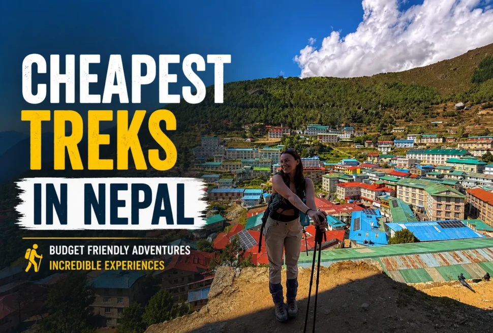
Most people who come to Nepal dream about Everest Base Camp. They train for months, save up, fly into Lukla with a heart full of excitement, and follow the same trail that tens of thousands walk every single year. And it is absolutely worth it. Everest Base Camp is spectacular.
But there is a group of trekkers who look at that route and think, what else is there? What happens if I go further, higher, and deeper into the Khumbu? What does the Everest region look like when you see it not from one angle but from every angle?
The Everest Three Pass Trek is the answer to that question.
This is the route that takes you over three of the highest trekking passes in the world. It sends you through the Khumbu Valley, across to the Gokyo Valley, and out through the Bhotekoshi Valley. It gives you Everest Base Camp, Kala Patthar, Gokyo Lakes, and Ngozumpa Glacier all in one continuous loop. When you finish, you will have seen the Everest region in a way that very few trekkers ever do.
It is not easy. It is long, it is high, and there are days that will test everything you have. But if you are reading this, you probably already know that. You are not looking for easy. You are looking for complete.
This guide gives you every day of the trek broken down with distance in kilometres, hours of walking, and elevation gain and loss so you can plan with full clarity.
Table of Contents
- 1 The Three Passes
- 2 Trek at a Glance
- 3 Full Day-by-Day Itinerary
- 3.1 Day 1 — Fly Kathmandu to Lukla, Trek to Phakding
- 3.2 Day 2 — Phakding to Namche Bazaar
- 3.3 Day 3 — Acclimatisation Day in Namche Bazaar
- 3.4 Day 4 — Namche Bazaar to Tengboche
- 3.5 Day 5 — Tengboche to Dingboche
- 3.6 Day 6 — Acclimatisation Day in Dingboche
- 3.7 Day 7 — Dingboche to Chhukung
- 3.8 Day 8 — Chhukung to Lobuche via Kongma La Pass (First Pass)
- 3.9 Day 9 — Lobuche to Gorak Shep, Trek to Everest Base Camp
- 3.10 Day 10 — Kala Patthar Sunrise, Trek to Dzongla
- 3.11 Day 11 — Dzongla to Thangnak via Cho La Pass (Second Pass)
- 3.12 Day 12 — Thangnak to Gokyo
- 3.13 Day 13 — Gokyo Ri Sunrise, Rest Day at Gokyo
- 3.14 Day 14 — Gokyo to Lungden via Renjo La Pass (Third Pass)
- 3.15 Day 15 — Lungden to Thame
- 3.16 Day 16 — Thame to Namche Bazaar
- 3.17 Day 17 — Namche Bazaar to Lukla
- 3.18 Day 18 — Fly Lukla to Kathmandu
- 4 Full Itinerary Summary Table
- 5 Best Time to Do the Everest Three Pass Trek
- 6 Permits Required
- 7 Physical Requirements and Preparation
- 8 Packing Essentials
- 9 Altitude Sickness: What You Need to Know
- 10 Why Choose Next Trip Nepal for This Trek
The Three Passes
Kongma La — 5,535m (18,159ft) The highest and hardest of the three. You gain over 800 metres from Chhukung on steep rocky ground past frozen lakes. The views of Lhotse, Makalu, and the Khumbu Glacier from the top are extraordinary. This is the day that earns its reputation.
Cho La — 5,420m (17,782ft) Cho La connects the Khumbu Valley to the Gokyo Valley and involves a short glacier crossing near the summit. It can be icy depending on the season. Cholatse and Ama Dablam watch over you the entire way across.
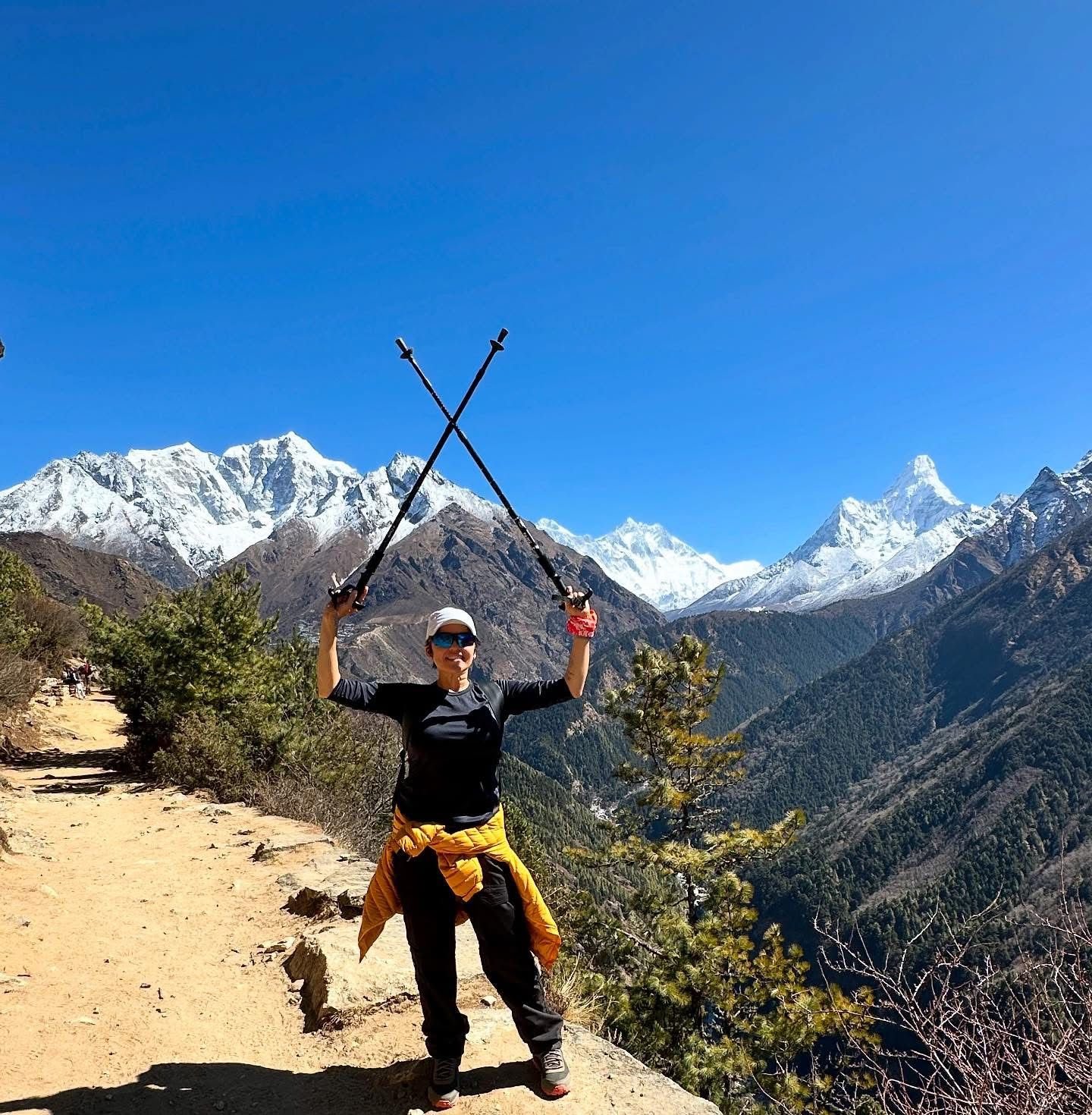
Renjo La — 5,360m (17,520ft) The most scenic of the three. From the top you see Everest, Lhotse, Makalu, Cho Oyu, and the full chain of Gokyo Lakes below you. Many trekkers call this the single most beautiful viewpoint of the entire circuit.
Trek at a Glance
| Detail | Data |
|---|---|
| Total Distance | 160 to 166 km |
| Duration | 17 to 20 days |
| Maximum Altitude | Kala Patthar 5,555m |
| Total Elevation Gain and Loss | Around 13,500m cumulative |
| Daily Walking Hours | 6 to 10 hours |
| Average Daily Distance | 8 to 12 km |
| Difficulty | Challenging |
| Best Seasons | April to May and October to November |
Full Day-by-Day Itinerary
Day 1 — Fly Kathmandu to Lukla, Trek to Phakding
| Route | Lukla (2,860m) to Phakding (2,610m) |
| Distance | 6.2 km |
| Trekking Time | 3 hours |
| Elevation | 250m loss |
The trek begins with the famous mountain flight into Tenzing Hillary Airport in Lukla. From Lukla you descend gently along the Thado Koshi River, crossing suspension bridges draped with prayer flags before reaching the quiet village of Phakding. Today is short by design. Your body is fresh but your lungs are only just beginning to adjust. Rest, eat well, and sleep early.
Overnight: Phakding
Day 2 — Phakding to Namche Bazaar
| Route | Phakding (2,610m) to Namche Bazaar (3,440m) |
| Distance | 7.4 km |
| Trekking Time | 6 hours |
| Elevation | 830m gain |
Your first demanding day. The trail follows the Dudh Koshi River north through dense forest, crossing the famous Hillary Suspension Bridge and passing through Monjo and the Sagarmatha National Park checkpoint. After the checkpoint the trail climbs steeply and steadily all the way to Namche. Somewhere on this climb, if the sky is clear, you catch your first glimpse of Everest through a gap in the trees. It stops people every time.
Namche Bazaar is built like an amphitheatre into the hillside at 3,440m. It has bakeries, gear shops, Wi-Fi cafes, and teahouses packed with trekkers from all over the world. It is the last real town before the high country.
Overnight: Namche Bazaar
Day 3 — Acclimatisation Day in Namche Bazaar
| Route | Day hike to Everest View Hotel area (3,880m) |
| Distance | 6 to 9 km round trip |
| Trekking Time | 4 to 5 hours |
| Elevation | 440m gain and return |
Do not treat this as a rest day. You hike higher than your sleeping altitude and return to Namche for the night. This is the climb high, sleep low principle that keeps you safe on the days ahead. The hike up to the Everest View Hotel rewards you with panoramic views of Everest, Lhotse, Ama Dablam, and Thamserku. You can also continue to the Sherpa villages of Khumjung and Khunde to visit Edmund Hillary’s famous school and the Khumjung Monastery. Spend the afternoon exploring Namche, eating well, and hydrating.
Overnight: Namche Bazaar
Day 4 — Namche Bazaar to Tengboche
| Route | Namche Bazaar (3,440m) to Tengboche (3,855m) |
| Distance | 10 km |
| Trekking Time | 5 hours |
| Elevation | 415m net gain with descent and re-climb |
From Namche the trail drops sharply down to the Dudh Koshi River before climbing back up through rhododendron and pine forest to Tengboche. The trail passes through Kyangjuma and Sanasa before reaching the ridge at Tengboche. The views of Ama Dablam on this section are among the finest anywhere in Nepal.
Tengboche Monastery is the most important monastery in the Khumbu region, sitting at 3,855m with a direct view of Everest, Lhotse, and Nuptse. If your timing is right you may hear the monks chanting during their evening prayers. It is worth sitting and listening.
Overnight: Tengboche
Day 5 — Tengboche to Dingboche
| Route | Tengboche (3,855m) to Dingboche (4,360m) |
| Distance | 11 km |
| Trekking Time | 5 to 6 hours |
| Elevation | 505m gain |
You descend from Tengboche through birch and rhododendron forest to the Imja Khola valley floor, then climb steadily through Pangboche, one of the oldest Sherpa villages in the Khumbu. The trail continues up the wide Imja Valley, the vegetation becoming sparser as you gain altitude, until you reach Dingboche. The village sits in a wide open basin at 4,360m surrounded by stone walled fields and the looming presence of Lhotse directly to the north.
Overnight: Dingboche
Day 6 — Acclimatisation Day in Dingboche
| Route | Day hike to Nangkartshang Peak (5,083m) or Chhukung direction |
| Distance | 8 to 10 km round trip |
| Trekking Time | 5 hours |
| Elevation | 700m gain and return |
Your second acclimatisation day and arguably more important than the first because you are now solidly above 4,000 metres. The recommended hike is up to Nangkartshang Peak at 5,083m, which gives you sweeping views of Makalu, Lhotse, Baruntse, and Island Peak. Alternatively you can walk toward Chhukung to scout the terrain for the day after tomorrow.
Eat a big dinner tonight. Tomorrow is Chhukung and the day after that is Kongma La, the hardest day of the entire trek.
Overnight: Dingboche
Day 7 — Dingboche to Chhukung
| Route | Dingboche (4,360m) to Chhukung (4,730m) |
| Distance | 4.5 km |
| Trekking Time | 2 to 3 hours |
| Elevation | 370m gain |
A short day, and intentionally so. The trail follows the Imja Khola through glacial moraine with Lhotse and Island Peak filling the view ahead. Chhukung is a tiny collection of teahouses at the end of the Imja Valley with some of the most dramatic mountain scenery in the entire Khumbu.
Use the afternoon to rest your legs completely. Tomorrow you cross Kongma La, the highest pass of the three, and you want every bit of energy you can save. Walk slowly around the village, stay warm, drink water, and sleep as well as you can at 4,730m.
Overnight: Chhukung
Day 8 — Chhukung to Lobuche via Kongma La Pass (First Pass)
| Route | Chhukung (4,730m) over Kongma La (5,535m) to Lobuche (4,910m) |
| Distance | 11.7 km |
| Trekking Time | 7 to 8 hours |
| Elevation | 805m gain to pass, 625m loss to Lobuche |
This is the hardest day of the trek. Start before sunrise.
The ascent from Chhukung to Kongma La gains over 800 metres on steep, rocky, relentless terrain. There are frozen lakes scattered across the upper slopes that reflect the early morning sky in shades of silver and gold. The air is thin and every step above 5,000m requires real effort and deliberate breathing.
The pass itself sits at 5,535m. From the top you look down into the Khumbu Valley on one side and back across the Imja Valley on the other. Everest, Lhotse, Makalu, and the full sweep of the Khumbu Glacier are laid out before you in a panorama that is genuinely difficult to process. It is too big, too beautiful, and too real all at once.
The descent to Lobuche is loose and steep on tired legs. Take your time on the way down. Lobuche sits on the lateral moraine of the Khumbu Glacier at 4,910m and has a collection of teahouses that will feel like luxury after the day you just had.
Overnight: Lobuche
Day 9 — Lobuche to Gorak Shep, Trek to Everest Base Camp
| Route | Lobuche (4,910m) to Gorak Shep (5,185m) to Everest Base Camp (5,364m) and back to Gorak Shep |
| Distance | 13 to 14 km |
| Trekking Time | 6 to 8 hours |
| Elevation | 275m gain to Gorak Shep, then 179m gain to EBC |
From Lobuche the trail follows the lateral moraine of the Khumbu Glacier north to Gorak Shep, the last settlement before Everest Base Camp. The landscape here is raw and almost lunar, all rock and ice with no vegetation whatsoever.
From Gorak Shep you drop down onto the glacier moraine and follow the rocky trail to Everest Base Camp at 5,364m. During climbing season in April and May the camp is a city of coloured tents spread across the ice. In other seasons it is quieter but no less powerful. You are standing at the foot of the highest mountain on Earth.
Return to Gorak Shep for the night.
Overnight: Gorak Shep
Day 10 — Kala Patthar Sunrise, Trek to Dzongla
| Route | Gorak Shep (5,185m) up Kala Patthar (5,555m) then down to Dzongla (4,830m) |
| Distance | 12 to 13 km |
| Trekking Time | 6 to 7 hours total |
| Elevation | 370m gain to Kala Patthar, then 725m loss to Dzongla |
Wake at 4am. This is non-negotiable.
The climb to Kala Patthar in the dark with headlamps is one of the great experiences in all of trekking. As the sky begins to lighten, Everest turns from black to deep orange to blazing gold. The view from the summit of Kala Patthar at 5,555m is the closest and most complete view of Everest that any trekker can reach without a climbing permit. Everest, Nuptse, Lhotse, and the entire Western Cwm spread out before you in the early morning light. It is worth every difficult step.
After sunrise you descend back through Gorak Shep and head west across the moraine toward Dzongla, a tiny settlement sitting below Cho La. The walk is long after an early start but the terrain is manageable.
Overnight: Dzongla
Day 11 — Dzongla to Thangnak via Cho La Pass (Second Pass)
| Route | Dzongla (4,830m) over Cho La (5,420m) to Thangnak (4,700m) |
| Distance | 9.5 km |
| Trekking Time | 6 to 7 hours |
| Elevation | 590m gain to pass, 720m loss to Thangnak |
Your second pass and another early start. The climb from Dzongla to Cho La is steep and becomes rocky and icy near the top. The glacier crossing just below the summit is the most technically demanding section of the entire Three Pass route. The rocks can be extremely slippery and trekking poles are essential. In some conditions microspikes or crampons are required.
From the top of Cho La the descent into the Gokyo Valley is dramatic. You pick your way carefully down loose boulders and scree before the trail levels out across the Ngozumpa Glacier, the longest glacier in Nepal. Crossing the glacier involves navigating a maze of ice, rock, and meltwater streams for about an hour before you reach the far side and continue to Thangnak.
Thangnak is small with only a few teahouses but after the intensity of Cho La it feels like a very welcome place to stop.
Overnight: Thangnak
Day 12 — Thangnak to Gokyo
| Route | Thangnak (4,700m) to Gokyo (4,750m) |
| Distance | 3.7 km |
| Trekking Time | 2 to 3 hours |
| Elevation | Relatively flat with minor ups and downs |
A short day but do not underestimate it. The trail crosses more of the Ngozumpa Glacier terrain with plenty of up and down on uneven ground before arriving at Gokyo beside the third and largest of the Gokyo Lakes.
Gokyo is one of the most beautiful places in the entire Himalaya. The lake is an impossible shade of turquoise, the surrounding peaks are reflected in its surface on calm mornings, and the Ngozumpa Glacier flows down from the heights behind the village like a frozen river. After the raw drama of Kongma La, Kala Patthar, and Cho La, Gokyo feels almost peaceful.
Use the afternoon to rest and prepare for the Gokyo Ri climb tomorrow morning.
Overnight: Gokyo
Day 13 — Gokyo Ri Sunrise, Rest Day at Gokyo
| Route | Gokyo (4,750m) up to Gokyo Ri (5,357m) and back |
| Distance | 4 to 5 km round trip |
| Trekking Time | 3 to 4 hours for the climb |
| Elevation | 607m gain and loss |
Once again, wake before sunrise and climb.
Gokyo Ri rewards early risers with one of the most celebrated panoramas in all of trekking. From the summit at 5,357m you see four of the world’s six highest mountains simultaneously, Everest, Cho Oyu, Lhotse, and Makalu, lined up along the horizon. Below you the chain of Gokyo Lakes glitters in the early light and the Ngozumpa Glacier winds down through the valley. It is a view that makes people cry.
Return to Gokyo for breakfast and spend the rest of the day resting. Your body has been through enormous stress over the past two weeks. Give it a full recovery day before the final pass.
Overnight: Gokyo
Day 14 — Gokyo to Lungden via Renjo La Pass (Third Pass)
| Route | Gokyo (4,750m) over Renjo La (5,360m) to Lungden (4,500m) |
| Distance | 12.5 km |
| Trekking Time | 7 to 8 hours |
| Elevation | 610m gain to pass, 860m loss to Lungden |
Your third and final pass. Start early.
The climb from Gokyo to Renjo La is tough but consistent, winding up through boulders and moraine above the lake chain. The trail is well marked and the gradient, while steep, is steady rather than brutal. As you approach the pass the chain of Gokyo Lakes spreads out below you one by one and the peaks above Gokyo become enormous.
And then you reach the top.
The view from Renjo La is extraordinary even by the standards of this extraordinary trek. Everest, Lhotse, Makalu, and Cho Oyu line the horizon. The Gokyo Lakes shine below on one side and the Bhotekoshi Valley drops away on the other. Most trekkers who do the Three Pass route say this is the finest single viewpoint of the entire journey. Take your time here.
The descent to Lungden is long and loose, dropping 860 metres through rocky terrain into the wide Bhotekoshi Valley. By the time you reach Lungden your knees will know about it but your heart will be full.
Overnight: Lungden
Day 15 — Lungden to Thame
| Route | Lungden (4,500m) to Thame (3,750m) |
| Distance | 11.5 km |
| Trekking Time | 5 to 6 hours |
| Elevation | 750m loss |
A long descent through the beautiful Bhotekoshi Valley following the river downstream. The trail passes through Marulung at 4,200m before continuing through the valley to Thame. The landscape here is wide and open with Himalayan peaks lining the ridges on either side. You may see yak trains moving up and down the valley carrying supplies to the high settlements.
Thame feels almost warm after the weeks you have spent above 4,500m. Stop for lunch at the monastery above the village if you have the legs for the short climb up.
Overnight: Thame
Day 16 — Thame to Namche Bazaar
| Route | Thame (3,750m) to Namche Bazaar (3,440m) |
| Distance | 6.8 to 11 km |
| Trekking Time | 5 to 6 hours |
| Elevation | 310m net loss |
The trail follows the Bhote Koshi River downstream back toward Namche through rhododendron and pine forest. The walking is mostly downhill and forgiving on the legs. Namche appears around a bend in the valley after several hours and the sight of it, its cafes, its bakeries, its warmth and energy, is genuinely welcome after the remote high country you have been travelling through.
Treat yourself to a proper meal and a hot shower tonight. You have crossed all three passes, you have stood at Everest Base Camp, you have watched the sunrise from Kala Patthar and Gokyo Ri. You deserve it.
Overnight: Namche Bazaar
Day 17 — Namche Bazaar to Lukla
| Route | Namche Bazaar (3,440m) to Lukla (2,860m) |
| Distance | 19 to 21 km |
| Trekking Time | 6 to 7 hours |
| Elevation | 580m net loss |
Your last day on the trail. The route reverses the first two days, descending from Namche through forest, crossing the Hillary Suspension Bridge, and passing through Phakding before the final climb up to Lukla.
It is a long day and your body is tired, but there is a particular kind of joy in walking these last kilometres knowing what you have accomplished. You have completed one of the great trekking journeys in the world.
Celebrate in Lukla tonight. You have genuinely earned it.
Overnight: Lukla
Day 18 — Fly Lukla to Kathmandu
| Route | Lukla (2,860m) to Kathmandu (1,400m) |
| Flight Time | 40 minutes from Kathmandu or 20 minutes from Manthali |
The final mountain flight back to Kathmandu. As the plane banks away from Lukla you will catch one last view of the peaks you have been living among for the past three weeks. Everest, Lhotse, Ama Dablam, Cho Oyu, all of them visible for a few final seconds through the small window before the plane descends into warmer, thicker air and the city comes back into view.
Full Itinerary Summary Table
| Day | Route | Distance | Time | Gain | Loss |
|---|---|---|---|---|---|
| 1 | Lukla to Phakding | 6.2 km | 3 hrs | 0m | 250m |
| 2 | Phakding to Namche | 7.4 km | 6 hrs | 830m | 0m |
| 3 | Acclimatisation Namche | 6 to 9 km | 4 to 5 hrs | 440m | 440m |
| 4 | Namche to Tengboche | 10 km | 5 hrs | 415m | 415m |
| 5 | Tengboche to Dingboche | 11 km | 5 to 6 hrs | 505m | 0m |
| 6 | Acclimatisation Dingboche | 8 to 10 km | 5 hrs | 700m | 700m |
| 7 | Dingboche to Chhukung | 4.5 km | 2 to 3 hrs | 370m | 0m |
| 8 | Chhukung over Kongma La to Lobuche | 11.7 km | 7 to 8 hrs | 805m | 625m |
| 9 | Lobuche to Gorak Shep to EBC | 13 to 14 km | 6 to 8 hrs | 454m | 0m |
| 10 | Kala Patthar then to Dzongla | 12 to 13 km | 6 to 7 hrs | 370m | 725m |
| 11 | Dzongla over Cho La to Thangnak | 9.5 km | 6 to 7 hrs | 590m | 720m |
| 12 | Thangnak to Gokyo | 3.7 km | 2 to 3 hrs | 50m | 0m |
| 13 | Gokyo Ri climb and rest | 4 to 5 km | 3 to 4 hrs | 607m | 607m |
| 14 | Gokyo over Renjo La to Lungden | 12.5 km | 7 to 8 hrs | 610m | 860m |
| 15 | Lungden to Thame | 11.5 km | 5 to 6 hrs | 0m | 750m |
| 16 | Thame to Namche | 6.8 km | 5 hrs | 0m | 310m |
| 17 | Namche to Lukla | 19 to 21 km | 6 to 7 hrs | 0m | 580m |
| 18 | Fly to Kathmandu | Flight | 40 mins |
Best Time to Do the Everest Three Pass Trek
Spring — March to May This is the most popular season. The skies are generally clear in the early morning, rhododendrons are in full bloom on the lower trails, and the temperatures are cold but manageable at high altitude. April and May are peak months and the trails and teahouses will be busy.
Autumn — September to November The second great season. Post-monsoon skies are crystal clear and the visibility from the high passes is at its absolute best. October and November are the sweet spot. Nights are cold but days are perfect for trekking.
Winter — December to February Possible for experienced trekkers but the passes can be blocked by snow and temperatures at high camps drop to extreme levels. Not recommended for most people.
Monsoon — June to August The trails become muddy, views are obscured, and the passes can be dangerous. Avoid this season.
Permits Required
You need two permits to trek in this region. The first is the Sagarmatha National Park Entry permit, which costs 3,000 NPR for foreign nationals. The second is the Khumbu Pasang Lhamu Rural Municipality trekking card, which costs 2,000 NPR. Both can be arranged in Kathmandu or Lukla. Your trekking agency will typically handle this for you.
Note that since 2023 a licensed guide is mandatory in the Khumbu region. Solo trekking without a guide is no longer permitted.
Physical Requirements and Preparation
The Everest Three Pass Trek is classified as a challenging trek. You do not need technical climbing skills but you do need to arrive in strong physical condition.
Ideal preparation includes four to six months of regular cardiovascular training — running, cycling, stair climbing, and hiking with a loaded pack are all useful. Your legs need to be strong enough to handle 10 to 12 km of steep terrain for seven or eight consecutive days above 4,500m.
If you have no previous experience above 4,000m, consider doing Everest Base Camp or the Annapurna Circuit first to understand how your body responds to altitude before committing to this route.
Packing Essentials
The key items that matter most on this trek are your boots, your sleeping bag, and your down jacket. Everything else is secondary.
Your boots must be waterproof, broken in, and appropriate for rocky and potentially icy terrain. Do not attempt this trek in trail running shoes.
Your sleeping bag should be rated to at least minus 10 degrees Celsius. Teahouse rooms at high altitude are cold, and the difference between a good bag and a poor one is the difference between sleeping and lying awake shivering all night.
Your down jacket will be your best friend above 4,500m. Wear it constantly when you are not moving.
Other essentials include trekking poles, a quality headlamp with extra batteries, sun protection including glacier glasses and high SPF sunscreen, a water purification system, and a basic first aid kit including Diamox if your doctor recommends it.
Altitude Sickness: What You Need to Know
Altitude sickness is the single greatest risk on this trek and it is not something to be casual about. Acute Mountain Sickness can affect anyone regardless of fitness level and it can escalate to life threatening conditions quickly if not managed properly.
The acclimatisation days in Namche and Dingboche are in the itinerary for a reason. Do not skip them. Do not rush ahead if you feel unwell. The rule is simple: if your symptoms are getting worse do not go higher.
Symptoms to watch for include persistent headache, nausea, dizziness, loss of appetite, extreme fatigue, and difficulty sleeping. If you experience any of these, stop ascending, rest, hydrate, and communicate with your guide. If symptoms are severe, descend immediately. Descending even 300 to 500 metres can produce dramatic improvement.
Your guide is trained to recognise altitude sickness and their judgment should be trusted and respected.
Why Choose Next Trip Nepal for This Trek
Planning the Everest Three Pass Trek requires experience, local knowledge, and a team that genuinely cares about your safety and experience on the mountain. At Next Trip Nepal we have been guiding trekkers through the Khumbu for years. Our guides are experienced, certified, and deeply familiar with every section of this route including the remote and technical sections around the passes.
We handle all permits, accommodation bookings, and logistics so you can focus entirely on the experience. Our itineraries are designed with genuine acclimatisation in mind, not just to get you to the finish line but to get you there safely and comfortably.
If you are ready to do the most complete trek in the Everest region, visit nextripnepal.com to see our Everest Three Pass Trek packages, check available dates, and get in touch with our team. We also offer the classic Everest Base Camp Trek if you are looking for a slightly shorter but equally magnificent journey into the Khumbu.
For those who want to explore beyond the Everest region, browse our full collection of Nepal trekking packages covering Annapurna, Langtang, Manaslu, and more.